by guest blogger Bonnie Spencer
April 10, 2016
When I agreed to go with CW on his 150-mile Buckeye Trail circuit hike last October, I didn’t expect to do any long-distance hiking beyond that. However, soon after I returned his daypack to him, and while my ankle and toes were still healing, I was already thinking about the next big hike. Concerned that I might be going crazy, and not ready to commit to anything yet, I kept those curious thoughts to myself for a while. But eventually they emerged, greatly surprising CW, and we planned our next BT 10-percent hike for April.
Though I do enjoy the hiking (if the weather and temperature are near perfect) and I like seeing so many different parts of Ohio, the thing I’m into the most is completing something big. Since I have already walked over 150 consecutive miles of the BT, it’s hard to not continue. And it’s nice spending the time with CW doing something he loves to do (for as long as he will put up with my whining when circumstances are not near perfect).
Since I am goal-oriented, here are the goals for this hike:
Goal #1: Don’t look at my watch as much. I may have to bury it in the bottom of my pack to accomplish this, but I want to be more aware of the things around me than I am of the time.
Goal #2: Get in as many miles each day as possible to keep our trips to a minimum. We’re hiking farther from home this time, so we will need to pay for motels since I still won’t camp. Also, we want to cut down on the driving as we will have to take two cars again.
Goal #3: Find ice cream every day. If you read my blogs on the first hike, you knew that was coming.
We got a head start on our hike by actually beginning the last week of March. The weather looked good and we had three consecutive days available. Besides, we never know what obstacles we might encounter that could negatively affect our schedule, and we planned to complete our miles with Jim Gilkey’s circuit hike, which happened to be in the section we would end in and was scheduled for the fourth weekend in April.
Day 1: Lockington to Newport (13 trail miles)
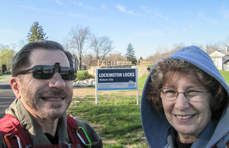
We left Dad’s house in Xenia at 7:30 am and drove north on backroads. The fields we passed were reluctant to wake up, still holding onto their blankets of lingering fog. By the time we reached Lockington, had the cars in place, and stepped onto the trail, it was nearly 9:30.
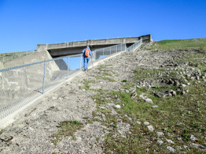
Our hike began on country and service roads by Lock 1 South at the southern end of the Loramie Summit. We had to climb steeply over 100 feet along a railing beside the spillway in order to get to the top of Lockington Dam. After a mile, there seemed to be a blaze missing. CW wasn’t concerned because he remembered the way from hiking through there in the summer, but I was determined to find it. I finally located it—on a post that had broken off and was lying in a fire pit. I sure was glad to have my personal guide since the post wasn’t pointing in the right direction.
Ah, Spring! We love spring. Though the temperature wasn’t much above freezing when we started out, we were layered sufficiently to keep warm. CW commented on how wonderful it was to not encounter any mosquitoes and cobwebs, which were so bad on his previous trip. About two minutes later, he ran into his first cobweb of the day. At least he was right about the mosquitoes.
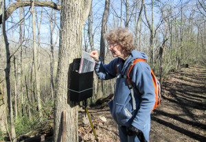
We joined the Miami and Erie Canal Towpath and soon came to a mailbox in the woods. Tree mail? For a moment I thought I was on Survivor. Would it contain a clue to a challenge up ahead, or maybe information on a coming merge with some fellow hikers? But no. Inside was a BT log in a Ziploc bag. CW recorded our hike in the book. There were also copies of a map, created by Preston Bartlett, with interesting things to explore in the area. It was a fun surprise.
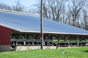
The rest of the day, we alternated between towpaths and country roads. Except for a mile stretch on busy Rt. 66, it was very pleasant. For over an hour, we listened to what sounded like a cattle drive. We couldn’t help breaking out into the Rawhide theme song. Finally we located the talkative cows, we thought. They were quiet when we reached them, so we couldn’t be sure. They were all lined up in a barn, staring out at us. Not being farmers, and not seeing anyone around to ask, we figured they were being milked—and happy that the wait was over. We are open to being corrected.
We reached our car just after 4:00.
While walking, I contemplated my ice cream goal. (You thought it was going to be something serious, didn’t you?) Would I just get a different kind each day of this hike, or would I try for a different kind each day of the entire BT hike? Are there that many different flavors? It sure would be fun to see. I decided to go for it.
We were parked at a gas station/garage on Rt. 66. There was an ice cream stand on the property, but it hadn’t opened for the season. We decided to buy ice cream out of the case at the gas station because the owners were so nice about allowing us to park there. I couldn’t remember all the flavors I’d already had, but I knew I would be safe with a Girl Scouts Thin Mints Dessert Bar since I’d never heard of it.
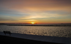
For two and a half hours, we looked for a place to stay. Our GPS was useless, so we drove around hoping our car would intuitively head for the motels. It didn’t find much. The first one we came to was way too expensive. The next one was reasonable, but there were no vacancies. Becoming frustrated, we took our laptop into McDonald’s and finally located an unbelievable place: reasonable, vacancies, close enough to the trail—just right! West Bank Inn on Grand Lake in Celina would be our home for two nights.
Day 2: Newport to New Bremen (15.5 trail miles)
One really good thing about staying in the area where we are hiking is being able to get a much earlier start in the morning. Ha! We didn’t get on the trail until 9:45.
Overnight, I had a pain in my back that wouldn’t allow me to turn over in bed. It robbed me of sleep, and I thought the hike would be over. However, in the morning, I was able to walk without pain. We took precautions, though. We waited for the drug store to open, then purchased an Icy Hot Patch. Doc CW also prescribed an Ibuprofen. We decided to do the day’s hike in two legs. It would require more shuttling, but it seemed like a smart thing to do in case I had any problems.
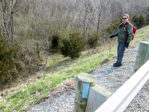
We began the hike by following a blaze over a guard rail and descending a steep bank to follow a quiet towpath for half a mile. At one point, while I waited for CW to go back to look for his hiking pole he’d left when he stopped to tie his shoe, I realized how relaxed I was. Not only that morning, but I hadn’t been overly conscious of time the day before, either. Goal #1 was looking—and feeling—good!
There was a trail detour due to a bridge being out, so we did some extra road walking. Some was on Rt.66 again, but it wasn’t bad like the day before since it was in a residential area.
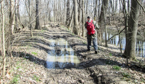
The rest of the morning was on towpaths, country roads, and a grassy stretch that went through unfenced backyards between two rows of houses. We had one very muddy crossing of a small ravine that caused us to stop to scrape as much mud off our boots as we could. We passed many quiet, contented cows this day and wondered if they might be employees of Carnation Evaporated Milk. (If you are under 60, you may not get that.)
We finished the first leg at 1:00 in Fort Loramie. For lunch, we chose to skip our peanut butter sandwiches and eat at Morrie’s Landing, located across from the campgrounds at Lake Loramie State Park. The food was fantastic, but we were there an hour. By the time we got the cars reshuttled and began hiking, it was 2:45.
The afternoon began on sidewalks through Fort Loramie and roads through Lake Loramie State Park, where we walked past Morrie’s. It ended on the sidewalks of New Bremen. Sandwiched in between, the trail followed the canal. The towpath had great variety. The path itself changed from dirt to grass to pavement to crushed gravel. It passed through woods and alongside subdivisions, farms and fields, and even a golf course.
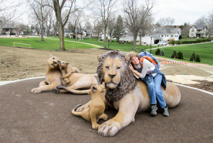
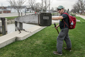
When we entered New Bremen, we encountered some lions, but they proved to be a friendly welcoming committee. CW displayed his strength by opening the 7000-pound gate of Lock 1 North, part of a renovation project in the picturesque German village. This lock marked the northern end of the Loramie Summit.
We finished before 6:30 and returned to Fort Loramie for the other car. Our ice cream decision was simple. We were parked across the street from the Dairy King & Motel. Yes, you read that correctly. Right now it sounds like a perfect combination, but at the time we just laughed at the idea. I guess that’s why we didn’t consider it when we were looking for a place to stay the day before. I don’t know what the rooms are like, but the turtle sundae with pecans was delicious.
Day 3: New Bremen to St. Marys (7.5 trail miles)
It rained and stormed throughout the night. In the morning it was still rainy and blustery with a forecast of thunderstorms sometime in the afternoon. CW would have been a happy hiker if I’d said I wanted to go home, but to the surprise of both of us, I didn’t. I couldn’t stand not getting any miles in that day (Goal #2). We piddled around though, not in any hurry to venture out along a canal in 20-plus mph winds. I’m not a swimmer.
We donned our rain gear and decided to leave our packs in the car. Because of the thunderstorm threat, we wouldn’t be doing a full day. We stuffed the things we thought we might need into our pockets and started hiking at 11:00. Our starting time was getting worse each day.
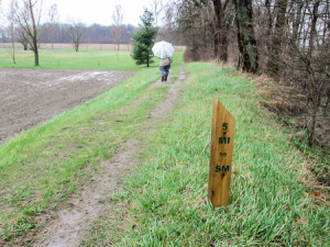
It was still raining as we started out in New Bremen, but not nearly as hard as just an hour before. It soon turned to a light rain, and then it stopped altogether. The wind was constant, but it was always at our backs. CW put his umbrella up and let the wind propel him down the trail. We made good time.
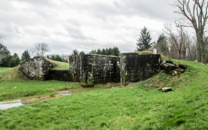
Again we followed the canal on paved or grassy towpaths. The day’s hike took us from just past Lock 1 North to Lock 13 in St. Marys. The site of each is marked by a sign. Varying amounts of remains can be seen. For some, all that is visible are bolts that held the wooden locks together. Others have much of the stone structure still standing.
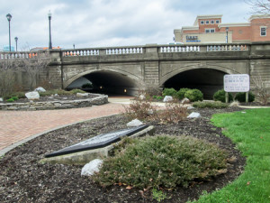
In St. Marys, the trail goes through Memorial Park. The three-acre landscaped area contains, among other attractions, a clock tower, a covered foot bridge, a replica of the “Belle of St. Marys” canal boat, and a veteran’s walkway. Leaving the park, we passed through the twin arch that horses would walk through while the canal boats traveled through the other arch.
We reached the car by 2:00. The sun was shining by then. We would have considered doing a few more miles, but we didn’t want to get caught in a storm on the way back to Xenia. Of course, we did take time for ice cream. After driving around a bit looking for an ice cream shop and being unsuccessful, we settled for Dairy Queen where I had a Salted Caramel Truffle Blizzard.
We ended our first trip with only 36 miles, but we had pleasant weather all three days and came home with no damaged body parts. We already have our room on the lake booked for the next trip. I just need to make my list of the ice cream flavors I’ve had on the Buckeye Trail so far.

