by guest blogger Bonnie Spencer
May 15, 2018
Day 11 (Monday): west of Belle Valley to AEP Bicentennial Campground K (6.7 trail miles + 0.4 mile looking for blazes)
We’re back at the Best Western in Caldwell for the third and final week of our spring hike. We have a lot of off-road hiking on the week’s agenda, though some details are still fluid. The wintry weather has turned to summer heat. Maybe the lovely spring temperatures made their appearance during the past two weeks while we were home. Oh well, it is what it is.
Today Karen, the same Karen who hiked several days with us last fall, met us at our motel right after we checked in. We found out last week that she still needs to hike the last few miles of Belle Valley. What a wonderful coincidence! That’s what we had planned for today. What better way to start our week than to share the trail with a friend.
Karen followed us north to Belle Valley. After leaving her car at a country crossroads, we drove to our starting points. Karen had 0.9 mile more to do than we did, so we dropped her off at Ragan’s Chapel on Chapel Drive and drove down to our starting place to wait.
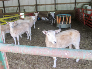
The dog always prefers to stay in the background
We had plenty to occupy us during our wait because we were back at Tony’s barn. Some of the newly shorn sheep still wore expressions of guilt for the coat nibbling incident in week one. The goats were gone, but a small pony had joined the mix. Beautiful white pigeons decorated the rafters.
The dog that blends in with the sheep was still in the background, lying down behind the pony. Today I discovered how shy it is. When I walked back to take a close-up of the pony, the dog slinked away along the far side of the pen, careful to stay behind the sheep, and lay down, all the time watching where I was. When I walked toward the front of the pen, it slinked back to its obscure spot near the pony.
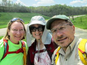
Karen, Bonnie, and CW ready to hit the sunny trail
Karen arrived and put in a little animal time herself. Then we prepared to set out. We would be walking through woods. Not knowing how bad the ticks might be, we dusted our socks with sulfur powder and took on what I call the dorky look—socks pulled up over our pant legs.
We started down the road at 1:15 p.m. It wasn’t far before the Buckeye Trail entered the woods on a footpath into the AEP (American Electric Power) ReCreation Land. This is a 60,000-acre outdoor recreation area on land that was once strip-mined. The AEP has planted trees, created campsites, stocked lakes and ponds for fishing, and created trails in their efforts to reclaim the land. Although use of the land is free, visitors are required to carry a permit, which can easily be printed off the AEP website. I’ve had ours tucked away in my backpack for weeks.
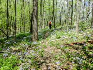
Karen surrounded by lavender phlox
I was expecting unmaintained trails that we’d have to fight our way through, so I was encouraged that we had an actual path to walk on. And it was well blazed. The trail was adorned with phlox, spring beauties, wild geraniums, trilliums, and other wildflowers.
After about a mile, we came out on a service road but couldn’t find any blazes. The BT was supposed to join that road but we thought we might have missed a blaze earlier and were in the wrong spot. We followed the road for a bit. Still not seeing any blazes, CW got out his digital map. We eventually located the spot where the BT is supposed to join the road.
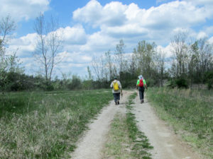
CW and Karen off the trail and looking for blazes
I was OK with continuing on, only because we had walked farther than the trail miles and basically parallel to the trail, but Karen preferred not to skip the actual trail. We all walked back along the trail we had missed. When we reached the place we’d gone wrong, we looked for a blaze. I finally noticed a tiny bit of blue peeking out from a piece of curled bark that hung from a branch.
CW and Karen worked to reattach the turn blaze to its tree. They retrieved a bandana they’d seen a few yards back on the trail. CW carefully uncurled the bark and tied the bandana around the tree and bark. Hopefully, the next hikers won’t miss their turn. We retraced our steps on the missed section and continued on.
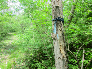
Mission accomplished: turn blaze has been reattached to tree with an abandoned bandana
After a short distance on two service roads, the BT entered grasslands. What the BT map describes as a mowed path wasn’t. Not seeing a path or turn blazes, we headed straight through the grass that was over our boots. When we came to a wall of trees with no apparent way to go, CW got out his digital map again. We were far off the trail, so we retraced our steps to the service road. We never did see a turn blaze, but we located blazes off to the left. This path wasn’t mown either, but the grass was slightly pressed down. Through this section, we began finding ticks on our pants, but very few.
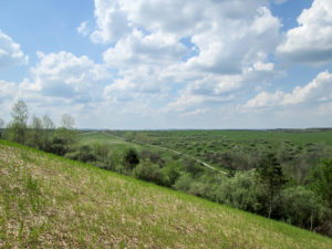
Valley below reseeded pipeline land
Less than a mile from there, the BT previously crossed a road and continued though a wooded area. However, those woods were cleared for gas pipeline. The BTA website has had a trail alert for over a year telling of a detour on the road.
We crossed the road anyway and took the trail a short distance to where the pipeline work had been done. It was completed and the area was reseeded. We got a grand view of the valley below, but we couldn’t tell exactly where to go with the blazes removed. We returned to the road and took the detour.
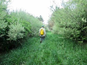
CW on unmown trail lined with autumn olive trees
A half mile later we rejoined the BT on a footpath though fields dominated by autumn olive trees. I’m beginning to recognize them now from their strong fragrance, silvery appearance, and small white flowers. Two miles later, the BT joined a road near the AEP’s Bicentennial Campground K. It was less than a mile farther to the car. We finished just before 5:30.
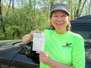
Karen holding Belle Valley map signifying another section completed
All in all, the day was quite pleasant. The best thing was hiking again with Karen. The paths weren’t overgrown yet, and although the weather was warm, it was bearable. A couple of steep ascents did show, however, that I was a little out of shape. Two weeks off the trail sure makes a difference.
We all celebrated finishing the Belle Valley section today with ice cream at DQ before Karen headed home. I got a new summer flavor of blizzard: Summer Berry Cheesecake. It was fruitily delicious.
Day 12 (Tuesday): Ludlow Township to Scenic River Trailhead on County Nine Road (9.7 trail miles)
A long day is planned. We had decided to leave the last 20 miles of Road Fork till the fall. However, George has wanted to hike the last half of that again, where Archers Fork Loop is located, and he was free to do it today. We had to take advantage of the fellowship. We will do 9.7 miles through the Wayne National Forest, some of it on new trail as of this year. The shuttling is time consuming and the terrain is challenging, thus the expectation for a long day.
It was close to 7:30 a.m. when we left the motel. Despite my lack of sleep, I felt pretty good. We followed George on some gravelly, dusty back roads. Our GPS knew the names of the roads we were on, but the screen showed only an arrow in a sea of green. I joked that George’s dust must be concealing our GPS roads. At 8:30, we placed our car at the Scenic River Trailhead, dusted ourselves down for ticks, and left in George’s car for our starting point.
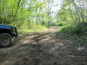
A four-wheel drive truck wouldn’t even attempt this road
Fifteen minutes later, we came to a back road so bad that there was a four-wheel drive truck sitting at the end of it trying to gather enough courage to venture up. Its driver was nowhere to be seen. All we could see from the car was the steep climb before the road curved.
After George and CW walked on around the turn to check it out, they began looking at maps for an alternate route. George was turning his car around to leave when CW said, “You wanna try it?” Really?
George thought for a minute, then hesitantly said, “I guess we can try it.” Really??
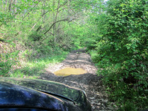
CW talked George into trying the one-lane road with craters
It was a good thing we had our seat belts on. The first pothole we hit would have thrown me from the car. Fortunately only my scream was hurled out the window. We jolted through another deep hole filled with water but stopped before the third one. So far this amusement park ride had gone only 100 feet. Thank goodness, they decided to shut it down. Even if they could get over the next hole, they didn’t know what other obstacles might be ahead. George backed out and they found another way to our destination.
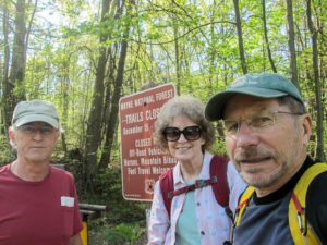
George, Bonnie, and CW ready to tackle the hills of Wayne National Forest
At 9:10 we reached the small pull-off where the BT crosses SR 260, and ten minutes later we began hiking. As yesterday, I was happy with the many wide trails the BT followed today. Even though in a few places we had to walk through unmown grass or around muddy patches, there wasn’t brush encroaching on the paths. And we collected only one tick all day.
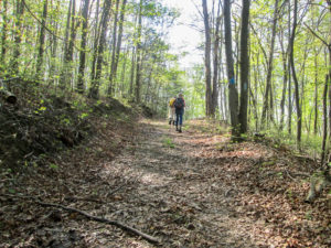
Spacious trail through Wayne National Forest
The forecast was sunny with a high in the 70s, but it would feel like the 80s. Being in the woods, we experienced dappled sunlight much of the day, but there were completely sunny stretches as well. Although I started out with good energy, the combination of heat and hills was already getting to me after only two miles.
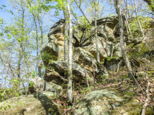
One of the many magnificent rock outcroppings along Archers Fork Loop Trail
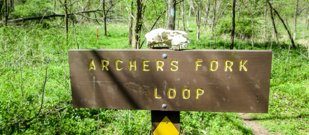
A mile into our hike, the BT joined Archers Fork Loop Trail, 12 miles of rugged elevation changes. The BT piggybacks on 6.3 of those miles. It’s a beautiful trail with lots of wildflowers this time of year and happy bird songs. It passes grand rock outcroppings and crosses numerous streams. I love the streams, but on the other side a climb is always waiting.
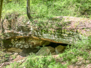
50′-long natural sandstone bridge near Archers Fork Loop Trail (photo courtesy of George Tyo)
We came to a sign that indicated the Great Cave was nearby. By walking a short distance off the trail, we could look down to see it, but we didn’t go any farther. On down the trail, a sign pointed the way to a natural sandstone bridge. George was ahead of us and took the time to descend the steep side trail to see it. On his return, he wondered what possessed him to do that. Nothing possessed CW or me to follow suit.
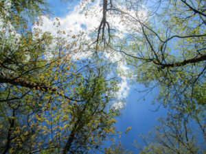
View from my resting position on the trail
We encountered some unbelievably steep ascents. I had to take lots of breaks. My body was giving out. At one point, I was ahead of the guys. Surrounded by rocks too large to sit on, I lay down on the trail to rest. I seriously considered ending my hike two miles from the end where we crossed a road and having them come back to pick me up. I didn’t think I could go on. But then I’d have to make it up later. Maybe I should have tried crawling, but I didn’t think of it at the time. I kept going, though I wasn’t moving much faster than if I had crawled.
These might have been the longest miles I have ever hiked. Never have they passed as slowly as they did today. We finally finished at 5:30. That would be CW and me, because he was hanging near me to make sure I didn’t drop on the trail. George finished at 5:00. He might have gotten a nap in. He was lying on the ground near our car, with his head on his backpack when we snailed in.
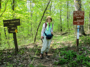
Made it to the end and still standing—with the help of my hiking sticks
Needless to say, the fun factor was low today, but only because of the heat. It was great to have George join us. The trails were wonderful and well blazed, and the wildflowers displayed their joy. We accomplished 9.7 more miles. And I’m not still out on the trail somewhere. So there were many things to be thankful for.
It took an hour and a half to pick up George’s car and get back to Caldwell. We all ate at Arby’s, which is in the Pilot building across the street from our motel, and discussed where to hike tomorrow. George is graciously going to shuttle us before he heads home.
I want so much to finish Road Fork now and not wait for fall. The woods are not grown up yet. The ticks haven’t been a problem. I would have another section finished. It’s a long shuttle, but it’s closer to where we are now than where we’ll stay in the fall.
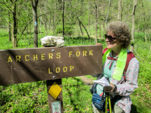
“Looks like you hiked on a really hot day, too.”
On the other hand, CW wisely pointed out that the stretch that remains is even longer than what we did today, it’s more strenuous terrain (how can that be?), and it’s supposed to be hotter. He also reminded me that I could barely make it today in the heat. OK. Although I’m dying to finish Road Fork now, I don’t want that to be literal. So we decided on a shorter off-road section tomorrow that is closer to the motel and not nearly as strenuous.
With that decision made, we bought Magnum Almond ice cream bars at Pilot to take back to our room. So delicious! That was definitely a fun thing about today.
Day 13 (Wednesday): AEP from Bicentennial Campground K to Wood Grove Campground (6.5 trail miles)
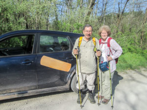
George’s band-aid posed with us before it headed off for home
We met George at Lori’s for breakfast. While we ate, a customer came in raving about the band-aid on a car parked outside and asked George if it was his. She was disappointed that she didn’t have her camera to get a picture of it. George took a picture with his phone and sent it to her email. CW googled magnetic band-aids on his phone for her. He and George made her day.
We had a short shuttle today—without the back road drama of yesterday. We left our car where we would end, and George drove us to our beginning spot near the Bicentennial Campground K. We would continue in the AEP from where we ended Monday with Karen. This hike would begin the Stockport section for us. We began hiking at 9:20 a.m., 45 minutes after we left the motel.
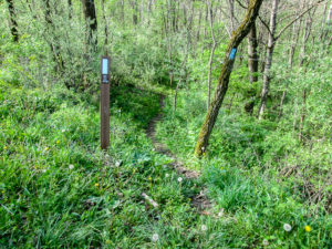
Footpath into AEP at the beginning of the Stockport section
The forecast was partly to mostly sunny with temperatures reaching the 80s. It was in the mid-60s when we began. Our plan was to move quickly while we were fresh and before the thermometer rose.
The trail entered the woods on a somewhat narrow footpath. After half an hour, we passed a sign marking a no-hunting area but welcoming BT hikers. During shuttling we had seen a couple men dressed in camouflage parked at the edge of some woods. George didn’t think this was hunting season, but still the sign gave me a feeling of safety. Maybe the men were going to sneak up on mushrooms. Morel hunting is the big thing up here right now.
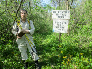
A welcome sign, for sure
We started off at a swift pace. I hoped to get four miles in before I began feeling the effects of the heat, but I only made it about three. Much of the trail didn’t have enough tree cover to keep the sun off of us, but there was certainly more shade than we’d have had on the road. An occasional breeze helped to keep me going.
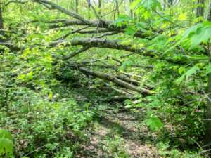
Just a small obstacle to climb through
The trail meandered and undulated big time, but the ascents were nothing like in Wayne National Forest yesterday. They were more like a kiddie roller coaster, quick up and downs interspersed with flat stretches. And the longer, steeper hills actually had an end.
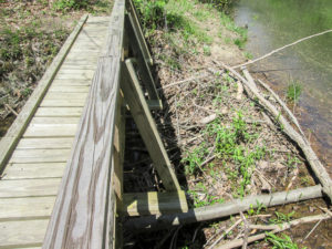
Bridge built beside a beaver dam that the Buckeye Trail used to use to cross the stream
We encountered lots of trees across our path. If not for the heat, it would have been even more fun figuring out how to navigate each one. We also crossed several streams. Today the climbs on the other side were not so drastic. Bridges took us across bigger streams. One bridge was built right beside a beaver dam. CW came through here before the bridge was built. At that time the trail crossed the water on the dam.
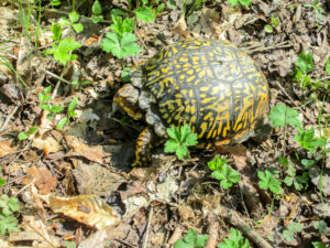
A fellow traveler resting in the middle of the trail
We saw one other hiker today. When we met him, he was resting in the middle of the trail, not even concerned that he might get stepped on. Kind of like me yesterday. We snapped pictures of him before carefully walking around and moving down the trail. The box turtle rested on.
After four miles, I was wilting from the heat, but I was able to keep moving at a pretty good pace on level and downhill trail. Since it wasn’t another eight-hour day, I knew the end was not far off and I wanted to get out of the sun. Still, that last mile seemed forever.
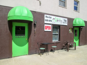
Local Roots, a really cool coffee shop, in Caldwell
We reached our car a little after 1:00. This was exciting not only because we survived the heat and accomplished our hiking goal for the day, but also because we finished early enough to check out Local Roots. That’s the coffee shop by our motel that closes at 4:00 every day—the one with an ice cream cone on their sign.
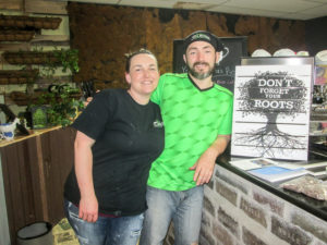
Steph and Rusty Moncrief, owners of the Local Roots coffee shop in Caldwell
Besides enjoying scoops of Buckeye Classic ice cream, we loved getting acquainted with Rusty and Steph Moncrief, the owners. Rusty is from the area, thus the shop’s name. Local Roots will be a year old in July. They serve breakfast and lunch. The sign outside says, “Best coffee, real smoothies & more.” CW attests to the best coffee. Steph and Rusty are super nice people and so welcoming. We left happy that we’d made new friends.
What a great way to cap off the day’s hike. And it was early. I had time for a nap before we ate a light supper at Lori’s.
Day 14 (Thursday): Macksburg to Centerville (in Morgan County) (11.4 trail miles + 0.3 miles to car)
Today we wanted to get more miles under our feet than we thought we could do in the woods, so we did some road walking in the Whipple section. After breakfast at Lori’s, we scooted down to Macksburg, where we ended our hike in the second week, and left a car at D & E Drive-In again. Then we drove the trail, all on back roads, to a point 8.9 miles away. We would walk counterclockwise today, back to Macksburg.
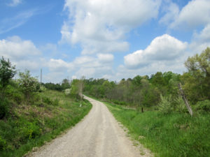
Beautiful sky, but not enough clouds on such a hot day
It was another hot day. The temperature would reach the high 70s but feel like the 80s. The possible thunderstorm never materialized. Actually, we would have welcomed one if it was quick and cooled things off. The partly cloudy/partly sunny day turned out to be mostly sunny. The sky was beautiful, but it would have looked even better to me if there were a few more clouds to cover that sun.
We began hiking just after 10:00 a.m. It was still in the low 70s. We were fresh and moved quickly, wanting to cover ground before the heat zapped our energy.
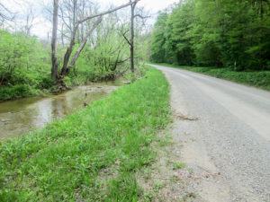
Keith Fork along Keithtown Road in Noble County
The road pleasantly paralleled Keith Fork, and we listened to the happy gurgling as the water played among the rocks. I was amused by a squirrel that jumped from a limb about 15’ up. It made a slight arc to land softly in the thick, unmown grass, then raced across the road.
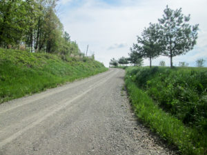
One of our uphill climbs
Though the trail today had a few steep climbs, most of it was gently rolling or level. After a mile we came to our first serious climb. I don’t think it would have bothered me at all if not for the heat, which was already increasing. But we were still making good time—and enjoying the peacefulness of the morning.
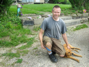
John and his beloved Red
Houses are sparse on these roads. Three miles into our hike, we met John working in his yard. For the next half hour, I forgot about how hot I was. We enjoyed getting to know John and learning some history about the house he and his wife live in. He was familiar with the places we’ve been in the area, and we were surprised that he celebrates every Labor Day with friends in our neck of the woods watching the fireworks on the Ohio River. He kindly offered us cold water, but we had plenty. We were, however, refreshed by the good conversation.
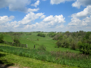
View of the countryside from a ridge
We continued on. The view of the countryside from atop the ridge was also refreshing. But it was still hot. Occasional shade from trees and a wonderful breeze that visited often gave us some relief. We came to a great resting spot in someone’s front yard. By the road, in the shade, were some large rocks stacked at angles, and I found the perfect one to sit on. A strong breeze blew, the best one all day.
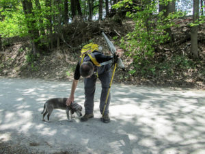
A harmless dog checking out CW
While CW stood in the road and waited for me to revive a bit, I watched a dog slowly and quietly come up behind him. Its head hung low, and I could tell that it was as harmless as a kitten, just wanting to check out this person who had parked himself in its road. It was the most benign dog I’ve seen on the trail. After a couple of minutes, it moseyed away.
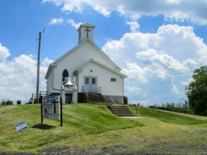
A church with a convenient port-o-john
We came to a church on a small rise. I’d been looking for it because the BT map said it had a privy. The map is eight years old, so I didn’t know if there was any reason to hope it would still be there. But sure enough, there was a port-o-john right beside the building. I don’t know if it’s for the congregation or for visitors to the cemetery. Surely it isn’t for the few hikers that happen by, but we made use of it.
When we reached Macksburg, the BT went under the I-77 bridge. As we started under, a lady stopped her car to ask if we needed a ride. CW told her no, we were just crazy hikers. We continued under the bridge to complete our trail miles, then walked the extra 0.3 mile to D & E.
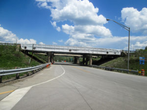
The BT once again passes under I-77
It was a little after 2:00. We rested and cooled off with lunch and ice cream. I got the Cool Mint Flavor Burst this time. I also downed two large glasses of ice water. After an hour, we were ready to tackle some more miles.
We drove back over the trail we had walked this morning, honking at John’s house as we went by because CW told him he would. Passing our other car, we found a wide grassy berm 2.5 miles farther down the road. We parked and once again began hiking counterclockwise, ready to attack more meanderings and undulations and heat. Since the distance ahead of us was so short, it was less daunting.
A friendly man stopped his truck and asked if we were mushroom hunting. That was the second person today. The first was in the motel lobby this morning, a man from Waynesville who is up here hunting for morels himself.
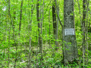
Licensed Shooting Preserve along a back road in Morgan County
The guy in the truck grew up in the next county. He knows all the back roads in the area and loves them. We told him we were just hiking the Buckeye Trail and that tomorrow we’d be back in the AEP. He suggested we take a bag with us to get some mushrooms. He offered us a ride, but of course we couldn’t accept it.
We got back to our car at 4:50. It had taken us only an hour. We drove past our other car to see if there was another good place to park in order to walk a little more. We didn’t find one so we called it a day.
For such a hot day, we felt good about our accomplishment. We had added 11.4 more miles. We had traveled through beautiful country and had received three offers of help from the good folks of Noble and Morgan Counties. It was a fun and friendly day.
Day 15 (Friday): AEP from Wood Grove Campground to west of Reinersville (6.4 trail miles)
We’ve reached the last day of our spring hike. When we checked out of Best Western this morning, it felt as if we were leaving home and friends since we’ve stayed here two of our three weeks.
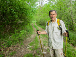
CW on service road in the AEP
Today’s hike was in the AEP in the Stockport section again. A relatively short shuttle had our first car placed in 20 minutes. Ten more minutes, and we were at the parking spot near Wood Grove Campground where we finished Wednesday.
This would be our shortest hike of all 15 days, partly due to the continuing heat, but mostly because we had to drive home today. The day was supposed to be partly cloudy. When we packed up our cars this morning, it was completely cloudy. I was excited that we might get some hiking in while the weather was comfortable. However, during shuttling, the sun began peeking out, and by the time we began hiking at 9:30 a.m., it was totally on the job.
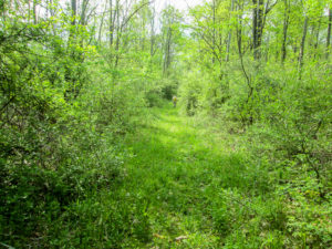
Service road became an unmown grassy trail
The BT entered the woods on a wide trail that appeared to be an old service road. Grass grew up beside the bare tire lanes. After a while the trail became all grass. I didn’t mind that it was ankle deep. We hadn’t been bothered by ticks to speak of all week, and it was so much better than the shoulder-high brush we dealt with last fall. The trail was generally level and the temperature had not risen yet, so we hoofed it. We hoped to finish our miles quickly and get started home.
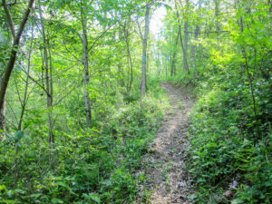
A meandering dirt path through the AEP
Eventually the trail narrowed and began its ups and downs. Often we walked on dirt or leaf-covered paths that hugged hills. We crossed streams, wound around rocks, and climbed over fallen trees.
We passed by several ponds, some of which were covered with scum. One was heavily surrounded by cattails that looked as though they were on a mission to take over the trail. New green blades were making their way up among last year’s faded, fuzzy-headed stalks. The trail beside it was on marshy grass that squished under our boots.
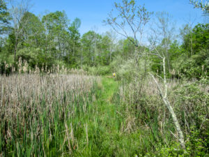
Marshy trail being invaded by cattails
We continued on across a small area of grass and saw two trails, neither of which had any blazes. CW got the digital map out and discovered that we should have made a sharp turn back along the other side of the pond. We were surprised that we hadn’t seen any indication to turn because everything else had been perfectly blazed. I imagine it is hard to paint a blaze on a cattail.
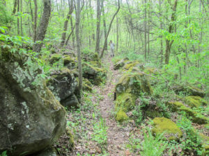
The BT takes a path through some rocks
After one and a quarter hours, we had covered about half the trail. By this time, the heat was wearing me down. At two hours in, I found a rock to rest on in the shade. Another half hour and I took another short rest. Some of the hills were steep, but the switchbacks made them easier to maintain our good pace.
In spite of the sweat dripping off of me, the last mile was great. It was fairly level and shaded nicely. We were able to pick up our speed and still admire the wildflowers blooming beside the trail.
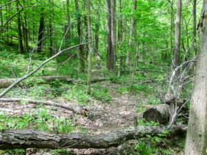
On the homestretch
We emerged from the woods into a parking area at SR 78 and SR 83, near a bridge over Dyes Fork. It took us just over three hours to finish. Even with the unwelcome warmth, we enjoyed these trails. They were fun to navigate and offered a variety of scenery.
We paid another visit to Local Roots. Rusty and Steph had told us they wouldn’t be there Friday. We enjoyed talking with Shawn while he scooped out our peach ice cream. It seemed like a fitting flavor today. Yesterday John told us about the peach trees on his property that produce such large and delicious fruit. A friend of his never liked peaches, but John finally got him to taste one of his homegrown masterpieces. Now his friend can hardly wait for the harvest each year.
We drove away a bit sad to leave this area we’ve spent so much time in over the past few weeks, but it will be good to get back to our normal lives. We managed to get to Xenia in time to pick Sugar up and save her from another night in the kennel. I’m sure she will be glad to get back to her normal life as well.
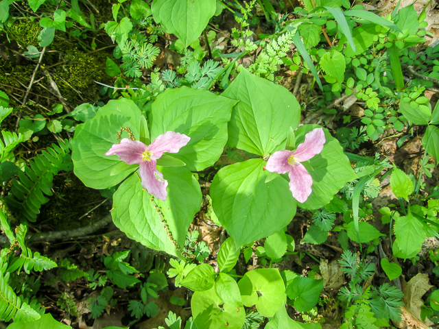
White trillium that turns pink near the end of its life
This spring we hiked 153.9 more miles on the Buckeye Trail, bringing our total to 966.5. We now have under 500 miles to go to complete the BT. We added 3,085 miles to our cars and 371,810 steps to my feet. Our trails took us into five different sections of the BT. We finished Bowerston, did all of Belle Valley, did most of Road Fork, did over a third of Whipple, and began Stockport. Jumping around has been somewhat maddening, but we’ll fill in the gaps in the fall.
In spite of the winter and summer weather, it was a fun spring adventure. We met wonderful people: Karen and all the staff at Best Western, Rusty and Steph, John, and kind folks who stopped to offer us a ride. We had the excitement of flooded roads and trails. The local animals entertained us. We experienced beautiful country where life moves at a slow and easy pace. We were fortunate to share the trail with Karen and George. I made it through some endurance tests—perhaps not with flying colors, but with rosy (heat-reddened) cheeks. And ice cream is always fun.
Thanks for sharing our journey. Please join us in the fall when we finish the Wilderness Loop and then head west.
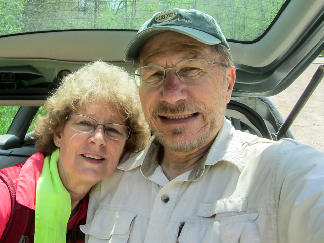
966.5 miles now completed on the Buckeye Trail

Dolores R. Birkle
May 20, 2018It has been a joy to get to know about Ohio in this unique way. I have traveled many miles with you (sitting at my computer). I marvel at your endurance. It is so good to record all that you are experiencing, so many can benefit from it in the future. Thank you!
CW Spencer
May 20, 2018I’m so glad you are enjoying traveling with us, Dolores. We still have a few (hundred) more miles to go. Keep your walkin’ shoes handy.
localroots
October 29, 2018Thanks for the kind words about Local Roots and us. It truly has been a blessing to have you enrich our days when you can make it.
Also, it’s wild to see the pictures of the area around my parents farm which is just a couple of miles away from the Macksburg exit!!
CW Spencer
June 9, 2020Meeting great people like you guys along the trail are truly highlights that make our journey unforgettable. Thank you for your gracious hospitality. ~Bonnie