by guest blogger Bonnie Spencer
April 24, 2018
Day 6 (Monday): Belle Valley to northwest of Fulda (9.7 trail miles + 0.1 mile to car)
We’re off for another fun week of hiking the Buckeye Trail in southeast Ohio. Since we left a car where we hiked last time, I was able to take a nap on the drive up. When I awoke, we were already in Caldwell where we’re staying this week. It was early, so we grabbed some breakfast at McDonald’s. We still arrived at the motel before 11:00 a.m., but we were able to check in.
Today we began the Road Fork section. This was one of the closest shuttling days we’ve had. It took us only 15 minutes to get from our motel to the place we would end the day’s hike, Archers Ridge Community Church. We took primary roads and got there by noon.
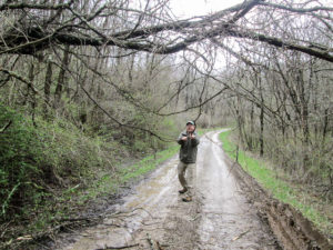
CW fights stubborn branches that prevent our car from passing
We decided to drive the trail to Belle Valley. Driving the trail can be beneficial. It familiarizes us with where we’ll be walking. Sometimes it reveals problems, as it did on our last trip when we found the road flooded. If we hadn’t been driving the trail, we wouldn’t have discovered the impassable spot until we hiked to it, and then we’d have had no other choice but to retrace our steps to the car. So it was especially good to do today with the continued flooding in this area.
We turned onto a road the BT map describes as narrow and rutted. Our first surprise was when we came to branches hanging down across the road. We knocked some of them down but others were stubborn. Finally, CW had to hold a branch up while I drove underneath, carefully in order to avoid a 6” deep rut on the right side of the road.
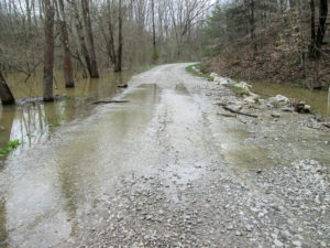
Water across Caldwell Lake Road
Successfully past the curtain of limbs, we continued on till we came to our second surprise: a deep rut that extended across two-thirds of the road. There wasn’t enough room to drive around it, and CW was concerned that if we tried to go over, the car might get stuck. So he backed the quarter of a mile to the beginning of the road, with a stop at the curtain where he held up that stubborn branch again while I drove backwards under it. Then we took real roads to our starting point.
We began hiking at 1:00 p.m. It was a quiet day on back roads. We saw only a handful of cars. After about two miles, we came upon water flowing across the road. We were able to cross at the edge on rocks that poked up through the water. That was the only flooded trail we encountered today.
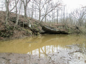
Rock shelter along Caldwell Lake Road
Off to the side was an impressive rock shelter. In CW’s book, Hiking Without Dave, he tells of hiking here with Bob. While they were admiring the rock shelter, a man drove up on an ATV. He was not a friend of the Buckeye Trail. In spite of the guys pointing out a nearby blaze, the man refused to accept that the BT went through here. Today we didn’t see any tree close by displaying the blue blaze, even though the entire trail was otherwise well blazed. We couldn’t help but wonder what happened to that particular blaze.
We saw only a few animals today, but not many close up. There were deer running deep in the woods, turkeys scooting down the road in front of us, and a couple of noisy dogs that kept their distance.
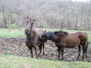
Affectionate pasture-mates
In one pasture, we saw a horse that showed no interest in us. We walked on about 100 yards and saw another horse. This one came to the fence as we approached. Suddenly the first horse came galloping across the field to the same spot. The barbed wire fence was low in a ditch there and I thought the horse was going to jump it, but it came to an abrupt stop next to the other horse and began nuzzling it. Was it being protective? Or maybe possessive? Whatever it was, it was cute.
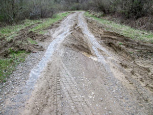
Navigation on this road requires an ATV
We reached the “narrow and rutted” road. Just before we got to the spot where we had earlier put our car in reverse, we came to another place that would have been impossible for us to navigate. We would have needed a four-wheel drive. Walking it was a cinch, though.
We finished our miles today at 5:10 p.m. We had another 0.1 mile to go uphill to our car. Archers Ridge Community Church is not on the BT, but it is a convenient place to park. As we walk and drive in this area, we pass many small church buildings with cemeteries. This church does not seem to be used anymore.
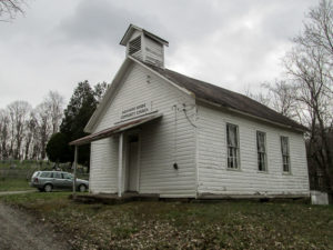
Archers Ridge Community Church with cemetery in the background
The weather was great for hiking. The forecast said low 40s that would feel like the 30s. However, it felt like the 40s to us most of the day. Though we had rain and sleet during our morning shuttle, it didn’t rain anymore after we started hiking. We did have a hodgepodge of light snow flurries, tiny snow pellets, chilly breezes, one appearance by the sun, and several dry, cloudy stretches. At the end of the day, from inside a warm car, we watched denser flurries that blew sideways. It is supposed to snow up to 2” tonight. I don’t know what that may do to our plans tomorrow, but I don’t have to think about that tonight.
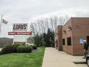
Lori’s Family Restaurant in Caldwell
We ate supper at Lori’s (pronounced with a long i) Family Restaurant next door to our Best Western. Both businesses are owned by the same family. Every day, we get 10% off dinner and a voucher for a free breakfast. Supper was followed with dessert from DQ. Tonight it was an Oreo Cookie Blizzard for me.
The hills seemed easier to navigate than they did two weeks ago. We didn’t have to walk in rain. The morning shuttle provided excitement. And we met some adorable horses. The fun continues.
Day 7 (Tuesday): northwest of Fulda to west of Road Fork (11.3 trail miles + 0.1 mile to car)
The only snow left over from last night was a light coating on the cars and small patches in the grass. We slept a little later today and enjoyed a slower start. When we stopped by the front desk in the lobby for our breakfast vouchers for Lori’s, we got into a lengthy conversation with Karen and Deb. They were interested in our hike. Deb was familiar with the BT, but it was new and exciting to Karen.
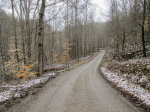
A dusting of snow along the trail descending Hohman Road
We thought our voucher might get us an egg and a slice of toast, so we were thoroughly surprised by hearty meals of eggs, home fries, choice of meat, toast, and a drink. Beyond full, we finally left the motel at 10:00 a.m. in snow flurries. A half hour later we had the first car placed across the road from Road Fork Baptist Church. We drove the trail to Archers Ridge Community Church—no surprises today—and started hiking at 11:15.
Our trail began with a long comfortable descent, but of course that was soon followed by a lengthy uphill climb. Mild climbs are not bothering me much, but I can feel it when the degree of incline increases. My pace automatically slows proportionately.

“Starflakes” on my gloves
The snow flurries turned into snow pellets, making a racket on my hood. They bombarded us most of the day. Sometimes they played mischievously, but when the wind blasted them directly into our faces, they became downright bullies.
I began noticing the pellets landing on my clothes. Some were six-pointed stars that looked like those sugary sprinkles used to decorate desserts. They weren’t delicate enough to be snowflakes. We began calling them starflakes.
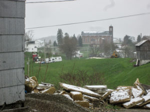
Immaculate Conception Catholic Church (in the distance) in Fulda
This was the day for churches. Besides beginning and ending our hike at them, we saw the Immaculate Conception Catholic Church from a distance as we hiked through Fulda. The church was founded in 1847 by German immigrants. By 1870, the original building could no longer house the growing congregation. The present building was completed in 1875. Our timing was perfect. It was noon and the bells chimed the hour. That was followed by ten minutes of hymns that floated through the air to carry us along the trail.
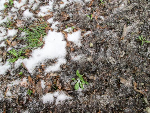
Snow pellets pile up on the road
Today we saw an average of less than one vehicle per mile. One of those met us on Hoot Owl Ridge Road. The starflakes were steadily coming down when the couple in the truck stopped to ask if we needed a ride. As pellets ricocheted off of us, I told them no, thanks. We were just out hiking.
I wasn’t sure if it was unbelief or amusement I saw in their expressions, so I explained what we were doing. They had not heard of the Buckeye Trail, so of course, we showed them the map. In spite of how crazy we appeared, they welcomed us to Noble County, sounding quite proud of where they live. We continued talking for several minutes as pellets blew in their window.
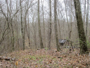
Herb’s Hut on Hoot Owl Ridge Road
CW asked if they knew Herb Hulls. Herb is active in the Buckeye Trail Association, and he used to own property on Hoot Owl Ridge Road. He built a shelter there to be used by BT backpackers. When he sold the land, it was with the requirement that the shelter would remain as a BT campsite. Our new friends did know Herb. He was a taxidermist and had done some work for them. We would have liked to have had more time to get to know this Noble County couple.
A ways down the road, we passed Herb’s Hut. It sits maybe 70 yards off the trail and is visible through the trees this time of year. A small sign alerts BT hikers to the spot when the woods fill in.
We made very good time and finished by 4:00 p.m., just as the sun was coming out. Oh well, we didn’t need the sun. Amazingly, we had kept quite warm—except for our faces when we walked into the wind.
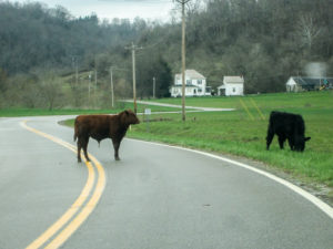
Standoff with one of the locals
Again we didn’t see many animals today. Our best animal encounter was on the way to pick up our other car. A bull was in the middle of the road, quite content to stand its ground and stare us down. CW slowly drove toward it, taking a chance it wouldn’t charge the car. Thankfully, it moved to the side of the road, continuing the staring contest as we passed.
We had supper at Lori’s again. The only ice cream they had was vanilla. Though it wasn’t on the menu, they said they could do a hot fudge sundae. I checked my list and realized that I hadn’t yet had a plain vanilla hot fudge sundae on this journey. Now we wouldn’t have to track down something else tonight. It was excellent hot fudge—very hot and very fudgy.
It was a fun day of discovering starflakes, meeting the Noble County Welcome Wagon, sharing BT information with the motel staff, hiking to hymns, and being stopped by an AWOL bull.
Day 8 (Wednesday): west of Road Fork to Lamping Homestead (10.9 trail miles)
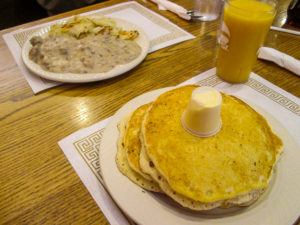
Breakfast at Lori’s Family Restaurant in Caldwell
We took our time again this morning. And again we used breakfast vouchers at Lori’s. CW got biscuits and gravy; I got pancakes. Oh my gosh—so much food! There were three humongous pancakes. I managed to eat one and a half, but had to take the rest back to the room.
After breakfast, we talked with Karen again at the front desk. We’ve been trying to decide whether to stay our next week in Caldwell again or move down to Marietta. The BT goes through remote areas in this part of the state. It is a problem finding motels close to the trail. We like this Best Western. Karen is the general manager and said we could leave a car here again for two weeks. That helped us make our decision to reserve a room here for our next trip, even though Marietta might be a little closer to the route we have planned in May.
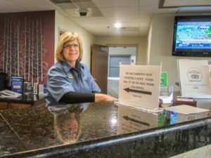
Karen, general manager of Best Western in Caldwell
We didn’t leave the motel till 9:45 a.m. It took close to an hour to get the first car placed. Then we drove the trail back. There were narrow dirt lanes, gravel roads, lots of meandering, and steep undulations. It would be fun walking it.
Today was a perfect day. The sun graced our entire hike. Although it began a little chilly, the temperature reached the high 50s. When the wind blew, it was a gentle, refreshing breeze.
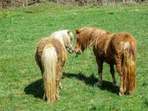
Ponies showing us another side
Soon after we began hiking at 11:20, we saw two small ponies. Both were across the field, grazing in different places. They ignored us for a while but finally came our way and met at the fence to pose for us. It was quite a photo shoot; they showed us all sides.
A little farther on, an unchained dog had zero interest in posing. We readied our sticks and CW got his umbrella out of his pack as well. The dog seemed genuinely mean, but it kept its distance as it followed us a few yards down the road.
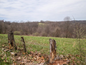
View of distant hills from Creighton Ridge Road
We passed from Noble County into Monroe County. The county line here is also the legal boundary of the Marietta unit of Wayne National Forest. Two other units, Athens and Ironton, also comprise the nearly quarter million acres of the Wayne in the Appalachian foothills of southeast Ohio. This is the only national forest in the state.
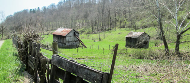
The BT turned onto a packed dirt road edged in forest. I like being in the woods when the flora doesn’t invade my space, so this was enjoyable. After a mile the surface became gravel, and the road partially opened up to countryside. We saw a great many abandoned houses, and even more barns and sheds in various stages of deterioration. It’s a typical sight on these back roads. I don’t know why the structures aren’t taken down, but they make great, albeit sad, pictures.
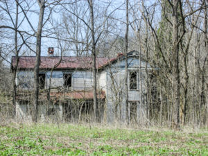
Abandoned house on a back road in Monroe County
We saw our field of cattle for the week. There were a couple of dozen playing follow-the-leader. When their leader headed our way, they headed our way. When their leader moved closer and stared, they moved closer and stared. When it followed us along the fence, they followed us. When it turned back and crossed a stream into another section of the pasture, they all followed. I wondered if there was ever a rogue cow that did its own thing, and if the leader would have a bruised ego about that.
There were basically no cars today, or people. It was just a quiet, pleasant walk. In places, we enjoyed the soothing sound of streams that ran beside the road, sometimes accompanied by bird songs. We took pictures of the few wildflowers we began to see.
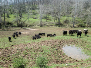
Cattle playing a game of follow-the-leader
Our last two miles took us onto SR 537, paved but only slightly busier than the previous roads. We had one last long incline to reach our car, which was inside the entrance to Lamping Homestead. We finished at 4:00 p.m., walking 10.9 miles in only 4 hours and 40 minutes. We are surprised at how well we are doing on the hills.
We ate dinner at Lori’s and went to DQ for dessert. I got a Peanut Buster Parfait.
What a beautiful day this has been: perfect hiking conditions, peaceful trails, and pastoral scenery. Not only that, but now we also have a room reserved for our next week of hiking.
Day 9 (Thursday): Lamping Homestead to Ring Mill Campground (7.5 trail miles)
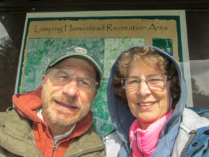
Looks like the rain has stopped when we start out the morning at Lamping Homestead
CW ate breakfast by himself at Lori’s. I stayed in the room and ate some of my leftover pancakes from yesterday because I didn’t want to throw away good food. When CW got back, he finished what I couldn’t eat.
Since we will be staying in Caldwell our next week up, our daily hiking itinerary will be greatly affected. Today we will hike what was planned for tomorrow. That is a good change. Though it is only 7.5 miles of trail, we have to drive quite a distance to get there. That wouldn’t be good for a Friday since we have to drive home after we hike.
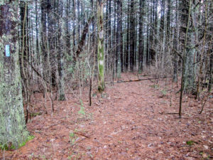
Pine needle path on the Long Loop in Lamping Homestead
We got away from the motel at 9:00 a.m., earlier than the past couple of days, and began hiking at 10:50. Our first two miles went through Lamping Homestead Recreation Area. It is a relatively small and secluded section of the Wayne National Forest that offers camping, picnicking, mountain biking, fishing, and hiking on two loop trails.
The Lamping family were the first settlers on this site in the 1800s. They didn’t stay long. The only evidence today of them having been here is a small family cemetery. Other families moved in when they left. There were buildings from the Lamping homestead as late as 1971 when the Forest Service acquired the land, but all the structures have been removed now.
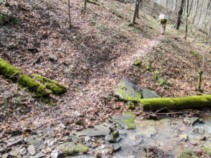
Narrow leafy trail on the Short Loop in Lamping Homestead
Until last summer, the BT skirted the homestead on a dirt and gravel road (T307). The road is pleasant—the BT still uses part of it—but we are so glad some of the trail has been moved to take advantage of paths through the homestead. Many are wide and covered with pine needles and cones. Others are narrow and leaf covered; our poles kept us from sliding off the edge. A few trees were down across the path. That’s fun when there’s actually a way over or under them.
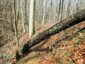
Fallen tree on the Short Loop in Lamping Homestead
The trail often paralleled steams that were full of music today. It crossed several gullies. One was especially tricky as we crossed on slippery rocks and leaves and then had to climb up a steep switchback on the other side.
We loved this trail in spite of the wacky weather. We had driven through rain and snow this morning. The rain appeared to be over by the time we began hiking, but it was teasing us. Every time I wrote in my notebook that the weather had cleared up, something began falling from the sky. We experienced rain, snow, sleet, and mixtures, with dry, sunny periods in between. But it couldn’t dampen our enjoyment of these two miles. Idyllic, CW called them. I had to look that up. Merriam-Webster says it is “pleasing or picturesque in natural simplicity.” I totally agree!
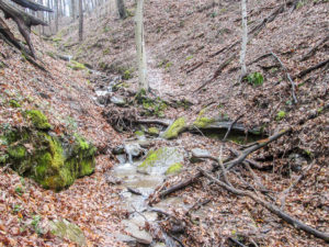
A tricky but fun gully to navigate
The BT exits the homestead onto T307. We had a half mile or so on that before two miles on another back road. That’s where we encountered our biggest hill today. I am finding that even the long, steep inclines like this do not intimidate me anymore. I know I’ll get to the top eventually. Why waste time dreading something that is going to come? It will pass, and I’ll be stronger for it afterwards.
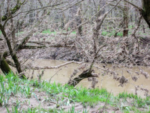
Plant debris in trees along the Little Muskingum River
Our last three miles were on another dirt and gravel road that first parallels Straight Fork, then crosses it on a bridge. We came to a spot where water several inches deep ran across the road. We had driven through it this morning, and we knew we would be able to walk around it by using the edge of the yard. Later the road parallels the Little Muskingum River. Plant debris in the lower branches of trees along the river showed the recent flood depth.
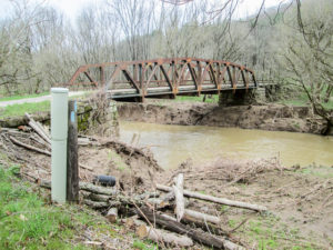
Metal truss bridge over Little Muskingum River
We crossed the Little Muskingum on a metal truss bridge that was constructed in 1955. It replaced a covered bridge dating back to 1882. The bridge took us right to the entrance of Ring Mill Campground where our car was parked. We finished at 2:50 p.m.
Most of the towns we drive through in this area do not have much in the way of businesses. This morning we had passed through one, though, that had great possibilities for a meal. On our way home, we stopped in Woodsfield to look for a family diner. There were several fast food establishments, but we finally saw Jerry Lee’s Pizza & Restaurant and decided to check it out. We were so glad we did. It was a small friendly place. Everyone who came in seemed to know everyone else. It was fun listening to their conversations, and for a moment I wanted to move to Woodsfield to be a part of their lives.
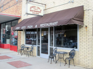
Jerry Lee’s Pizza & Restaurant in Woodsfield
The restaurant had a small pizza buffet that included broasted chicken and salad bar, but there was also an extensive menu. We both ordered the spaghetti and meatballs special that came with garlic toast and salad. We couldn’t believe it when our waitress told us to go make our own salads. We got to go wild at the bar. There was a good selection, and everything was fresh. The meal was huge and tasty. I tried to get CW to eat some of my spaghetti, but he couldn’t. I was so full, but I ate it all anyway. I didn’t want to eat it for breakfast tomorrow.
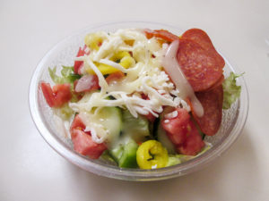
Yummy make-your-own salad at Jerry Lee’s Pizza & Restaurant
Today we finally discovered an ice cream place other than the DQ close to our motel. We’ve been passing it every day, but I didn’t see the ice cream cone on their sign until today. Unfortunately, we were a couple of hours too late; they were closed. We went next door to Save-a-Lot and bought a box of four Choco DreamWiches. It was the smallest amount of ice cream we could find there. Even though we could eat only two, we still saved-a-lot on ice cream tonight. We tried unsuccessfully to give the other two away at the front desk. The attendant put them in the freezer down there with our room number. We leave in the morning. I hope someone eats them because I don’t want them for breakfast, either.
Day 10 (Friday): Whipple to Macksburg (11.6 trail miles + 0.4 mile to and from car)
Today was a big day, which began with another big breakfast at Lori’s before we checked out of the motel by 9:00 a.m.
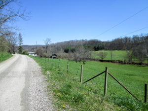
View along Duck Creek Road
Since we hiked yesterday what was planned for today, we had to find something else. The Road Fork miles that remain are too far away for a Friday when we will be traveling home afterwards. What’s left of Belle Valley, though not very many miles, is through woods that might take longer than we want. We needed to cover more miles as quickly as possible, so we chose a stretch of the Whipple section that is all roads and relatively close to the motel.
It took only 15 minutes to drive south to Macksburg and leave a car at the D & E Drive-In, a mom and pop restaurant that CW was familiar with. Then we drove farther south to Whipple. We parked a tenth of a mile from the BT near a small grocery store. CW knows of it from backpacking here several years ago. He was looking forward to seeing the owners again, but the store appeared to be closed permanently.
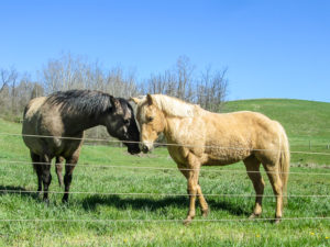
More affectionate horses
We began hiking a little after 10:00 a.m. The day was sunny with not a cloud in the blue sky. Crisp 40s later rose to the 50s, and we shed a layer or two. The occasional breezes were welcome. It was a beautiful day to hike.
We crossed Duck Creek on SR 821 and soon turned onto Duck Creek Road. It paralleled the creek. For five quiet miles, we enjoyed lots of beautiful country landscapes with no traffic. From several pastures, horses welcomed us to their neighborhood.
Every day we see red-winged blackbirds. Today I finally managed to get a picture of one. They usually don’t wait for me to get my camera out. The BT then passed by the Washington County Fish and Game Club. They have a 7-acre lake for fishing and over 100 acres to hunt in. We didn’t see any activity today.
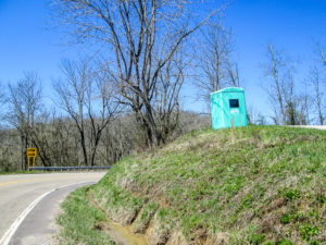
A not-a-port-o-john-anymore along the trail
The Buckeye Trail passes through the unincorporated community of Warner and soon rejoins SR 821 for over a mile. Being a main, paved road, I thought it would be busy but there was very little traffic. I spotted what sure looked like a port-o-john on a grassy bank beside the road. This was too good to be true. We checked it out. The toilet had been removed and there was a window in one side. It seemed to be converted into a shelter for kids to wait for a school bus. Oh well.
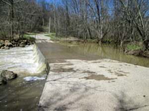
Ford over Duck Creek on Buehls Run Road
The BT leaves SR 821 for three miles on Buehls Run Road. At the beginning there is a concrete ford over Duck Creek. The BT map provides an alternate route that is 0.4 mile longer if there is too much water over the ford. Today there was a considerable amount rushing over the road. It wasn’t deep enough to float our car downstream when we drove through it earlier, but we weren’t so sure about walking it.
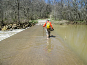
CW crossing the ford over Duck Creek
We had several concerns. Was it deeper than it appeared to be? Was it slippery? Could we be washed off the road? And CW’s shoes aren’t waterproof like mine are. He decided to take his shoes and socks off and test the waters. It felt safe to him, so we chose to cross.
The water was quite cold and CW’s feet went numb. But after he put his shoes and socks back on, he said he was refreshed. It felt as though he’d been to a spa for some wonderful foot treatment (not that he’s ever been to a spa). I crossed in my boots, and the Gore-Tex did its job.
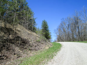
Ascending Buehls Run Road
We walked along Buehls Run Road, an asphalt road covered with loose gravel, for three miles. The map alerted us to a serious ascent. It seemed to go on forever. We just took it one step at a time. Every time I looked up to see if the end was in sight, I saw bright blue sky sitting atop the white road and edged in browns and greens of the landscape. It was such a beautiful sight, and it energized me to the top.
Our next road had mercy on us. It was mostly downhill and took us back to SR 821 where a lot of repair work was being done. I never saw so much heavy equipment at one workplace. We were careful as we walked close to a long line of trucks and then tried to avoid stepping in fresh tar. Another mile and a half and we finished our trail miles. We had an additional 0.3 mile to get to our car at the restaurant.

Tropical Orange Flavor Burst at D & E Drive-In in Macksburg
It was going on 3:00, so we ate at D & E. They had sandwiches, salads, soup, and desserts. We had sausage sandwiches, followed by ice cream. I had a Tropical Orange Flavor Burst, which is vanilla ice cream with some kind of orange syrup swirled in it. It was very good. It tasted like the Dreamsicles I had as a child.
We drove down to Whipple to get the other car, then went back up to Caldwell to leave a car at the motel till we return for our final week of hiking.
This week we added 51.0 miles. The weather was another adventure with rain, snow, snow pellets, sleet, “starflakes,” and wind. But we also enjoyed many beautiful dry and sunny hours on the trail. Once again, the animals entertained us. We are loving these idyllic back roads in this part of the state. It was definitely another fun week. Check back in about three weeks for the final blog in this series.
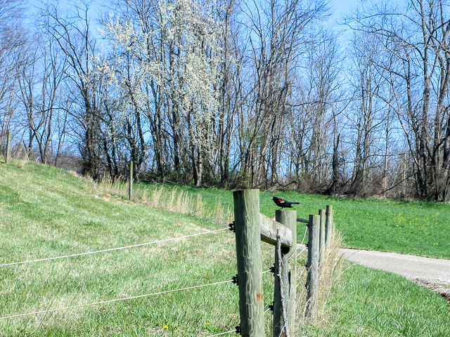
Red-winged blackbird

