by guest blogger Bonnie Spencer
October 9, 2018
CW and I are both huge Cincinnati Reds fans. One of our favorite Reds is Joe Nuxhall, a famous left-handed pitcher. When the lefty retired as a player in 1967, he immediately joined the Reds radio broadcasting team. For the next 37 years, “Nuxy” was a familiar voice of the Reds, ending his broadcasts with his trademark sign-off: This is the old left-hander, rounding third and heading for home. The last six words are prominently displayed on the outside of the stadium of the Reds, The Great American Ball Park.
It’s fall, which means it’s time for CW and me to hit the Buckeye Trail for another, our seventh, 10-percent hike. The trail can roughly be viewed as a ball diamond. However, because we’re hiking clockwise, first and third bases are reversed. Still, the idea is the same. We began at home plate in the southwest corner of the state, passed first base in the northwest corner, and passed second base at Lake Erie in the northeast. Last spring we were running circles around third base in The Wilderness Loop (TWL) in southeast Ohio. We are headed back to that area to complete TWL and then begin the southwest stretch toward home. But that’s all for the baseball analogy. We hope to be more successful in heading for home than our beloved Reds have been the past several years.
Day 1 (Monday): northeast of Deucher at northern trailhead for Scenic River Trail to west of Deucher (6.1 trail miles)
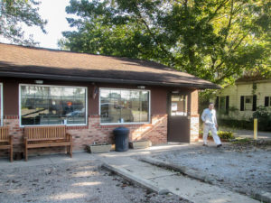
CW getting his doughnut fix from Family Donut Shoppe in Londonderry
We dropped off Pickle Poodle (she’s a poodle and her vet calls her a pickle) at the vet’s for boarding and headed out of town in our two cars under sunny blue skies. We had found an alternate route to interstate that didn’t increase travel time. Yippee! After an hour, we reached a foggy Chillicothe where I picked up a mocha frappe so I could stay awake the rest of the drive. Shortly after that, CW pulled over in Londonderry at Family Donut Shoppe. Apparently, he never passes it without stopping. Since I can’t eat and drive at the same time, I ate in the car on the side of the road. A college friend lives a few miles off that road. I waved in her direction and called a garbled, gooey greeting to Marilyn through a mouthful of chocolate éclair.
As we drove on, feathery clouds hung low in the fields, seemingly within my reach. They begged me to stop the car and play with them. In contrast, a mass of pure white clouds sat at the foot of a hill straight ahead, looking as though it had dropped from the sky because it was too heavy to float any longer.
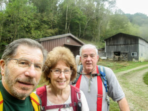
CW, me, and “Zombie Bob,” looking pretty alive
We were surprised when our GPS took us over the Ohio River into West Virginia, but it brought us back and we reached our motel in Marietta where Bob was waiting for us. He’s one of CW’s hiking buddies (“Zombie Bob” in Hiking Without Dave). He was planning to camp in the area and hike with us for three days.
We checked into the motel, got a bite to eat, and then shuttled cars. With Bob driving, we only needed one of ours. When we got to our first spot, we drove right by the house of some people CW and Bob met while hiking the BT their first time around. We stopped and talked with the lady for a while before parking a car nearby and proceeding to our starting point.
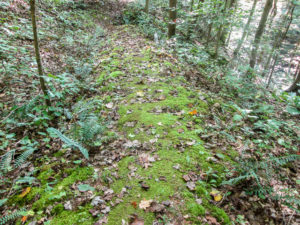
Mossy path edged with ferns in Wayne National Forest
We were on the trail just after 2:00 p.m. Today we hiked trails through Wayne National Forest (WNF) with less than a mile on roads. We were pleased to find it well-marked and not overgrown. When CW was through this area with Bob nearly 10 years ago, they had to do some bushwhacking. Today, even when the path was weedy, it was obvious where to walk and the growth wasn’t over a foot tall. Much of the trail was a footpath. In other places, it followed skid roads where logs are hauled.
We undulated between ridges. After 20 minutes, we encountered our first steep climb. It and others to follow were challenging for sure. I’m rusty since my last hills were nearly five months ago. I had to take breaks on them, but the rest of the terrain was enjoyable. Besides the rustling leaves, I listened to the percussion of acorns rhythmically dropping onto rocks and fallen trees.
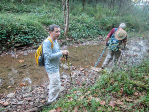
CW and Bob crossing one of the many streams we encountered in the Wayne
When the ascents weren’t steep, I tried to move quickly. At one point, I got quite a bit ahead of the guys. I heard CW calling my name from somewhere above.
“Where are you?” he yelled.
“Down here,” I yelled back.
“Which way did you go at the fork?”
I had followed the blazes onto a switchback, but I guess they hadn’t switched. We yelled back and forth until we couldn’t hear each other. Several minutes later they came back in range, and we yelled through the forest a while longer. After at least 20 minutes total, they caught up to the point where I had been waiting. CW said they hadn’t even been talking politics, which is usually the case when they stray from the trail. It took us over two hours to do three miles, and we still had three more miles to go.
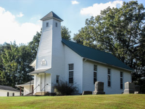
Deucher Baptist Church . . . which is not on the Buckeye Trail . . . so neither were we
After a half mile more on trails, we crossed a paved road. On the other side was CR 9. We knew from the map that the BT goes on CR 9, so up we went. Although it ascended gradually, it was continuous. We kept walking . . . and walking . . . and walking. No blazes. I finally read the map more carefully. When we crossed the road below, we were supposed to re-enter the woods on a footpath and come out on CR 9 farther up the hill. Well, it was way too late for that. I didn’t have the energy to go all the way back down and come all the way back up on a trail that ran relatively parallel to the road we had just conquered. Later we drove by that entrance to the woods. It looked to be on the unmaintained side, which made us feel better about our decision.
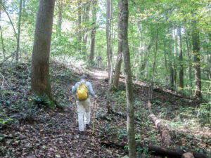
CW on a shaded trail through Wayne National Forest with Bob out front on spider patrol
The worst thing about the day for me was the heat. It reached into the low 80s. Can we pick the weeks to hike, or what? Usually we would start the last week of September, which happened to be much cooler. However, we already had our reservations and Sugar’s (Pickle Poodle’s real name) made. Thankfully, the forest cover provided a large amount of shade, so it could’ve been worse.
It was bad for the spiders; we destroyed a lot of homes today. By the end of the day, I felt as if I were wrapped in a web. But we didn’t see any ticks. Last fall they were terrible, so this year CW proactively sprayed a set of clothes for each of us with permethrin.
We finished at 6:00, having hiked our 6.1 miles. Not bad for a Monday when half the day was taken up driving from home. And we covered the farthest part of TWL to the east.
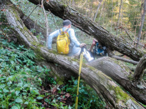
CW and Bob climbing through downed trees across the BT in Wayne National Forest
After we got both cars, we scouted for a place to park near our ending point tomorrow. The ideal spot was at a hay barn that CW stayed in when he backpacked TWL in 2014. We hadn’t found the owner at the barn to ask permission, so we drove quite a bit to find some other possibilities. We decided on one and were leaving the area. A man on a huge tractor was coming down the road and was about to pass us when CW stopped our car in the road and hopped out. It was the man, and he said we could park at his barn for the next two days. He said to park in front of the corn picker. We had seen more than one implement, though, and city folks don’t know much about farm equipment. CW said that if he parked in the wrong place the first day, just leave a note on the windshield. With a mischievous grin, the man said no need, he’d just drag it.
By then, it was after 7:00 and getting dark. Bob decided to get a room at our motel for two nights. He and CW went out to eat while I stayed in the room to wash the spider webs away and work on my blog. But before they went, CW drove across the road to Kroger and brought me back a pint of Lemon Cake ice cream. It was hard as cement. I left it in the refrigerator a while, but that didn’t help. Since I didn’t have an ice pick, I finally microwaved it so I could get the spoon into it. It tasted pretty good.
Day 2 (Tuesday): west of Deucher to Sitka (4.9 trail miles + 3.5 non-trail miles)
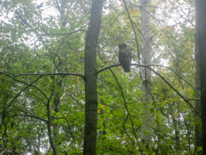
The first owl we’ve seen on the Buckeye Trail
Our plan was to hike 9.4 miles today, continuing through WNF and ending in Sitka at the hay barn. But hiking plans often change—especially for me when the 3 Hs (as CW calls them) come together for the perfect storm: hills, heat, and humidity.
We began hiking at 9:15 a.m. It was cloudy and slightly cool. For the first 20 minutes, we ascended at an 11% grade. I can’t translate that to what it will be like to walk up a hill, but I’ve learned that when the BT map follows a hill with a %, it means steep. Today there were a lot of %s. When we reached the top of that first hill, I was drenched from the humidity.
We also had to contend with more spider webs. Common sounds in the forest today were not noises from the wildlife, but screams from the lead hiker getting wrapped by a massive web when he forgot to swing his sticks out to knock them down.
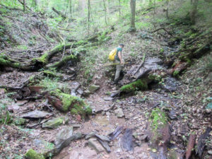
CW climbing out of a streambed
Today’s trails provided much variety. We walked through leaves, low brush, and muddy areas. We walked on rocks, hills, ridges, narrow rims, and wide paths. We tried to avoid stepping on the walnuts, acorns, and buckeyes. There were many limbs and trees across the path that provided challenges. We saw several varieties of ferns, fungi, and mosses. The trail crossed quite a few streams. The water itself was no problem, but getting down the bank and then up the other side was sometimes tricky.
About 45 minutes into our hike, the trail followed the edge of private property. The couple who live there were out doing some work. We talked with them about 20 minutes. The man couldn’t believe how far we were going. He kept telling us we’d better go because rain was coming, but we kept talking because we so seldom see people along the trail to talk with. He is going bear hunting in West Virginia next week and invited us to go. Yeah, like I want to actually go looking for bears? Then he admonished us to be on the lookout for copperheads that are out this time of year. And I had just been worried about ticks.
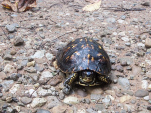
Turtle #3 in two days . . . or maybe we are being followed
We continued on, now watching for copperheads as well as spiders. There were whopping ascents. CW and Bob stopped to rest during one, but I went on to try to reach the top before resting. I finally sat on a log for 10 minutes. I was hot and weary, and wondering how I would make it to the end. When I heard their voices, I began walking again slowly. I didn’t want to get too far ahead today.
We finally reached our next point close to 12:30. We had hiked for over three hours and hadn’t even gone three miles. The trail crossed a road there. We had lunch by a guardrail. I read the map to see what was coming next. The map details gave several % grades, higher than the ones we’d already done. I lay down in front of the guardrail, still wondering how I could do 6.5 more miles.
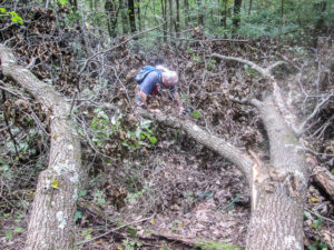
Bob walking in the treetops . . . that are lying on the trail
With no other options at the time, we got back on the trail, which—surprise!—climbed steeply. During a break 40 minutes later, as I groaned in misery, we discussed an alternate plan. If there was a place at the next road crossing where we could park a car on another day, we would leave the trail and walk the road to the barn. That would shorten our trail miles today, but at least we would arrive at the car before dark.
But to get to that road, we had to first walk through the treetops. We came to a huge downed oak tree, its vast leafy branches right across the trail and extending in both directions. We tried to go down and around but there was too much brush. Bob took the direct route straight through. CW and I went up the bank fighting brambles. Then we walked back down on trunks and thick branches. Eventually we had to step down between them into pockets of smaller dead, crunchy branches. CW said it was the perfect place to find those copperheads.
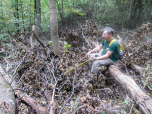
CW halfway across the tree with only one stick
But CW wasn’t there to protect me. About that time, he realized he had only one hiking stick. He had left his other one back a ways on the trail and had to go back for it. Bob and I made it to the trail with no snake encounters and waited for CW to return and tangle with the oak again.
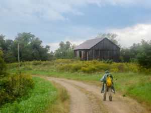
Pretty country road after a brief rain
Five minutes later we reached our road. We were thrilled to see there was room to park a car. So we skipped 4.5 miles of woods and hit the road, listening to distant thunder. Sprinkles eventually came. Then harder sprinkles. Then it poured. I was drenched, but at least it was cooler than the drenching from sweat. The downpour stopped before long, and the sun came out again.
After an hour and a half, we passed the spot where the trail came out on the road. From there we could begin counting our mileage again. It was 1.2 road miles to our car. And we found the car exactly where CW had parked it. I guess Bob knows his corn pickers.
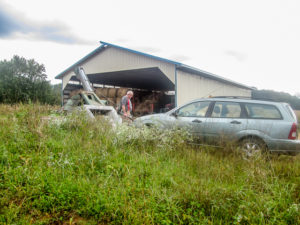
Our car right where we left it by the corn picker
So that’s how our 9.4-mile day ended up being only 4.9. We’ll have 4.5 miles in WNF to make up another day.
Another long (in time, not miles—sigh), weary, grimy day kept me in the room again. CW brought supper back from Wendy’s and a small container of Haagen-Dazs Chocolate Peanut Butter ice cream from Kroger. No need for a microwave tonight.
Day 3 (Wednesday): Sitka to Whipple (12.8 trail miles)
Bob didn’t hike today. He decided to go home this morning, but he kindly offered to shuttle us before he left. And of course we accepted. First we drove to Whipple and dropped our car off. Since today’s miles would all be on roads, Bob drove the trail to our starting point. That can be risky because some back roads might be walkable but not drivable.
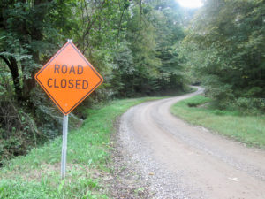
Road Closed sign we encountered while shuttling and chose to ignore
Today we came to a Road Closed sign but ventured forward anyway. We didn’t find the reason for the sign and made it through with no problem. Bob dropped us off at the hay barn in Sitka. The corn picker would not have the company of our car today.
The forecast was partly cloudy with a high of 80 degrees. When we started out around 9:30 a.m., it was in the low 70s. We felt the humidity immediately. Within a half hour, I was swimming in perspiration. Two miles in, we reached Pleasant Ridge Road, which lived up to its name. We began experiencing occasional cooling breezes. They would come and go throughout the day.
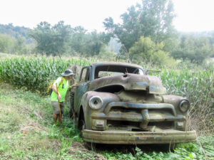
CW looking for a price tag
If it wasn’t for the heat and humidity, the hike would have been enjoyable. The roads were the kind we like: low-traffic country roads. They switched among paved, packed gravel with a partial covering of loose gravel, and dirt with a few potholes. There were plenty of ups and downs, ascending to ridges and descending into valleys. This was Day 3 and I was feeling stronger on the hills. But I was totally depleted of energy because of the humidity.
CW can take the heat and humidity pretty well. It’s just me whining and groaning as sweat drips off me and I think I can’t take another step. In spite of that, we were making decent time. Much better than in the woods yesterday. In our first two hours today, we walked as many trail miles as we did yesterday in close to 5.5 hours.
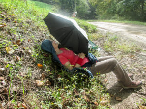
Me taking a serious rest
Halfway through, we took a few minutes to sit down and eat. The rest helped me a little, but an hour later the sun popped out. I hadn’t thought it could get any worse, but it did. The sweat dripped faster. And I whined and groaned more. Twenty minutes later I was lying on my rain jacket on a bank beside the road with CW’s umbrella shielding me. I could have fallen asleep. This is where I was when another hiker came walking by.
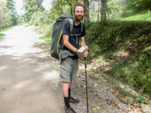
Nathan, a North Country Trail backpacker, with 440 out of 4,600 miles left
Nathan is backpacking the North Country Trail (NCT), which coincides with a large portion of the BT. He started around Cincinnati and hiked west to North Dakota. Then he began his second leg in New York and is hiking to Cincinnati. He’ll finish his 400-plus remaining miles of the NCT before CW and I finish our fall hike.
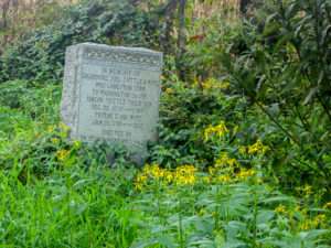
A memorial stone along Kohl Road for Joel Tuttle and his family who settled in the area in 1777
Yesterday Nathan was hiking in WNF. He was not pleased that he’d only covered 21 miles. Oh my gosh! And we couldn’t even make it to 5 miles! We gave him all the food we had in our packs to help him on his way. Although we were headed the same way, we (I) couldn’t keep up with his pace, so we said our goodbyes. Meeting Nathan was definitely the high point of today’s hike.
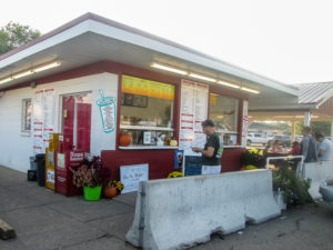
Cone-N-Shake in Marietta, home of the Thang
After returning to the motel, we walked next door to Bob Evans for supper. Then we asked the man working at the front desk in the lobby where we could get ice cream. He suggested Cone-N-Shake not far down the road. We found it and I got a Kit Kat Thang (their equivalent of a DQ Blizzard). There was only one size—and apparently it was “huge.” I tried to get CW to eat some of it, but his “small” cone was six inches high and he wasn’t interested. I can’t throw ice cream away, so I gave it to him when I couldn’t eat any more and he threw it away . . . I think. I couldn’t look.
Day 4 (Thursday): Chesterhill to Shews’ Orchard (10.2 trail miles)
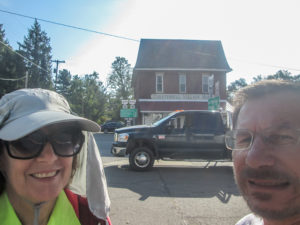
Beginning a sunny day in Chesterhill
We set off today in both cars to walk some more roads, but this time west of Marietta in the Stockport section. Shuttling took nearly two hours. From the air-conditioned car, I was enjoying the blue sky, the bright sun, and the beautiful countryside. I figured I wouldn’t be able to enjoy it when we hit the trail. Heat, humidity, and sun were in the forecast again.
We left a car at Shews’ Orchard. CW checked with Marjie Shew to make sure it was OK to park there. I waited in the car and watched the lively Australian Shepherd bounce around the yard. We drove back to Chesterhill and stopped in at the diner to use the restroom. The restaurant looked inviting, and we planned right then to return there to eat when we finished hiking.
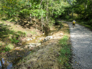
A great trail to start off our day
We started walking at 10:15 a.m. from the center of Chesterhill, a village with a population of less than 300. I had my long-sleeved shirt and hat on because of the sun. We turned off of a house-lined street onto a lane that pulled us right into the trees. The leaf-covered trail was shady, and the air was still cool. The next roads were more exposed, but clouds moved in to shade us and breezes kept us company. It was great. I didn’t perspire for the first hour. What an enjoyable beginning.
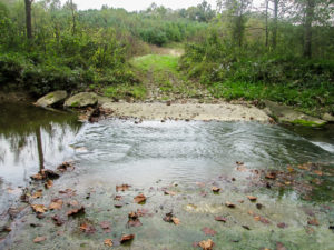
A stream over a road closed permanently to traffic but open to BT hikers
Then the humidity kicked back in. After two hours, I was lying in the grass on CW’s Matador ground cloth and using his backpack for a pillow. Fifteen minutes of cooling down helped, and I was up to tackle the hills and weather again. I would have to sit down and rest several more times before we finished.
We had to ford several small streams that ran over the roads. One mile-long road has been decommissioned, so it is no longer maintained by the county. It is blocked to traffic at both ends, but the BTA has permission to continue using it.
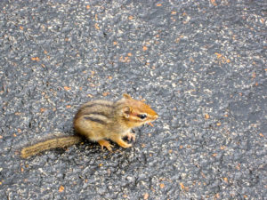
A chipmunk that allowed us to get quite close
While driving and hiking this week, we’ve seen lots of chipmunks skittering across the roads. They’re so quick that it’s impossible to get a good look at the cute little critters. That’s why it was such a surprise that a chipmunk was sitting in the road today and didn’t move as we slowly approached. I got a close-up photo of him before he turned and scooted away, disappearing into the grass. We thought he might have been slightly injured.
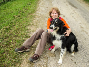
Me and Jubie
Around 2:30, it rained enough that I got my poncho out. However, like yesterday, it didn’t last long. We made it to Shews’ Orchard a little after 3:00. Pete Shew was out taking down some old fencing. We had a delightful conversation with him and Jubie. That’s the Australian Shepherd. I needed to rest again so I sat down on the road. That put me on Jubie’s level. He immediately appeared at my side and just about wrestled me the rest of the way down.
With Jubie escorting us, we retrieved our car from .2 miles down the lane. Then he trotted in front of us in the middle of the road as we drove back out. We couldn’t get around him. It was hilarious.
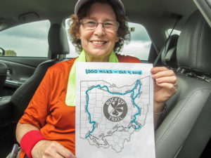
I reached 1,000 miles on the BT at the end of the day!
We covered 10.2 miles today in five hours. The weather and hills were difficult again, but today was better overall than yesterday. Instead of sweating buckets, it was only teacups. We were blessed with unexpected clouds and uplifting breezes much of the day. We saw a touch of fall color in the landscape.
And at the end of today’s hike, I hit the 1,000-mile mark on my way around the state. Only about 440 more miles to go!
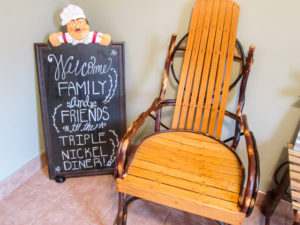
Entrance of the Triple Nickel Diner in Chesterhill
On our way to Chesterhill, we encountered a brief, but heavy, downpour. When we arrived, we made a beeline for the Triple Nickel Diner and had Shew Burgers, made from 100% grass-fed Angus beef supplied by Shews’ Orchard. Delicious! Then we stopped at Whit’s Frozen Custard in Marietta, another place the man at the front desk told us about last night. I got a scoop of Caramel Pecan Pie and took it back to the room to eat.
Day 5 (Friday): Centerville (in Morgan County) to south end of AEP ReCreation Land (7.2 trail miles)
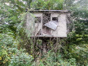
A vacant tree house where we probably could have gotten cheap rates this week
Originally we were going to do a few miles through the AEP today, but we decided against it. The woods can be unpredictable, and we will be pressed for time to get home to pick Sugar up. We chose to walk 7.2 miles on roads. Though it would require a lot of shuttle time, we could cover the trail quickly.
We checked out of the motel and were hiking an hour and a half later. It was an overcast day with temperatures in the 50s and 60s. This is what we had waited for all week. Finally fall weather. It was delicious.
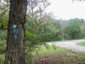
The Whipple section ends here and the BT continues north and south in the Stockport section
We were back in the Whipple section walking west on the bottom of TWL as we’d done for most of the week. Again we were on little-traveled roads. They were quiet except for the crunching of our boots on the pebbles and the gurgling of the various creeks the trail followed. Most of the trail birds didn’t even have any breakfast chitchat going on. However, all the bird population from Hackney had gathered in the trees on one side of the road to celebrate our arrival. Several beagles on the other side joined in.
After close to six miles, we came to the end of the Whipple section. It ran into the Stockport section that went both north and south from that point. We went north for 0.9 miles till we reached the southern edge of the AEP, where we had originally planned to hike today. We’d made a good choice in switching. We hiked 7.2 miles in 2.5 hours, finishing just before noon.
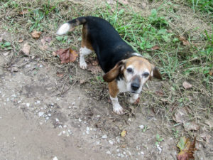
A friendly beagle walked us to our car to finish the first week of hiking
We haven’t had any close encounters with dogs this week, unless you count Jubie yesterday. We passed a house today where there’s a dog CW remembers as being more aggressive than any others he’s seen on the trail. The house sat far back from the road. CW spotted the dog sleeping at the bottom of the front steps. We walked quietly in the grass on the other side of the road, and he didn’t stir.
At the last house we passed, a beagle trotted down to the road. He didn’t make a sound. He followed us the length of his yard, then made his way to the road and continued to follow us to our car. He was a happy dog just wanting to stroll with us.
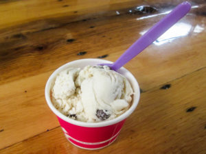
Campfire S’more ice cream at Local Roots in Caldwell
We drove up to Caldwell to leave a car where we’ll be staying our next trip up. Then we dropped in at Local Roots, the coffee shop we discovered in the spring. We talked a bit to Rusty and Shawn. During our next hiking trip, CW will be doing a presentation on the Buckeye Trail one evening at Local Roots. Before heading home, we each dined on one of their unique sandwiches followed by Campfire S’more ice cream. Everything was excellent!
This week has been an endurance test for me. I finished achy and worn-out. Because of the heat, we added only 41.2 BT miles (less than Nathan would do in two days). But I’ll choose to remember the good things: getting to hike with Bob for two days, not losing CW in the woods permanently, encountering zero ticks and copperheads, meeting Nathan on the NCT, being loved on by Jubie, discovering the Triple Nickel Diner and the Shew Burger, finishing 1,000 miles on the BT, experiencing the great food at Local Roots, being blessed by the friendliness of everyone we met along the trail, and getting to end the week with cooler weather. Hopefully, that is an indication of what’s coming next. Check back in a couple of weeks for Part Two of our fall adventure.
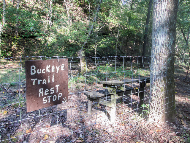
More of these are needed on the Buckeye Trail

localroots
October 29, 2018The pics look great (especially the Buckeye Classic 😉 Congrats on breaking the 1,000 mile mark Bonnie!!
CW Spencer
October 29, 2018Thanks Rusty and Stephanie. We are grateful that you have been a part of our journey. Is the Buckeye Classic the daily delicious sandwich in Part Two? I didn’t remember it being named yet when CW got it.