by guest blogger Bonnie Spencer
November 6, 2018
Day 11 (Monday): Burr Oak State Park Boat Dock #3 to Boat Dock #1 (7.3 trail miles)
Today CW and I are beginning the third and final week of our fall hike on the Buckeye Trail. Since we finished The Wilderness Loop our last time out, we will travel in a generally westward direction this week. We are staying at the lodge at Burr Oak State Park. The Buckeye Trail crosses the drive to the lodge, so we will enjoy some closer shuttling than we’ve had recently.
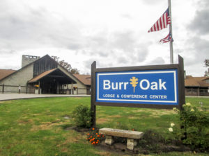
Burr Oak Lodge & Conference Center in Burr Oak State Park
We arrived at the lodge at 11:00 a.m. and checked in early. We are accustomed to motels where we pull up near a side entrance to carry everything to our room through a hallway lined with closed doors. And we always have way more than two people should have: duffle bags, a shoe bag, backpacks, boxes and bags of food, a laptop, a crate and bags of various hiking items, and a closetful of hanging clothes. We both had concerns of looking like the Beverly Hillbillies as we lugged everything through the open and attractively furnished lobby of the lodge. Our only consolation was that we would be embarrassed together.
To our relief, we found the lobby to be very quiet at 11:00 a.m. It took each of us three trips to unload everything. I didn’t notice anyone staring or pointing. I think we pulled off a stealthy maneuver.
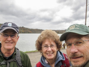
George, me, and CW ready to hike from Boat Dock #3
This week we plan to finish the Stockport section and do as much in the New Straitsville section as we can. Most of the first miles are on roads. Then there is considerable hiking in the woods around Burr Oak Lake and farther west through more of Wayne National Forest (WNF). We want to begin with the woods, though, and save the road walking for later in the week. Quite a bit of rain fell yesterday, and much more is predicted mid-week. Due to concerns about the stream crossings, we prefer to hike the woods before the other rain comes.
CW invited George to hike with us. He met us at the lodge at noon. (Fortunately for him, we had already carried everything in.) We shuttled cars, using George’s and one of ours, and were hiking by 12:45 p.m.
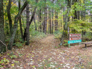
The Chipmunk Trail began on a path of pine needles
Our hike began six miles into the New Straitsville section where the Buckeye Trail closely follows the outside shore of Burr Oak Lake, which is shaped like a jagged backwards J. The lake was created for use as flood control, water supply, and recreation in 1950 when the Tom Jenkins Dam was constructed by the U.S. Army Corps of Engineers.
The first five miles of today’s hike is also known as the Robert and Mary Lou Paton Trail, named for charter members of the BTA. That trail ends at the Nature Center building on the drive that goes to the lodge. There, the BT picks up the Chipmunk Trail for a short way, and then joins the Ravine Trail for 1.5 miles.
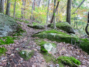
A path through moss-covered rocks on the Robert and Mary Lou Paton Trail
Most of the paths were covered with leaves. In some places, rocks and roots tried to trip us. Other stretches were muddy and slick. The trail undulated, sometimes steeply. During the last couple of miles, the brush began encroaching on our trail. Each of these annoyances was short-lived, though. It was a fun hike.
We enjoyed the crisp, fall day. The temperature hovered around 50 degrees. A few sprinkles fell early on, but they didn’t linger. For much of the day, the sun made its way through the trees to us.
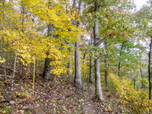
Yellow splashes along the Ravine Trail at Burr Oak Lake
Two weeks ago, we saw little color. Today there was much more. Even though the leaves were mostly yellow and lacked vibrancy, they still pushed my joy button.
We finished a little after 5:00 p.m. By 5:15, we were seated at Bonnie’s in nearby Glouster. It is another hometown restaurant where everyone knows everyone else. Bonnie was in the dining room talking with customers. George, CW, and I all had the meatloaf special with parsley potatoes and baked beans. It was good home cookin’.
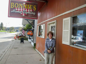
Bonnie’s restaurant in Glouster
Afterward, we stopped a few blocks away at DQ. We haven’t come across any ice cream shops, so I was glad to see a big sign in DQ showing four limited-time blizzards I’ve never had. I may be frequenting DQ this week. Tonight I got the Reese’s Outrageous Blizzard.
We took George back to his car. He came prepared to camp. Since there was a campsite at the boat dock, we left him to set up his tent. We tried not to think of him out in the cold as we drove back to our warm room.
Day 12 (Tuesday): Burr Oak State Park Boat Dock #1 to Smoke Rise Ranch Resort office (11.4 trail miles)
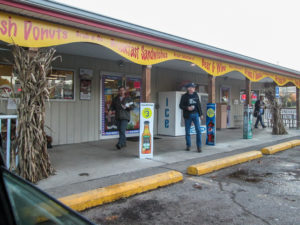
CW and George coming out of Cornerstone with their donuts
George met us at the lodge for a second day of hiking. He had already been to Bonnie’s for some more of her home cooking. We left shortly after 8:00 a.m. to shuttle cars. While CW was driving, the car pulled into the lot at Cornerstone, a market at a Sunoco station in Glouster. The guys got donuts. They both seemed to be quite familiar with the place. Must be from when they hiked through this area two years ago.
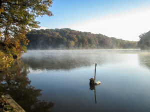
Morning fog rising from Burr Oak Lake at Boat Dock #1
Today’s hike would cover over 11 miles with less than a fourth of them being on roads. We would start at Boat Dock #1 where we ended yesterday and end at the Smoke Rise Ranch office. As we walked across the parking lot of the boat dock at 9:00, it seemed apropos that fog was hovering over the lake. It looked like smoke rising from the water.
For nearly three miles, we continued on a meandering path that followed the shore of the lake. We had to step carefully to avoid stumbling on the rocks and roots firmly established in the trail and on the loose layer of limbs, walnuts, and buckeyes. The trail was a balanced mixture of ups, downs, and level stretches.
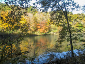
The sun lighting up the trees across Burr Oak Lake
This was another perfect hiking day, starting out at 36 degrees and rising into the 60s. There wasn’t a drop of precipitation. The sun was out most of the day. The trees sheltered us from its direct effects, but we enjoyed the show it put on. It lit up the trees overhead, which was especially striking against the blue sky. We often stopped to soak in the beauty of the sun reflecting on the lake and painting brilliant colors on the opposite shore.
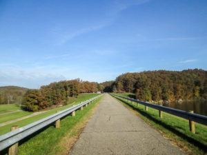
Crossing Sunday Creek on Tom Jenkins Dam
We reached Tom Jenkins Dam. It is constructed on Sunday Creek, a tributary of the Hocking River, and named for the late congressman who helped get legislation through congress authorizing its construction. The Buckeye Trail crosses the dam and leaves the lake.
After a short distance on a road, we crossed over a guardrail and took a footpath into WNF. We were now in the Athens unit of WNF rather than the Marietta unit where The Wilderness Loop is located.
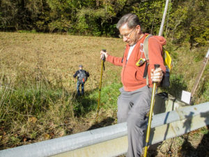
The Buckeye Trail goes over a guardrail and into Wayne National Forest on a footpath
It seemed to me that we went up more than down, and the ups were longer than along the lake. I surely got a workout. Some of the trails were muddy service roads. It became monotonous to try to get around the mucky spots. We were amused by a description in the BT map for this area: “meandering footpath with apparent aimlessness . . . over hill ‘n’ dale.”
A short section of trail passes through private property that is fenced off. Two stiles have been placed to allow hikers to enter and leave. We appreciate property owners who allow the BT to use their land.
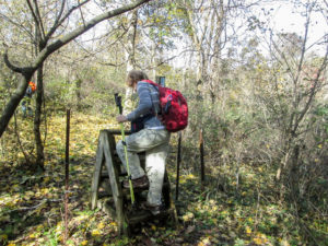
Crossing a stile onto private property
We joined another road and passed a house that sat 100 feet back on elevated ground. All was peaceful and quiet. Suddenly, a black dog popped up in front of the house and began barking. Then a second one arose. Then a third. All three loudly made their way down to the road. All three of us were armed with our dog spray.
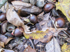
While meandering aimlessly, we saw numerous acorns on the path already sprouting
The racket brought a woman out of the house. She tried valiantly to get them back, but they aren’t used to hikers passing by and wanted some action. Then another woman came out shaking a container of food and scattering it on the ground like she was feeding chickens. That finally enticed them away from us. Saved by the dog food. Maybe we should carry dog biscuits instead of spray.
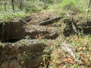
The trail was washed away in one place in Wallace H. O’Dowd Wildlife Area
After a mile and a half, we left the road and entered Wallace H. O’Dowd Wildlife Area. It is composed of nearly 6,700 acres that have been extensively timbered and mined for coal in the past, and it’s now regarded as a recovering forest. It had some of the muddiest trails yet. There was also a place where the trail had been washed away. The openings in the ground were so deep that we had to go off the trail to get around. While still in the wildlife area, the BT joined real roads for a mile and a half. We were glad to be off the rutted ones.
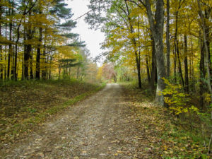
A much-welcomed gravel road through Wallace H. O’Dowd Wildlife Area
The last mile or so was on the property of Smoke Rise Ranch Resort. Smoke Rise is a western-style guest ranch and is a working cattle ranch on 2,000 acres of privately owned land. On half of the trail we had to skirt mud, but since we were so close to the end of our hike, it didn’t bother me so much.
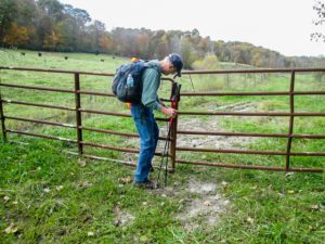
George opening one of several gates the BT passes through on Smoke Rise Ranch property
I first became acquainted with Smoke Rise in 2015 when CW and I volunteered at the First Annual “Run for the Blue Blazes” Marathon Trail Run. The marathon ran between Shawnee and Burr Oak. Our station was beside the Smoke Rise office. As we awaited the runners to offer them water and snacks, we were kept company by ponies, goats, dogs, and one cat that was intent on jumping up on the table to sample the goodies. Today there was only one pony roaming loose, but we saw other horses, cattle, and a pen of noisy Guinea fowl.
We finished hiking a little after 3:00 p.m. From “smoke rise” on Burr Oak Lake to Smoke Rise Ranch, it had been a great day. By 3:30, we were back at Bonnie’s. It was close and we were hungry. We all got the spaghetti special. We didn’t see Bonnie today.
We drove George to his car at Boat Dock #1. He had his drone in the car. We watched as he got it out and flew it briefly. He likes to send it up and take pictures. Today it went up about 300 feet and he got a couple of nice photos of the lake and boat dock.
Then we parted, George to go home and we to visit DQ. We stopped to get gas in the car first. As we parked at DQ, we were surprised to see George pull in. He treated us to ice cream before we parted again. Today mine was an Oreo Hot Cocoa Blizzard.
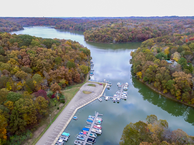
Burr Oak Lake at Boat Dock #1 (photo courtesy of George Tyo)
Day 13 (Wednesday): Wildcat Hollow Trailhead to Burr Oak State Park Boat Dock #3; Salem Road north of Wayne National Forest boundary to Tecumseh Lake in Shawnee (7.4 trail miles + 1.7 miles due to missed blazes)
As we shuttled cars for today’s hike, I could hardly take my eyes off the sky. The clouds were a mixture of white and various shades of gray. In the east, the soft shapes were backlit by the sun, causing their edges to glow.
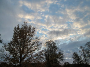
Beautiful morning clouds backlit by the early sun
We would be grateful for every minute the sun hung around and for every dry step we took because rain was in the forecast for this afternoon. Not just a quick hi and bye, but a moving in with a full set of packed luggage. The rain is supposed to continue throughout the night and all day tomorrow with a flood watch in effect until Friday morning. The 1-2” of rain expected can raise the streams we cross, make already damp and muddy trails more treacherous, and even cause low-lying back roads to be impassable. That’s why our daily hiking schedule has been “fluid” all week. So today was a game of beat the rain.
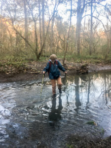
Carefully crossing Sunday Creek so I don’t get water in my boots
We started off with 2.6 miles around the east side of Burr Oak Lake. Originally we had this trail tacked onto some road miles, but we’ll do the road part tomorrow.
We began at 8:45 a.m. on the Wildcat Hollow Trail. Before long, the trail crossed the East Branch of Sunday Creek. CW remembers having to wade through almost waist-deep water here on a previous hike with George. It was only several inches deep today, but we still looked up and down the creek for a better place to cross. Not finding one, we forged ahead. It was probably because I tip-toed across that no water got over the tops of my boots and inside.
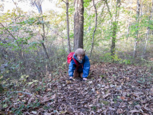
After 1,070 miles on the BT, I fell and ruined my perfect record
We began racing along the leaf-covered trails. Every minute counted. My sticks were propelling me. I watched the ground because of all the things that can trip us up. Then it happened. I felt the toe of my boot hit something like a root, and I was instantly on my hands and knees. I had fallen! In 1,070 miles on the BT, I hadn’t fallen. I had been determined to make it all the way to the end with a perfect record. But now . . . It’s like getting a scratch on a new car. It won’t matter how many times I fall from here on out because my record is ruined. Unlike the scratch, though, I can’t erase the fall. CW has preserved it digitally. Funny thing is, I looked for that root and couldn’t find it—or anything else even slightly sticking up in the path. Hmmm.
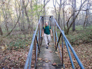
CW crossing a pipe bridge over Bloody Run
The race resumed. The trail took us up on ridges, then back down to the flood plain. At one point we couldn’t find blazes, but we didn’t wander far from the trail. The BT briefly left the shore of the lake. We crossed Bloody Run on a pipe bridge. Then the trail went through a field that can get swampy. It didn’t seem bad today, but it was fun walking across the 450’ bog bridge.
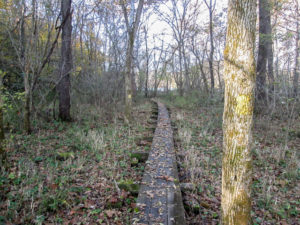
Wooden bog bridge through a potentially wet field
We finished just after 10:00. While driving to pick up the other car, we discussed how to get to the town of Shawnee where we would be hiking next. It was about 30 miles west in WNF. CW’s GPS gave him a shorter and quicker way to get there than our map offered us, so he decided to take it. Rain was coming, and we needed to shuttle as quickly as possible.
The GPS did fine until we came to a questionable road that neither of us felt good about taking. We had to backtrack quite a ways and then go the other route after all. It wasn’t until 11:30 that we finally got to Shawnee and parked a car at Tecumseh Lake.
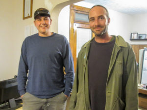
Ryan, BTA AmeriCorps volunteer, and Andrew, Executive Director of the BTA
The BTA headquarters is in Shawnee. We stopped at the office to see Andrew, the executive director, and get some directions to the spot we’d start this hike from. We got a bonus when we met George and Ryan, the two new AmeriCorps volunteers. Then we rushed off to stay ahead of the rain.
We were hiking at 12:10 p.m. The trail started right off with a steep climb, but we moved as quickly as we were able, meandering and undulating our way through the forest.
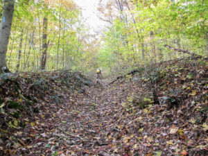
CW on the initial climb into the woods of Wayne National Forest
We came to an old service road. Although it was badly rutted, we were flying over it with the help of our sticks. We had to watch our footing so carefully that we totally forgot to look for blazes. Had we looked, we wouldn’t have found any. There were none because the BT doesn’t go on the road. We were supposed to cross it and keep going on the footpath.
We backtracked. Forever. Until then, I hadn’t realized we’d been going downhill. Now we had to climb back up the ruts. I was disappointed to find that after an hour, we’d gone only 0.4 miles that counted. And the rain was on its way.
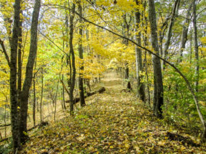
Even moving fast, we couldn’t miss this beauty
We hurried on, diligently watching for blazes. Whoever was in front would yell out “blaze” every time they saw one so we wouldn’t make another costly mistake. Every so often, the wind would roar through the trees, swirling leaves all around us. We knew what it meant, but it felt wonderful and was a fun sight. Although we were in a race, we still were enjoying the beauty of our surroundings—just enjoying them quickly.
At 1:45 p.m., we lost the game. The rain began lightly but soon turned into a steady downpour. We quickly put on our rain ponchos and continued with a slightly slower pace but still moving like two people who wanted to be finished. As we slid through the forest for almost two more hours, our boots and pants soaked up water.
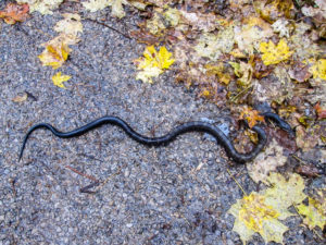
The snake seemed to be confused as to where the trail was too
We got in one more short detour when we forgot to call out our blazes. Again we started down a road instead of crossing it. But we didn’t go nearly as far as the previous time before realizing what we’d done. On this detour, we saw a snake along the side of the road. It was alive and didn’t look to be hurt, but it didn’t move until CW touched it with a hiking stick. Then it only changed its position to look at us.
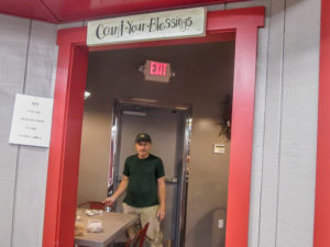
B&C Mini-Mart in Shawnee had a cozy little dining area
We reached Tecumseh Lake at 3:30 and stopped in briefly at the BTA office again. Then we went to B&C Mini-Mart in Shawnee to check out their ice cream. After eating something warm from their deli, I had a Klondike Heath bar. Then back to the lodge we went to dry ourselves and our boots out for another day in the rain tomorrow.
Day 14 (Thursday): Shews’ Orchard to Wildcat Hollow Trailhead; Smoke Rise Ranch Resort office to Salem Road north of the Wayne National Forest boundary (15.0 trail miles)
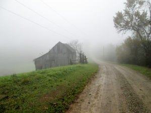
A foggy morning on the Buckeye Trail
The weather forecast for today that I looked at said rain all day; the one CW looked at said no rain till the afternoon. We chose his—but I still put my rain pants on and carried my poncho. We had a few sprinkles while shuttling cars, but most of the moisture just hung in the air giving the landscape a gray, misty appearance.
This morning we went east to do those road miles we didn’t do yesterday. They would finish the Stockport section and begin the New Straitsville section, connecting parts of the BT we’ve already hiked.
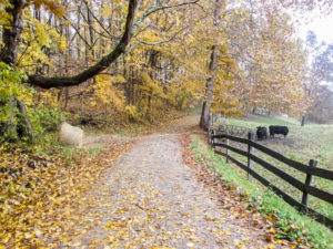
A back road in Morgan County
On the way to leave a car at the Wildcat Hollow Trailhead, CW noticed Sunday Creek was up a couple of feet from yesterday. We would not have been able to cross it today. Since we would be walking on back roads, we drove the trail to our starting point to look for any surprises. We were thankful not to find any roads covered by high water.
We began hiking just after 9:00 a.m. There was no rain falling at the time, but I wore my rain jacket anyway. It was partly for warmth, but I also wanted to be ready when those sprinkles hit. At times, the atmosphere was humid and uncomfortable. I would have preferred the rain. However, the trail would climb to a ridge where the air was more pleasant and we’d forget how badly we’d felt a few minutes earlier. I eventually stuffed my rain jacket into my pack.
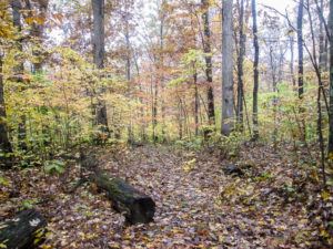
A slippery trail through Wayne National Forest
After two hours of walking, we came to the end of the Stockport section. One more section of the BT was completed. We continued on into the New Straitsville section and soon came to the only off-road piece of today’s hike. The BT dips down into a small area of WNF for one mile. I thought it would be difficult to navigate after all the rain yesterday. However, it was just wetter and required a little more care not to slip. We encountered one treetop across the path but were able to push through the branches. While we were in WNF, a light rain began falling. We got out the rain jackets, but it had basically stopped by the time we emerged from the forest.
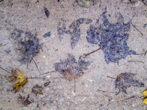
Road art: leaf decoupage with a mud finish
We finished by 12:45 p.m. We picked up the other car and headed west. It began raining. We stopped at Cornerstone, where CW gets donuts. They have more than donuts. Between us, we sampled their soup, salads, and sandwiches. All were delicious. While we ate, it continued to rain.
The morning hike had taken less than four hours. I wanted to get a little more hiking in. I was prepared for the rain today, so that wasn’t a deterrent. There was another piece of road west of Burr Oak that we had skipped. It was only six miles long. CW has walked it twice, so I was willing to walk it by myself with him hanging close by in the car. But even though he didn’t want to do any more hiking today, he walked with me.
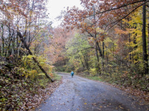
Leaving Smoke Rise on wet roads
We began hiking from Smoke Rise about 3:20. There were still sprinkles. I knew the heavy stuff would start hitting us anytime, so we both donned our rain ponchos. On the paved roads, I carefully watched every step I took, avoiding slippery leaves that could quickly cause me to lose my footing. Maybe I will try for a different record: only one fall on the entire BT.
The BT took us southwest into Murray City where we left Athens County and entered Hocking County. It soon turned northwest out of the city and put us on our last road of the day. We had four miles to go. Somewhere before we finished, we crossed into Perry County making it a three-county afternoon. The sprinkles had stopped. We decided it wasn’t going to rain, so we took off the hot ponchos.
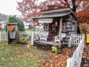
An eye-catching autumn display in a Murray City yard
We didn’t pass a lot of houses, but CW was concerned about some of them having dogs. A woman called to us from her yard to warn us that there was a lady down the road with two big dogs that run into the road. We were grateful for that bit of news and got our dog spray ready.
When we reached that area, we saw four dwellings lined up close together on one side of the road with woods on the other side. The first one was a trailer. Goats ran around in the yard. Two of them climbed up onto the tiny stoop by the door to watch us pass. No dogs, though. Chickens occupied the yard of the second house. One sat on the porch railing. No dogs there either.
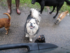
Some of the menagerie viewed from our car as we drove back by after our hike
The third house was a long wooden structure. Bingo. Two large black dogs ran into the street barking at us. The lady came out of the house and assured us they were harmless. She was right. Their tails wagged and they wanted to be petted. A medium-sized dog appeared on the porch beside her. Then another one entered the scene from between houses three and four. It was tiny and yappy, and jealous of the attention its friends were receiving. The lady said they were all rescue dogs.
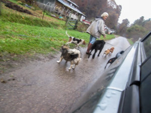
Rescuer and rescuees off for a walk
Those were the last houses we saw. For the rest of our hike, we put our spray away and enjoyed the trees. We finished at 5:30.
When we drove back past the dogs, the lady was in the road with them. The pack had grown to seven. We stopped the car and talked with her a little more. She explained how each had come to live with her. As we drove away in one direction, she walked down the road the opposite way, closely followed by seven happy rescuees.
We stopped at DQ for ice cream. I finally got smart and ordered a mini blizzard instead of a small. Mini sounds so tiny, but it was plenty big enough. I got Dipped Strawberry made with Ghirardelli. I’ll definitely get it again—when I’m not hiking the BT, of course.
Day 15 (Friday): North Country Trail Trailhead on T190 to East Trailhead for Boch Hollow State Nature Preserve (0.0 trail miles + 1.0 mile walking around Athens and Walmart)
Yes, you read that correctly: we walked zero miles on the Buckeye Trail on this last day of our fall hike. So don’t expect any hiking adventures today. We didn’t have any.
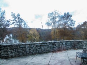
View of Burr Oak Lake from our window in the lodge
CW and I were surprised to run into Sally at Burr Oak. Until recently, she worked with BTA, but now she’s moved on to a different job that brought her to the lodge this week as a coordinator for an environmental conference for teachers. We chatted a bit this morning before CW and I checked out. She thought it was great how we plan out all our days. I laughed and told her that our plans often change daily. Then CW and I headed out to hike our miles.
If we did the trail in order, we would begin at Tecumseh Lake in Shawnee today. But because that would put us in a muddy WNF, we decided to skip that section and do the road miles beyond it. And since we were moving west, it would be on our way home. A perfect plan.
CW said he was going to stop at Cornerstone on the way for a donut. It was only five miles from the lodge, and we would pass right by it. We hadn’t driven far when something seemed wrong with my car. I got CW on the walkie-talkie.
“The car is making a strange noise.”
“What kind of noise?”
“Kind of a rattle . . . but not really a rattle. And it only does it when the car is accelerating.”
“I’ll look under the hood when we stop.”
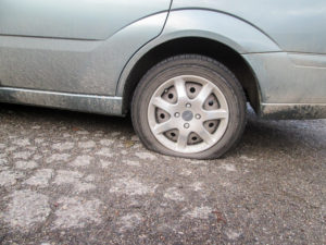
Buckeye Trail Flat Tire #2
When we got to the mart, CW didn’t have to open the hood to see my flat tire. It wasn’t the back tire that we had plugged the second week of our hike. It was the other back tire.
We discussed our options. CW decided to first see if he could get a used tire to get home on. We walked a block away to a repair shop. They didn’t have one the right size, but the man directed us to a shop about a mile away where we might get a used tire and get it mounted.
It was closed when we got there, and no hours were posted. CW called the number on the building. A man said they wouldn’t open till 10:30 today. It was 9:40. CW asked about a used tire. The man said he had one that size but sold it yesterday.
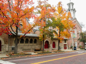
Autumn in Athens
Our next plan was to go to Walmart and get a new set of tires. My tires weren’t too old, but apparently they weren’t too good either. Athens has a Walmart. Athens wasn’t on the way home, but it was closer than the one that was on the way home. We chose Athens.
CW bought a can of Fix a Flat. I asked him how many cans it would take to get us home. He didn’t pursue that idea, but he did buy an extra can for the drive to Athens—just in case. We traded cars so he could drive the injured one.
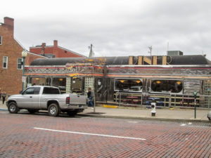
Court Street Diner in Athens
In Athens we purchased four new tires. While waiting for the work to be done, we located a diner in the part of town near the university. It was apparent by now that we weren’t going to make it to the trail, so we spent some time walking up and down the streets. The sidewalks were full of students.
When the smells from the pizza parlors and sub shops got to us, we headed back to Court Street Diner. It’s one of those long shiny silver structures with glass block accents. This one has a historical marker in front because it sits on the spot formerly occupied by the Berry Hotel, a premier hotel built in 1892. The building stood there until 1974.
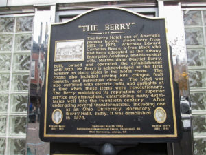
Historical marker for the Berry Hotel in front of Court Street Diner in Athens
After a delicious lunch of burgers and fries, we returned to Walmart and walked some more. It was kind of like hiking: we meandered aimlessly through the aisles. By 2:00 p.m., we were headed home in two roadworthy vehicles. No ice cream stop today since I didn’t hike. That was just as well because I knew I’d need a mocha frappe from McDonald’s to get me home.
So we got in only four days of hiking this week—and only 41.1 miles. That was disappointing, but it was a good week anyway. In spite of the rain that caught us on Wednesday, we had great weather. And the fall scenery was beautiful.
This fall we added 125.6 miles for a total of 1,092.1 miles on the Buckeye Trail. I walked 316,344 steps and passed the 1,000-mile mark. Our two cars travelled 3,125 miles—on 13 tires counting the donut. Although the first week was miserably hot, the other two were the perfect fall weather we always hope for. It may seem as if the endless trails and roads lined with fall color would become boring, but I never tire of them. We enjoyed sharing the trail with Bob and George and meeting others along the way, like Nathan nearing the end of his North Country Trail trek and Steven who stopped on a rainy back road to offer help to two strangers with a flat tire.
I’m excited to have finished the Whipple, Road Fork, and Stockport sections. We have completed over half of the New Straitsville section. And we’ve left no gaps! We have rounded third base and are heading for home. We hope to continue toward home and complete the BT in 2019, but we just never know what will crop up in our path to change our carefully made plans. And isn’t that what makes life exciting?
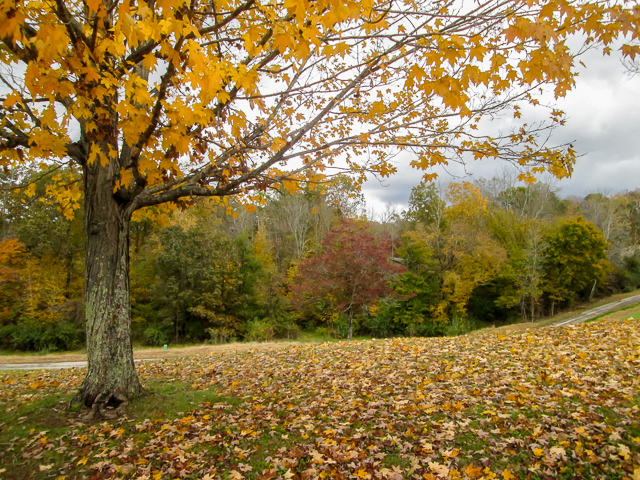
Gorgeous view from the parking lot of Burr Oak Lodge

localroots
November 9, 2018Looks like a great finish to your hiking season 🙂
CW Spencer
November 9, 2018Yes, it was. Great weather, great adventure, beautiful scenery . . . four new tires. What’s not to love about it? Thanks for sharing the season with us.