by guest blogger Bonnie Spencer
October 23, 2018
Day 6 (Monday): one mile south of AEP ReCreation Land to Stockport (11.9 trail miles)
After dropping Sugar off for boarding, we drove through gray drizzle and reached Caldwell in less than three hours. We got a bite to eat to kill some time and then checked in early at our Best Western.
We also stopped by Local Roots to say we made it into town. That’s where CW will be doing a presentation Wednesday evening on the Buckeye Trail and his book Hiking Without Dave. Rusty wasn’t there, but we enjoyed talking with Shawn a few minutes before hitting the trail.
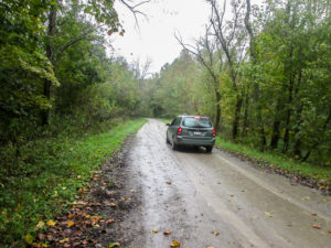
CW leaving me behind on the trail, in the rain
Today we planned 11.9 miles in the Stockport section. They would all be on back roads, so it would be easy to make good time. And it was a good choice for a rainy day when we didn’t want to be in the woods. Two weeks ago we hiked to the end of the Whipple section and then went north in the Stockport section. That was all part of The Wilderness Loop (TWL). Today we would go southwest from the end of Whipple and head away from TWL.
CW hasn’t felt 100% the last few days and wasn’t up to hiking the almost-12 miles. We decided to take only one car. I would hike and he would be close by in the car. Technically, he doesn’t have to hike these miles for his second time around the Buckeye Trail; he’s already done them twice due to hikes with different buddies.
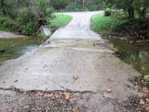
One of several streams that flowed over roads, none of which presented any problems
CW drove ahead of me on the trail, found a place to park, and walked back to meet me. Then we’d walk together to the car. At the car, I kept walking while he drove ahead again. He also checked out several streams that flowed over roads. If they had been too deep, he was ready to ferry me across, but none of them were problems.
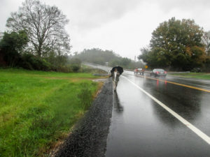
CW walking back to me in the rain
It rained for the first two hours, sometimes just a steady sprinkle and sometimes heavier and blowing, but never a downpour. The temperature hovered around 60 degrees. We loved it. It was so much better than the heat and humidity of our last trip. I was flying from point to point, thinking there wouldn’t be much to write about today.
We kept in touch with the walkie-talkies whenever we were in range. I hadn’t seen or heard CW for a while. Then the car came into view. It was sitting on the side of the gravel road, hazard lights flashing. That’s nice. He’s flashing his lights for me. I figured he didn’t feel like walking and was just waiting for me. Then he stepped out of the car and I heard, “We have a flat.”
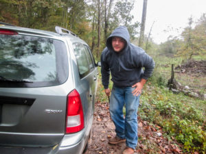
Steven stopped to help change our flat tire
We have been blessed on our BT excursions with no car trouble. Today, however, we would be blessed as a result of car trouble. CW was doing a fine job of changing the tire when a young man stopped to see if we needed help. Steven lived a ways down the road. He said another guy hiked through there a week ago. CW asked if it was Nathan, the North Country Trail backpacker we met two weeks ago. Yes, it was. I asked Steven if he knew the Buckeye Trail went by his house. He said since last week he did.
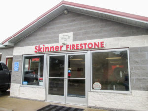
A little detour to Skinner Firestone in Beverly to add some excitement to our day
After Steven helped change the tire, he gave us directions to a place to get the tire fixed. We wouldn’t have had a clue where to go. We drove about 6.5 miles to Beverly and found the people at Skinner Firestone to be friendly, helpful, quick, and reasonable. Bay 1 was open and waiting for us. A worker removed a ¾-inch-long wedge-shaped stone and patched the tire. What a good experience our flat tire turned out to be.
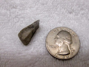
The sharp-edged stone that delayed our hike for an hour and a half
I was back hiking at 4:00 p.m. after an hour and a half delay. The rain seemed to be done, which was a delightful surprise since the forecast said it would rain all day. We stopped at Steven’s house to thank him again for his kindness and helpfulness, and CW showed him the sharp-edged stone that had wedged itself into the tread of our tire.
Before we’d walked 100 yards farther down the road, a man stopped his truck and asked where we were hiking from. He was aware of the BT passing by his house and was interested in our travels. Due to health problems, he can’t do the walking he’d like to do.
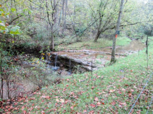
A waterfall in Olney Run, which the Buckeye Trail followed for two miles
When CW went on ahead throughout the day, he was also on the lookout for out-of-control dogs. The morning had been quiet in that regard, but the afternoon was a little livelier. I was walking by myself and heard aggressive dogs up ahead. I couldn’t see them because of a rise in the road. My first thought was, I hope CW is here in time to protect me. My second thought was, Oh, I hope they aren’t eating him.
When I could look over the rise, I was relieved to see CW walking toward me. But the two dogs had been barking at him. They had even come out into the road and were circling him. He thought this was going to be the time he finally got bit on the BT. A man came out of the house, then, and finally got them to back off. When we passed the house together a few minutes later, the dogs started out after us. Fortunately, a woman came out, and one word from her immediately turned them around.
Later CW drove by another house where five dogs came out at the car. He couldn’t tell how dangerous they might be, but the imbalance of numbers was not a pleasant thought. He parked on my side of that property, and when I got close, he drove me past.
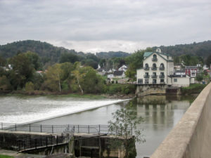
Historic Stockport Mill Inn and Restaurant on the Muskingum River with still-functional Lock #6 in the foreground
The BT passes the historic Stockport Mill Inn and Restaurant. It was built in 1906 and is the third mill on this site since the first one began operating in 1842. I went two more blocks and finished the day’s hike. CW was waiting in the car.
It was 6:30 and beginning to get dark. We drove nearly an hour to get back to the motel. After a light supper next door at Lori’s Restaurant, we walked across the street to Pilot Travel Center where I got a Magnum Double Chocolate Vanilla bar. It was a sad purchase because I think I’ve had every variety of Magnum bar now and I won’t be able to get them any more on my hike.
Day 7 (Tuesday): east of Sitka (4.5 trail miles)
Today we will do the 4.5 miles in TWL in the Whipple section that we skipped two weeks ago on an unbearably hot and humid day. At that time, CW brought up the idea of just using one car, like we did yesterday with me walking all the trail and CW part of it. It sounded adventurous to me and I was actually excited about navigating the woods on my own. But it’s in Wayne National Forest (WNF) and he can’t just drive down the road a ways. It could only be broken up in two pieces: 0.5 miles and 4.0 miles.
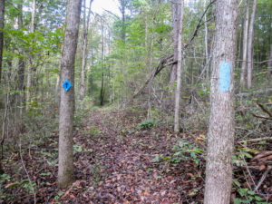
The first half mile flew by on easy trail
I did a lot of thinking overnight. Our plan became scary (as things often do in the dark). It was the four-mile section that bothered me. It takes only one little problem to mess up the whole day: high water I can’t get across, an impossible trail blockage, a missing blaze, or one little misstep. Without cellular service or long-range walkie-talkies, we wouldn’t be able to communicate. Sure, CW would be hiking in from the opposite end to meet me, but I’ve learned that four miles in the woods—especially in the rugged WNF—is much longer than four miles on the road. I could be stuck waiting hours for CW to find me.
This morning, we decided it wouldn’t be wise for me to attempt the trail on my own. So we both drove. I would get to do the first half mile by myself though. We left a car at the end of our hike. Then CW took me to where we “quit” two weeks ago. He walked in a short distance with me to see how the trail looked. When he started back out, I jokingly told him I would beat him to the point.
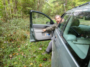
CW was surprised that I nearly beat him walking
The trail was clear and relatively level. I was slack packing this part and I flew. CW had walked back out to the car, but hadn’t started right off to the spot down the road where I would be coming out. After a few minutes, I heard the car go by on the road above. My last bit was up a hill. I emerged from the woods as CW was parking the car. We were both surprised. I did move fast . . . but I might have slightly miscalculated that distance.
From there, we hiked together. It was another great day: partly sunny and a high in the low 50s. With the forest cover, we didn’t get any of the sun until early afternoon, but our movement kept us warm enough.
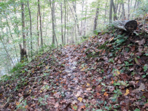
A narrow, slippery ledge around a hill
The rain yesterday left a general wetness throughout the forest today. Some trail was exposed mud, but we were able to avoid much of it by walking on the weedy edges. The mud covered with wet leaves slowed us down considerably, though, especially when it was on a narrow ledge.
We encountered the normal trees across the trail—and some that were not of the ordinary variety. After we climbed over one particular tree, the path immediately switched right back to the same tree. In the second place, the trunk was thicker. We couldn’t step over it. It was situated on a hill and was too far off the ground to sit on it and swing our legs over. I wasted quite a bit of time trying to work my way down the hill to climb over where I thought it was closer to the ground. I kept sliding on the wet leaves. The tree had no bark and was slippery, so I couldn’t hold on to it. I barely made it back up to where the trail went under the trunk.
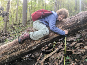
Me trying to get over a fat, slippery tree
The only way over was to crawl on my stomach. CW had already gotten over that way and tried to help me, but I wasn’t accepting any help today. Even though I didn’t get my solo adventure, I still wanted to see if I would have made it on my own. I hugged the trunk quite a while before I finally managed to inch myself over and drop to the other side. Mission accomplished—even if it did take me ten minutes.
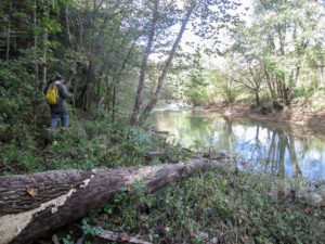
After a long descent, we reached the Little Muskingum River
A long, slippery descent (at a 20% grade!) took us down to the flood plain of the Little Muskingum River. For about a mile the trail followed the river, and we had the privilege of listening to the soothing sounds of the water breaking over rocks as it flowed on its busy way. We stopped to watch a leaf playfully tumble lobe over lobe through the air until it gently settled onto the water’s surface to be transported off to its next adventure.
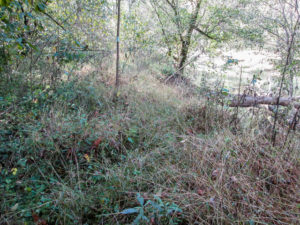
Uncleared trail along the Little Muskingum River
After hiking for two hours, we found a log to sit on while we ate a quick lunch. We were happy to discover we were more than halfway to our car. Soon after lunch, we began the ascent away from the river. The switchbacks were a great help, but it was still strenuous.
We came to our second out-of-the-ordinary tree across the trail. The trunk was enormous, and the root system was pulled up out of the ground leaving a gaping hole. We were on the trail looking across a chasm to the other part of the trail. Since I can’t walk on air, I decided to continue up the hill and cut over to the trail. CW followed. It was a slippery slant and we moved at a snail’s pace, but we reached the unreachable trail.
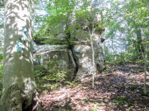
A rock formation along the Buckeye Trail in Wayne National Forest
The trail eventually leveled out and we made it to the car by 2:30. We had hiked 4.5 miles in four hours. Despite the terrain greatly slowing our pace, it was a fun day. I was glad to hike it with CW. But I also liked knowing that, had I hiked it by myself, I would have been successful. And today’s hike finished the Whipple section. Yea! We only need two more pieces to complete TWL puzzle.
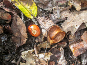
Fittingly, we saw lots of buckeyes on the Buckeye Trail
We passed through Marietta to get back to Caldwell and just had to pay another visit to Whit’s Frozen Custard. I got a Tiger Pride Whitser (Whit’s version of a Blizzard). It was vanilla ice cream with raspberry, hot fudge, and macadamias. The flavor was good and there were lots of nuts, but I expected to see ribbons of sticky raspberry and gooey hot fudge swirling through it. I saw only a trace of chocolate. Maybe they “Whitsed” it too long.
Day 8 (Wednesday): west of Reinersville to south end of AEP ReCreation Land (5.6 trail miles)
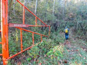
Gated service road into the AEP ReCreation Land
We planned a quick, easy day of hiking. We wanted sufficient time in the afternoon to clean up, rest, and eat before CW’s book presentation in the evening. The 5.6 miles were in the AEP ReCreation Land. We hiked in the AEP last spring. As far as woodland miles go, they were much quicker than in WNF. We were expecting the same from these, and we were not disappointed.
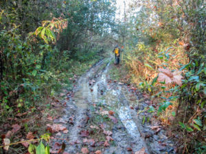
The muddy beginning of the service road, where “rain” was falling
We entered the AEP from SR 78/SR 83 on a gated service road. I thought it had suddenly begun to rain. I could see the water hitting the muddy puddles in the rutted road, and I felt it on my head as well. Raindrops were doing a tap dance on the leafy ground cover, but no rain had been in the forecast. CW pointed to the blue sky and assured me it wasn’t rain. Then I saw a breeze in the tree tops blowing moisture off the leaves to confuse me.
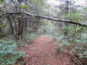
A pine needle path in the AEP
After two miles of fast-paced walking on the service road, the trail changed to footpaths through inviting wooded areas. The terrain was not monotonous. Challenging climbs were eased by switchbacks. As yesterday, we had to tread carefully on slippery narrow hillside trails. A few downed trees crossed our path. The trail had lots of small ups and downs at mostly dry creek beds. We forded Onion Run twice, but that was only a matter of choosing the most stable rocks to step on.
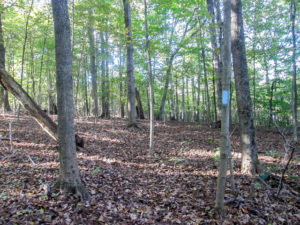
In some places, blue blazes were the only signs of a trail
In some places, all we saw were trees rising from a thick blanket of leaves. It was a beautiful sight, but with hardly any foot traffic, the path wasn’t always visible. Without the abundance of well-placed blazes, we couldn’t have followed the trail.
The weather was perfect. The temperature was in the 50s. Half the time the sun filtered through the trees, or in more open areas, nearly blinded us; during the other half it was pleasantly cloudy. Breezes appeared at just the right moments, except that one that played a trick on me. We had a great day in the woods.
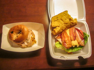
Lunch from Local Roots: turkey, egg, & cheese on bagel and the daily delicious on Stephanie’s homemade tomato basil bread
We finished at 11:30. It took us 2 hours and 45 minutes. We still have more to do in the Stockport section, but today’s miles completed the Stockport piece of TWL, along the western edge.
After we returned to the motel, CW went up to Local Roots and brought lunch to the room for us. At 4:00, we went back to the coffee shop. While setting up for CW’s presentation, we had ice cream: scoops of peppermint. Stephanie insisted that mine was free because she heard I had a birthday coming up soon.
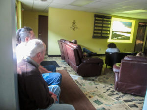
Some attendees of CW’s presentation at Local Roots
CW gave his talk “A Healing Hike on the Buckeye Trail.” We had a nice time talking with the people who came. [Note: There will be more on this event in the next Current Steps newsletter. If you’re not a subscriber, you can sign up here on the website to receive it free.] Then it was back to the room to get rested up for a very long day tomorrow.
Day 9 (Thursday): Ring Mill Campground to Ludlow Township (10.1 trail miles + 0.8 miles due to missed blazes)
This was the day I had been dreading. We need to do ten miles in the Road Fork section. The distance to shuttle is long. It’s in WNF, known for its rugged terrain. When George did ten miles with us last spring over there, I nearly didn’t make it. Of course, it was extremely warm that day, but the steep terrain did its part to slow me down. CW thought we might not do better than a mile an hour. Ten hours in the woods plus a long shuttle time meant a very early rising, me having to drive while tired, and a huge concern about getting caught in the woods in the dark. Not too exciting for me. On the other hand, if we pulled it off, we would finish the Road Fork section—and the entire Wilderness Loop.
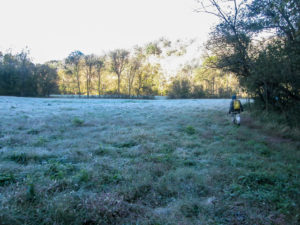
A frosty field with a backdrop of morning sun shining on the trees
With determination, we arose at 4:30 a.m. We left the motel at 6:15 in the dark, bundled up because it was in the 30s. After the sun made its appearance, it would stay out all day and raise the temperature to the mid-50s. There was no rain in the forecast.
We discovered there was a place to park a car in the middle, so we decided to do the hike in two legs. Although reshuttling would eat up valuable hiking time, it would provide the option to bail if it looked as if we couldn’t finish by dark. Also, while reshuttling we would have access to a bathroom.
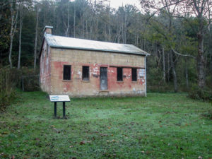
Ring House, built of sandstone blocks in 1846 by Walter and Margaret Ring
Our hike began at Ring Mill Campground. In 1840, Walter Ring, a miller, and his wife Margaret bought this land, which included a log house and a grist mill. They later added a sawmill. A school also stood on the property. The community was known as Ring’s Mill. In 1846, the Rings built a house of sandstone blocks. This historic Ring House is the only structure left.
We were on the trail by 8:00 a.m. It was so cold that even inside my gloves my fingertips were freezing. I had hand warmers back in the room but hadn’t thought to take them. Fortunately, my hands warmed up with the rest of me before too long, and I could enjoy the great trails.
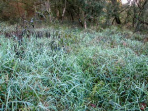
The Buckeye Trail is hidden under unmown saw grass
We started on a service road where we had to walk in weeds quite a bit to get around the swampy areas and the water-filled ruts. After half a mile, the trail joined a variety of footpaths that followed the Little Muskingum River. Some took us through unmown saw grass and bushes that soaked our pants up to the knees. We crossed several streams on small wooden bridges or exposed rocks. Others we could hop across.
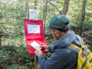
CW signing the book at a sign-in station for BT hikers in Wayne National Forest
Our map told us that after 2.5 miles, the trail would ford Old Camp Run, a stream wider than the others we’d encountered. It also mentioned that if the water was too high, we could go downstream a quarter of a mile and use a private bridge. A BT work crew had been in the area the past few days. I’m sure I read on the BTA website that one of their projects was to build a bridge here. That’s why we put this hike off till they wrapped up their work yesterday. However, last night we found out from one of the crew that they didn’t get to that project. So I was expecting the worst.
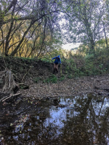
Me making my way down into Old Camp Run with the aid of a strategically placed grapevine
When we reached Old Camp Run, the water was not the problem. We could easily cross on rocks and dry parts of the bed. Getting down the bank to the bed and back up the other side was the challenge. We walked along the bank a ways, but it was equally steep everywhere, pretty much straight down. Then CW spotted a wonderfully thick and secure vine and remembered that he’d used it before. We were halfway there. On the other side, we discovered a hefty rope with knots at intervals tied to a utility pole. What a great idea because our hiking sticks weren’t any help.
The sticks sure got a workout elsewhere today though. There were numerous steep hills, both ascending and descending. We were relieved when we came to relatively level stretches so we could catch our breath.
Nearly halfway through, the trail left the woods and joined a road. Shortly we came to our car. I was feeling so good that I kind of wished the car was at the end and we could keep walking.
While reshuttling, we ate our lunch back at Ring Mill Campground and enjoyed the cool, sunny day from the car. Our entire break lasted an hour and a half. In spite of the hills, the morning had gone well. We were pleased that we were doing much better than a mile an hour. We set a goal to finish by 4:00.
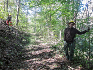
We met a Wayne National Forest work crew on the trail
After a quick mile on roads, we re-entered WNF on a service road, then joined a footpath. All day we alternated between service roads and trails. The silence was lovely for an hour and a half. Then it was invaded by the whirring of chainsaws through the forest. We thought it might be a BT crew clearing trail. When we reached them, we found it was a WNF work crew. They were felling trees, preparing for a controlled burn planned for the spring.
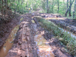
The worst muddy service road we encountered—and it wasn’t on the BT!
Some service roads were in awful condition. They were terribly rutted. The ruts were filled with muddy water and the higher ridges were mushy mud. That was the case with one particular road that had no edge to walk on. The soft clay clung to our boots in large globs, increasing the weight we had to carry. After we made it through that, we noticed that we weren’t noticing any blazes. We had to backtrack through that mud, which wasn’t even on the BT, to find the missed blaze directing us off the service road.
Farther on, we missed another turn blaze. CW was quite a ways behind me, so we each missed it separately. We figure we lost a half hour of time and walked an extra 0.8 miles because of our two mistakes.
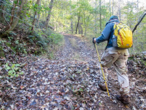
The last long hill for the day seemed to never end
Our last service road was ridiculously steep. CW thinks it’s the steepest hill on the BT. It continues for several tenths of a mile with no relief. Making it even more difficult to conquer were the large rocks, both embedded and lying loose.
We finished hiking around 4:20. If not for those two missed blazes, we would have made our 4:00 goal. But we were happy. Although the trail was a challenge, it wasn’t as difficult as we had expected. All day we commented to each other about how perfect the weather was and how beautiful the woods were. The hike I had dreaded was a delight. And we not only finished the Road Fork section, but also The Wilderness Loop. Woohoo!
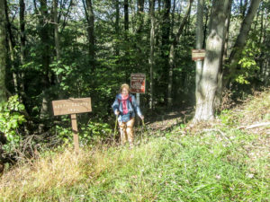
The final steps on The Wilderness Loop
We celebrated by driving north to Woodsfield to eat at Jerry Lee’s, a restaurant we discovered last spring. We love the hometown feel of it and how everyone talks across the tables to their neighbors because everyone knows everyone else. The funniest story I heard tonight was about a deer hunter that tied his kill to his vehicle never realizing that he’d actually bagged a goat!
We got back to the motel at 7:30 and picked up ice cream at Pilot. I got a Good Humor Giant King Chocolate & Vanilla Cone. It was very good, but I would have been happy with a mini cone after the huge meal at Jerry Lee’s.
Day 10 (Friday): Stockport to Chesterhill (11.2 trail miles + 0.1 mile due to missed blaze)
We sadly checked out of the Caldwell Best Western. We have spent three separate hiking weeks here and it’s like home. But since we have completed the trails in this area, we have to move on.
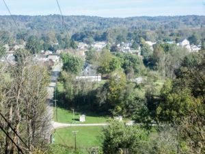
Looking down on the village of Stockport from the top of the hill we climbed
We began hiking just after 10:00 a.m. from Stockport, where we ended Monday. The village was originally named Windsor. The first postmaster, Samuel Beswick, changed the name because there was another Windsor, Ohio. Mr. Beswick chose the new name because he was from Stockport, England.
The trail we would walk today was where CW began his very first hike on the Buckeye Trail. If I had started here, I probably wouldn’t have continued because the morning began with killer uphill roads. We climbed out of Stockport to a plateau above the village.
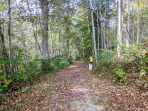
We could walk on trails like this all day
Most of the day was on roads of some type, with a few miles off road. Blazing was very good in general, but for a mile or so we had trouble. We took the wrong trail once in a wooded area because we didn’t see a turn blaze. Perhaps it was there and we missed it. Blazes are supposed to be placed so that one can always be seen ahead. In this case, neither trail had a visible one until we walked a ways. We also had difficulty on some minor roads that didn’t have street name signs. Due to the lack of sufficient blazing, we couldn’t be sure we were on the correct roads, so we had to guess until we located a blaze.
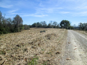
A recently harvested cornfield
It was another beautiful day of sunny blue skies, crisp temperatures, and quiet country scenery. We passed Amish farms, buggies on the roads, and fields of corn being harvested.
We did have a couple of noisy dog encounters. One just barked a lot. The other one charged at me, but it didn’t like the hiking sticks in its face so it kept its distance. Also, CW was nearby ready to spring his umbrella open.
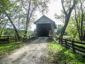
Barkhurst Mill Covered Bridge (also known as Williams Covered Bridge) in Morgan County
The BT goes through the Barkhurst Mill Covered Bridge, also known as Williams Covered Bridge, over West Branch Wolf Creek. It was built in 1872. At one time it was closed to automobiles due to deterioration but remained open to foot traffic. After receiving a grant, Morgan County completed restoration of the bridge in 2014 and reopened it to vehicles.
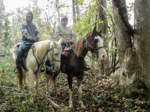
A “small world” encounter when we met horse riders CW was acquainted with from a previous hike
A half mile past the bridge, the trail joined a skid road. With the brush growing up in the middle of it, we were pretty sure it hadn’t been used by vehicles recently. As we trudged up the steep incline, two riders on horses appeared. It was a mother and son. We were all surprised because CW and a friend had met them on a previous hike through the area. They took a few minutes to get further acquainted.
A mile and a half later, we walked into Chesterhill. It was just after 3:00 p.m. That was perfect because our goal was to finish the day’s hike in five hours. We passed the ending point and kept walking another couple of blocks to the Triple Nickel Diner where we savored encore Shew Burgers.
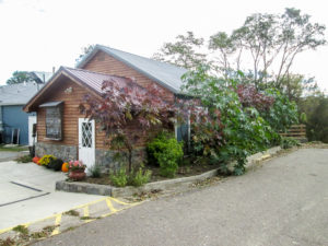
The Triple Nickel Diner in Chesterhill
Today’s hike connected the last dots. Now all the gaps we had created from skipping around have been filled in. That brings a great sense of wholeness to this person who likes order.
We picked up the other car and headed toward home by way of Burr Oak Lodge. We made reservations for our next trip and also obtained permission to leave a car there. CW discovered an ice cream case in the lobby. We both got fudge bars. Our week was complete.
This has been a fantastic week of hiking. The weather couldn’t have been better. We finished the Whipple and Road Fork sections and The Wilderness Loop. We have finally rounded third base. We added 43.3 more BT miles. And CW had the privilege of giving a book presentation at Local Roots.
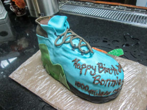
My awesome hiking boot birthday cake, which also commemorates 1,000 miles on the BT
Besides all this, I got a surprise. This morning on our way out of Caldwell, we stopped by Local Roots. CW had cooked something up with Stephanie to create a birthday cake for me. He wanted something in the shape of a hiking boot in Buckeye Trail blue. He was thinking a flat side view. He was as surprised as I was to see an awesome 3-D boot. (The only thing missing was some mud!) So I came home with one extra boot.
I hope you will return in a couple of weeks for the third and final part of our fall hike.
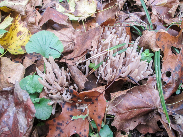
Coral Mushrooms growing in the middle of a trail in the AEP in Morgan County

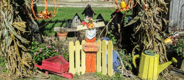
localroots
October 29, 2018Thanks for the great presentation. We still are having people ask how it went, wishing they could have made it or curious if there will be another sooooo…. 😉
…and the pics in your blog are beautiful!!!
CW Spencer
June 9, 2020CW considers it a privilege to have been able to give his presentation at Local Roots. Thank you for the opportunity! So glad you enjoyed the photos. ~Bonnie
Dolores R. Birkle
October 31, 2018Loved hiking with you. The way you describe in detail each day makes it very interesting. I am learning about Ohio in a whole new way and glad to know there is still “country” in Ohio. The funniest part was you climbing over the big tree across the path!. The stamina and determination of both you and CW is outstanding. Your goal is set high, but i know you will accomplish it.
Dolores Birkle
CW Spencer
November 2, 2018And we love to have you hike with us, Dolores. I so often think of you when I get into funny situations. Now why is that?