by guest blogger Bonnie Spencer
October 13, 2015
I must have been out of my mind when I said I would go with CW on his 150-mile Buckeye Trail circuit hike this year. Last year Jim and George backpacked the Wilderness Loop with him. This year there wasn’t anyone who could spare the time needed to cover such a distance. CW changed his original plan of continuing from the Wilderness Loop and decided to do a segment of the trail closer to home and largely on bike trails. I think he hoped to get some shuttling assistance from me so he could do a few days at a time, then maybe get home for a night. Imagine his surprise (and mine!) when I said maybe I’d try to walk it with him.
I had my ground rules, though. One was, appropriately, “no ground.” I would not do any camping. I would also do no backpacking. Only day hikes for me. I would stay at home each night—either my home or Dad’s in Xenia. In spite of my wimpiness, CW seemed to genuinely like the idea of me hiking with him.
I used to walk three miles a day and occasionally longer distances but slacked off over the past four years. So, what made a non-walker like me even consider doing such a thing? There were a couple of things that motivated me, leading to some goals.
Goal #1: It seemed like a good way to spend time with my husband. I’m pretty sure he’s not going to take up counted cross stitch and join me on the couch in front of the TV, but I could join him in his passion for hiking.
Goal #2: Walking is healthy. Maybe this will jump-start my being more physically active. I’m really hoping it will work wonders on my cholesterol before I go back to the doctor.
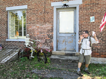
A scary character on the bike trail
This was enough to get me started. In the days leading up to the hike, CW would say things like, “It would probably be good for you to do some walking to build up to the long walk,” or “Maybe you should toughen up your feet so you don’t get blisters.” This was pretty much daily. But I was always too busy. I wondered if CW might be taking bets from anyone on how many days I would last. But at least I would make an attempt. We started on October 7.
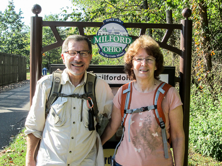
Day 1: Milford to Foster (13 trail miles)
We would be taking two cars each day and shuttling. That meant I had to drive one of them. I usually fall asleep in a moving car. I thought this could potentially be more difficult for me than hiking 150 miles.
We had trouble finding one of the trailheads right off the bat. Following is an example of our typical dialogue.
CW: I can’t believe I missed 22.
B: Where’s 22?
CW: The road we were on earlier when we were looking for the trail head.
B: You mean the road we ended up on when we turned the wrong way.
CW: Yeah.
B: We turned right to get there. But just now we were on the other side of the road so you should have turned left.
CW: That wouldn’t go to 22.
B: But that’s where we were earlier. We turned right when we should have turned left and went down that curvy road and ended up on that road we had to turn around on. You just said that was 22.
CW: I don’t know what road that was, but we were on 22 before. I thought I turned right but I must have turned left.
B: You didn’t turn left because if you did you would have gone down that curvy road again.
Conversations like this make it questionable as to whether we will make it all 150 miles together.
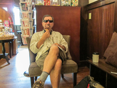
CW enjoys a cone at Loveland Sweets
We finally began hiking at 10:30. The entire day was on the bike trail and the weather was beautiful. When we stopped to eat lunch, the only bench we could find was in the sun. CW held the umbrella over us the whole time. What a guy!
When we reached Loveland, we searched out some ice cream. We discovered Loveland Sweets just off the trail on the main road. We’re always looking for ice cream, so another goal was hatched.
Goal #3: We would try to find ice cream every day. And to make it more exciting, I would branch out and eat a different kind each day.
We had a lovely conversation in the park with Julie. She had heard Captain Blue speak at the Cincinnati Nature Center and was interested in CW’s walk. We gave her a postcard that tells about CW’s book and lists suicide warning signs. As we walked away, another goal was formed.
Goal #4: Every day we would try to give out at least one postcard, the purpose being to get information out there on suicide prevention.
We reached our car at 4:15, tired and sore.
Day 2: Foster to Morgan’s Canoe Livery (10 trail miles)
We got a little earlier start and began hiking at 9:55. We had seen signs from the beginning of the hike announcing intermittent closures on the trail at mile 35-35.5. This was one of those days. Two miles into our hike, we reached the old abandoned Peters Cartridge Company. The property was surrounded by barbed wire, yellow tape, orange mesh, and a chain-link gate that crossed the trail. Rifle and shotgun ammunition was manufactured there until near the end of WWII. Now the lead-contaminated soil is being cleaned so the structure can be converted into apartments.
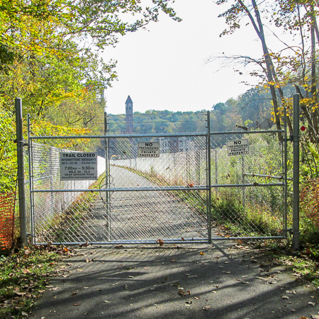
Trail closure on Day 2
CW tried to find a way around by going down the hill, but it was so steep that he had to hang onto trees to keep from sliding on down into the Little Miami River. When he ran into barbed wire, he decided to pull himself back up.
A couple on the trail gave us directions for driving to the other side of the closure to a parking lot. When we got there, we found that workers and machinery had taken over the lot. We eventually ended up at Stubbs Mills where there was a place to park the car and continue walking. In November when the trail is reopened, we will make up the 4.6 miles we skipped.
After we ate lunch in the park at Morrow, we searched for ice cream. Miranda’s Old Time Ice Cream Shop looked like the perfect place—except for the sign that said it was only open on weekends. Bummer! We walked a block off the trail to the Marathon Village Market where we bought Magnum Double Caramel ice cream bars.
It was another beautiful fall day for hiking, all on the bike trail. Still getting used to the idea of giving out postcards, we missed a couple of opportunities that day and didn’t part with any. Finished at 3:40.
Day 3: Morgan’s Canoe Livery to Caesar Creek Visitor’s Center (10.4 trail miles)
At 10:00, we set out once more on the bike trail. After six miles, the Buckeye Trail crossed the ditch via a primitive wooden footbridge and continued on roads. We ate our lunch on the bridge, greatly needing the refreshment for the strenuous climb up Elbon Road.
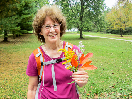
A colorful fall bouquet
Some places the blazing was a little insufficient to make our hike go smoothly. At one point we turned the direction we thought but were still questioning our choice. There had been very little traffic on the roads, which is nice from a safety standpoint, but as we stood at the side of the road looking at our map, some outdoor enthusiasts (there were bikes on the back of their van) passed us, stopped, and backed up. The guy asked us if we were hiking the Buckeye Trail. When we said yes, he assured us we were heading the right direction. He said there used to be a tree with blazes at the intersection, but it had been cut down. After a brief conversation, we gave the couple a postcard and continued on. We went through some more woods for the last part of the day’s hike and arrived at the Visitor’s Center around 2:30.
There was no ice cream anywhere on our hike so on the way to pick up the other car, we pulled into a small market in the country. Just inside the door was a waist-high freezer case with various ice cream novelties. We ate our selection outside at a picnic table. CW’s fudgsicle had grown ice crystals; my drumstick tasted like that ice cream that never melts, inside a rubbery cone. But Goal #3 was accomplished for the day!
Day 4: Caesar Creek Visitor’s Center to Horseman’s Group Camp (9.8 trail miles)
This day we would hike through Caesar Creek State Park. After a couple of wrong turns, we finally got the first car parked at Horseman’s Group Camp and returned to the Visitor’s Center. We ran into Randall, waiting for a BT meeting to begin. We chatted a bit, then got on the trail by 9:15.

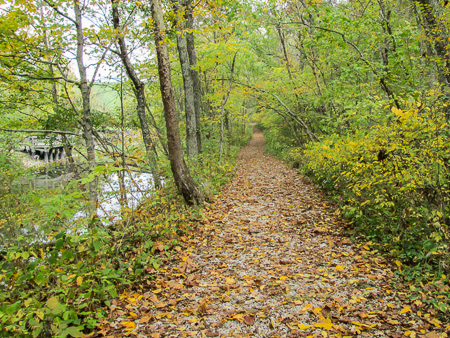
A perfect spot
The trail through the woods was fantastic. We walked on a blanket of fallen, crinkly leaves. The blue blazes weren’t as plentiful as we would have liked, but when we realized from posted metal maps that the BT and the Perimeter Trail were the same for several miles, we also had yellow blazes to follow.
The roller coaster trail is on a ridge that goes along the west and north sides of Caesar Creek Lake. We paused in what was the perfect spot to take in the excellence of the day. Through the trees we could look down on the glistening lake. The leaves were beginning to show off. The breeze was yummy. Another degree cooler and I would have needed to pull out my jacket.
After six miles of the sun-dappled trails, we reached Furnas Shores Ramp and ate our lunch. Then there were more woods to enjoy. When we emerged from them, we looked for the swimming beach but there was massive work going on in the area in preparation for a marina. Apparently some blazes, as well as the trail, were lost in the bulldozing. We lost a half hour before CW flagged down a park official who pointed us in the right direction.
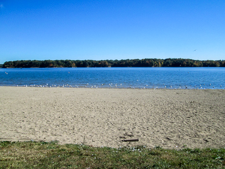
We finally found the beach
Past the beach, we entered the woods again, then walked nearly a mile across the top of a saddle dam. We found a red-blazed trail that we thought would lead to Horseman’s Camp, but on our map we weren’t sure if it was the right horse trail. After 10 minutes of walking, CW decided to leave me there and jog ahead to see if it came out at the right place. It did and he returned for me. He was concerned about me being bored, but it was so peaceful that I just sat and enjoyed. We reached our car at 3:50.
We drove to the Corwin Peddler for ice cream. The lady told us she had mango, caramel, and chocolate saucer. I wasn’t sure if the mango and caramel were saucer too, or just the chocolate. And I had no idea what that even meant. I thought maybe it was served in a saucer. But when she brought out my caramel and CW’s chocolate, they were both in styrofoam cups with lids.
No one else was in the shop so the three of us talked while we ate. CW gave her a postcard. As I was finishing, I thought I really needed to ask what saucer ice cream was before we left and never found out. But before I could, CW asked the question. The lady looked totally puzzled, like he was speaking a foreign language. He explained, “You said this is chocolate saucer ice cream.” She finally got it and said, “It’s soft serve ice cream.” We all burst into laughter.
A beautiful fall day for hiking
~~~
After four days, we had to take a couple of zero days because of prior commitments. We have done 43.2 trail miles. I had one blister that really didn’t bother me and lots of aches in my legs and ankles. Nothing was so painful, though, that I couldn’t walk. OK, so I ended up on the first zero day with one ankle elevated and iced because I noticed it was swollen, but I think I’m doing pretty well for a non-walker.
110,724 steps and counting . . .

