
by guest blogger Bonnie Spencer
October 23, 2015
Day 5: Horseman’s Group Camp to Access Ramp at Spring Valley-Paintersville Road (10.6 trail miles)
After two zero days, we were back in Caesar Creek State Park. My ankle was still swollen, but the pain wasn’t bad enough to keep me off of it. We began hiking at 10:15, taking the Moonlight Vista Bridle Trail from Horseman’s Camp to get back to the BT.
After a mile on the BT, we reached the second saddle dam and saw another red-blazed trail to the left. It was also the Moonlight Vista Trail. We realized, then, that it was the one we were supposed to take at the end of our previous hike. This one would have been a more direct route to the car—but then I wouldn’t have had that lovely time sitting in the peaceful woods while waiting for CW to check out the trail.
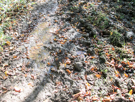
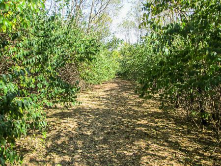
The trail was much worse than this shows
Though it was another dry day with a comfortable temperature, it had rained the night before. A lot of the day’s trail was shared with horse trails—deep and muddy horse trails. We walked on the edges of the trail where the ground was higher and less oozy, pushing through the brush and holding ourselves up with our sticks so we wouldn’t slip down into the mire. We added a temporary goal for the day: Don’t fall in the mud. It was slow-going and exhaustive.
Not all of the trail was muddy, though. Some of it was on the remains of a paved road, now disguised as a leaf-covered path. Some was on a ridge
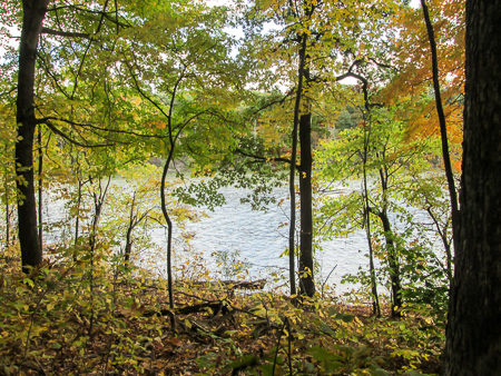
Ridge overlooking Caesar Creek Lake
above Caesar Creek Lake or on grassy stretches through corn fields. At lunchtime, we found some stumps to sit on in a small clearing. The last half hour or so of our hike took us by Caesar Creek where the mosquitoes were dining. We hurried through, leaving a few casualties behind. We finished at 5:00 and headed to McDonald’s for our own dining pleasure: Reese’s McFlurries.
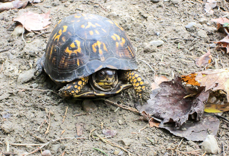
We weren’t sure if he was going to let us pass
We saw only one person (and a reptile) the whole time in the woods and didn’t strike up a conversation, so we didn’t give out any postcards. The pain in the side of my ankle was masked by the pain that I felt at the front. Also, on the front of the same leg, a rash appeared where the tongue of my boot had been pressing all day. And not only my ankle was swollen, but my whole foot was. Still nothing to keep me from continuing.
Day 6: Access Ramp at Spring Valley-Paintersville Road to Yellow Springs Station (19.3 trail miles)
We had the luxury this day of driving only one car because my dad would be picking us up in Yellow Springs. We started walking just before 9:00, with 19 miles ahead of us. CW had covered longer distances in one day, but my longest hike in the past had been 18 miles. This would be a real test of my hiking stamina.
We started out on country roads. After a bit, someone yelled from a distance, “Hey! . . . Hey!” It took a couple of times before it actually registered in my brain that someone was calling to us. I turned back and saw a man in front of his house. “Are you OK?” We yelled back that we were just out hiking.
Approaching Xenia on the Little Miami Scenic Trail
“Do you need to go somewhere?”
“No, we’re just hiking. Thanks!”
It would have been a great conversation starter if his house hadn’t sat so far back from the road making normal voices impossible. But it is encouraging that strangers are out there ready to help us.
We reached the Little Miami Scenic Trail in an hour and stayed on it the rest of the day. It took us through Xenia where we rested briefly at the Xenia Station Trailhead before proceeding through town to McDonald’s. It was our choice for lunch since it is right on the trail. Refreshed from the food and rest, we continued on for nine more miles to Yellow Springs Station.
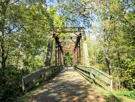
Bridge over the Little Miami River
With very sore legs, we were both relieved to sit on a bench until Dad picked us up at 5:30. I barely managed to get back up, and I was hobbling when we went to Young’s Jersey Dairy a few miles down Route 68 for sandwiches and ice cream. I decided on a hot fudge brownie sundae.
My left ankle hurt all day, but only in the front. The rash that appeared the day before had spread around my leg. My right big toe was hurting from my shoe pressing on the nail. And my foot was still swollen. But I had made it one more day—and a very long day at that.
Day 7: Yellow Springs Station to Fairborn YMCA (10.7 trail miles)
In spite of my foot problems, nothing felt bad enough to keep me at home. I took an Ibuprofen before we left the house because of my ankle pain and off we went.
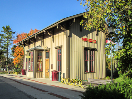
Yellow Springs Station
We completed our car shuffling and began hiking at 9:20. The trail left Yellow Springs Station and followed residential streets for a mile, then turned onto country roads. We passed some neighborhoods of newer houses but mostly old farmhouses. There were fields of winter wheat just coming up and fields of corn, some harvested and others still waiting to be. When the breeze blew, it stirred up thousands of conversations among the stalks. It was like listening to a foreign language being spoken when you can’t understand a word of it so you just enjoy the sound. We stopped to eat somewhere on Armstrong Road in a shady spot on a bank behind a guardrail.
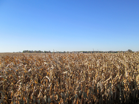
When the breeze blows, the stalks talk
Soon after lunch, we entered Fairborn. Then the trail left roads for a short distance to go through Cold Springs Reserve. It came out on residential streets and passed by the soccer fields of Rona Hills Park before going through a business district where we saw Wright State University’s CalamityVille. That is the National Center for Medical Readiness where, among other things, training occurs to deal with disasters and emergencies.
We reached our car at the YMCA at 2:00, completing the Caesar Creek section of the BT. I had taken my second Ibuprofen an hour earlier. I made it through the day OK and was sure I’d be able to do the same thing the next day.
Cold Springs Reserve is a spot of serenity in the city
Since we had to drive back to Yellow Springs to get the other car, we naturally had to go back to Young’s Jersey Dairy for our day’s ice cream. This time I got a scoop of chocolate chunk black raspberry.
We hadn’t given out any postcards this week, which led me to revise our fourth goal. Rather than feeling like we needed to force a conversation in order to meet a goal of handing out a postcard each day, and feeling guilty if we didn’t, we now will just be aware of any opportunities that open up and try to take advantage of them.
~~~
Our plan was to hike two more days that week. The great weather we had been blessed with for all seven days so far was going to continue. I had every intention of heading out again for Day 8 after taking my Ibuprofen. However, that morning I read something online saying that if only one ankle is swollen after hiking it could mean there is an injury and should be checked out. Made sense, so I decided to see a doctor before I perhaps did more damage. By now my lower leg was also swollen and the toe on my right foot was worse than I had thought. My nail was loose and pushed up from the swelling underneath it.
I kept my leg elevated a lot over the weekend, which helped with the swelling. On the fourth day, I found out I couldn’t see the podiatrist for three more days. My appointment rearranged our schedule for the week and would only allow one day for hiking. Since the swelling would go down when I stayed off my feet and the pain still wasn’t bad, I decided to take advantage of the good weather and hike that one day—and hope I didn’t make things worse before seeing the doctor.
Day 8: Fairborn YMCA to Island MetroPark (12.3 trail miles)
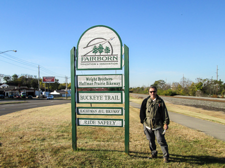
Wright Brothers’ Huffman Prairie Bikeway is behind CW
I wrapped my foot and ankle in a bandage, taped my toe, took an Ibuprofen, and wore sturdy sandals with thick socks that were perfect for not disturbing my toe. We began hiking the Troy section, starting from the YMCA at 9:40. It was dry, sunny, and very breezy. After a half mile on city sidewalks, we turned onto Wright Brothers’ Huffman Prairie Bikeway (WBHPB).
We hadn’t gone far when a McDonald’s lured us across the street. CW can hardly pass up a golden arch. We enjoyed sausage burritos before getting back on task.
WBHPB went for several miles before joining the Mad River Recreation Trail (MRRT) at Huffman Dam. The dam was completed in 1922. We took some time looking at it, reading the plaques, and taking pictures. Then we crossed it and kept walking. Something made me ask CW if he was
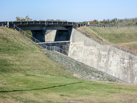
Huffman Dam
sure we were going the right way. He said no, he hadn’t seen any blazes. He looked at the map and said that we weren’t supposed to cross the dam but join the other trail at the south end of it. As we turned around to recross the dam, I confiscated the map for the rest of the day.
After passing Wright-Patterson Air Force Base (WPAFB), we eventually left MRRT to follow a footpath along the northern edge of Eastwood MetroPark. It also followed the Mad River. The uneven terrain made walking on my ankle a little more difficult, but the fall woods were so beautiful that I didn’t mind at all. We ate lunch in the park, and I took my second Ibuprofen.
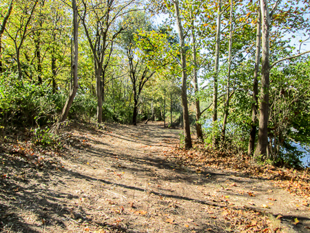
Footpath along Mad River in Eastwood MetroPark
The footpath went for nearly a mile until the BT crossed through the park and rejoined the MRRT. We paralleled the Mad River and passed under several bridges until MRRT ended. We then zigzagged to the top of the levee and crossed Trail Bridge into Deeds Point MetroPark where we were greeted by Wilbur and Orville Wright.
Great Miami River Recreation Trail (GMRRT) began there and took us along the Great Miami River to our waiting car at Island MetroPark. We got there at 3:45. After fighting with our GPS, we finally made it out of Dayton and back to Fairborn where we tracked down some ice cream. We discovered The Inside Scoop Ice Cream Shop on Main Street. Their dark chocolate raspberry truffle was delicious.
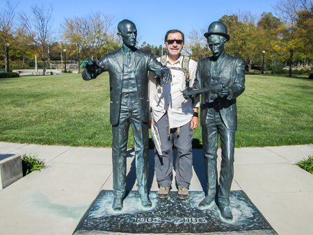
Wilbur, CW and Orville . . . or is it Orville, CW and Wilbur?
The parts of the BT that go through the MetroParks are some of CW’s favorites for both the ease of hiking the bike trails and the scenic parks through which they pass. The BT we hiked this day has changed somewhat since six years ago when he first hiked it. CW remembers that back then the BT left the Huffman Prairie Bikeway for several miles to follow footpaths, cross lawns, and pass close by the chain-link fence around WPAFB. Now it is simpler since it sticks closely to the bike trail.
My sandals worked great. My feet felt OK at the end of the day. The bandage kept my foot and ankle from swelling. Maybe I needed another one for my leg because it did swell. The rash that had mostly disappeared had returned with a vengeance and had spread farther up my leg, but I had 12 more miles logged!
~~~
Happy Birthday to Me . . . Everyone should try something new on their birthday. For me this year, it was going to the podiatrist for the first time ever.
Good news! I have no fractures. Must just be overworked ligaments that I was assured will heal in time. The doc wrapped my foot and leg in an elastic bandage and said to keep wearing it. He drained my toe and bandaged it. Said I would probably lose the nail, but it would be fine. I have the go-ahead to finish the hike. That is, if I can get shoes on over all the bandages. So next week it’s back on the trail.
Oh, and we gave the podiatrist a postcard.
240,333 steps and counting . . .


Brenda
October 23, 2015I’m thoroughly enjoying these Bonnie! Interesting and fun and I was glad to find out about your ankle by the end. I loved the conversational cornstalks!
CW Spencer
October 25, 2015I thought you would like the cornstalks. I actually thought of you–you and Anne of Green Gables–when I heard them talking, because of your imaginations.
Brenda
October 25, 2015And apparently your imagination too! Don’t you love how exciting and beautiful the world is through our senses. So much to experience!