by guest blogger Bonnie Spencer
November 1, 2016
Day 10: Spencer Wildlife Area to SR 83 south of Litchfield (6.8 trail miles)
We were eager to begin the last week of our hike. Our progress the previous two weeks left us with only 45 miles to complete. As always we were hoping for agreeable weather. In addition, we were looking forward to better seasonal color than we’d experienced so far.
On our way to the clinic to drop Sugar off for her “vacation,” we stopped at Tim Horton’s to pick up a box of Timbits for the staff. The office manager was happy to see Sugar again. Sugar sometimes gets to hang out in her office.
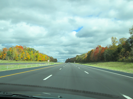
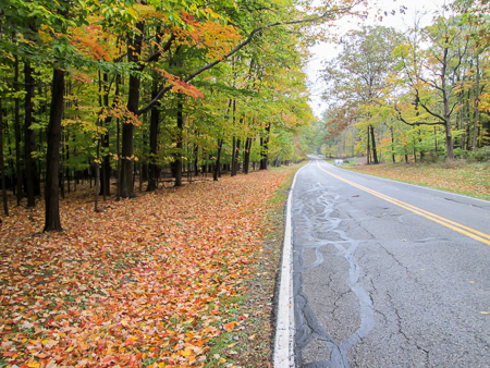
Enjoying fall along I-71
Since we were driving only one car up, CW took I-71. After a nap, I woke up to the fall I’d been waiting for. The farther north we went, the more colorful the scenery was. We oohed and aahed our way through the vibrant interstate corridor.
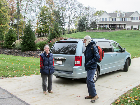
When we got to Medina to pick up the car we had left there, we passed right by our motel. We stopped and were able to check in early, so we unloaded the car before continuing on. While at Pat and Mary’s house, we looked over the BT map and discussed CW’s itinerary because Pat wanted to hike with us sometime during the week.
We were about to leave their house, but first Pat had to show me the toilet. When we dropped the car off a week before, I used their bathroom and had to ask how to flush the toilet. There was no handle. There was a divided button on the top. I tried pressing one half, then the other half, then both together. Nothing happened. Turns out I just needed to push harder till my finger felt like it would break. So today he showed me the toilet and it had a handle. He had switched the upstairs and downstairs toilets! I almost felt obligated to use it after he went to all that work.

Road closed for only the day we wanted to use it
I realize that so far none of this has much to do with our hike, but it all contributed to why we got such a late start hiking. Also in the mix was the trouble we had setting up the cars. CW says half the hike is the logistics. We couldn’t find a suitable place to park where we wanted, so we settled on a place that would reduce the mileage we had planned on for the day. We also had a difficult time getting to our beginning spot on the west side of Spencer Lake, partly due to a road closure and partly because there wasn’t a road across the lake. It was nearly 1:00 when we finally began hiking from Spencer Wildlife Area.

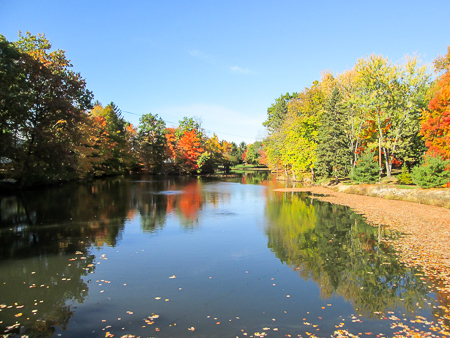
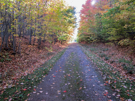
Spencer Lake eleven days earlier
The weather for the afternoon alternated between sunny and overcast skies. At times the breeze was extremely cold. I would have walked faster to keep warm but I had to stop every few steps to take a picture. The view of the autumn colors over the water as we crossed Spencer Lake on the causeway was well worth the trouble we had getting there.

Spencer Lake on this trip
The trees were at their peak. Such a huge difference from our trip up two weeks ago. I took the same shot last time up and this time so I could compare them.
Just over the causeway, I heard something that I thought sounded like a duck call coming from a wooded area next to the small parking lot. Then something rustled in the tall grass at the edge of the lot. I got a glimpse of a bird but couldn’t get a good photo before it stealthily disappeared into the brush. It was sufficient, though, to help me later learn that it was the shy male ring-necked pheasant. The sound I heard was its crow-like caw-cawk.
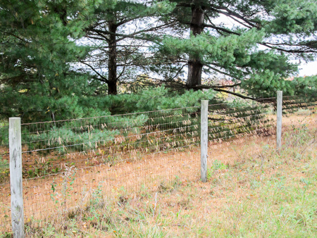
Pine needles hanging on a fence
The rest of the trail today was on roads. Besides the brilliant scenery, we saw subdued pine groves, brown wooden fences, farmhouses, and barns that all contrasted perfectly. We passed an archery range, oil pumps and storage tanks in fields, a community park, and something that looked like a graveyard for garbage trucks and other large vehicles that had reached the end of their roads.
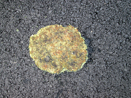
Hedge apple roadkill
We saw little in the way of animals—only roadkill. I nearly stepped on a squirrel sprawled across the edge line. I was looking down at the time to keep the wind out of my face and I didn’t see him coming. We also encountered a mouse and a snake. I didn’t want to take pictures of dead critters, but I did snap the smashed hedge apples. We came across an entire banquet of them, some as flat as crepes. I had no idea that those huge bumpy fruits could be squashed so thin. Must have been from heavy farm equipment.
We finished hiking our meager 6.8 miles at 5:50. Our GPS led us to two no-longer-there ice cream shops, so we ended up at the Dairy Queen near our motel. I had a Peanut Butter Cookie Dough Smash Blizzard. I didn’t know what the “smash” referred to, but I hoped it didn’t have anything to do with the road.
Day 11: SR 83 south of Litchfield to Lake Medina (15.2 trail miles)
We decided on two legs for today. We would hike clockwise, but do the second leg first. We’ve done that before and it makes for less driving, even though it really messes with my need to do things in order. Since we wanted to cover a lot of miles, we planned on getting an early start. That didn’t quite happen.
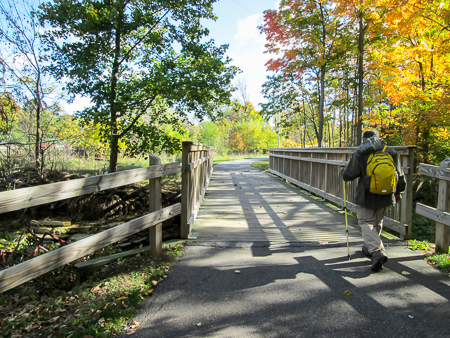
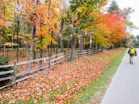
An eye-catching scene along Abbeyville Road
We left the motel in our two cars with a general idea of where to go to get to the easternmost point for the day, a parking lot at the north end of Lake Medina. First of all, due to traffic and our mistakes, we took two different routes. Then, when we each got to the area, neither of us could find the lot. I sat tight a mile away while CW finally tracked it down and gave me directions. We still had to work out further directions to the north end of the Lester Rail Trail where we would begin the second leg. It was 9:15 by the time we began hiking.
The morning was sunny but in the 40s. We had dressed for the cold, though. By zipping and unzipping our jackets, and removing and putting them back on, we stayed pretty comfortable throughout the day as the temperature rose to the mid-50s. Brisk walking helped keep us warm and make up some lost time.
Lester Rail Trail
The Lester Rail Trail is three miles of fine, firmly-packed gravel. We covered it in an hour. Then it was on to sidewalks that took us past houses and businesses for another hour. The trail went through Medina. We weren’t ready to eat lunch yet but checked out the restaurants in Medina Square for when we shuttled back through later.
In Medina the BT left sidewalks and turned onto Champion Creek Trail. It is a mile-long paved trail that winds around an apartment building complex before meandering through Nichols Park. The park seems to be home to several deer that we saw running and leaping through the woods close to the trail.
Champion Creek Trail in Medina
After leaving the park, we walked about a mile along busy SR 18. There was a sidewalk a lot of the way. For the rest, there was sufficient shoulder and grass for safety. The BT then turned left into a parking area for Lake Medina County Park.
We followed the upper trail through the park. It crossed a bridge over the West Branch of Rocky River, then ascended wooden steps up an embankment to the top of the levy. All we could see as we climbed was sky, so when we reached the top, we were hit all at once with the beauty of Lake Medina.
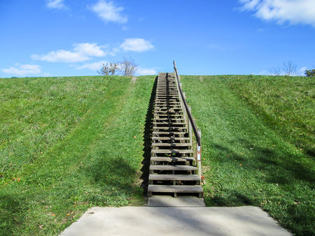
Steps to the top of the levy in Lake Medina County Park
The blue water was edged on the west by white rocky banks and on the east by colorful woods. Mansions peeked out through the trees. The sun glistened on the deep blue water under a lighter blue sky scattered with cottony clouds. We thoroughly enjoyed the mile-long walk around the west side of the lake before turning off into the parking lot at the north end where our car awaited us.
We drove back through Medina and went to the restaurant we’d picked out earlier, eager for a fulfilling dining experience. We have been very impressed with most of the restaurants we’ve eaten in, but once in a while we get one that disappoints. That was the case today.
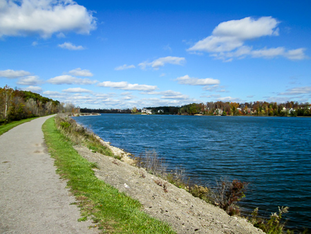
View of Lake Medina from the Buckeye Trail on top of the levy
CW tried something new. Unfortunately, he didn’t much care for it. I ordered a sandwich that was supposed to come with chips but it arrived with fries. I questioned it. The waitress said it comes with fries. I asked to see a menu. Another lady got into it. She said the sandwich comes with fries. Again I asked to see a menu. She reluctantly brought one over, and as she repeated that it comes with fries, she ran her finger along the line that said, “All deli sandwiches served with chips.” I got my chips—but no apology.
About 25 minutes before they were supposed to close, the lady told us they were closing. I just stared at her thinking, Are we supposed to get up and leave? Then she said we didn’t need to leave. Not sure why she told us they were closing. I ate more quickly, though. Their credit card machine wouldn’t work and we had to use cash. When CW asked for a receipt, the lady acted like it was a chore and wrote one out by hand. I took the last of my chips with me as we hurried back to the trail. Needless to say, we won’t return, but I could enjoy the situation—my sandwich was delicious!
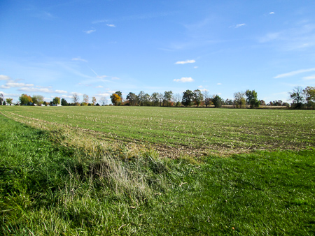
Winter wheat planted among corn stalk stubble
At 2:40 we were hiking again, from our spot south of Litchfield where we had stopped the day before. We had 6.5 miles of roads ahead of us through farmland to the Lester Rail Trail Trailhead. We saw harvested cornfields turning green again with winter wheat. The afternoon was quiet and beautiful for the most part.
We saw several dogs. Many were thankfully behind fences. One that was loose tried to appear dangerous. As he barked his meanest bark, all four feet dug at the ground sending leaves flying behind him. He kept his distance, though, and I could only laugh.

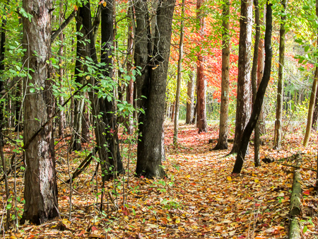
Woods along Lester Road
However, farther down the road we had a scare. I saw two large dogs by their house 50 yards from the road and commented on how quiet they were. Usually dogs see us coming and begin barking before we ever see them. We had just passed the property, however, when we heard the barking begin. As we turned back, we saw them racing toward us. Their hackles were up and they weren’t stopping or slowing. No one was out to call them off. CW got his hiking stick in the mouth of one. I didn’t have a stick so I got behind him, taking off my backpack in record speed so I could swing it at one if I needed to. The stick must have worked because they retreated. During the short but close encounter, CW was thinking that this might be the time he finally got nailed. Fortunately, the hammer didn’t fall this day.
In spite of a late start, we finished the day at 5:10. We really couldn’t have asked for a more perfect fall day for hiking—unless maybe the removal of a couple overzealous dogs from it. We went to Buehler’s grocery store. They had a little ice cream counter where we got Banana Splits to celebrate making it through the day unsplit.
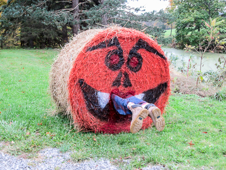
Hope it wasn’t a BT hiker!
Day 12: Lake Medina to Richfield Heritage Preserve (16.9 trail miles)
Today would be longer in miles than yesterday and the most strenuous of any hikes I’ve done on the BT. That’s what CW told me, and he’s usually right about these things. There was also a rainy forecast. We were determined to get an earlier start than yesterday.
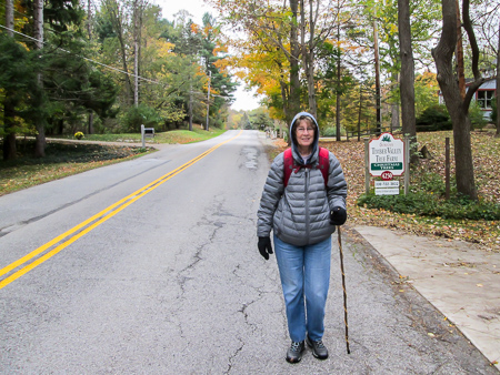
Bundled up for 30-degree temperatures
By 7:30 we were driving east on SR 18, straight toward a captivating sunrise. A thin layer of sleepy blue was sandwiched in between pale yellows and oranges piled high across the horizon like cozy comforters on a king size bed. Even though the sun wasn’t totally up, the trees had already managed to capture some rays, eager to be about their business of dazzling mankind.
Road low on traffic and high on beauty
While shuttling the cars, we received a call from Pat. He would show up sometime during the day and walk with us. He does some maintaining of the trail in the Medina section and wanted to take us through a new part of the trail he’d been working on.
We started out from Lake Medina shortly after 8:30. The temperature was in the 30s. The cold and wind made it hard to breathe the first half mile, which was on a busy open road. After that, we moved onto less-trafficked and more-sheltered roads. Being bundled up for the weather, we warmed up as we walked.
Mary dropped Pat off to hike the rest of the day with us
We met a couple ladies out walking. They suspected we were hiking the BT. One had recently renewed her BT membership, and she knew Pat. Less than half an hour later, as we were admiring all the fine huge houses set back among flaming trees, a car approached and turned into a driveway right in front of us. It was Mary dropping off Pat. He was hoping we would have been farther along, not being fond of road walking. I was wishing we’d gotten farther, feeling wimpy that we’d only covered 1.5 miles before he joined us.
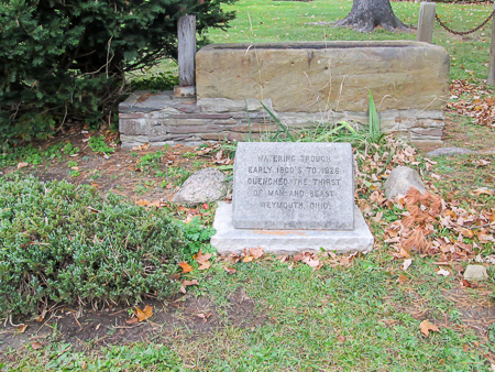
Watering trough from the early 1800s in the community of Weymouth
The temperature was actually going down before it would rise into the 40s later. At one point we could see our breath. With gloves and hoods—and hills to conquer—I kept sufficiently warm most of the day. CW was right about the terrain. The roads had steeper rises than what we had walked so far.
We walked through the community of Weymouth. There is a monument in front of a stone watering trough that dates back to the early 1800s. Nearly every day our hikes take us by old cemeteries. Today it was Beach Cemetery in Hinckley Township. Some grave markers designated the resting places of men who fought in the American Revolutionary War.
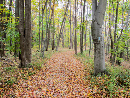
Buckeye Trail shares a bridle trail through Hinckley Reservation
After eight miles, the trail finally went off road. We entered Hinckley Reservation, which is part of Cleveland MetroParks. For a while we followed a bridle trail and had to carefully watch where we stepped, but it was still nice to be on dirt paths. There were a couple questionable spots lacking sufficient blazing, so we were fortunate to have Pat with us.
At 1:00 we reached Johnson Picnic Area and stopped for lunch under the shelter. Earlier it had started to sprinkle, and for the rest of the day it rained on and off.
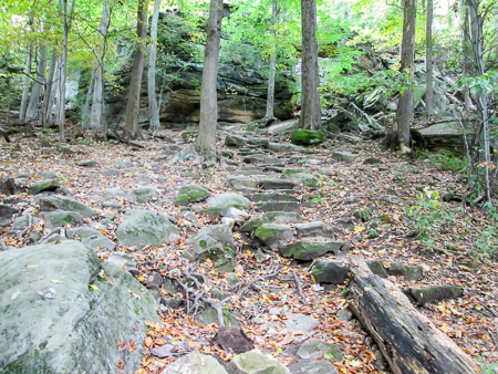
Ascent to the top of the rock ledges in Hinckley Reservation
We continued through Hinckley Reservation for 2.5 more miles. The trail passed by Hinckley Lake, through a wetland and two more picnic areas, and along the edge of a hay field. But the coolest part for me—and, by far, the most difficult—was the steep ascent to the top of the rock ledges. It was exhausting, but fun.
Near the top, we spent considerable time reading what people had chiseled into the rock faces. Dates went back at least to 1879. I was curious about the stories those rocks held. A couple had carved their names with a date, later added a wedding date, and again returned to add the name of their new son.

Historic mill and waterwheel at Richfield Heritage Preserve
Leaving Hinckley Reservation, we were back on roads, some quite steep, for 3.5 miles. Where the trail left SR 303, there was more road ahead to take us to Rising Valley Park where we had expected to end our hike today. However, this was the place where Pat and others had been creating new trail to move the BT off road.
We entered a 336-acre fenced area where the BT winds for about 1.5 miles through woods that used to be a Girl Scout camp. It is now called Richfield Heritage Preserve and is open to the public. Besides hiking trails, there are ponds and several historic buildings. The kinks are still being worked out between the BTA and the Richfield Joint Recreation District. Today a fenced bridge the BT uses had a lock on it, so we had to forego a section of the trail. Nevertheless, we were thankful for the opportunity to experience this new off-road trail.

Locked out of a bridge the BT uses in Richfield Heritage Preserve
We exited the preserve at 5:40. Pat’s truck was waiting in the parking lot. He drove us to our car not far away. This had definitely been the hardest day so far on the BT as far as the terrain. And the guys told me this was nothing compared to some parts of the BT I have yet to do. Oh my!
On the way to the motel we stopped at a grocery to pick up some veggies (ours had frozen in the refrigerator in our room) and ice cream. I got a pint of Bear Claw. I finished off the whole thing. Surely I had earned it today.
Detour along Valley Parkway in Brecksville Reservation
Day 13: Richfield Heritage Preserve to Brecksville Reservation (6.5 trail miles)
Yesterday had been our hardest day. Today was one of our easiest. We only had 6.5 miles to finish the Medina section and our fall hike. Since we had our room for another night, we could enjoy a more leisurely beginning to our day and take our time on the trail.
The sun shines through on the bridle path in Brecksville Reservation for our last mile
It was a gray, dreary, drizzly morning. The rain had hung around last night and into the morning and was supposed to continue, but by the time we stepped onto the trail around 10:30 most of the rain had passed. We experienced a little mist through the day, but I never had to get my poncho out.
We thought the rain might have taken a toll on the trees overnight. Although some trees were bare where they had been richly adorned yesterday, there was still an abundance of breath-taking views today. We weren’t in any hurry to end this adventure.

Curious deer in Brecksville Reservation
The first four miles were on roads that mostly passed large houses, many of them mansions, some more modest. Then we entered Brecksville Reservation, a unit of Cleveland MetroParks. The BT follows bridle trails, but work is being done on some of them that makes them temporarily unusable. For another 1.5 miles we had to walk along Valley Parkway, which parallels the trail. It’s a simple two-lane road edged by woods, though, so it was pleasant.
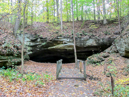
Deer Lick Cave in Brecksville Reservation
The last mile was a perfect ending to our hike. We got back into the woods on winding, leaf-covered paths. The sun broke through the clouds, shining through the trees. We saw four deer that stopped what they were doing and watched us for the longest time. Like the deer back home in our yard, they seemed to have little fear of us.
Close to the end, the trail descended stone steps to a stream with a trickling waterfall. There were two small wooden bridges to cross, rock formations surrounding the area, and a cave.

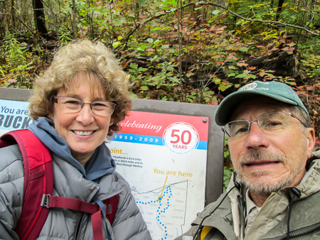
The final climb to the end of the Medina section
The path then climbed back uphill to the rim trail and soon ended where two other BT sections join the Medina section. That means we will return to that location at least two more times on future hikes. The spot is marked by a sign donated by Cleveland MetroParks that honored the BTA’s 50th year. We finished at 1:30.
We drove into Brecksville and celebrated our accomplishment with lunch at Simon’s Restaurant. We further celebrated at Honey Hut Ice Cream where I got a Raspberry Fudge Brownie Twister. We highly recommend both establishments. Tomorrow we will head home to rest up for next April. CW found a back way so we don’t have to drive interstate. Yea!
Three more sections of the BT and 172.1 miles completed
~~~
This 10-percenter added 172.1 miles and 411,765 steps to my feet and 3,475 miles to the tires of our cars. I have now completed three 10-percenters for a total of 469.8 miles on my BT journey.
I think I did pretty well at “enjoying the moment.” When I shivered with the cold wind blowing in my face or withered in the heat of the sun, when we got a late start hiking or couldn’t find a way to get to where we needed to go, when a dining experience was less than satisfactory or when our GPS couldn’t locate an ice cream shop at the end of a tiring day—I could always find something to enjoy. Sometimes it just takes a little longer.
There was a lot of time to think while walking all of those quiet country roads, and my thoughts often went to missing Dad. There was an emptiness in not being able to share this hike with him. He would have loved hearing about the paragliding spiders, Oreo cows, and golden caterpillars. He was a smart man, though, and probably knew all about them. The soybean harvesting would have brought out his own stories from his summers spent on the farm. I walked the BT miles in the hiking boots he gave me. I drove the road miles in his car. In every one of those miles, I carried him in my heart and enjoyed the adventure for both of us.