
by guest blogger Bonnie Spencer
October 16, 2017
Day 6 (Monday): Mogadore to Hartville (10.5 trail miles)
We are rested up and in good shape for another week of hiking. The stitches have been removed from my nose, so I don’t have to bother with Band-Aids to cover them. A cold sore that appeared in the corner of my mouth on the previous trip up while hiking and stressing in all that heat is finally better. It was super painful and wouldn’t heal. This is the first morning I didn’t feel like the Tin Man, having to lubricate it so I could open my mouth. If that’s the only bad thing healthwise from the last hike (CW had no problems at all), then we have had a very successful hike so far.
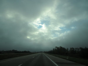
Windows through the gray clouds
We dropped Sugar off at the kennel and headed north—in one car since we left one up in Navarre. Pure luxury for me, not having to drive. It rained a lot yesterday. Today it looked as though it would continue, but it turned out we had only a little mist. Low gray clouds were moving swiftly. We could see through them to the blue sky and bright white clouds above them. That seemed like a good sign for our day. It hasn’t looked much like fall yet, but north of Columbus we finally began seeing some color in the trees beside the highway.
We picked the car up, checked into our motel in Bolivar, and ate a quick bite at the McDonald’s conveniently located next door. Then we spotted the cars and started on the trail at 2:15 p.m. to hike from Mogadore south to Hartville to finish the Mogadore section.
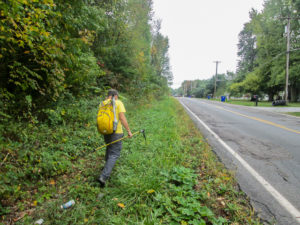
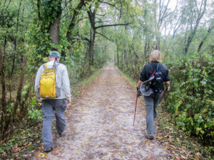
CW walking in weeds to avoid traffic
Today’s hike was under cloudy skies. It did get warm—in the 70s, I think—but at least the sun wasn’t beating down on us. All but 2.5 miles were on roads. They were country roads with varying amounts of traffic. The first mile was on a busy two-lane, so we walked on the grassy shoulder. The second mile was not as busy, but we had to tread through tall weeds whenever a car passed.
The next mile was much quieter and safer. It took us by the Goodyear Blimp Hangar at Wingfoot Lake. Wingfoot Two is based here. Goodyear has two other airships in the U.S. The Spirit of Innovation is based in California and Wingfoot One’s home is in Florida. I don’t know where Wingfoot Two was today, but Wingfoot One was visiting, perhaps for maintenance, and moored in the yard by the hangar. Visitors were invited into a fenced-off parking lot to get a little better view than we could get through the tall chain link fence that surrounds the entire property. It was impressive.
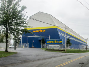
Goodyear Blimp Hangar on Wingfoot Road in Suffield
The BT took us onto busy SR 43 for less than half a mile. Cars were flying by. We were so glad to get back to the quiet roads for the next three miles. We spotted a couple of wild turkeys ahead of us but couldn’t get close enough to them to get a picture. A jet flew low overhead, but we couldn’t find it. It remained concealed above the gray cloud cover.
We passed a variety of country houses. Some were two-story farmhouses; others were newer ranch-style buildings. Some looked like estates set far back from the road; others were much more modest and grouped close together with small yards bordering the road.
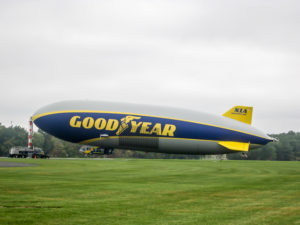
Goodyear blimp Wingfoot One
My eyes burned from the sweat that continually ran down my face. Maybe I should add a sweatband to my hiking gear. I was so glad that the perspiration was from exertion and warm temperatures, though—not from the burning sun.
We finally reached Quail Hollow Park, a 703-acre recreational area that was established in 1975 as a state park. In 2016, management of the park changed to the Stark County Park District. It has 12 trails that provide 19 miles of hiking, mountain biking, horseback riding, and cross-country skiing. We hiked 2.6 miles through the park and were on parts of eight different trails.
I had heard a lot about Quail Hollow from CW, mostly how every time he hiked through there, no matter whom he was with, they would get lost and go in circles. I preferred to ignore that and concentrate on the nice name. Quail Hollow sounds quiet, peaceful, woodsy. I was determined we wouldn’t get lost. I even wrote in my notebook: We will not get lost!
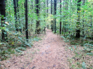
Coniferous Forest Trail in Quail Hollow Park
The trail was wide and, in spite of lots of roots, easy to navigate. We walked through a coniferous forest, a deciduous forest, and meadowlands. We passed vernal ponds, a tall grass prairie, and a sedge marsh. About halfway through, we crossed a lawn that passed by an elaborate formal herb garden and the Stewart Manor House. Built in 1929, the house is now used for educational and community activities. Not wanting to get caught by darkness, we didn’t have time to stop and admire the grounds.
We got through Quail Hollow in 1 hour and 15 minutes. There were a couple of places we were unsure of the correct trail to take, but we studied the map harder and scouted ahead and made it. It was quiet, peaceful, and woodsy. CW said it was the first time he’s done it right.
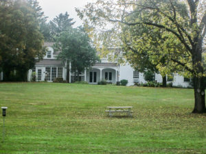
Stewart Manor House in Quail Hollow Park
One more mile on roads got us into Hartville. We reached our car at 6:30, happy to have finished before dark and to have gotten through Quail Hollow without getting lost.
Getting to the other car was another story. We took a wrong turn and added 15 minutes to the drive. Now it was mostly dark and we had a long way back to the motel, made longer by having to avoid interstate for me and not knowing what roads to take to do that. We just had a general idea. And I hadn’t had my ice cream yet, so I wasn’t a happy hiker at this point.
I followed CW. Now it was pitch black. When we shuttled cars earlier, we had seen an ice cream shop. We planned to stop there after our hike, but missed it when we took that wrong turn. On the way back to the motel, CW spotted it. It was so dark and I was concentrating on not losing him that I didn’t see the tiny bit of light back from the road. We turned around and stepped inside the door at 7:29. The girl working there said they close at 7:30 and that we needed to keep that in mind in the future. O-kay. I didn’t think she’d be interested in my sad story of why we were just getting there, so we quickly ordered our ice cream and went to the car to eat it. My Cookie Doughlicious was delicious, but I can’t tell you the name of the place. I didn’t see it displayed anywhere. Just some little place on SR 43 . . . that closes at 7:30 p.m. sharply.
We finally made it back to the motel after 9:00. It took two hours from the time we picked up the second car. It was quite a long and tiring day.
Day 7 (Tuesday): Hartville to Nimisila Reservoir (12.3 trail miles + 0.5 extra miles due to not paying close attention to the map and blazes)
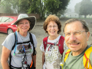
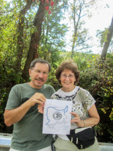
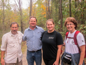
Karen, Bonnie, and CW ready to hike out of Hartville
We are excited to have Karen Fisk hiking with us for a few days. She’s a fellow BT hiker who is section hiking the entire trail and needs considerable miles in the Massillon section. She has done 7.5 miles near the northern end of the section, which is why CW and I hiked that part on our previous trip.
We met Karen at Nimisila Reservoir this morning, then shuttled up to Hartville, the beginning of the section. It was very foggy when we began hiking just past 9:30 a.m. Fog is good. It means less sun. But the forecast said it would get to the high 70s and be partly cloudy changing to partly sunny. Sounded like another warm day. All day we would be on roads.
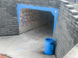
Tunnel under Market Avenue used by students
It wasn’t a half hour before we got off track. Actually we were on a track—it went around the edge of Lake Community Park—but we should have gone straight through a parking lot. I lose map concentration when there’s someone else to talk with. We didn’t go too far before we realized there were no blazes and it looked as if we would just go in circles if we continued. We got off the track and back on the BT that soon led us by sports fields and then through a tunnel under Market Avenue, used by students from the high school and middle school located on the other side of the street. It was only 10:00 a.m., but the tunnel was busy with students coming through. They were probably wondering why these old people were wandering through their tunnel.
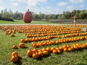
“Linus, we found the home of the Great Pumpkin!”
By 10:30, partly cloudy had departed. Partly sunny didn’t show up. The rest of the day was just plain sunny—and very warm. My sunhat came out but I couldn’t bear to put my long sleeves on. Occasional shade from trees and cool breezes helped get me through. And Karen’s stories. Everything she sees reminds her of an experience she has had or a tidbit of knowledge she has picked up somewhere. She and her husband are trivia nuts. We learned very interesting things. For example, the 7-slot grill on Jeeps represents the seven continents.
Around 2:30, we found a shaded guard rail and stopped for lunch. It felt good to rest. We had hiked about seven miles. I used this spot to mark my halfway point around the Buckeye Trail—720 miles. I guess now I really do have to finish it!
CW and Bonnie halfway around the BT together
We still had five more miles to finish in the hot sun—some on country roads, some through residential neighborhoods. It was pretty quiet except for a group of cows we met. Something we did stirred them up from their peaceful grazing. Maybe the bulls were being protective of the cows. They got quite loud and drifted to the corner of their enclosure closest to us. I kept looking back to make sure they hadn’t found an opening, not wanting to get stampeded. I didn’t want to be added to Karen’s collection of road kill photos.
With two miles to go, I missed another turn. I was so excited about being close to the end that I forgot to read the map. They let me keep the map, though, and we finished at 3:20. It took us 5 hours and 45 minutes counting a 30-minute lunch break to hike 12.3 miles. These miles completed the entire Little Loop for CW and me that we had begun in the spring.
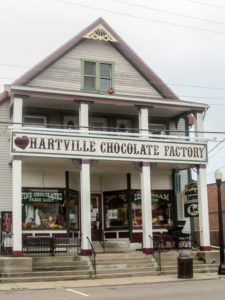
Hartville Chocolate Factory
When we drove back up to Hartville for the other car, I got to experience the Hartville Chocolate Factory I’d heard so much about. The homemade candy all looked so scrumptious, but I tasted only a free sample that was available. They had ice cream, too, so we all made our selections and sat out front on benches to enjoy it. I got a scoop of Cappuccino Mocha Truffle. A great end to the day.
Day 8 (Wednesday): Crystal Springs to Navarre (11.4 trail miles)
We were looking forward to a cooler day. The high would be in the mid-70s. With cloudy skies predicted, there was a chance of a thunderstorm and later showers. We were prepared if the rain came.
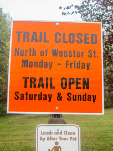
Big, scary orange trail closure sign
We met Karen at Craig Pittman Memorial Park in Navarre. It would be our ending spot for the day. There was a large orange sign displayed that said the trail was closed above Wooster Street Monday through Friday. Big orange signs containing any form of the word “closure” are always good for a skip of the heart—and that isn’t a happy skip. We decided not to cross that closure till we actually reached it.
It was misting as we began hiking about 9:15 a.m. The temperature was in the 60s, pleasantly cool. It felt great. It would mist several times today, but never for long. Most of the day, we were on towpath trails that were either packed crushed limestone or asphalt. That meant level ground and easy walking. We were all in high spirits.
CW and Karen on the Ohio & Erie Canal Towpath Trail
We began hiking on the Ohio and Erie Canal Towpath Trail (OECTT). Before we even went a mile, we passed an eating establishment near a trailhead. Its sign boasted they had the “best breakfast in town.” It wasn’t even 10:00 and we’d all had breakfast, so as tempting as it was to explore the truth in their advertising, we decided to pass it up.
Two miles farther and we came to the Lake Avenue Trailhead. There was a canoe livery there as well as bike rentals, a bike shop, the Blue Heron Deli, and a couple other shops. We considered visiting the deli, but again the timing wasn’t right. It was only 10:30, too early for lunch. I tucked the Blue Heron away. Maybe we could work something out later.
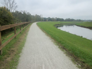
OECTT on the Massillon Levee above Tuscarawas River
Right after leaving the trailhead, the OECTT rises to the top of the Massillon Levee, paralleling SR 21. We saw geese, seagulls, and a blue heron enjoying the water of the Tuscarawas River.
After a mile and a half more, the OECTT temporarily ends and the BT ascends a ramp to a bridge that crosses over the river. We walked through a Massillon neighborhood and ended up in Oak Knoll Park. It was 11:30, so we ate lunch under a shelter there.
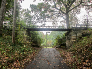
Oldest iron bridge in Ohio, located in Oak Knoll Park in Massillon
Leaving the park, we walked under the oldest standing iron bridge in Ohio. It was made by Russell & Company in Massillon in 1859 for a road in Alliance, Ohio. In 1899, it was moved to Oak Knoll Park to be displayed as an important piece of Stark County history.
We soon returned to the OECTT, which continued south between SR 21 and the river. Right before we passed under US 30, a sprinkle turned into a heavy rain. We took advantage of a dry spot under the bridge to don our rain attire. Very soon after that, the rain stopped. That must have been our afternoon shower. We never did get the thunderstorm.
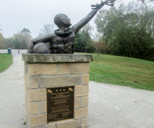
“Reach for the Stars” statue in John Glenn Grove Trailhead
We reached the John Glenn Grove Trailhead where there is a statue honoring the astronaut and U.S. senator. Here we saw the twin to the orange sign we’d seen this morning. I’d forgotten about the closure, but we were now two miles above Wooster Street. We didn’t know where this might occur or if there would be a way around it. We forged ahead and hoped for the best.
About a tenth of a mile above Wooster Street, we found construction going on inside a fenced area of the Navarre Waterworks. The OECTT was outside the fence and it wasn’t blocked at the time. Alongside the trail lay piles of construction materials. It looked as if trucks filled that area at times, but none were there today. We had no trouble getting past the “closure.”
Rochester House in Navarre
The last mile of the BT today left the OECTT at Wooster Street and followed sidewalks through the village of Navarre. The village has many wonderful old buildings and signs marking historical sites. One building, the Rochester House, was built around 1840 as an inn on the Ohio & Erie Canal. It also served as a stop on the Underground Railroad.
We took a leisurely break at Anderson’s in the Village, which contains a coffee shop. We were almost at the end and didn’t need to rest, but the porch with its rocking chairs was too inviting. The sun had come out, too, so we also appreciated the shade.
One of many historical signs throughout Navarre
The BT left the sidewalks to join the Navarre Canal Corridor Trail into Craig Pittman Memorial Park. We finished at 3:40. After driving us to our car, Karen headed home. CW and I drove to the Lake Avenue Trailhead and checked out that Blue Heron Deli.
We ate some tasty soup, sandwiches, and salads on the sheltered porch. The sun was shining brightly, and the sky was blue with puffy white clouds and a few light gray ones. When we went back inside to get our ice cream, the skies opened up. Rain poured down at a 45 degree angle from the sunny skies. By the time we got back outside, there was only a light rain. Then it stopped altogether. We were grateful that we hadn’t encountered that on the trail. My Peanut Butter Brownie Crunch was delicious.
Day 9 (Thursday): Navarre to near Zoarville (14.3 trail miles)
Karen lives close enough that she has been driving back and forth from home each day to hike with us. This morning she met us at the motel. We drove through fog to get our cars in place and began hiking at 8:50 a.m. under cloudy skies. It was 61 degrees and wasn’t supposed to get over 70 today. No rain was in the forecast.
We planned a longer day in order to shorten tomorrow’s hike. It was a great day for more miles. With the pleasant weather and the trail again being level towpath for the majority of our hike, we were excited about the day.
In a couple of miles, a man and woman with a dog passed us up. A little farther, when they rested on a bench, we caught up to them. We spent an enjoyable few minutes talking with them, answering their questions about hiking the Buckeye Trail.
An unexpected meeting on the OECTT – CW, Jim, Sarah, and Bonnie
We had gone a couple more miles when a man and woman rode past us on bicycles going the opposite direction. We all said hi as we passed. A few seconds later, we heard the sound of tires suddenly skidding on the gravelly trail. We turned around to see them looking at us. The man said, “CW?” We finally realized it was Jim whom we had met on our last trip up and ate lunch with in Mantua. He and his daughter Sarah do a lot of biking together and they just happened to be on that trail when we were. We were all in shock at the “coincidence.” We enjoyed visiting for a while, and CW and I were so happy to meet Sarah. They continued on their ride and we headed off towards Bolivar.
In preparing for this hike, I had discovered the Canal Street Diner in Bolivar. The BT goes right past it, and it was located halfway through our 14-mile hike. I had been talking it up so the plan was to eat lunch there today. We reached the diner about 12:30.
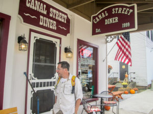
Canal Street Diner in Bolivar
Two women were sitting out front on a bench. We struck up a conversation with them and talked for a while. They were sisters-in-law and had eaten breakfast at the diner. We talked about where everyone was from and told them about the Buckeye Trail that runs through their town. They weren’t familiar with it. We were enjoying our new friends, but food was calling.
Inside we found the same Bolivar friendliness. The atmosphere was inviting. The menu was extensive. The diner was doing a good business and the waitress seemed to know everyone and freely joked with them. She thoroughly enjoyed her job, and we thoroughly enjoyed our lunch of sandwiches, salads, and homemade soups.
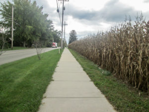
Cornfield next to the sidewalk in downtown Bolivar
An hour later we resumed our hike through the streets of Bolivar, passing by the Fort Laurens State Memorial. Fort Laurens was Ohio’s only Revolutionary War fort. On the site is a museum and, also, the Tomb of the Unknown Patriot that memorializes unknown casualties of the American Revolution. We were on the other side of the street and didn’t take time to cross over and walk through the grounds. We still had many miles to go today.
A relatively short primitive horse path (read as narrow unmaintained trail with sticker bushes grabbing at you) led to a 60-foot trail bridge over I-77 and eventually back to the towpath. In the next two miles, the BT passed by the remains of Locks 7 through 10.
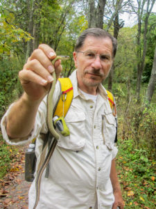
CW and a trail snake
A woman was walking the trail rather swiftly, but she took time to stop and talk with us. CW was holding a snake at the time that I had almost stepped on because it blended in with the trail. The woman was obviously a nature lover. She told us about snakes hanging from trees along the trail. She had also seen eagles in the area. They once followed her closely down the trail and back. She went on ahead, then later passed us coming back. This time, she said to watch for the turtles that sometimes can be found on logs in the canal. We couldn’t find any eagles or turtles today. And I was relieved that we didn’t see any dangling snakes, either.
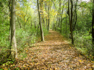
Leaf-covered towpath is beautiful vision
We passed by steps that ascended to a footbridge to reach Zoar Village. Zoar was founded in 1817 by German Separatists. They had persuaded Ohio to build the canal through their land, and everyone in the village helped to dig the ditch. We attended the BTA TrailFest that was held in Zoar in 2016, so we were familiar with the quaint village. No time to stop today, though. We still had three more miles to go to reach our car.
The rest of the hike was more of the same towpath. I guess it could have gotten monotonous, but you can hardly beat the beauty of a tree-lined path covered with fall leaves stretching before you—unless there had been more color. We still haven’t seen much of that.
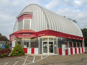
Jack’s KremeLand Diner & Dariette in Navarre
We finished at 4:30. Pretty good for walking over 14 miles and taking time along the way to have some good conversations with strangers and new friends. On the way to the other car, we stopped off at Jack’s KremeLand Diner & Dariette in Navarre for ice cream. It’s a cool-looking ‘50s-style diner. I got a scoop of Panda Paws, “vanilla ice cream with peanut butter panda paw cups and swirls of thick rich fudge.” It tasted as good as the name is cute.
Day 10 (Friday): Near Zoarville to New Cumberland (8.2 trail miles)
Karen isn’t hiking with us today. She covered what we are doing today in 2016 when she did the hike-in to TrailFest in Zoar. Thanks to the mileage we put in yesterday, we only have 8.2 miles this morning.
While driving to get the cars into place, the sun was low and shining from a blue sky dotted with puffy white clouds. It sure didn’t look like the cloudy morning that was forecast. However, by the time we were ready to hike at 8:00, more clouds had appeared. It was in the 60s and turned out to be great hiking weather. I was soon able to take off my jacket.
Zoarville Station Bridge
Our woodsy trail yesterday had ended at SR 800. Today we walked a quarter mile on that road to cross over the Tuscarawas River and get to an off-road trail that went another quarter mile. We crossed the Zoarville Station Bridge. The 105-foot-long structure was built in 1868 as a highway bridge over the Tuscarawas River in Dover and was moved to its present site in 1905. It is the only Fink Through Truss bridge still existing.
The rest of the morning was on roads through beautiful countryside. It was quiet except for the birds happily singing and our boots softly hitting the pavement. We were enjoying the perfect morning.
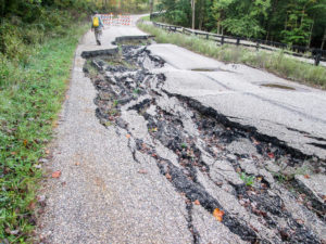
Land slippage on Boy Scout Road in Tuscarawas County
An update on the BTA website had alerted us to a land slippage on Boy Scout Road. The road has been closed since January. CW had checked with Steve Walker and found that, although the road remained closed to vehicles, hikers could get through. When we reached the spot, we found a large section of road caved in. It looked like a sinkhole.
The BT goes past Camp Tuscazoar, created nearly 100 years ago as a Boy Scout camp. A gentleman driving out of the camp rolled down his window and commented on the nice day we had for hiking. We agreed. His truck was full of firewood he had chopped this morning.
Rolling hills and sunshine
The terrain began fairly level today, but an hour into our hike, it had become rolling hills. I definitely had some trouble rolling up the steepest of them. Then the sun found a way through the clouds. In spite of the warmth and hills, we still made good time and finished shortly after 11:00 a.m. We had now completed the Massillon section.
We picked up the other car and drove to New Philadelphia. CW had made arrangements to leave a car again, this time with a friend from his childhood years. Jerry is the son of one of CW’s grade school teachers. We enjoyed a brief visit with Jerry and his wife Judy. Though we hated to run off, we needed to get on the road.
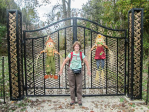
Bonnie hanging out with the scarecrows
It was nearing 12:30. We wanted to get a quick bite somewhere before heading home to pick up the dog. The Daily Grind Café in the center of town caught our eye. They have an extensive menu of soups, sandwiches, and salads. We ordered at the register, then sat down and waited for our food to be brought to our table.
We waited a half hour before CW went back and asked how much longer it would be. He was told the food was on its way. Ten minutes later, he went back again to ask for our soup and tell them to box up our sandwiches to go. We ate our soup at record speed and were back at the counter when the girl brought out our sandwiches. I asked if I could quickly get a cup of ice cream to go. She got it right away so I didn’t have to stand in line. I did have to pay, though. CW said I should have gotten it free.
We ate my ice cream (yes, I shared) and our sandwiches in the car. The sandwiches were very good but extremely messy. CW didn’t have an easy job of it, eating a sandwich dripping sauce while he was driving.
This dining experience wasn’t great—maybe they were having an unusually bad day—but the Mocha Chip ice cream was great. And we made it home to get Sugar before closing time.
This week we hiked 56.7 miles on the Buckeye Trail. On our next trip, we will tackle the Bowerston section. I’ve been warned that there are more hills a comin’.
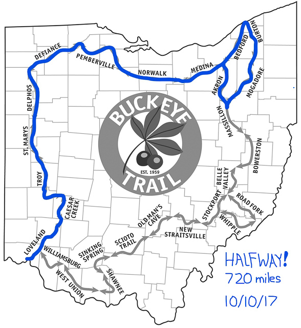
Halfway around the Buckeye Trail


Brenda
October 17, 2017Wow, what adventures! You guys always find the greatest places to eat, and reading about it makes me hungry, especially for ice cream! I can do without the dangling snakes though, or even the ones on the path. The “land slippage” looks intense, but that is so cool about the Goodyear blimp! I can’t believe how far you’ve come.
CW Spencer
October 17, 2017It seems like it is feast or famine with restaurants and ice cream. Either we find more cool ones than we can try out, or we can’t find anything interesting. I love little diners with home cooked food. I had stuffed pepper soup at the Blue Heron (delicious!). Then I saw it at another place. Must be a specialty in that area.
If the snakes get any bigger than the little ones we’ve come across—or if I see any in the trees!—that will be more adventure than what I want!