by guest blogger Bonnie Spencer
April 25, 2017
CW and I are hiking the Burton section of the Buckeye Trail this week. It begins where we left off at Lake Erie our last trip up and runs south through Painesville, Chardon, and Burton. Since we’re back to hiking by ourselves, we’re also back to driving two cars. The forecast looks as though we’ll have two nice days followed by two days of rain and thunderstorms. Whatever the conditions, we need to knock out a lot of miles in four days so we can start for home early Friday.
Day 10 (Monday): Hiram Rapids to Mantua (11.0 trail miles)
Here’s a teaser: We ended Burton before we began.
After dropping Sugar off for her third “vacation” in five weeks, we both drove north. To avoid the interstates for me, we took 42 most of the way. This doubled our driving time, but it was a beautiful day. We passed interesting farm markets, gift shops, family diners, Grandpa’s Cheese Barn, and ice cream shops. I briefly thought of the lovely time I could have if we didn’t have to hike, but we had a goal to complete and it involved me walking for my ice cream this week.
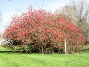
Flowering quince along the Buckeye Trail
It was after 2:00 p.m. when we got to our motel in Twinsburg. Since it was on the way, we checked in and unloaded the car before heading on to Lake Erie. Our plan was to begin at the lake and do about 12 miles. On the way, we pulled over for a powwow. CW saw what a late start we would be getting and decided we needed to switch gears and hike the south end of the section. We were already in the area so we would be able to start sooner.
We left a car at a trailhead 3.2 miles into the next section, Mogadore. Not that we wanted extra miles, but at home we had looked at maps and couldn’t see anywhere to park at the ending point of Burton. We then drove up to where we wanted to start. It was a country intersection with no place to park. We drove north 0.6 more miles and found a small off-road parking area.
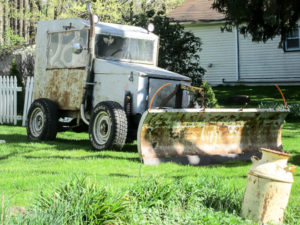
Snow plow getting some time off
At 4:00 p.m. we began hiking. We had to move fast since it would start getting dark around 8:00. Besides feeling a degree of pressure on these days due to our time constraints, we also miss having time to meet people along the way. We did speak briefly with a young man who stopped his golf cart on the road to ask what we were doing. At the time, CW was admiring an old snow plow parked in a yard. The man learned what the blue blazes on his road mean and thought he might start hiking the trail sometime.
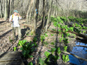
CW encountering skunk cabbage
The trail followed country roads. The late afternoon sun was quite warm, but we enjoyed a cooling breeze. Many signs of spring helped to create a pleasant walk.
About 5:30 we took a service road into the property of Camp Asbury, owned by the East Ohio Conference of the United Methodist Church. CW remembered having a difficult time finding his way through on his last hike here, but today it was beautifully blazed. The trail was dry for the most part and fun as it meandered through the woods. In places it was rocky with moss and roots added in. It traversed a grassy field and passed a pond. It crossed several streams on a variety of bridges.
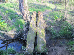
Moss-covered split log bridge in Camp Asbury
Close to 7:00 p.m. we reached the road and the end of the Burton section. A small parking area was there that hadn’t shown up on the Google map. We could have stopped here and done more miles in Burton, but now we had to go on to our car. Oh well, we’ll be happy about that when we come back in the fall.
The BT joins the Headwaters Trail going west. It is a limestone-paved trail built on the former Cleveland-Mahoning Railroad line. The trail presently goes between Mantua and Garrettsville, but there are plans to extend it.
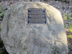
Memorial along Headwaters Trail for crew lost in a freight train accident in 1949
By the side of the trail was a boulder bearing a plaque. It marks the spot where three crewmen lost their lives in a 1949 train accident involving a ruptured steam engine fire box.
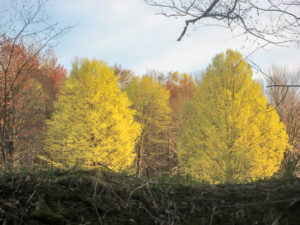
It was a pleasant walk as the trees partly shaded us. In the distant south, we saw budding trees ablaze from the low evening sun. It looked like a fall scene. We reached the village of Mantua at 8:00 p.m. while it was still light. We had completed 11 miles in four hours without a break. And we had now finished the Burton section—even though we hadn’t started it yet.
By the time we got back to the motel, it was very late. We got ice cream next door at Sheetz gas station. It was a good decision. Our Tollhouse Chocolate Chip Cookie Sandwiches were delicious.
Budding trees lit up by late afternoon sun
Day 11 (Tuesday): Headlands Beach State Park at Lake Erie to Girdled Road Reservation (14.4 trail miles)
Our original hiking schedule for the week went out the window when we changed plans yesterday. Now we would be making it up as we went. We still wanted to get a lot of miles in today since the weather was supposed to be good. We decided to do it in two legs, though, just in case we ran into any problems.
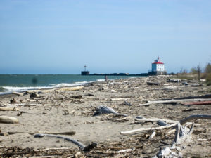
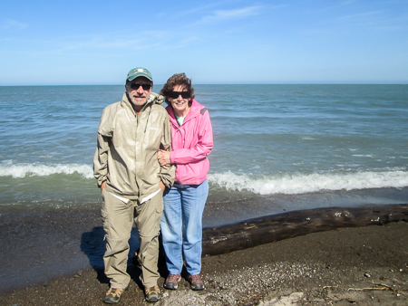
Headlands Beach on Lake Erie
We left the motel a little after 8:00 a.m. but it was a long way up to the lake. And we got lost on the way. We accidentally ended up in a great parking lot and saw blazes there, but it was way too far for us to walk today. We looked at maps and finally located the spot we wanted, left a car, and drove to the lake.
Since we didn’t get to walk down to the lake two weeks ago, we took time to do that today. The weather was so much nicer today. I left an impression on the beach when I tripped over the wood sticking out of the sand. I’ve been so careful not to fall on the trail. At least I picked a soft place to go down.
We didn’t get started hiking until 10:40 a.m. It was in the 50s, but was heading for 60. The sun was bright and the breeze was cool.
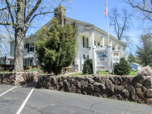
Rider’s Inn B&B in Painesville
We passed several plants: asphalt, Morton Salt, lime and stone, and concrete and stone. The trail went through Grand River right past Pickle Bill’s parking lot.
After an hour we entered Painesville and walked on sidewalks. We passed Rider’s Inn, which is presently a B&B. The inn goes back to 1812 when it accommodated stagecoach travelers. Later it became a stop on the Underground Railroad.
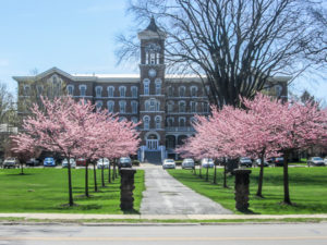
Redbuds line the walk to College Hall, the first building of Lake Erie College
Not much farther we passed the beautiful campus of Lake Erie College. It was founded in the mid-1800s as Lake Erie Female Seminary and is now a coeducational institution. Across the street is a statue of Edward Paine, a captain in the Revolutionary War, who founded Painesville in 1800.
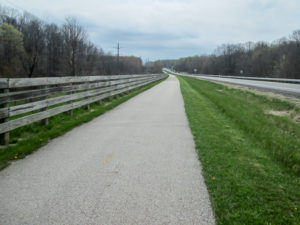
After five miles of streets this morning, we joined the Lake County Metroparks Greenway Corridor (The Greenway). It is 4.8 miles of paved trail that mostly follows the former Baltimore & Ohio (B&O) Railroad. It was quite warm with no shade to rest in. We finally took a short lunch break on a sunny bench.
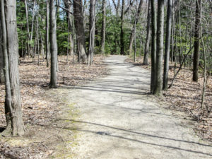
Trail through Environmental Learning Center property
We stayed on The Greenway for four miles until finding, as noted on the Greenway website, that it was closed beneath the 608 overpass. I was glad for the closure because the BT detours through the edge of the Environmental Learning Center property, offering a little reprieve from the heat. We were on a trail of compacted gravel. A sign said it was moderate difficulty. We descended some whopper steps and figured we’d pay for it later.
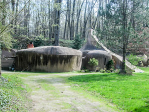
“Flintstone” House on Cascade Road in Lake County
We were back on roads after half a mile and still had about three miles to the car. Most of the roads were quiet country roads we could enjoy—except for being very hot and tired. On Cascade Road we passed the “Flintstone” house. It is a private home built in 1970 of concrete in a stone age design. I read that the present owner doesn’t like the name—he prefers to call it the Cave House—but it has been written about to the point that the name has stuck.
Our payback for those steps through the learning center came by way of a steep incline on Girdled Road to reach our car at the north entrance to Girdled Road Reservation. It was 4:00. Yesterday we were just getting started at this time. Today we already had 12.4 miles in, and we hoped to do more after lunch.
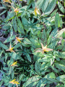
Trout lilies in Girdled Road Reservation
On the way back to the lake to get the other car, we stopped in at Scooter’s Dawg House to see if their scooter dawgs were as good as two weeks ago. They were. CW asked if they had an order of fries any smaller than junior. He was told he could get “tiny” fries. When they came, the pile looked just as big, only not as high because they had toppled over. I couldn’t help him eat them because I had a Grease Monkey to deal with. It was a concoction of vanilla ice cream, bananas, chocolate syrup, whipped cream, and pecans. It was so huge that CW had to abandon his fries to help me out. I didn’t hear him complain.
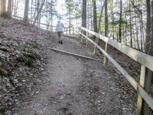
One of the many steep ascents in Girdled Road Reservation
We didn’t feel like walking any more, but with our late start this morning we’d barely covered more miles than yesterday. So we reshuttled to walk two miles through Girdled Road Reservation. It was just after 6:00 p.m. The heat had lessened. The woods were quiet and peaceful. We took our time and enjoyed it immensely.
The trails were compacted gravel. Three of the four trails we followed were designated as difficult. We encountered many hills and steps. By this time my mind was the only thing that balked at the sight of a coming ascent; my body was doing fine with them.
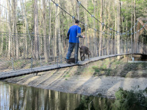
Cool swinging bridge in Girdled Road Reservation that even dogs have fun crossing
Others were enjoying the nice evening on the trail. A young couple had full backpacks, preparing for a hike out west. A young man was running up and down the hills (my body wasn’t doing that fine). We met a couple with their two dogs on the swinging bridge over Big Creek. The back legs of the small dog sometimes slipped through the boards, but it didn’t seem to bother him. I think he got across the bridge quicker than I did.
We got to our car at the small overflow parking area in Skok Meadow by 7:30. We had spent about eight hours hiking 14.4 miles and reshuttling. It isn’t as much as we’d hoped to cover today. It leaves a lot to do in the next two days. But somehow we will manage.
Day 12 (Wednesday): Girdled Road Reservation to the North Gate to Headwaters Park (19.6 trail miles)
Our rain gear was loaded into our packs. Although the rain probability had diminished for the day, the chance was still there and we would be prepared. It was cloudy and in the 50s when we started hiking at 9:00 a.m. The temperature was supposed to rise to 60.
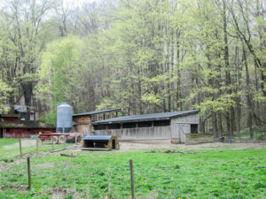
Home of the Happy Hens
We decided to walk two legs again today. A car was parked in Chardon where we hoped to arrive around lunchtime.
After a fraction of a mile on a busy road with practically no shoulder, we were grateful to move onto quieter roads. Houses were spaced far apart, though there was always at least one in sight. We listened to the morning birdsongs. A lot of happy clucking traveled across a field to our ears. Honestly, it sounded as if the chickens were laughing.
It quickly became humid and our jackets came off. When we entered Big Creek Park, a bit of breeze cooled us. The bugs were annoying, though. They were like little dive bombers zeroed in on sweaty faces.
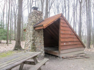
Lean-to in Big Creek Park built as Eagle Scout project
The trail was full of twists and turns making it fun to follow. We passed ponds, picnic areas, and a campground where nice-looking lean-tos had been built by Eagle scouts. The BT went out on the road for about a mile, then turned back into Big Creek Park. There had been several updates for the Burton section since our map was printed. Re-entering Big Creek Park was a major one, adding over five miles to the section. However, it was a good one because it took us off of a dangerous road.
We experienced an occasional sprinkle but didn’t need our ponchos. Sometimes there was just a mist that felt like pinpricks of coolness.
Part of Maple Highlands Trail parallels Route 44
When we left Big Creek Park for the second time, we crossed a road to access the Maple Highlands Trail. Like The Greenway, it utilizes sections of the abandoned B&O Railroad corridor. We walked about four miles on it before entering Chardon, the county seat of Geauga County. The BT passes through Chardon Square where Captain Edward Paine, Jr., the son of the founder of Painesville, moved into a log cabin in 1812 and founded Chardon.
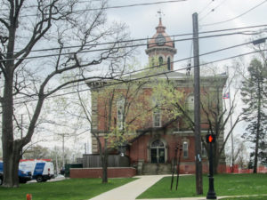
Courthouse built in 1869 after previous one was destroyed in a fire
CW asked a local resident for a good place to eat. He directed us to Morgan’s Place—The Smokehouse on the Square. It was only a few steps off the trail. The food was delicious, the service was great, and we lingered way too long. Almost an hour and a half later, we walked the few blocks to our car and reshuttled to continue.
In reshuttling, CW accidentally left his backpack in the destination vehicle. Not good for him: it contained his rain gear. Good for me: he carried my pack. He did have his umbrella, though.
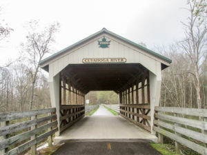
Covered bridge on Maple Highlands Trail over the Cuyahoga River
We started hiking at 4:45 p.m. South of the town center, we again joined the Maple Highland Trail. Some of the road crossings were on covered bridges. We would stay on this for 6.5 miles till we reached our car.
Thunder began rumbling. We were totally aware of our good fortune in dodging rain all three of our weeks up here, but we didn’t dawdle. The trail was flat, and it was easy to make good time.
I thought we might escape it all, but some rain finally came. CW used my poncho because I didn’t want my backpack (on his back) to get wet. I had a little raincoat with a hood and CW’s umbrella. It didn’t pour until the last half hour. We were drenched when we reached the car a little after 7:00 p.m. We had definitely stayed at Morgan’s Place too long.
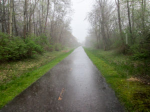
Rain pounding down on the trail
We drove back to Chardon. It had stopped raining by now. Before picking up the other car, we searched for ice cream. We found Froyotwist frozen yogurt. It was our first time at one of these. I had to watch the kids to see how it works. You dispense the yogurt of your choice from containers in the wall. Then you add any toppings you want from a huge selection in an island bar. It gets weighed and you pay by the ounce. Great idea—and great product.
I got pistachio frozen yogurt and covered it with various chocolaty candy toppings and hot fudge. We ate our treats by the window and watched the rain come down in sheets. When it finally slowed down, we both drove back to the motel, a 50-mile trip, on dark, rainy roads.
Day 13 (Thursday): North Gate to Headwaters Park to Hiram Rapids (15.7 trail miles)
This morning we saw news coverage of a flooded Sam’s parking lot last night one county over. People were still in the store and their cars were half covered in the lot. More rain was supposed to come today. CW even heard of possible hail. Our plan was to walk fast and wait till we finished for the day to eat a meal. We had close to 16 miles to cover in order to finish Burton.
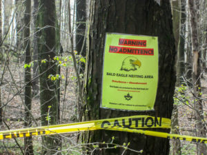
Bald eagle nesting area in Headwaters Park
We began at 9:00 a.m. with over two miles of nice trails heading generally south through Headwaters Park. It was cool and the sun filtered through the trees. After last night’s storm, it was a serene setting. A large area along the path was marked off with yellow caution tape in order to protect nesting bald eagles. We didn’t even take time to look for them.
Shortly after emerging from the woods onto country roads, we began hearing thunder. After yesterday, that should have caused our ponchos to come out, but we kept walking thinking we might just beat the rain to Burton. We didn’t. The clouds opened up, and we had to put ponchos and rain pants on in the pouring rain.
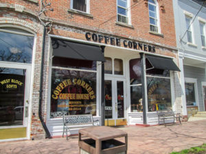
Coffee Corners Coffee House in Burton
It lasted less than a half hour. By the time we walked into the Village of Burton at 11:00, the sun was heating things up and we had shed the rain gear.
Even though we weren’t going to take time for lunch, we did want to find some ice cream. We immediately spotted Coffee Corners Coffee House; their window said they had ice cream. Inside, there were several small rooms containing different sized tables. One room had easy chairs; one had a shelf of books to read while drinking coffee.
Log Cabin Sugar Camp on Village Green in Burton
I got a scoop of Butter Pecan Cashew. Their menu of deli sandwiches looked good. We decided to return after we finished hiking for the day.
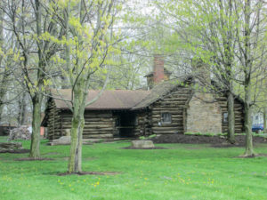
We continued on. Like Chardon, Burton has a Village Green and the BT goes through it. On the Green stands the Log Cabin Sugar Camp built in 1931, the first and only municipal owned and operated Maple Sugar Camp in the country. It is a working sugar house where maple syrup is produced every spring and maple candy is made all year. Burton holds pancake and sausage breakfasts in March and is known as “PancakeTown USA.”
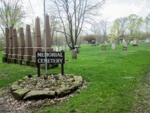
Memorial Cemetery in Burton
Not far from the town square, the BT leaves the road for a lane that leads to Memorial Cemetery containing graves of early pioneers. It then winds around farmed fields till it reaches Rapid Road. We were glad to see this road because we would follow it the last six plus miles to our car. We were hot and tired and just wanted to be done. We seem to experience that at the end of every one of our 10-percenters.
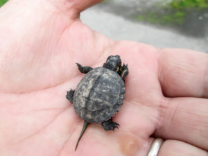
A fellow traveler on the BT
We encountered another traveler going our direction. It was the smallest turtle either of us had ever seen in the wild. I wondered how long it might take him to walk the whole Buckeye Trail. We couldn’t wait for him, though. We still had a couple miles to go. We moved him off the road to safety and continued on.
At 4:00 p.m. we got to our car. We had hiked 15.7 miles in seven hours. We wasted no time in returning to Coffee Corners in Burton to eat a relaxing meal. There was no reason to rush now.
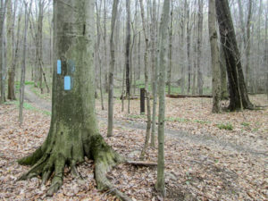
Great blazing in the Burton section
This week we had hiked 60.8 miles to complete the Burton section (and begin Mogadore). We had dodged practically all of the bad weather. For me the heat was worse than the little bit of rain we encountered. The beautiful wooded trails were, for the most part, dried out this week and so refreshing. We were both impressed with the blazing in this section: fresh, perfect, and plentiful.
For the entire three weeks, we walked a total of 184.9 miles. It took me 430,445 steps to accomplish that and we put 3,046 miles on our cars. Besides enjoying the camaraderie of George and Richard and encountering enough mud to last a lifetime, what stands out most to me about this spring hike is the challenging terrain. I discovered how hilly northeastern Ohio can be. And gradually I stopped dreading every hill I saw. That’s way too much dread to deal with. After three weeks of undulations, I can tell I’m getting stronger physically. It would be great if it would carry over to next fall when we come back . . . but I know that isn’t the way things work.
Over 650 miles completed on the Buckeye Trail
CW and I have now done four 10-percenters together for a total of 654.7 miles. We have completed 12 sections of the Buckeye Trail. We’ll be back in the fall to continue, and I hope you’ll be back, too.


Bonnie, I love your posts. What an adventure. I admire your dedication. I’m definitely a fair weather hiker. Thanks for sharing your adventure.
You’re welcome, Elaine. Glad you enjoy these. I’m a fair-weather hiker as well. CW knows I have a narrow temperature range for comfort that I don’t generally go outside of. But when we schedule these hikes, I can’t choose the weather. It does make things exciting, though.
Hey, you two! I just finished the BT, and Marie is here with me. We remember many of those places. Read your book for our evening “cool down” time. Keep hiking!
Glad we could help you cool down. Congratulations on completing the entire Buckeye Trail!! We’ve been missing your blog while you’ve been on the trail.
Bonnie
Wow, I just did the hike with you! Your endurance is outstanding! I truly enjoyed the tour of Ohio. Your description is so detailed and the pictures are lovely and fun to see while I “hike” with you as I sit at my computer. Thank you for sharing with me.
Dolores
Thank you for “hiking” with us, Dolores! It was great to have you along. I thought you would like the part about us “making it up as we went.” I thought of you as I wrote that.