by guest blogger Bonnie Spencer
September 7, 2019
CW and I have been hiking the Buckeye Trail together since the fall of 2015. Since the trail is a loop, we spent nearly 550 miles of it walking away from the finish line before changing direction back toward our goal. Steadily, we’ve made progress, and that goal is finally starting to come into focus—at least in our mind’s eye.
When we began, CW’s idea was to do 10-percent hikes. That meant we would complete the BT in ten long hikes. The reality, though, was that we basically covered 3 of the 26 sections each time and it turned out to be more like 11-percent hikes. That’s why this, our ninth hike, will complete our journey.
We have exactly three sections remaining: Shawnee, West Union, and Williamsburg. I’ve been told that I’m not out of the hills yet, so the terrain will interfere with my view of the finish line a while longer. I look forward to where the trail will turn tamer somewhere in West Union. Until then, I’ll embrace the challenge of climbing to ridgetops.
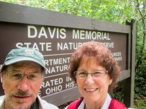
Ready to embark on our Buckeye Trail completion hike
Our normal schedule for fall is to hike mostly in October, but I really want to finish hiking and blogging before my birthday in the middle of that month. That’s my birthday present to myself. So we hope to finish in early October, which will make September our big month.
A complication is that CW recently developed two hernias. We won’t know how serious they are until he sees the specialist at the end of August. We decided to get a head start on hiking, though, by doing a few days prior to his appointment. He will just be careful not to overdo it. One good thing is that he has already completed the Shawnee section twice, so I can do some solo miles if necessary.
Day 1 (Thursday): Davis Memorial State Nature Preserve to Cedar Fork Cemetery east of Mineral Springs Lake and Shawnee Backpack Trail at Shawnee State Forest F6 to Shawnee Backpack Trail at SR 125 (4.6 trail miles)
We saw a small break in the summer weather, so we took advantage of it and drove east with our hiking gear this August afternoon. Although today was extremely hot and humid, we wanted to get in a few miles of hiking this evening and then get an early start tomorrow morning when the forecast is more agreeable. We reached Peebles at 1:30 p.m. and ate a quick lunch at McDonald’s.
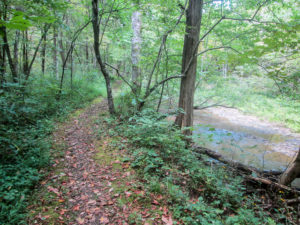
The Buckeye Trail follows Cedar Fork through Davis Memorial State Nature Preserve
The few miles we wanted to do were the first 2.3 miles of the Shawnee section that begin in Davis Memorial State Nature Preserve, 168 acres in Adams County that are home to many species of plants that are rarely found in Ohio. After spotting the cars, we started hiking at 2:40 at the entrance to the preserve. It was in the 80s and quite humid, but we were fresh and eager to get going. A few paces down the trail I remembered my pedometer was back in the car. I don’t need it for mileage—I use the maps for that—but it counts my steps. So I hurried back to the car while CW held my place on the trail.
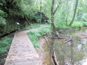
Boardwalk through Davis Memorial State Nature Preserve
The path through the preserve was clear and wide enough to be enjoyable. The undulations were gentle. The canopy provided good cover from the sun. Large wooden signs placed at trail intersections kept us from wandering off the Buckeye Trail. A few interpretive signs told of geological features and plant species.
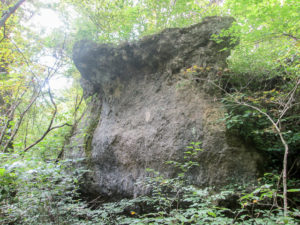
A dolomite outcrop in Davis Memorial State Nature Preserve
Many dolomite outcrops, which are magnesium-rich bedrock, can be seen in this area. One sign said that here in central Adams County is one of the few places in Ohio where dolomite is exposed. Some of the exposure is due to a fault that caused vertical displacement of 30 feet. It is the longest of six faults in Adams County and, according to another sign, is visible in the stream bed of Cedar Fork when the water is clear. The water was clear today but I wasn’t sure what I was looking for and wasn’t able to see the crack. The dolomite cliffs are impressive, though.
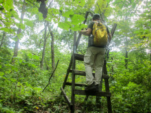
CW crossing a stile into an untamed land
Our pleasant trail ended after a mile and a half when we crossed a stile and entered private property. We descended steeply on a narrow not-much-of-a-path to a large grassy pasture. The map gave instructions to head across the pasture, but it wasn’t clear where we were to ford a creek into the adjoining pasture. I think we picked the wrong place, because we had difficulty finding where to leave the second pasture into the woods on the other side. CW finally located the extremely overgrown trail.
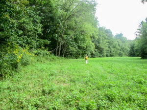
Hmm. Where’s the way out of this pasture?
The path into the woods climbed. By this time, the heat was getting to me from the walk through the sunny pastures. I struggled to get up the hill, stopping often to catch my breath.
Finally we reached an agricultural field. Nothing had been planted in it this season, so we could walk straight across. The map said there was a “large blue blaze directly across the field.” However, we couldn’t see it until we reached the other side. It was a piece of wood painted BT blue and nailed to a tree, but branches hung down hiding it from view.
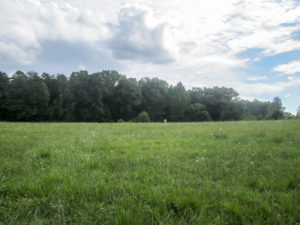
Crossing a field toward a hidden blaze
The trail joined a service road and then a long driveway that led to Cedar Fork Cemetery where our car was parked. It was almost 4:30. It had taken a little over two hours, but it felt like so much longer.
I was cooling off in the car while we discussed what to do next when I noticed hundreds of pinpoint dots all over my pants. I didn’t remember getting splattered with anything. I looked closer and saw that the spots were moving. They were so small we couldn’t see what they were. They might have been the smallest ticks ever—or CW said maybe mites. He didn’t have any. He had sprayed his pants with Permethrin; I hadn’t.
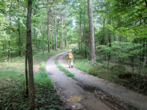
Long winding driveway to our car at Cedar Fork Cemetery
I got out of the car and brushed off all that I saw, but they were so tiny they hid in every seam and tuck. CW would spray me down with Repel when we got to the other car. I started to get back in the car but it had been taken over by a couple dozen sweat bees. They were probably drawn in by the peach slices CW had been eating when my spots began to move. We eventually got the bees shooed out and hurried away before another plague could hit.
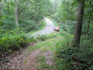
Looking down on our car from where we began the Shawnee Backpack Trail
I had expected to reshuttle the cars and maybe hike some road miles from where we stopped. CW had the idea, though, to drive 30 miles south and hike another 2.3-mile stretch of woods. We would end up a mile from Shawnee Lodge, where we are staying tonight. I was all for getting more woods out of the way, so off we went.
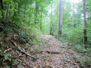
Shawnee Backpack Trail through Shawnee State Forest
After a lengthy drive and having a little trouble finding our starting point, we didn’t begin hiking again till nearly 6:30. That’s risky when we don’t know what the path will be like and when the weather is zapping my energy. CW’s big concern was that we might not finish before dark.
We were hiking on the Shawnee Backpack Trail (SBPT) in Shawnee State Forest. It was a wide and dry dirt path strewn with rocks and small limbs. We were relieved that we didn’t have to fight vegetation. CW said it looked as if it had been freshly bulldozed.
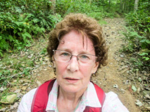
Misery in the middle of the trail
The inclines were plentiful and steep. The temperature was in the 80s. Sweat dripped from me and I was wiped out. I couldn’t find any convenient resting spots. When I couldn’t take another step, or even keep standing, I sat in the middle of the trail until I recovered enough to continue.
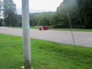
Shawnee Backpack Trail parking lot on SR 125
It was still light when we finished at 8:00. We were in the SBPT parking lot, only a mile from the lodge, but by the time we picked up the other car, we weren’t settled into our room until after 9:00 p.m. We ate supper in the room, something we had brought with us. There is nowhere nearby to find ice cream. In the lobby we’d seen a freezer case with Dippin’ Dots. I got Redberry Sherbet. They were refreshing.
Day 2 (Friday): Cedar Fork Cemetery east of Mineral Springs Lake to east of Wamsley (13.3 trail miles)
I had hoped for a decent starting time for today’s hike. I wanted to hike in the cool morning. I wanted to cover a lot of miles—it would all be on roads—and finish in the afternoon. That would get us back to the room early and give me time to write the day’s blog and get to bed early. Maybe I’m hoping for the wrong things in the hiking department.
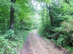
Primitive Mt. Unger Road
We didn’t leave the lodge until 9:20 a.m. Then we drove northwest on the trail, 24 miles of backroads, to get to the cemetery where we ended our first leg yesterday. One road was described in the BT map as “very primitive.” The two miles were narrow, rocky, and rutted. In some places I had to keep to the edge because the center of the lane was too high for my car. CW’s Element did all right but my Prius was not happy. I promised her she would not have to travel it again.
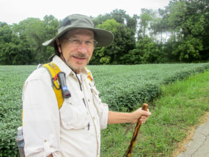
CW in front of a field of soybeans
When we reached the end of the road and stopped bouncing, we found a perfect parking spot that was at a trail point and was ten miles from where we would begin. We left the Element and continued up the trail, detouring into Peebles. The Prius was low on gas, and after what she’d just been through, we certainly didn’t want to starve her. We also made a restroom stop next door at McDonald’s and picked up a couple of breakfast sandwiches to put in our backpacks for later. When we finally began hiking, it was already 11:30.
The good thing about the late start was that the lingering sprinkles from the early morning rain had just stopped. It was still in the mid-60s and cloudy. And there were breezes, which would continue through much of the day. The quiet roads were paved, and most of the hills were not overly challenging.
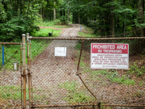
Gate 5 to GE Aircraft Engines property
After two miles, the BT left Mineral Springs Road and followed Peach Mountain Lane. We didn’t see any peaches but we felt the mountain. The road borders the 7,000-acre GE Aviation Engine Testing site in Peebles. Jet engines are tested there around the clock. Several tests are performed, two of them being the ice ball test and the bird test. In the latter, euthanized birds are thrown into running engines. We passed three locked gates to the property.
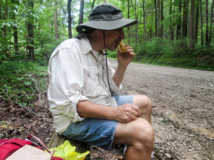
Egg McMuffin break on Peach Mountain Lane
At 1:00 p.m. we came upon a good sitting log, so we took a 15-minute lunch break to eat our Egg McMuffins. While eating, we heard a siren start up across the road. Then CW thought he heard the sound of a jet engine. It was difficult to hear above the siren. The screaming continued as long as we were in hearing range . . . I think. I finally became accustomed to the sound and tuned it out.
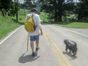
CW and Happy Dog
The road descended back to Mineral Springs Road, and we soon passed the spot where the Mineral Springs Health Resort stood long ago. It was 1840 when the health benefits of the nearby mineral springs were first promoted. The resort was built in 1864. It was originally called Sodaville and attracted people from all over the country. The hotel burned in 1924, and the resort finally closed in 1940.
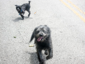
Happy Dog and Yappy Dog
Several dogs made appearances throughout the day. In most cases their owners came out of their houses and assured us the canines were harmless. However, one happy dog with no owner in sight was ready for a walk in the country. She trotted along with us for over half a mile, not making a sound, her tail happily waving the entire time. A small, yappy dog joined us. He was both comical and annoying, but our happy friend just ignored him. We repeatedly tried unsuccessfully to send the dogs home. When we reached the end of their road, CW had to act mean to finally turn them back.
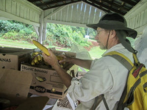
CW picking out a couple of bananas
As we passed a small white church, a lady was driving out of the parking lot. She stopped and asked if we were from around there. When we told her what we were doing, she invited us to help ourselves to the cold organic bananas that were under a shelter. We did. We enjoyed our bananas, a bench in the shade, a cool breeze, and a bathroom (privy). It was a b-eautiful 20-minute break.
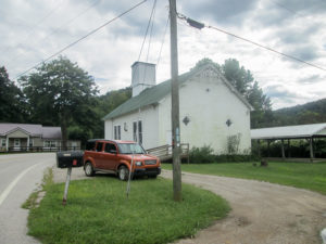
Our car waiting for us by C U Chapel in Wamsley
We had about 3.5 more sunny miles before we reached our car parked at the C U Chapel in Wamsley shortly after 4:00 p.m. Earlier we had discussed me walking the next three miles, part of which was that “primitive” road from this morning, by myself. I was tired but I wanted to knock off the additional miles, so I took the challenge.
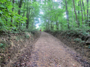
CW driving ahead of me on steep Mt. Unger Road
After cooling off in the car, I began walking without my pack. CW drove ahead of me. I knew the trees would provide shade so I thought it would be a cool, easy walk. I didn’t remember that the first half of Mt. Unger Road was mostly uphill. Even in the shade, I was hot from exertion. Plus it was close and buggy due to the creek running beside the road. CW stayed near enough that I was able to stick my head in the car to get a blast of air when I needed to. In spite of the difficulties, I made good time.
The BTA has a bit of property with a campsite along this road. We saw a gated driveway flanked with blue blazes that probably leads to the campsite. According to a map update, the Buckeye Trail follows a footpath to the campsite, but I didn’t see it. I stuck to the road, which I think basically parallels that driveway.
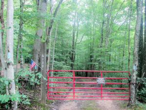
Entrance to BTA campsite property
I cooled off in the car before the second half of Mt. Unger, which was mostly level or downhill. At the end of it, the BT joined a paved road for three quarters of a mile to the next trail point where I planned to stop.
When we approached that intersection, two dogs ran out barking at me. They were loud and relentless. I walked on the far side of the car, but they found me. I had to keep turning around and waving my stick at them. We went three tenths of a mile farther to avoid the same problem tomorrow. We also found a better parking spot there. We finished at 5:40 p.m.
Since we had to pick up the other car in the vicinity of Peebles, we ate supper there at the White Star Restaurant. We didn’t get back to the lodge until after 8:00—not even close to the early evening I had hoped for. But I was happy about hiking 13.3 miles. There was no time to go looking for ice cream; I settled for Rainbow Dippin’ Dots tonight.
Day 3 (Saturday): east of Wamsley to Shawnee Backpack Trail at Shawnee State Forest F6 (10.0 trail miles)
Today we had to make an early start happen. CW had to be back home around 2:00 p.m. for another commitment, and we had ten miles to hike to connect the trail up north with the Shawnee Backpack Trail we hiked near the lodge. Last night we carefully worked out times and shuttling, deciding to do two legs. That takes extra time, but in this case we thought it would work to our advantage.
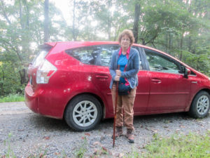
Ready for a short solo hike
We were checked out and ready to hike before 8:00 a.m. The first leg began near the lodge. We had noticed earlier in the week that the stretch of road leading up to the SBPT was practically all uphill if we went clockwise, our normal direction. That’s why I would walk it counterclockwise. Since CW began experiencing a little pain yesterday, he would take it easier today and I would do these 1.5 miles solo.
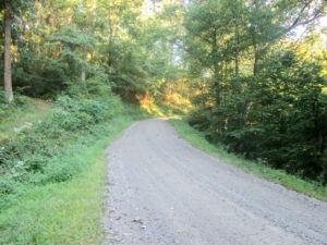
Downhill thanks to counterclockwise hiking
It was a beautiful morning. The sun was out, but the roads were shaded. The temperature was in the mid-50s. I raced down the trail without my pack and soon warmed up. As CW drove by me, I handed my jacket to him through the window, neither of us stopping. Within half an hour we reached the parked car. I hopped in the other car with CW and we drove on up to where we ended yesterday, beyond the bothersome dogs.
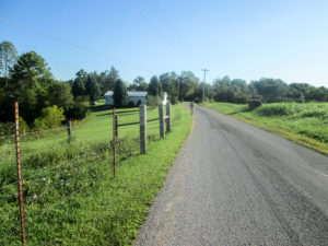
Typical country landscape
I think CW would have turned me loose on the roads if not for the constant possibility of a dog attack. We started out together on the paved backroads at 8:45, enjoying shade when we had it. Few cars interrupted the peaceful setting of rolling landscape, small white churches, farmhouses, fields of baled hay, and pastures of cows and horses.
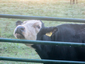
Please take my picture.
One particular cow caught my attention. It was black with a white face. The edge of the white was so sharp that it looked as if the cow wore a mask. I wanted to take a picture but decided I’d better not take the time. As I walked away, she called me back. She continued mooing as she approached the fence, watching me with those big eyes. I had no choice but to take her picture.
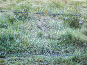
Dew-soaked spider web
Spiders had their food nets hung out farther down the fence, trying to catch their breakfast. All I saw in the webs, though, were glistening dewdrops. They highlighted the intricate patterns.
Our cute dog encounter today was a feisty little thing. Nellie’s owner kept calling her but she wasn’t listening. CW was walking in front of me on the road. Nellie ran beside us in the grass, yapping continuously. She ran up in front of CW, then back behind me, then in front of CW, then back. She seemed to be herding us—right off her property.
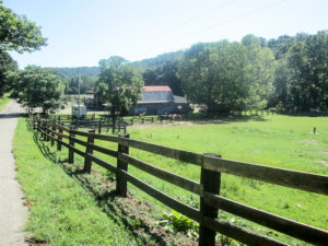
Approaching Ben’s Happy Trails Riding Stables and Campground
The BT passes Ben’s Happy Trails Riding Stables and Campground. While we walked by some of their pastures, the lodge and stable came into view. CW has heard that the owners are BT friendly. We came to the buildings. One had a porch across the front. It was in the shadows and I couldn’t see anyone. Suddenly I was startled by a booming “Howdy!” I finally made out two men sitting on the porch. “Mr. Howdy” asked if we wanted some cold water or anything. We would have loved to sit and talk a while, but CW explained to him that we were on a tight schedule today.
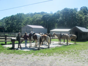
Horses waiting for their riders at Ben’s Happy Trails
The houses eventually disappeared, and with them the possibility of dangerous dogs. The last half mile I walked alone to the car while CW waited on a shaded bridge. I finished about 11:45. We had basically walked non-stop for three hours.
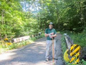
CW waiting for me to return with the car
I drove back to CW, we picked up the other car, and we grabbed a quick lunch at McDonald’s in Peebles. We arrived home shortly after 2:00 p.m., just what we were shooting for. There hadn’t been time to stop anywhere for ice cream, so I ate some at home that I had purchased specifically for this situation. It was Wildberry Lavender Mascarpone.
We hiked almost 28 miles the past three days, over half of the Shawnee section. It was a good beginning. However, our hiking will be on hold until we see CW’s doctor next week.
Day 4 (Monday): Shawnee Backpack Trail parking lot on SR 125 to Shawnee Backpack Trail at Mackletree Run Road (6.2 trail miles)
It has been a little over a week since Day 3. CW’s specialist informed him that he has not two—but three!—hernias. He is waiting for a surgery date, but she cleared him for hiking until then. So this week we are continuing our hike through Shawnee State Forest.
These few days will be quite hot, but since we can’t change that, I’ve resigned myself to the situation. I know that each day the hiking will end and I will recover with cold water, A/C, and ice cream.
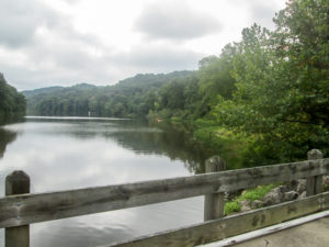
Crossing Turkey Creek
We began hiking by 11:50 a.m. at the Shawnee Backpack Trail parking lot, the farthest trail point we’d reached on our last trip. We crossed a bridge over Turkey Creek and started down the road that leads to the lodge. The actual Buckeye Trail leaves the road and continues on the SBPT. However, due to timber harvest activity in this area, the trail is temporarily rerouted onto a forest road. We didn’t mind at all. We like forest roads, and it shortened the hike by a mile.
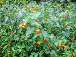
Jewelweed on Lampblack Run Road
Lampblack is a wide gravel road. It alternated between sunny and shady, but it was humid the entire time. I’m sure the temperature reached the 80s. It didn’t take long for my eyes to burn from sweat. I don’t remember the hills being too uncomfortable—probably because my attention was totally hijacked by the bugs.
I had sprayed myself down with a bug repellent solution my friend gave me. She mixes it herself and it is free of toxins. She raves about how wonderfully it works, so I have been eager to see for myself. Besides spraying my clothes, I applied a lot to my arms and a little to my face. CW had his Permethrin pants on and sprayed Repel on his socks, but he also put some of my repellent on his arms and face. Gnats and larger insects were out in full force, but we were amazed that they didn’t land on us. The repellent didn’t stop them from coming close, though. The buzzing was relentless.
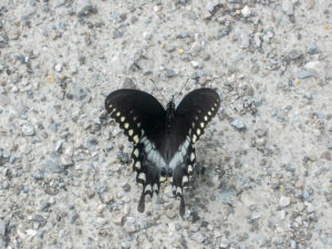
Swallowtail butterfly on the road
The flying creatures I wanted to get close to I couldn’t. We saw a hummingbird, but it was gone in a flash. Numerous swallowtail butterflies frolicked along the road. Many times they had settled on fecal matter on the road. I was kind of glad I wasn’t able to get a picture of that. I finally managed to sneak up on one in a more tasteful spot.
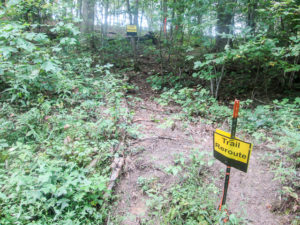
Unexpected, but well-marked, trail reroute
After an hour and 15 minutes, we reached the end of the detour where we would rejoin the SBPT. Yellow “Trail Reroute” signs directed us into the woods before we came to the actual trail, though. It took us a while to figure out what that was about, but it was just a little more of the same detour. The few hundred feet on new trail were well marked with those yellow signs, and we rejoined the SBPT.
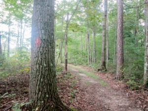
Shawnee Backpack Trail is marked with red blazes
The trail was not difficult to follow. Although the SBPT does not have any BT blue blazes, it is marked with red blazes, which look more like blotches. Occasionally, we saw a Carsonite post with both the BT and the North Country Trail emblems on it. In many places, we enjoyed a lovely wide path. Sometimes it was narrower and grassy. And in other places, it was barely a path and quite overgrown. But it was soft overgrowth without any brambles.
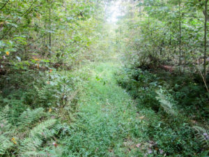
Overgrown path on a portion of Shawnee Backpack Trail
We encountered spider webs every few feet. I had to continuously swing my sticks up to knock them down because we usually couldn’t see them. And still I missed many of them and had to stop to peel the webs off of me. Stick swinging was a chore, but at least it had a dual purpose. Each time my hand came up near my head, it disturbed the bugs buzzing adoringly around me and gave me a moment of peace.
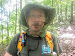
CW solved his bug problem
I finally put more repellent on my face; I had probably sweated the other off. CW got out his bug net. Mine was back in one of the cars being totally useless. I hadn’t even thought to bring it. I’ve never used it, but it would be in my backpack before tomorrow morning.
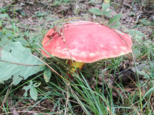
One of many different kinds of fungi along Shawnee Backpack Trail
We encountered some pretty steep hills. The ascents would not have been so bad if not for the heat. And some of the descents were a bit tricky. When they were covered with small gravel and twigs, it was easy to slide. The hiking sticks are needed to keep from falling, but they can’t effectively do that job when they have to also swing at spider webs with each step.
The bugs and webs and heat were nuisances. Without them, the trail itself would have been no problem. We made it through, though, and reached our car on Mackletree Run Road before 3:30 p.m.
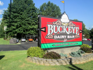
Buckeye Dairy Bar in West Portsmouth
We spent the next two hours driving on the trail to different points to figure out how we would work out tomorrow’s hike. We ended up at Buckeye Dairy Bar in West Portsmouth. Our plan was to get ice cream and then go back to the lodge and eat supper in our room. We had brought food with us. But we decided to get Buckeye Burgers instead, which were thick and delicious, and I got a chocolate chip milkshake.
Day 5 (Tuesday): Shawnee Backpack Trail at Mackletree Run Road to Moon Hollow Trailhead in The Edge of Appalachia Preserve (13.4 trail miles + 0.2 miles for missing blaze)
Today was an ambitious day. We would cover over 13 miles, 9 of them in woods. We would do that in three legs. Reshuttling would be extra complicated because we didn’t plan to walk all the miles in order. Three shuttles would also eat up a lot of time. We knew we were in for a long day.
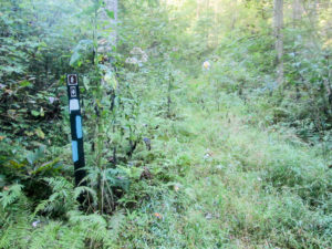
Missed turn blaze onto the Wilderness Loop Trail
We were on the trail a little after 8:00 a.m. Starting from where we stopped yesterday, we had 0.2 miles of the SBPT left before the BT turned off onto the Wilderness Loop Trail (WLT). The turn was marked well, but we both missed it. CW was looking at his phone about that time to see if we were on the trail, which we were—at the moment. I was ahead of him on web duty, and I was deep into the battle.
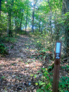
Carsonite post on the Wilderness Loop Trail
We had heard that the WLT is not maintained right now and that several large downed trees block the paths. That news was not encouraging to us since the section we were doing is six miles long. It started off with a steep incline. After 20 minutes, we seemed to reach a ridgetop and the trail settled into meanderings and mostly gentle undulations along the ridge. It didn’t seem any different than the SBPT. I was as happy with it as I could be under the circumstances.
The weather was a repeat of yesterday—hot and humid with a feel-like temperature in the 90s. Though the bugs must have been sleeping when we started, the buzzing began after a while. And the spider webs were making me crazy. Even with swinging my sticks non-stop, I managed to keep running into the invisible blockades.
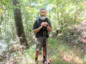
Walking Fool
About two hours into the day, I was losing it with the spiders. CW was a little ways back. Hmm. I wonder if he was tired of listening to my screaming encounters with the arachnids? I stopped to peel off yet another sticky web from my face. While I was lambasting its owner, I was startled to look up and see another hiker standing in the trail about 15 feet away. He was looking down at something. My thought was that he probably was being considerate and trying to look like he hadn’t heard my tirade.
I was embarrassed for a moment, but then started talking with him. We briefly exchanged spider woes. CW caught up and we all talked hiking for 15 minutes. Walking Fool, also known as Jerry, has hiked about half of the BT in scattered pieces but doesn’t have any immediate plans to complete it. He’s backpacking the trails in Shawnee State Forest to prepare for a long backpacking trip coming up this fall.
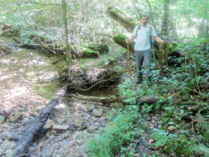
CW carefully passing a spot on the Wilderness Loop Trail where the trail is falling away
I was hoping Jerry had swept the webs off the path ahead of us. For a short time, it seemed he had, but then they returned. I’m amazed at how fast those creatures can rebuild. So back to fighting with them I went. One of those buzzing things, a rather large one, dove at my head. I wondered if maybe it was employed by the neighborhood spiders.
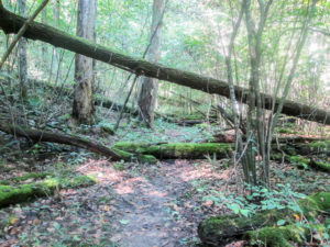
Downed trees on the Wilderness Loop Trail
Jerry informed us that when we crossed over Dead Man Hollow Road, the trail did indeed become more of a challenge. After three miles of good trail, we experienced the unmaintained portion. We had to climb over or walk around dozens of tree trunks. I usually think that’s kind of fun, but not so much with humid weather, buzzing in my ears, and spiders in my face.
Buckhorn Ridge Bridle Trail
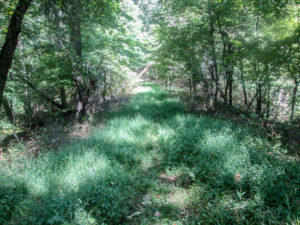
For our last 1.5 miles on the WLT, we walked on Buckhorn Ridge Bridle Trail. Much of it was covered with grass and weeds. We didn’t mind at all because it was wide and fairly level. Our pace increased. The bugs were still a nuisance, until I tried out my bug net. I can’t believe I’ve never used it before.
We reached our car parked on Sunshine Ridge Road at 1:00 p.m. I was beat from five hours of hard work destroying the livelihood of WLT spiders. But we cooled off in the cars while we reshuttled, making a restroom stop at a church privy we found on Sunshine Ridge.
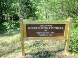
Entrance on Sunshine Ridge Road to The Edge of Appalachia Preserve
If we hiked in order, the next four miles would be on Sunshine Ridge Road and would finish the Shawnee section. However, we chose to first do 3.2 more wooded miles that begin the West Union section. They are also the beginning of new Buckeye Trail that just opened up in The Edge of Appalachia Preserve. The update for this trail change was just posted August 16 on the BTA website.
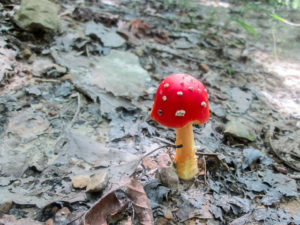
Fly Agaric (amanita muscaria)
The Edge of Appalachia Preserve is the largest privately protected nature preserve in the Midwest. It is co-owned by The Nature Conservancy and the Cincinnati Museum Center. The 20,000 acres are situated where the unglaciated Appalachian Plateau to the east meets the rolling Interior Low Plateau to the west. The Buckeye Trail Association has been helping to build the trail through it for many years, and they will maintain it.
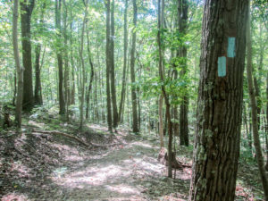
Fresh blazes and beautiful trail in The Edge of Appalachia Preserve
We entered The Edge of Appalachia Preserve at 2:30. Since it was just opened (the official opening is later this month), we expected the trail to be in great shape. We weren’t disappointed. The hard-packed dirt was covered with rocks, twigs, and nuts. The blazes were fresh and abundant. There didn’t seem to be as many spider webs across the trail. For the first mile, CW did web duty. My arms got a rest and I could enjoy the trail.
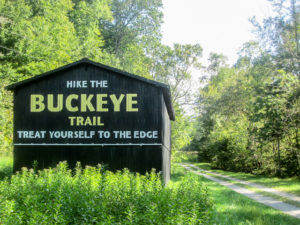
Tobacco barn at Moon Hollow Trailhead
Shortly after 4:00, we emerged from the woods into Moon Hollow Trailhead. An informational sign tells about the preserve and the trail. We admired a tobacco barn newly painted to advertise the Buckeye Trail. But we couldn’t linger long. We had to reshuttle for our third leg, which would fill in the gap in today’s hike.
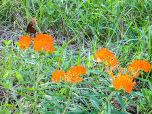
Butterfly on Butterfly Weed
From the trailhead, we had to drive a couple of roads to get back to Sunshine Ridge, the road we would be walking. We passed up the other car at the entrance to the preserve because that was where we would finish today. Then we drove to the end of Buckhorn Ridge Bridle Trail where we ended our first leg.
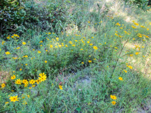
Sunshine on Sunshine Ridge Road
CW decided to walk only the last half of the four miles with me. I was pretty tired but determined to be upbeat. The lyrics to a song from the 1980s kept going through my head: I’m walking on sunshine, oh yeah. I started off down the road singing, “I’m walking on Sunshine Ri-idge.”
CW drove by after a while to park at the place he would begin walking. A few minutes later, he drove by me again, turned around, and drove beside me while “I’m Walking on Sunshine” played on the radio. How’d he do that?
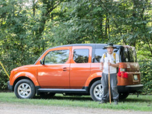
CW waiting to finish the day’s hike with me
The road was pleasantly shady with woods close on both sides. There were no houses, but a good amount of wildflowers. I was enjoying the silence . . . until the buzzing began. They’d found me. I was carrying my wooden hiking stick. I waved it close to my face, alternating right and left, to shoo them away. I finally stopped to dig out my bug net before I knocked myself in the head.
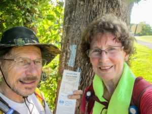
Shawnee section completed
CW was waiting at a little church for me. We continued on together, passing another church and a cemetery. The road was more open now so there was more sun, but the bugs were gone. We finished our hike by 6:30 p.m., also finishing the Shawnee section.
We headed to Buckeye Dairy Bar so I could get another milkshake. On the way, we talked ourselves out of eating the food in our room—again—and into encore Buckeye Burgers. My ice cream selection was a pineapple shake.
Day 6 (Wednesday): Moon Hollow Trailhead to BT crossing on Black’s Run Road (10.8 trail miles)
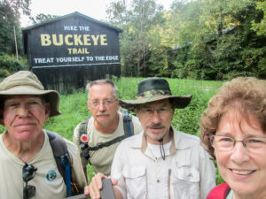
Jim, Richard, CW, and me at Moon Hollow Trailhead
Today we checked out of the lodge and met Jim and Richard at 8:30 a.m. at a tiny parking area almost hidden off of Black’s Run Road deep in the countryside. I didn’t even try to get my car up the rutted incline to where the other three cars were parked. It would be used to shuttle us anyway.
We would continue hiking in The Edge of Appalachia Preserve. Jim and Richard have both hiked the entire BT—they will complete a second time next month—but they haven’t hiked this new trail. They wanted to “treat themselves to the edge” as the barn says. Jim has spent considerable time on the trail, though, building a section of it with other BT volunteers.
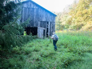
The second tobacco barn
We shuttled to Moon Hollow Trailhead and began hiking at 9:15. The trail crossed the road and passed by a second tobacco barn, not fancied up like its neighbor. We walked around back of the barn through a field of tall wildflowers to where the trail began looking like a trail. We were back on beautifully blazed paths. There was no way we could get lost. That’s very high on my priority list of factors that make a trail great.
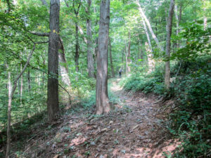
Nice trail in The Edge of Appalachia Preserve
We have been blessed with six dry days for hiking. That has contributed to my enjoyment of the trails. Add water to wooded paths and there are usually some places where safe footing could be in jeopardy.
In less than a mile, we passed a short spur trail to Moon Hollow Campsite. After a mile more, we reached Sunshine Ridge Road. Before this new trail change, the BT stayed on Sunshine Ridge Road where we left it yesterday at the entrance to the preserve. Today we were back on it for a mile and a half.
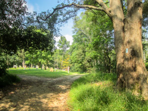
Cox Cemetery at the end of Sunshine Ridge Road
I felt comfortably isolated. There were no houses or churches. We saw a couple cabins for sale, I think, but I didn’t pay much attention to them. I was fading from the heat and needed my energy to walk. When the guys stopped for a short time, I saw the road ahead was shaded and flat and I kept on going. I walked the remaining mile to a little cemetery in the middle of nowhere and sat on the gravel road till the others caught up. It was quiet since the flock of wild turkeys I had stirred up had scattered.
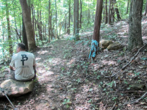
Creative blaze #1
Sunshine Ridge was not maintained any farther. We re-entered the woods on a footpath. The bugs had not been too bad today. Every so often they would make themselves heard for a short time. I had a total reprieve from menacing webs; either Richard or Jim was always in front taking care of them.
We saw a lot of grapevines. One had a diameter of maybe five inches. A small one dangled right in the middle of the path. A mischievous blazer had painted the end blue. If vines are for swinging, that blaze could send a hiker in any direction. Then we came to a vacated turtle shell beside the path. It had been blazed as well.
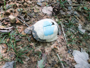
Creative blaze #2
Switchbacks are wonderful—but there should be a limit on consecutive ones. We were climbing a series of them. Richard was ahead. I was dragging far back with CW keeping me company. He said Richard looked like a figure in a shooting gallery game like where the ducks move back and forth. Richard moved across the hill to the right, then to the left, then back to the right, then left, each time a little higher up. I could imagine the humorous sight, but I didn’t have the strength to raise my head up to see it.
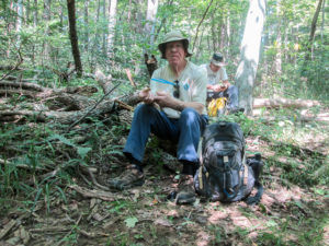
Lunch on a switchback
We had covered at least six switchbacks when we found some logs to sit on. The others ate lunch. CW tried to get me to eat something, but I told him I didn’t have the strength to chew. He said he’d chew a piece of jerky up for me. I passed. Jim then offered me applesauce because I wouldn’t need to chew. Passed on that too. All my remaining energy would go into staying upright and moving my feet. This is why I don’t like to hike in the summer months.
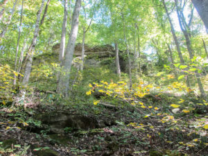
Cliff above Buckeye Trail in The Edge of Appalachia Preserve
It looked fairly level where we were, so I thought we had reached the ridgetop. When we started moving again, I soon saw how wrong I was. There were a couple more switchbacks. This was one of those days I didn’t see how I would make it to the end. The small inclines became laborious. I could even be moving along pretty well on level ground but have to stop when whoever was in front of me stopped, and then my brain could not talk my feet into starting up again.
We reached West Fork Road. That signaled our last 4 miles, which might as well have been 40. Richard took off and we didn’t see him again till we finished. I continued to drag myself along. CW continued to give me pep talks. We got to the cars at 4:15. Richard had been there 45 minutes.
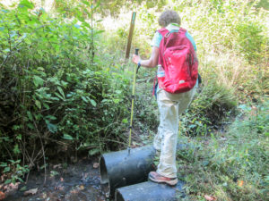
Just a few . . . more steps . . . to . . . the . . . car
I sat down, drank a bottle of cold water, and let the A/C blow in my face a couple of minutes. It wasn’t long before my sensation of dying had changed to “OK. Those miles are done. Yay!”
Richard and Jim both left for home. On the way to pick up our other car, CW and I stopped at Blue Creek General Store for restrooms and some ice cream. We decided to save time and get pork BBQ sandwiches at their small deli rather than make another stop on the way home. We followed the sandwiches with our ice cream selections from the case. I got a Chocolate Shortcake ice cream bar.
~~~
We’ve hiked six days so far in two separate trips, racking up 58.3 miles. Remaining miles are down to around 100. We did the entire Shawnee section and began the West Union section.
Besides counting down miles and retiring maps, we had other memorable experiences. Happy Dog accompanied us on the trail. A generous church lady offered us organic bananas. The masked cow pleaded with me to take her picture. I tried out my friend’s homemade mixture of bug repellent and my bug net for the first time. We discovered Buckeye Burgers. We met Walking Fool. We walked the newly opened section of the Buckeye Trail through The Edge of Appalachia Preserve and shared the day with Jim and Richard. And I survived these horribly draining days.
On one particularly high ridgetop I climbed on Day 6, I took a moment to wipe sweat from my eyes and gaze westward. Where is that finish line? For a second I thought I saw it. Then I realized it was only a spider web still stuck to my face. I’ll keep looking next week when we finish up the last little bit of The Edge of Appalachia Preserve and move on to miles and miles of backroads in the West Union section. Please come back and join us.
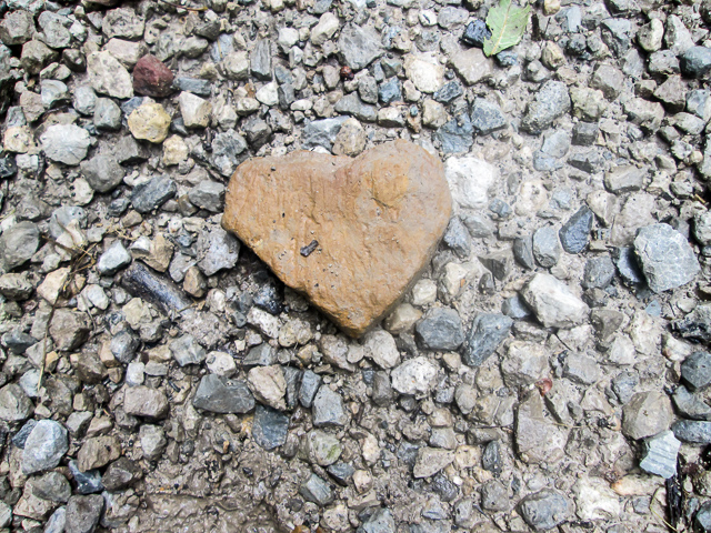
Love on the Buckeye Trail


Brenda
September 11, 2019I enjoyed this post and I can’t believe how close you are to finishing. I admire you but don’t envy you. 🙂 I loved the mushrooms and the heart rock. You have such a good eye for the beauty in the details.
CW Spencer
September 11, 2019Thank you, Brenda. Out of hundreds of pictures, I manage to get a good one once in a while. I’m glad you enjoyed the post. Sometimes I don’t envy me either–like this week while walking in more 90-degree weather.
Dolores R. Birkle
September 13, 2019I so much admire your goal setting and achievement. I feel like I have walked with you, your writing is so descriptive. Your stamina is epic!! This is a once in a life time walk and you have captured it all in your blog!!!
Thank you for sharing it with me. I love you both.
Dolores
CW Spencer
June 9, 2020It is our pleasure to share our journey with you. It has been wonderful knowing you have been there with us, Dolores. We love you, too. ~Bonnie