by guest blogger Bonnie Spencer
September 17, 2019
Day 7 (Monday): BT crossing on Black’s Run Road to east of Bentonville (13.5 trail miles)
CW has his surgery date. It’s still a couple weeks away, so we’re going to get more miles in until then. However, CW and his hernias are going to greatly limit how much they walk. Because of all his extra hiking with friends, CW has only a few miles in our last two sections that he hasn’t already hiked a second time. In West Union, some are near the beginning on the new trail through The Edge of Appalachia Preserve that just opened last month, and others are road miles at the end of the section. I may be walking all the road miles in between by myself.
We are hiking close enough to home now that we will drive home each night. And with CW not hiking most of the time, we only need one car. He even came up with a genius way for us to avoid two cars today, even though he had to hike the first three miles.

Trail through The Edge of Appalachia Preserve lined with late summer wildflowers
We located the spot we would park the car at the end of our three miles. Then we drove to the beginning, which was that small parking spot tucked away off a remote country road where we finished hiking last week. CW dropped me off, and I followed the blazes into the woods. CW drove the car back to the ending spot and began walking counterclockwise. We would pass each other on the trail. When I reached the car, I would drive to the beginning to pick him up. Neither of us had any concerns about getting lost since we’d seen how well the other 14 miles through The Edge of Appalachia Preserve were blazed.
I began hiking at 8:15. It wasn’t hot yet. There were no bugs. I had to fight a few spider webs, but it was nothing like last week. And it was another dry day. I thoroughly enjoyed this woodland trail. A lot of variety is packed into two miles.
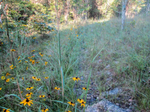
Prairie in The Edge of Appalachia Preserve
Besides the deciduous forest we are most familiar with, we also walked through prairie. It is being overtaken by trees, so it was interspersed with the woods. The prairie feels gentle to me. It is light and open, and the tall grasses are soft and caressing rather than mean and grabby. An interpretive sign indicated the prairie grasses and wildflowers are at their peak this time of year.

Flood’s grave beside the trail
About a mile in, a small gravestone marks where William Flood is buried. He served in the Continental Army during the Revolutionary War. In 1775 he enlisted in Daniel Morgan’s company of 96 riflemen known as “Morgan’s Virginia Riflemen.” They participated in the Quebec Campaign. I was flabbergasted to read that they marched 600 miles from Winchester, VA to Boston in 21 days, an average of 30 miles per day. I need to keep that in mind when I’m wimping out after 10 miles. Everything in the expedition went wrong, and Flood ended up as a prisoner of war. He eventually escaped and later re-enlisted with the same company where he served for five years until the end of the war. That’s when he moved to Adams County, Ohio. [I found this information in an excellent post by David Baker: Three Brave Men.]

View from Flood’s Point
A half mile beyond the grave is Flood’s Point, a rocky promontory from which to view the Ohio Brush Creek Valley. The 0.8 miles from Flood’s Point to the end of the trail has been designated as the Joan Jones Portman Trail. The trail descends from Flood’s Point, first past small dolomite cliffs that are so close hikers have to share the trail with them. There is also more prairie and more distant views of surrounding hills. It was on this section of the trail that CW and I passed each other.
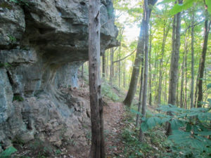
Dolomite cliffs along trail in The Edge of Appalachia Preserve
Across the road from the entrance to the trail is Creek’s Bend Trailhead and the Dr. George Rieveschl, Jr., Creek’s Bend Overlook. George Rieveschl, Jr., hiked through the 1,270-acre surrounding woods decades ago when they were about to be lumbered and developed into housing lots. He purchased the land and donated it to The Edge of Appalachia Preserve, thus protecting the land forever. I took time to walk over and look around. The picnic tables under a large open pavilion and a stone overlook of Ohio Brush Creek were inviting. There is also a canoe access to the creek, interpretive signs, and a short prairie garden walking trail.
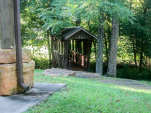
Covered footbridge between picnic area and parking lot at Creek’s Bend Overlook
I pulled myself away from the peaceful setting. I had less than a mile to walk on the road to reach the car. Then I headed off the pick CW up. He had already finished and was waiting by the road. We compared notes while driving back to where the car had been parked. We agreed this was one of our favorite sections of trail.

My Buckeye Trail support vehicle
I would walk the rest of today by myself, all on quiet backroads, with CW in my support vehicle. He taped signs on the back of his car that said “Buckeye Trail” and drove slowly behind me with his flashers blinking.
It was 10:30 when I started and already sunny and hot. I walked on whichever side of the road had shade. Much of the time neither side did. After three miles, we turned onto a road that steadily inclined. I had to take an A/C break in the car. As the temperature rose, my breaks came more often.
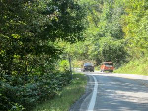
Policeman checking out my support vehicle
Sometimes CW drove ahead of me a ways and stopped along the road till I caught up. One of those times, a policeman drove by me and pulled up next to CW. I was relieved that he didn’t stay long. CW explained to him what we were doing. The policeman had no problem with it; he was just checking things out. CW thanked him for watching out for us.
From one road, we got a glimpse of the Ohio River, which was only a couple of miles away. Along that road, a man in his yard watched CW slowly drive by. He came closer to the road and stared intently at the vehicle. I could tell he was trying to read the sign. When I reached him, we exchanged hellos. Then I told him the car was with me. We talked for a few minutes. He shared how much he loves the peacefulness of living there. He offered me cold water, but I already had some.
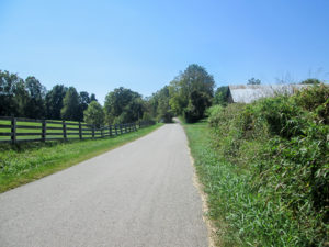
A long, hot road
We didn’t have a definite mileage goal. I was going to hike till I couldn’t. When I had walked over 12 miles for the day, I decided I could make it to the next point, which was over three miles away. However, the road had very little shade. Although the hills were not terribly steep, they became more difficult for me to handle because of the intense heat. I took off my pack thinking that would help. It didn’t help enough. I finally gave up when my feet refused to move. We stopped two miles short of the next point.
I hopped into the A/C and we stopped at Steak ‘n’ Shake where I got a Kit Kat milkshake. All was well again.
Day 8 (Tuesday): east of Bentonville to east of Redoak (13.5 trail miles)
For the second morning this week, we left the house while it was still dark outside. On the way to our beginning location, the sun rose in a nearly cloudless blue sky, and I watched fog hover over the fields. It would be another 90-degree day, but at least we were getting an early start.
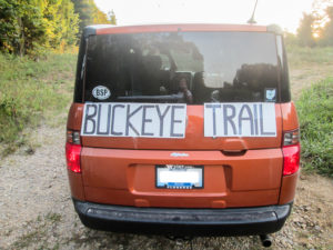
Improved Buckeye Trail sign
CW stopped in Bentonville to tape his improved sign on the support vehicle. Last night, he filled in the letters with black marker so the words were readable from a distance. Then we drove right to the spot outside of town where my body gave out yesterday.
I began hiking at 7:45 a.m. with CW following behind. My backpack remained in the car all day. With a light load and the temperature only in the 70s, I set off at a good pace. Even on the hills, I didn’t slow down. I knew the temperature would rise, so I savored the temporary comfort.
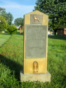
Anti-Horse Thief Society of Adams County monument in Bentonville
We soon covered the two miles to Bentonville. Just off the trail on SR 41 is a monument to the Bentonville Anti-Horse Thief Society of Adams County. The society was formed in 1853 to recover stolen horses and mules and to prosecute thieves. They didn’t horse around. In the early 1900s, however, the importance of horses in society lessened, and the vigilante group changed to a social club. They continue to hold an annual banquet.
The monument appears to be on private property between houses. A newer memorial is located a couple of blocks away in a small park. CW drove me there and back; I wasn’t going to waste steps or time walking there. A wire frame of a horse and rider, lit up with a strand of lights, sits next to a historical marker.
Leaving the community of Bentonville, we continued through the peaceful countryside. We saw very few cars as we passed farms, fields, and pastures of cattle. Many farmhouses were typical white two-story structures, but we also saw modern vinyl-sided houses planted among older barns and field machinery.

Turkey buzzards congregated in a tree
A turkey vulture flew over and landed in a tree. Then I saw a couple more circling. I was explaining to them that I felt good and they needed to look elsewhere when CW pointed out a tree on the other side of the road. More than a dozen vultures were resting in the branches.
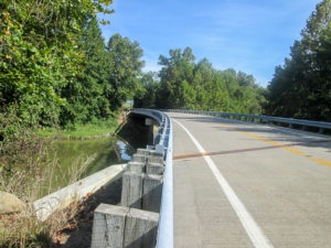
Modern bridge on SR 763 that replaced Eagle Creek Covered Bridge
On SR 763, a modern bridge crosses Eagle Creek. At one time a covered bridge stood there. Eagle Creek Covered Bridge was the last covered bridge in service on a state highway in Ohio. That is the main reason the Buckeye Trail is on SR 763. However, the bridge washed away in a flood in 1997.
We talked a while to a couple sitting on their porch. They were impressed with our hiking endeavor. The lady asked my age. When they heard it, they were even more impressed. They had caught me on a relatively good day. They shared a little history about their house and the area. Close by was a one-room schoolhouse. It is being taken over by vegetation and looks as though it has been left to self-destruct.
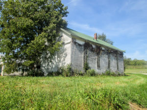
Old one-room schoolhouse in Brown County
We turned onto Chicken Hollow Road. It climbed as far as I could see. By now, I had been walking for three hours. I was disappointed when the climb continued well beyond what I could see. It was gradual, but long and steady. I saw the vultures circling again. Not yet, I told them.
When I reached the next point, I was tired and the temperature was probably in the 90s. I’d only gone 12 miles. I had hoped for several more miles today. The next point was only 1.5 miles farther; I could at least do that. I continued on.
Though I was still moving at my starting pace, even on the hills, inside I was registering done. When the vultures appeared a third time, I took it as a sign and decided I’d better stop at the end of the road. I didn’t want to reach the state I was in yesterday in which I could barely stand and possibly become the object of a feeding frenzy. I finished at 12:25 p.m. having completed only 13.5 miles, but that was amazing for me in this weather.
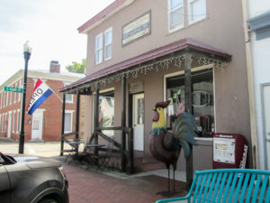
Cherry Street Eatery in Georgetown
On the way home, we looked for a place to eat lunch. In Georgetown, we discovered Cherry Street Eatery and enjoyed sandwiches and salads. The food was great and the staff was friendly. Someone, perhaps the owner, had brought in an abundance of extra homegrown tomatoes, and they were offering them to customers. We gladly took a few.
Down the road, we stopped at UDF where I got a scoop of Polar Bear Crunch. It was vanilla ice cream with mini chocolate chips and chunks of white chocolate. I couldn’t figure out what the crunchy ingredient was. But it was all good!
Day 9 (Wednesday): east of Redoak to Still Water Mennonite Church on West Fork Road in Georgetown (16.6 trail miles)
On our morning drive, the day turned from dark to light again, and we witnessed an orange sun rising. I was giddy to see the profile of a bunny cloud sitting right beside the giant orb. The sun backlit the bunny so it was perfectly outlined in neon orange. CW calls me Bunny. This had to be a sign that a great day lay ahead. I wanted a picture, but distant treetops kept getting in the way. By the time we found an opening and pulled the car off the road, the bunny had aged considerably, hardly recognizable any longer. I hoped that wasn’t part of the message to me.
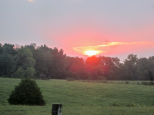
Aging bunny cloud to left of sun . . . with ears on fire
Today I was knocking off more road miles by myself. While CW taped his signs on the car, I set out without my backpack from where I ended yesterday. It was 7:35 a.m., and the morning was glorious. I knew it was heading for the 90s again, but this morning we had cloud cover. It lasted three hours, and I delighted in every minute of it.
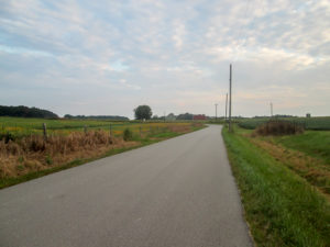
Delightful morning cloud cover
The roads were lined with a multitude of wildflowers, including goldenrod, morning glories, chicory, and black-eyed Susans. The fields of corn and soybeans concealed insects singing their happy songs—quite loudly.
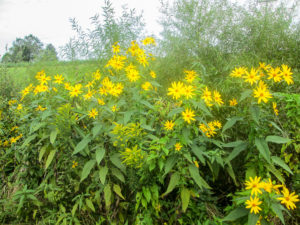
Cheery wildflowers are a good replacement for hot sun
The vultures didn’t show up for three miles. I saw one flying overhead. Then CW directed my attention to the farm we were about to pass. A couple dozen vultures sat like statues on the dark brown fence, blending into the landscape. When I approached to take a picture, they flew off, a few at a time until none remained. We didn’t see any of them the rest of the day. They must have been able to tell how great I felt today.
I moved at a quick pace from the beginning. It didn’t surprise me too much while the cloud cover kept me company, but it amazed me after the sun came out. I was reaching my points before I should have. Either I was walking faster than my normal 3 mph, or the mileages on the map were wrong.
The terrain seemed kinder. We might have finally found that gently rolling countryside. The roads undulated a lot, but only a couple of ascents grabbed my attention. One was on the steep side; the other was gradual but quite long. Neither one slowed me down, though.
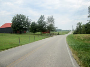
Gently rolling countryside
Several people stopped their cars on the road to talk. One man talked with CW behind me. Recently he let two women from New York who were hiking the BT camp on his property. When he drove past me, he gave me a thumbs up. Perhaps a mile farther, we saw him coming back the other way pulling a trailer of baled hay. A mailman on his delivery route pulled up by me. He was interested in how far I had walked today, how far I was going, and where the trail went from there.
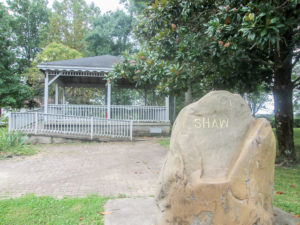
Memorial to Russell Shaw, founder of Russellville
Russellville was the only village we passed through today. In a small city park in the town square is a monument to Russell Shaw, the founder of Russellville. He was born in New York, but moved to Brown County, Ohio, in 1802. He was a soldier in the War of 1812. In 1816, he purchased 200 acres of land and established the town.
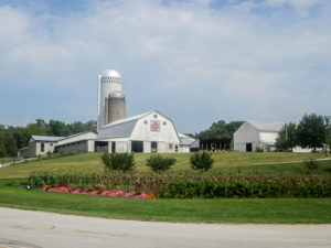
Attractive Amish farm in Brown County
When I had walked about 12 miles, CW thought I’d stop. But I was still going strong and didn’t want to do less than yesterday. So I walked 2.6 miles to the next point. When I completed 14.5 miles, he was sure I was finished. However, the road ahead was shady and level, and I wanted to get to the next point. That is the beginning of where CW needs to hike. He could see I still had some fuel left, so I continued, followed by my support vehicle. When I had completed 16.6 miles, I was finished. It was 1:00 p.m.
We did a little scouting for parking spots tomorrow. We aren’t sure how much hiking CW will feel like doing, but we will need two cars. On our way home we stopped at another UDF for my ice cream. Yesterday I had Polar Bear Crunch, so I thought I’d continue the animal theme. Today’s scoop was Zebra Stripes, vanilla ice cream with ribbons of dark fudgy chocolate.
Day 10 (Thursday): Still Water Mennonite Church on West Fork Road in Georgetown to Stony Hollow Road at US 68 and Lake Manor Restaurant in Mt. Orab to east of Williamsburg (12.5 trail miles)
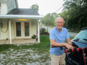
George dropping us off at our starting point
I didn’t have to drive today after all. Our trail angel, George, offered last night to drop us off at our starting spot this morning. We met at the Mt. Orab McDonald’s and then drove to where CW and I would finish hiking together. We left our car, and George drove us to where I stopped yesterday.
This hike would be 5.5 miles. CW still wasn’t sure if he would be able to make it the entire distance. Our contingency plan was that if he felt he needed to stop, I would walk on to the car and come back for him. We started just after 7:30 a.m. and walked at a leisurely pace.
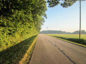
Long sunny stretch
The sound of many cattle mooing reached us from some distant farm we never saw. We listened to them for a long while, wondering what they were so vocal about. Closer to us, we did see a dog that also wouldn’t stop talking—and he was coming after us. CW finally sprayed his mace in front of our aggressor. It seemed to put an invisible fence between him and us. He continued barking . . . while facing away from us. That gave me a good chuckle to start off the day.
The roads were generally flat, making walking easy. The sun shined brightly. Sometimes we had long stretches of unshaded roads, but without hills it wasn’t uncomfortable.

Shelter for Buckeye Trail hikers tucked into the woods on private property
After two miles, we passed a campsite available to BT hikers. It is on private property and is not managed by the BTA. A small wooden sign in a clearing at the edge of woods indicates its presence. Tucked back farther is a shelter.
We greatly enjoyed the abundance of wildflowers all along the country roads and wished we could identify more of them. Fall decorations are popping up in yards. And, we have seen a lot of old barns and sheds. I love those rustic landscapes.
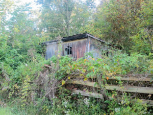
A deteriorating shed
We finished our miles by 10:00 and CW felt all right. About seven and a half miles remained in the West Union section. Our plan was to save them for tomorrow, and I would start walking the roads in the Williamsburg section today. Then I had an idea to tweak that plan. The last piece of West Union is less than a mile. If we did that together today, it would whittle down the miles CW would need to do tomorrow. He was okay with that.

CW and his coffee ready to hike
We only had one car, so we had to be creative again. I dropped CW off at the end of the West Union section about 10:30. He began walking counterclockwise while I drove the same direction back about a mile. I parked at the Lake Manor Restaurant and started walking clockwise. We passed each other on the dam at Grant Lake. As we approached each other, a blue heron burst from the shrubby bank and flew out over the lake.
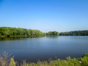
View of Grant Lake from the dam
When CW reached the car, he asked permission in the restaurant to park in their lot tomorrow since the car would sit there longer. He also picked up a menu. Then he taped his signs on the car and came to follow me. I had kept walking into the Williamsburg section.
I shed my backpack when CW caught up to me. The temperature was well into the 80s and the real-feel temperature was heading quickly for the 90s. I didn’t have a set number of miles to do—just as many as I could get in while my legs were still moving and I could still bear the heat.
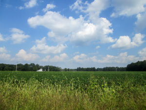
Nearly eye level with the soybeans
The BT goes through neighborhoods here, so there were a lot more houses than we’d been seeing. I didn’t notice much else. My concentration was on getting to the end—wherever that was. One particular soybean field did catch my attention. Usually the fields sit lower than the road, but this one was elevated. It was strange to be almost at eye level with the tops of the plants.
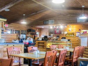
Log cabin decor inside Lake Manor Restaurant in Mt. Orab
I stopped walking at 12:55 p.m. having gone seven miles for the second leg. We returned to the Lake Manor Restaurant in Mt. Orab to try out the 48-item soup and salad bar. It was a good choice. Then we made a stop at Baskin-Robbins where I got Pistachio Almond ice cream. That was also a good choice.
Our trail angel offered to shuttle us again tomorrow. Woohoo!
Day 11 (Friday): Stony Hollow Road at US 68 to Lake Manor Restaurant in Mt. Orab and east of Williamsburg to Steve Newman Worldwalker Perimeter Trail at Tunnel Hill Road (11.4 trail miles + 0.7 miles for missing blaze)
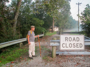
First road of the day wouldn’t give us any traffic problems
We met George at McDonald’s in Mt. Orab again. It was a short drive to Lake Manor Restaurant on US 68 where we left our car. That’s where we hoped to both end up. CW was feeling pretty good today so we went with our plan of finishing the miles he needed to do. George took us to where we stopped in the West Union section yesterday.

Barn in fog-covered soybean field with sun making bold entrance
Though George only drove a few miles down US 68, the trail back would double that mileage. We began at 7:30 a.m. on a road that was blocked off to traffic and curved around to take us right back to US 68. Along the road was a barn sitting in the middle of a soybean field. The morning fog still blanketed the field and created a film of haze over the barn. The scene glowed orange from the sun rising in the background.

CW going under the Bethel-New Hope Road overpass
We had to walk along US 68 a short distance before taking another unused road that ended at some trees. The trail went over a guardrail, through a bit of brush, under an overpass, and up a steep bank. At the top of the bank sat New Hope Covered Bridge. At 172 feet, it is the longest single span covered bridge in Ohio. It was built in 1878 over White Oak Creek and is now closed to motor traffic.
We soon crossed over US 68 heading east. It was only 8:00, but the sun was already fierce. The relatively flat roads were mostly unshaded. We went at our leisurely pace as yesterday.
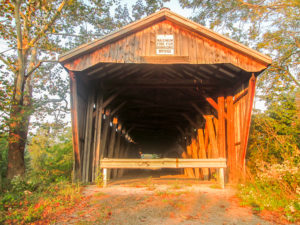
New Hope Covered Bridge
The BT briefly leaves a main road so hikers can experience a second covered bridge. Like New Hope, the Brown Bridge was also built in 1878, spans White Oak Creek, and is closed to motor traffic. It seems to be closed to foot traffic as well according to the “Keep Out” sign and the barricades that don’t allow any room to go around them. Nevertheless, the BT goes through the bridge.
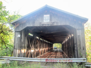
High barricade at end of Brown Covered Bridge
The barriers are high guardrails. CW had a little trouble getting over them. I was only able to get over the first one because I could slide my seat up onto it, but it was still difficult to get my legs over because the top is a metal edge. The second one was turned the other way so I couldn’t slide up on the edge. I finally took my backpack off and swung underneath while holding onto the rail. I would have been content to just look at the bridge.
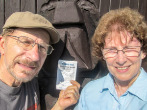
Big brown bear in front of Lake Manor Restaurant shared in our happiness to have West Union finished
We reached Lake Manor Restaurant at 10:20, completing the West Union section. Now CW has only two miles in the Williamsburg section to hike to complete his second time around the BT. With his temporary physical situation, I may be walking all the others by myself.
CW put the signs on the car and drove to where I stopped walking yesterday afternoon. I had less than four miles of road walking to do, which I covered quickly in spite of the fact I was broiling under the sun.

Straight ahead of CW’s car is the left turn I missed into the woods (notice the right turn blaze on the pole)
I reached my last road where CW had already pulled in. He couldn’t drive in far because cars weren’t permitted past that spot. A short way down this road, the BT enters the woods and goes 22 miles around East Fork Lake. We’ve heard that parts of the trail may not be blazed well and may be overgrown. I am not excited about doing this by myself, but it will probably be a while before CW will be able to do it with me. Even though I was tired today, I wanted to get started on it. I was wearing my boots and long pants today, and the first point was less than a mile away. CW gave me a quick lesson on using the Avenza map on his phone so I could make sure I was on the trail. Then he left to drive around to the road I would, hopefully, come out on.
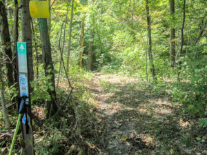
BT joins Steve Newman Worldwalker Perimeter Trail around East Fork Lake
I started down my road. It immediately turned right and I followed it along the edge of the woods, watching for where to enter. I didn’t see any blue blazes. I kept walking, even though it seemed as if I was going too far. Finally I checked with Avenza. I couldn’t believe it! I was way off the trail.
I retraced my steps until the little blue Avenza dot was back on the trail. I was all the way back to that bend in the road, about 100 feet straight ahead of where CW’s car had been parked. I had been sure I was supposed to turn right and take the road a bit farther because at the beginning of the road I’d seen a right turn blaze. I guess I missed the left turn blaze into the woods at the bend because my mind had already registered a right turn there. So I had started out by walking an extra 0.7 miles!
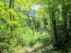
There’s a path hidden in there
The trail through the woods was blazed well enough that I didn’t need the map. Because of overgrowth, there were a few places I couldn’t actually see a path until I was right on top of it, but it was there. Horses also use this trail, so I had to carefully navigate some deeply rutted and slightly muddy spots. And I fought with the spiders. It was strenuous, and I was exhausted when I emerged from the woods. But I was glad to have begun this long stretch.
After I brushed two spiders out of my hair (we think they were Arrowhead spiders—Eek!), we went back to Country Inn Restaurant in Mt. Orab for lunch. And then we visited Baskin-Robbins again. I got Caramel Turtle Truffle, vanilla ice cream with caramel-filled milk chocolate turtles and caramel swirls.
~~~
We hiked 67.5 miles in the past five days, much of it in high temperatures. I never expected that I’d be able to cover so much distance so quickly in the hot conditions we had. Maybe it’s an extra surge of energy because I’m getting so close to the end.
We have completed the West Union section, and now only about 40 miles remain in the Williamsburg section. More than half of those are in the woods. It will just be me—me and Avenza, that is—so it should be quite an adventure. And just when I thought I was catching a glimpse of that finish line, I find myself surrounded by trees that obscure my view.
[Special Note: Part Three of “Finish Line . . . or Mirage?” won’t be posted until after we complete our hike sometime in October. Anyone who would like to is welcome to walk the last couple of miles with us and celebrate our journey. We will be ending at the Milford Trailhead on the Little Miami Scenic Trail. We aren’t sure yet what day that will be. If you are a subscriber to CW’s newsletter “Current Steps,” you will receive information about it. If you aren’t and would like to be informed, you can subscribe to his newsletter here on his website. You can also email us.]

Goldenrod in front of a field of ironweed in Brown County

Elainek
September 17, 2019Jack and I are in Arles France following your journey. So happy you were able to complete so many miles in the hot weather. We too are hiking but among many Roman ruins. Makes me think how new our country is. I hope CW is feeling ok and that his surgery goes smoothly. Congratulations, you are so close to your goal! Those vultures don’t know who they are messing with!
CW Spencer
September 17, 2019Cool! I’ve reached all the way to France. Hiking among the Roman ruins sounds exciting. Some of the falling-down barns we pass look pretty ancient, but I know they don’t compare. Thank you for your well-wishes for CW.
Brenda
September 20, 2019I enjoyed this so much! Is the reception really good enough along the way to trust your Avenza to work? Don’t you love technology!?
CW Spencer
June 9, 2020So glad you enjoyed the post. I just checked with CW about Avenza. It uses GPS rather than cell service, so it is always there if you have your GPS turned on. And yes, I love technology when it keeps us from getting lost on the trail! ~Bonnie