by guest blogger Bonnie Spencer
October 17, 2019
A week and a half passed since our last time out on the trail. I had planned to hit those woods through East Fork State Park after a weekend off, but that Sunday night I began feeling sick. I thought it was something I ate; CW thought it might be from my previous week of pounding the roads in the heat. Whatever it was, I could barely move Monday. While I was flat on my back that day, I did some serious thinking about my remaining hike.
I had over 21 miles of woods yet to do. They basically follow the southern perimeter of William H. Harsha Lake. The trail is not mild, but that doesn’t bother me. I can take the rough terrain, occasional churned-up spots from horses, downed trees, streams to ford, and perhaps some narrow sections. But we keep hearing about how parts of this trail aren’t maintained well: lots of overgrowth, much of which is prickly multiflora rose, and some inadequate blazing.
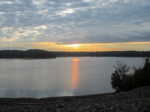
Sunrise over William H. Harsha Lake
The problem is a lack of needed volunteers to maintain the BT. For several years, CW helped to maintain some of this trail through East Fork, sometimes responsible for as many as six miles. During the spring and summer months, an immense number of hours are required to keep the trail navigable. So I understand there just isn’t the manpower necessary to keep the trail clear.
CW’s Avenza map could help me with a lack of blazes but it won’t bushwhack for me. I want to hike the Buckeye Trail, not fight my way through it. So in my agony that Monday, I came up with another plan.
The trail through the woods was rerouted a couple of years ago to a bike trail and roads north of the lake after much of the southern trail had been bulldozed. During wet seasons, the path becomes extremely muddy. Also parts of it are prone to flooding. A trail alert from April 2018 said the trail had been reopened, but the reroute is still described as a “dry boot alternative to the main trail.”
Only because of the “unmaintained” reports, I decided I wanted to do the northern route. So when I was feeling better the next day, I sheepishly posed my idea to CW. I say sheepishly because previously he had “encouraged” me to take that reroute, but I had refused. If the trail was open, then that’s where I should walk. I’m 99% purist when it comes to not missing an inch of the actual BT. However, faced with fighting angry woods by myself, I changed my mind about this section. Of course, CW was okay with my plan. Although by that time he had started to get excited about me doing the woods by myself.
Day 12 (Wednesday): east end of William H. Harsha Lake to west end of William H. Harsha Lake (11.9 trail miles)
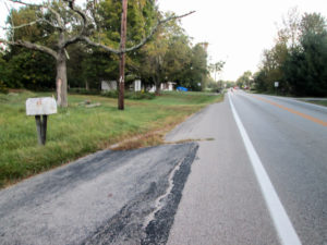
SR 133 took me into Williamsburg
CW’s surgery went well and his recovery has also gone better than we had hoped for. He will still be taking it easy, though. He only needs to do the last few miles with me, so he will continue to hang close in the support vehicle most of the time. He did bring his hiking shoes, though, in case he feels like walking a bit.
Today was a glorious day for hiking. The temperature range was low-50s to mid-70s with a low dew point. Fall has officially arrived according to the calendar, so we finally get to hike a little of our “fall” hike in the fall.
CW dropped me off at 7:50 a.m. at a spot east of the lake on SR 133. The last time I was out, I hiked south from there and went a mile into the woods. Today I walked north to take the alternate route.
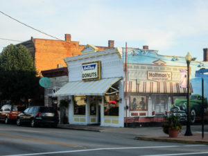
CW’s car in front of Holtman’s Donut Shop in Williamsburg
State Route 133 was busy with morning traffic, but I felt safe with the grassy yards to walk in. CW couldn’t stay with me on that road, so he disappeared into Williamsburg. He told me I’d find him in his car in front of Holtman’s Donut Shop. Before we began hiking together, I didn’t know of his love, or weakness, for donuts. We never have them at home. When the trail took me into Williamsburg, I had no trouble spotting him.
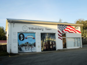
Elaborate mural of The Williamsburg Times
The Village of Williamsburg was founded in 1796. It is the oldest town and first county seat in Clermont County. It’s one of those small towns I would enjoy taking my time walking around in and visiting the shops. Beautiful murals painted by a local art teacher and student decorate the outside walls of buildings. A great mural for The Williamsburg Times is on a building I assumed housed the newspaper, but I discovered it stopped publishing in 1976. We tried to find out from someone who has lived in Williamsburg for many years what the building is used for but never got an answer. We think it’s a village secret—which makes me want to know more than ever what is in that building.

Beginning of the Williamsburg to Batavia Hike Bike Trail
A quiet side road in town ended at the beginning of the Williamsburg to Batavia Hike Bike Trail (WBHBT). When this trail is completed, it will be over 13 miles long and connect the two towns. Only parts of it are on dedicated hike/bike trails. Several miles are shared with roads, some of which go through East Fork Wildlife Area and East Fork State Park.
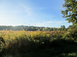
Birds disturbed by my passing in the East Fork Wildlife Area
After a quarter mile on the hike/bike trail, the BT joined a road through the peaceful wildlife area. A few cars passed by and people parked in the numerous pull-offs beside the road to walk trails into the woods. One person was out with her two dogs. I was surprised to see cornfields in this area. I stirred up some flocks of birds that were hidden in fields of tall wildflowers and weeds.

CW couldn’t resist walking across bridge over Kain Run
At the end of the road, the WBHBT crossed Kain Run on a bridge and continued on the paved trail with scatterings of fallen leaves. It was a beautiful setting. I had no feelings of guilt that I wasn’t in the woods on the other side of the lake. This was a much more pleasant experience than getting mauled by vicious vegetation.
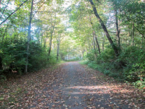
Beautiful alternative to being mauled by bushes
While passing more cornfields, I heard several dogs yelping excitedly. I couldn’t tell how far away they were. I hoped they were confined to cages, but they sounded like hunting dogs that might have treed something. I walked a little quicker.
Then I spotted a man ahead of me on the trail. He sat quietly on a low

Cornfields along the bike trail
stool. I briefly considered getting my mace out—for dogs or whatever. When I reached him I said hello and he offered an expressionless good morning. I wanted to ask if those were his dogs and what they were doing, but I decided not to when I noticed “Growler” printed on the sleeve of his jacket. I walked a little quicker.
When I was about 40 yards away, the yelping became louder. I turned to see four small brown animated dogs running around their master. I guess he had just brought them out to play among the corn.
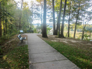
Serene spot from which to view the lake
The trail passed a side area with benches that overlooked the lake and then joined the main road that goes through the camping area of East Fork State Park. It continued outside the camping entrance until it reached another section of dedicated hike/bike trail. That piece was only a mile, but I wish it had been longer because I enjoy those green-canopied corridors that don’t invade my space. After two more miles on a road, the alternate route reconnected with the regular Buckeye Trail.
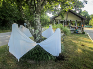
Fall decorations at East Fork State Park entrance gate
To the right, the trail continued toward the finish line, but I wanted to go left first to do the southern route back to the woods. We didn’t know how much time we had left today because we were waiting on a phone call from the guys coming to install our new water heater. To save time, I kept walking even though it was counterclockwise. After a mile and a half, the road ended.
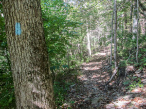
Rocky descent on perimeter trail
From there the trail went through approximately a half mile of the perimeter trail before joining another road. I would have continued counterclockwise, but I knew from the trail description and CW that it descended quite a bit going clockwise. I much preferred desending over climbing, so CW drove me to the other end. The shuttle was nine miles long and took 18 minutes, eating up a lot of time.

Freeze-dried astronaut ice cream
I enjoyed this short piece of trail. It was quite rocky. Parts of it were torn up by horses, but since it was dry I didn’t mind. In one spot, a downed tree with several large limbs blocked the trail. It just slowed me down a bit. CW made it back around to pick me up just before I reached the gate at the road—9 miles for him, 0.6 miles for me. It was 12:15 p.m.
I still had two more miles to hike to the south. CW was shuttling me around to start on them when our call came and we had to rush home.

Ice cream puzzle
We didn’t have time to stop for ice cream. I’ve had some at home for a hiking emergency, and I’ve wanted to try it. Since I’m about out of hiking days, I decided this was the day. It’s freeze dried, “originally developed for the early Apollo Missions” the package says. We’ve had it so long that it was cracked. It looked like a puzzle when I took it out of the package—entertainment to go with my dessert. The texture initially brought to mind thoughts of styrofoam, but the confection quickly melted into a creamy substance that I could easily imagine into ice cream. CW and I were both surprised to discover we liked it.
Day 13 (Thursday): west end of William H. Harsha Lake to Perintown (12.5 trail miles)

View of William H. Harsha Lake from dam
We were out early today. First on the agenda was to finish the two miles that I didn’t have time for yesterday. It was all on Slade Road, which follows the west edge of William H. Harsha Lake.
The lake is on the East Fork of the Little Miami River and is over 2,100 acres. It sprawls generally southeast to northwest, creating a lot of coastline. That’s why the southern trail is longer than the northern reroute on the WBHBT. The lake and dam were originally called East Fork but were renamed in 1981 to honor William H. Harsha, a retired congressman.

Glorious sunrise on Slade Road
Today was warmer than yesterday. It was already in the mid-70s when I started at 7:25 a.m. Early cloud cover helped to create a constantly changing and captivating sunrise.
The road went over the dam, passed a visitor’s center, and ended in a cul-de-sac from where I had entered my short off-road piece yesterday. I had now finished the part of the southern trail that was outside the woods.

Barn adorned with quilt pattern
CW shuttled me to the spot on Elk Lick Road where I turned south yesterday. Today I hiked north. There was still a lot of cloud cover. I enjoyed the peacefulness of the quiet countryside. It was full of many scenes that have become familiar to me: morning glories decorating a wooden fence, cornfields lining the road, gentle undulations stretching before me, barns bearing quilt art, tiny cemeteries holding volumes of history. At some point, CW leaned out of the car and encouraged me to savor the time because it would soon come to an end. That was good advice for this person who was racing to that finish line, which was finally coming into view.
After two miles, the Buckeye Trail followed SR 222 into Batavia. It was a very busy road, but I had plenty of grass to walk in. I was grateful it was all mowed. In town I took a break at UDF—no, not for ice cream, but for the restroom.
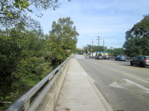
Crossing East Fork on Main Street in Batavia
The Village of Batavia was founded in 1814 and became the county seat of Clermont County in 1824. Previously, that designation was held by Williamsburg, and then by New Richmond for only a year. I walked on sidewalks along busy four-lane Main Street through the business district. The trail crossed East Fork and went under a railroad overpass.
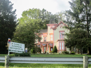
Family Animal Hospital in Batavia
One particular building that sat back from the road up on a hill captured my attention. The Family Animal Hospital is in a Victorian house built in 1855. Besides having been a home to families, it also housed Underground Railroad conductors and a 1930s gangster’s mistress before accommodating various medical practices.
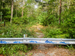
Over guardrail onto abandoned road
The BT used the access ramp to SR 32 to leave the town behind. It then followed a quieter road for a mile through an industrial district until it reached an old road that no longer looks like a road. I crossed a barricade and ascended on a path of chunky pieces of blacktop into a wooded area where the vegetation is successfully taking over. After another barricade, the road was intact and more open, but still closed to traffic. I crossed a third barrier and found CW waiting. I had reached the maintained road. It skirted the back of a subdivision of mansion-like houses, which looked out of place to me in such a rustic setting.
On the next road, a man on a three-wheeled motorcycle appeared. CW was up ahead of me around a bend at the time. As the man passed me, he yelled, “He’s waitin’ for ya,” and motioned behind him. Obviously, he had talked with CW.
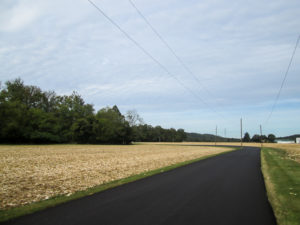
Harvested cornfields
We turned onto a newly blacktopped road and passed recently harvested cornfields. The cloud cover had long ago given way to the sun, but I enjoyed a strong breeze. CW was following closely behind me and I was walking at my fast pace when a car came around a curve from the opposite direction. It stopped by me and a woman asked if I was all right. She sounded concerned. I thought it might have looked as if CW and I had had a fight and I’d gotten out to walk away. I assured her I was just hiking the Buckeye Trail. She said if I was tired, there was a house around the bend and I could sit on the porch.

Bicycle art on fence?
The road narrowed. Two cars could barely pass without one having to pull off, yet the road was well-traveled by large trucks. In one place, houses were on our left. On the right was a strip of woods between the road and the East Fork. At the edge of the trees, I counted at least ten bicycles and tricycles hanging on a fence. It didn’t look as though they were used often the way they were partially hidden by overgrowth. Maybe it was an art display.
When we reached Round Bottom Road, it was 11:50. We had only four more miles to do, which would leave the final one and a half miles for our finishing hike. I had hoped to do them today and not have to make another trip. But we stopped. It was Marty’s fault today.

S’mores shake with Marty
The Reds would begin their last home game of the season in less than an hour. Marty Brennaman, the Cincinnati Reds play-by-play voice on the radio for the past 46 years, would broadcast his last game before retiring. I didn’t want to miss that, so I hopped in the car.
We drove to Arby’s for lunch. As soon as we pulled in, a poster in the window begged me to get a S’mores shake to go with my sandwich, so I obliged. We ate in the car in Arby’s parking lot while listening to Marty—for the last time.
Day 14 (Wednesday): Perintown to Valley View Nature Preserve in Milford (3.9 trail miles)

CW left me on Round Bottom Road
Today was the first time in nearly a week that we had a free morning to hike. It was sunny and warm, but I can walk in anything for less than four miles. And that is all we had to do today. CW needed to hike only the last mile. We didn’t want to drive two cars just for that, so we didn’t get to walk together.
He dropped me off on Round Bottom Road at 9:15 a.m. I had heard a lot about this road: how much traffic there is and that in some places there is no way to get off the road. But I wasn’t too bothered by these reports, either. Like the weather, I could endure it for four miles. CW couldn’t follow me on this busy and sometimes curvy two-lane road, so he drove to our ending spot at the nature preserve to await my call.

Round Bottom Road saved me from a dog
Almost immediately a dog made himself known by barking loudly as he ran back and forth across his yard. He kept his eyes on me and I kept my eyes on him. Fortunately, he was on the other side of the road and he had a healthy respect for Round Bottom. There was something good about the road after all.
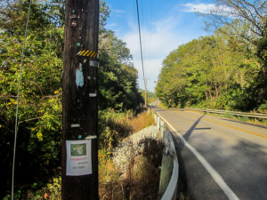
Nowhere to walk if cars come
In most places, I was able to get off the road when I needed to. Occasionally, though, there was a bad place. One dangerous spot was where I had to walk in the few inches between a guardrail and the edge line painted on the road. I covered those yards as quickly as possible and was relieved that no cars came before I reached the other end of the rail.
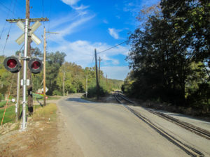
Busy road or empty tracks?
Railroad tracks run roughly parallel to Round Bottom Road and cross it in a couple of places. At the first place they crossed, I debated about whether to continue on the road or switch to the tracks. CW and I had talked about that. He had walked on the tracks part way the last time he hiked through here. I don’t like the idea of walking on railroad tracks. It can be dangerous, and it might even be illegal. However, I thought it would be safer in this case, so I chose the tracks, legal or not.

I got off the tracks when I could
I tried walking on the ends of the ties that extend outside the rails. That seemed a little less illegal than walking between the rails. But it also felt as if I could easily lose my footing and fall. I tried walking on the gravel beside the tracks, but there wasn’t much width before the ground sloped down. When there was a level place to the side of the tracks, I took advantage of it. Most of the time, however, I walked between the rails.
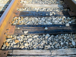
Oozing creosote
I had to look down constantly to know where to step. Many of the railroad ties were oozing creosote. It was extremely sticky. Out of curiosity, I tried to pick up a rock from one of those ties, but I was barely able to budge it. The creosote’s grip was too strong. I didn’t want to accidentally plant my boots on the tarry surface and possibly have to abandon them. They have been faithful for the past 900 miles and I can’t finish without them.
I was glad to be off the road. Sometimes I could see it and watch the vehicles rush by. Other times the tracks veered away from the road and trees blocked my view. Then I enjoyed the peaceful seclusion. Now I can add railroad track walking to my hiking experiences.
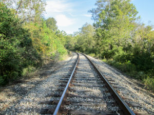
Secluded railroad tracks
When I reached the spot where CW needed to hike, I called him. He began walking counterclockwise from the nature preserve back to that spot. I continued toward the preserve where I would get the car and come back to pick him up.
The tracks were next to the road there, but they separated from it up ahead. Since I didn’t know how far from the road they went, there was a possibility of missing CW if I stayed on the tracks. I needed to get the car key from him, so I decided to switch back to the road. I left the tracks and walked down the bank. As soon as I reached level ground, a police car drove by. I was glad I’d gotten off the tracks when I did. I didn’t want to know if I’d been doing something illegal—or at least, I didn’t want to find out from a policeman.

CW heading toward dangerous spot on road
Only a mile or less remained, so it wasn’t long before CW passed off the key to me. My side of the road had been all right for walking, but CW had to navigate a very dangerous place by a guardrail. He had hardly any room to walk and the traffic was passing in both directions. This is the type of experience he associates with this particular road.

Entering historic Milford, first Buckeye Trail Trail Town
The Buckeye Trail left Round Bottom Road just after it intersected the tracks again. It went across a bridge over the East Fork into Milford. I was surprised to find out that, besides the Buckeye Trail, seven other major long-distance trails traverse through Milford. In 2012, Milford was the first town to be designated a Trail Town on the Buckeye Trail.
To become a Trail Town a community must go through an application process and show that it provides services for hikers, promotes the trail to its citizens and tourists, and acts as a steward of the trail. When CW and I began our hike in the fall of 2015, there were only four or five trail towns. Each year the number has grown until there are thirteen now.
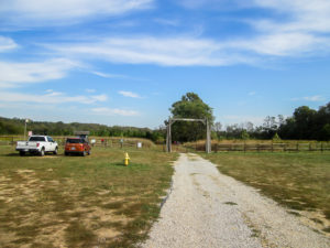
Approaching entrance to Valley View Nature Preserve off South Milford Road
A quarter of a mile from Round Bottom Road sits Pattison Elementary School. The trail turned just before the school and followed the paved drive that provides access to school parking to the left. The land to the right, between the drive and the East Fork, is within the boundary of Valley View Nature Preserve. Straight ahead was the car at the entrance to the preserve. I finished my day’s hike at 10:40 a.m.
If I could have climbed to the top of the Valley View sign, I’m sure I could have seen the long-awaited finish line across town. We have only 1.5 miles left for our final hike in a week and a half. A few friends will walk with us and help us celebrate. I’ll think about that tomorrow, though. Today I still needed to hunt down some ice cream.
I picked CW up where he was waiting. Then we drove to the other side of Milford to the Old Milford Parlor in historic downtown. It didn’t open till noon, so we went somewhere for lunch before returning for dessert. CW got a hot fudge sundae, which he said was the best he’d ever had.
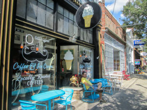
CW in an ice cream stupor in front of Old Milford Parlor
I tried something I’d never heard of: an affogato. It’s Italian for “drowned” and is a scoop of ice cream with hot espresso poured on top. I love coffee and chocolate flavors together, but I wondered if espresso would be too strong since I don’t like to drink coffee. The server said he could put a layer of cookie dough under the ice cream. The parlor is known for its edible cookie dough. I had to experience this. To counter the strong coffee as much as possible, I chose the chocolate brownie batter and chocolate ice cream. At first it was delicious, but eventually it began tasting extremely bitter. I finally stopped spooning up espresso with my ice cream and just ate the ice cream and batter. It was a return to delicious.
Day 15 (Saturday): Valley View Nature Preserve to Milford Trailhead on Little Miami Scenic Trail (1.5 trail miles)
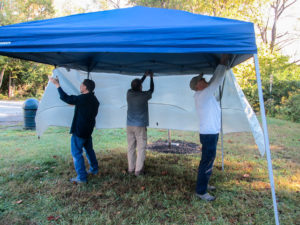
CW, Dale, and George setting up canopy
Our big day had come. We were at the end of our complete Buckeye Trail hike, over 1,440 miles. When I took my first steps in 2015, these last steps were not even a distant thought. My goal at the time was short term—just to help CW out that fall on his second time around the state. I had no plans to hike the entire trail. But it grew on me. It kept pulling me forward. And here I am four years later. I can see the finish line; it is not a mirage.
CW and I arrived at Jim Terrell Park in Milford at 9:15 a.m. George pulled in right after us. He’d come early to help set up a canopy for the celebration at the end of our hike today. Dale surprised us when he came out through the trees from where he’d been watching the Little Miami River flow by the park. He had come even earlier, having the farthest to travel today and not wanting to be late. Several more friends would also join us.
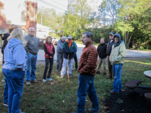
Hikers gather at Jim Terrell Park in Milford
The 27-acre park is just a block from the trailhead where we would end our hike, so it was a great location for our celebration. It is one of three camping areas within Milford available to those hiking through town, and it is the only one with an Adirondack-type sleeping shelter.
As the time neared 10:00, the eleven hikers gathered. It was a crisp morning, only in the 40s. Although it was a sunny day, the park was shaded at that time. Days before, rain was forecast for today. However, the last drops had fallen earlier in the morning. It was perfect weather for our last hike.
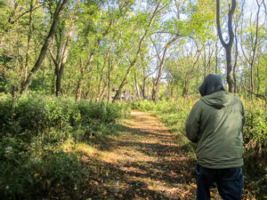
Trail through Valley View Nature Preserve
We shuttled the short distance through town to Valley View Nature Preserve. Back in 2002, the then-farmland along the East Fork was expected to be bulldozed for development. But then Valley View Foundation, a grassroots organization, was formed to preserve the 190 acres. It consists of rivers, streams, wooded hillsides, prairie, and wetlands. Today a fall community event was taking place, so it was easy to find someone to take a picture of our whole group before we began hiking at 10:30 a.m.

Group photo at start of hike
Front: Chris, CW, Dale, Bonnie, John
Back: Russell, Anne, Brian, Patti, Bob, George
The Buckeye Trail follows along part of the western edge of the preserve on wide grassy paths. We walked around the end of a community garden

Leaving the nature preserve for the sidewalks of Milford
enclosed by an eight-foot deer fence and later passed one of the barns on the property. Although Valley View has five miles of mowed trails, the BT uses less than a half mile of them. This is a place to which I definitely want to return to explore more of the trails. It was flat except for a slight climb to reach the road when we exited the preserve.

One of many gingerbread houses the trail passes in Milford
We left the nature trail for the sidewalks of Milford where we followed the blue blazes down tree-lined streets. A few of us lagged behind admiring the interesting houses decorated modestly with fall accents. Each one was unique in its design. Some sat behind picket or wrought iron fences. Many of the large two-story dwellings had verandas and turrets. We oohed and aahed over gingerbread architecture and fun color schemes.
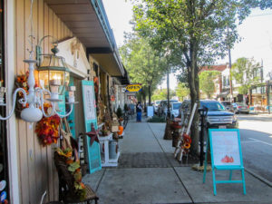
Downtown historic Milford
The Buckeye Trail drops down onto Main Street in historic downtown. We passed restaurants and a variety of shops. The shops were in full-fledged fall fashion. Merchandise spilled onto the sidewalks through their open doors on this autumn day. If I had been by myself, I couldn’t have resisted checking out each one. Across the street was Old Milford Parlor, our ice cream stop on our previous hiking day. It wasn’t a temptation today because I had something better waiting for me.
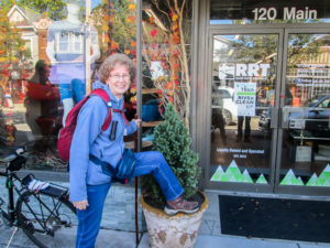
Roads Rivers and Trails outfitter where I bought my hiking boots 900 miles ago
I’ve heard the trail was specifically routed down an extra block in town so it would pass in front of Roads Rivers and Trails, an outfitter that is Buckeye Trail friendly. It even sells BT section maps. I bought my hiking boots there. They have been wonderful. The heels are beginning to wear thin, but that’s to be expected after 900 miles. Other than that, they’ve been almost perfect. Absolutely perfect would mean they are self-cleaning after a muddy hike.

More friends waiting for us across road from trailhead: Andrew, Tina, Tom, Kathy, and Elaine
We were perhaps three blocks from the trailhead. I had been in slow mode the entire hike. It had nothing to do with not wanting it to end; I did want to finish. But the day was so beautiful and hiking with wonderful friends was so special that I wanted to savor every moment. When we crossed the Little Miami River, five more smiling friends and two bouncing balloons greeted us.
All 26 sections completed
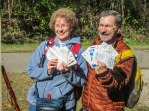
Across the road, three more friends joined us to walk up the driveway to the Milford Trailhead, the end of our trail. The finish line was actually a blazed post, and we reached it at 11:25 a.m. Four years of hiking finished. All 26 sections of the Buckeye Trail completed. I had remembered to put all the maps in my pack, so CW and I fanned them out for an end-of-the-hike photo. We also got a group picture of almost everyone who came.
Refreshment table
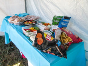
We all walked the block to the park where the canopy was set up. We put up tables under the canopy for the food and set camping chairs around outside of it. One of the round picnic tables and the edge of the shelter provided additional seating. We sat or stood, eating and conversing.

Guests waiting for the dinner bell
The setting was pleasant. It was the perfect amount of space for our group—cozy, but not cramped. The sun had replaced the earlier shade and graced us with the right amount of warmth. It was a classic fall day. I couldn’t have been more pleased. While everyone finished up their sandwiches, CW and I made some brief remarks. Then we quickly moved on to dessert.
When I had completed 500 miles on the Buckeye Trail, CW had a cake made for me at a local shop. It showed the trail we had completed up to that point. We loved the 500-mile cake—the appearance and the taste. So we returned to Mama C’s for an encore, only this time the entire trail was in blue. One small misspelling gave us a chuckle, but the cake was just as delicious.
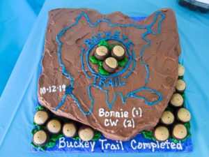
Buckeye Trail cake showing entire trail in completed blue
Cake was not the only dessert, though. Of course, we had to have ice cream. And it had to be a kind I had not yet eaten on the Buckeye Trail. I wanted it to be special. I worked on an idea for weeks that would incorporate blue blazes and buckeyes. It took that long because many of my ideas don’t work.
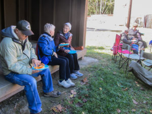
Enjoying food and conversation in the shelter
I wanted mini buckeye candies in the ice cream. We couldn’t find them anywhere. I finally considered cutting up regular-sized buckeyes. Then a shopkeeper suggested I make my own. I’d never made them, but she said it’s one of the easiest candies to make. I found a recipe for 80 buckeyes. Not knowing how many I would need, I did the whole recipe but made them tiny. I mixed, rolled, and dipped for six hours and still hadn’t used up all the mixture. But I had my mini buckeyes—500 of them! (The majority of them are still in my freezer.)
For the blazes, I tried cutting a couple different blue candies into tiny rectangles and mixing them into a small amount of vanilla ice cream. After freezing, one of them would have cracked some teeth. The other one might have worked but it would have taken me hours to blaze enough of that candy. After the buckeyes, there was no way I was going to do that. So I needed blue ice cream.
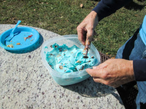
Bonnie’s Blue Blaze Buckeye Trail ice cream
We couldn’t find blue ice cream anywhere. I tried coloring some store-bought ice cream. It worked, but I had to soften it quite a bit to mix in the color. I thought I’d try making my own, which I’d never done. That way I could add the color before it hardened. I found a simple recipe. It worked, and it tasted okay until we compared it to the Breyer’s I had colored. So I colored more Breyer’s vanilla ice cream and added my mini buckeyes. That’s how I got the final ice cream of my hike: Bonnie’s Blue Blaze Buckeye Trail ice cream.
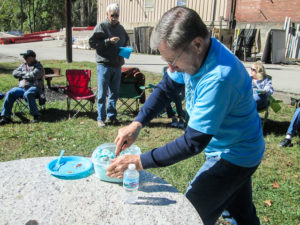
CW getting a workout scooping dry-iced ice cream
When we were ready to cut the cake, CW got the ice cream out of the cooler. Since we had never used dry ice before, I had read up on it online. Somehow I missed the section where it tells how dry ice freezes ice cream into concrete. CW couldn’t even chip away at it. He sat it in the sun while everyone enjoyed the cake. Later he got quite a bit of exercise digging it out. It was still hard enough that the buckeyes got mangled. I might as well have cut up those regular-sized buckeyes. But we all got our ice cream.
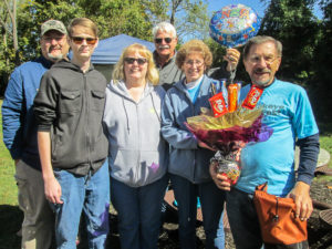
Lingerers helped us clean up: Brian, Andrew, Tina, Bob, Bonnie, and CW with candy bouquet
Today was a truly wonderful ending to our four-year adventure. I’m grateful for the unplanned and unique experience of walking all around Ohio with CW. We never know where a single step will lead. We have acquired a lot of memories—of the trail itself and of the people we met on our travels.
Thank you to everyone who has read some or all of my posts detailing our journey. We count it a blessing that you came along with us.
~~~
Final Hiking Statistics
Hike began: October 7, 2015
Hike ended: October 12, 2019
Total days hiked: 127
Total foot miles: 1,442
Total car miles: 26,477
Total steps: 3,471,844

Group photo at the finish pole
I have two final thoughts. The first is that the Buckeye Trail is long and requires a lot of people to properly care for it. There aren’t enough volunteers to do that. Now that I’ve enjoyed walking the trail, I hope to find some opportunities to work on the trail to make it better for other hikers.
My second thought is a bit selfish. I have found there is a lack of ice cream shops along the trail. Sometimes it is a major task to find one after a long day of hiking. I think the BTA should make sure ice cream is available for their hikers, at least every 20 miles. With a combination of rerouting the trail and opening their own chain of Blue Blaze Ice Cream Huts, they could lick the problem.

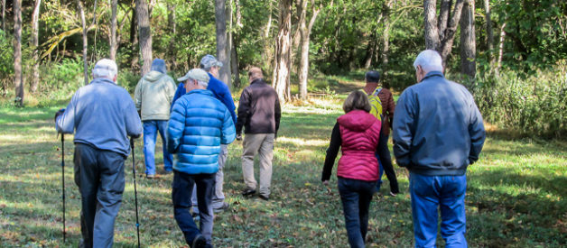
sharkbytes
October 17, 2019Hooray and Congrats. Sorry I missed that blue blaze ice cream. It sounds awesome
CW Spencer
October 17, 2019Thanks, Joan. CW and I just finished the last of the ice cream for lunch today. Now we will move on to the homemade blue stuff and add mini buckeyes from our freezer as we go. Thanks for reading my posts!