by guest blogger Bonnie Spencer
April 9, 2019
It has been a goal of mine to have a trail name before I finish the Buckeye Trail. CW and I have hiked over a thousand miles together on the BT now, and I still didn’t have one. Since we hope to finish in the fall, time is running out. So CW helped me come up with Cloud Gazer. I love watching the clouds. White puffy ones look so soft and pure. They warm my heart. But others can grab my attention as well with their own special traits. So Cloud Gazer it will be—until I trip and hurt myself on the trail because I’m too mesmerized with the sky.
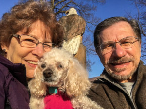
Us with sweet Sugar on her last day
Although I’ve gained a trail name, we’ve lost our 16-year-old toy poodle Sugar. Actually she was my parents’ dog, but we took her in when Dad passed three years ago. For the last five hiking seasons, we have begun each week with a visit to the vet’s office to drop off Sugar for boarding, but in March we took her for the last time—to have her euthanized. Dr. Tina and her staff at Docton Animal Clinic in Xenia have been so good to Sugar her whole life. I think they were as sad about Sugar as we were. We will miss seeing all of them.
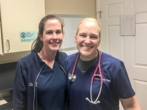
Sarah and Dr. Tina at Docton Animal Clinic
This spring we plan to finish the New Straitsville section and complete three more sections: Old Man’s Cave, Scioto Trails, and Sinking Springs. Several people want to hike parts of these sections with us. Since we won’t be held to five-day weeks due to Sugar’s boarding, CW has gotten creative with our hiking schedule. It will be broken up to avoid five consecutive days. But my log will still be in three parts. So here we go with Part One.
Day 1 (Thursday): Hocking State Forest parking area on Kreashbaum Road to parking area for Ash Cave (11.2 trail miles + 1 mile off trail)
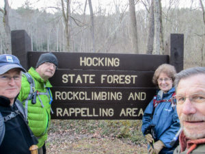
George, Richard, me, and CW
We were going to start on April 1 (no fooling), but we have so many miles to cover this spring that we decided to begin early—today in March—and knock some miles off in a one- or two-day trip. However, one of the two cars we would have taken developed a brake problem yesterday. Having only one car available would have ended our plans if not for George and Richard deciding to hike with us today.
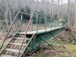
Footbridge over Big Pine Creek in Hocking Hills Forest
We met them in the parking area for Ash Cave in Hocking Hills State Park (HHSP) and shuttled north to the entrance to the Hocking Hills Forest climbing area. It was chillier than I had expected, so I dug out my scarf, gloves, and another jacket. I would soon warm up, though, and enjoy a nearly perfect day.
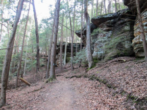
Sandstone cliffs in Hocking Hills Forest
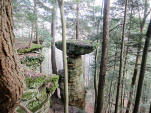
Table Rock viewed from atop the sandstone cliffs
We began hiking about 9:15 a.m. The first couple of miles were familiar territory. CW and I had made two trips here in 2014 to take pictures for the cover of his first book. It’s a fun trail. We crossed Big Pine Creek on a footbridge and joined a bridle path that wound through towering sandstone cliffs. In half a mile, we came to Table Rock. It is a wonderment how that rock continues to balance in place.
We followed footpaths and bridle trails that meandered along the edge of the cliffs above a repelling area and eventually led to a rock overlook beside a waterfall. At that spot, we left the cliffs.
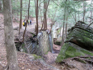
Rim trail on top of the cliffs
After crossing a small open area, we ascended a narrow, deeply rutted path through a young forest habitat. The area had been harvested, partly to provide an environment that would benefit species of wildlife whose populations have been falling.
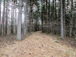
Fire lane through mature white pines on top of ridge
At the top of the ridge, a fire lane awaited us. I don’t know what I expected a fire lane to look like, but it wasn’t as gorgeous as this. The wide path was covered with cushiony brown pine needles, boughs of green needles, and pine cones. I wanted it to go on for miles, but it ended after only two tenths of a mile.
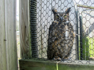
Great Horned Owl, one of the leading winged rodent hunters in the Hocking Hills area
We eventually reached the HHSP office. The trail took us there indirectly so we would pass by a small naturalist area, which consisted of three cages for displaying raptors found in the area. The only bird CW and I noticed there today was a great horned owl who was content to pose for us.
We ate our lunches outside the park office. It felt good to sit and rest after hiking over two hours. We had encountered several steep hills, always tough on my first day. The trails had been pleasant though. Muddy spots were isolated, and we had no difficulties fording the small streams.
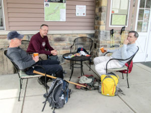
George, Richard, and CW having lunch outside the Hocking Hills State Park office
At noon, we resumed our hike. We would be going through the Old Man’s Cave area. The last time I was on these trails was decades ago. I’d forgotten what a huge tourist attraction it was. Today the trails were full of families with lots of kids and dogs. It must be spring break. Richard and George soon disappeared into the crowds in front of us.
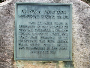
Plaque displayed on a boulder at the beginning of the Grandma Gatewood Trail
Not far from the office begins the Grandma Gatewood Memorial Hiking Trail. Emma Gatewood was an avid hiker. She was the first woman to hike the Appalachian Trail end to end in one season—and she was 67 at the time! Being one of the founders of the Buckeye Trail, she is a legend among BT hikers.
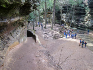
A view of Old Man’s Cave from the Buckeye Trail
The park has other trails besides Grandma Gatewood. Ours was marked well with blue blazes. We were enjoying the trail’s variety: massive rock formations, numerous waterfalls, stone steps, caves, tunnels, and bridges. I remember at one point seeing a post with a BT emblem at the top. Lower, indented arrows that may have been painted at one time now blended in with the post. I didn’t pay much attention. I just followed CW across an awesome stone bridge that bid me over to explore more magnificent rocks.
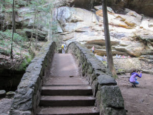
The bridge to lostness
After a while we realized we hadn’t been seeing blazes. And the you-are-here maps along the paths indicated that we weren’t where we wanted to be. With those maps, my printed BT map, and CW’s digital map, we finally managed to reach . . . the beginning of the Grandma Gatewood Trail. Yes, we were back at the beginning. After 40 minutes of being on the wrong trail, we found where we went wrong. We shouldn’t have crossed that beautiful stone bridge. And I should have looked closer at the arrows on that post.
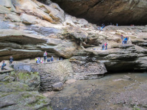
A view of Old Man’s Cave NOT from the Buckeye Trail
We caught up with George and Richard about an hour and a half later at the picnic area near Cedar Falls. They had been calmly waiting and enjoying a nice break for an hour and ten minutes. All CW and I got was a bathroom break. We had to pass on a short side trip to see the falls. We had 2.7 miles yet to go.
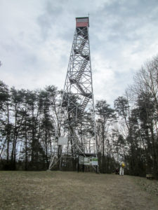
Unused Ash Cave fire tower in Hocking State Forest
The trail followed a service road, then a footpath. Some of the trail was steep and I lagged behind. CW dropped back with me. We caught up with the other guys after a mile. George was at the top of the Ash Cave fire tower, which is 80’ tall. The tower was built in 1934, one of 39 built in Ohio between 1922 and 1970. Their use was discontinued in 1978 due to changes in land use and advances in air detection of forest fires. CW and I didn’t want to hold the others up, so we didn’t climb.
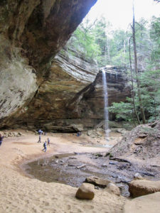
Ash Cave
Another service road and footpath led to Ash Cave, the largest stone recess in Ohio. It is 700’ across and 90’ high. Its name comes from the layers of ashes that still covered the floor in the late 1800s. Different theories exist about where the ashes came from. My favorite is that they were the remains of numerous campfires used by Native Americans who lived in the shelter for centuries.
We reached the Ash Cave parking lot just after 4:00 p.m. Richard went home. The rest of us decided to hike the two miles right before where we had started this morning. It was all on quiet roads with few private residences and several vacation houses. We finished in 45 minutes at 5:30. George headed home.
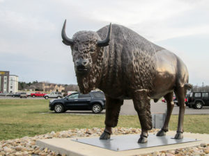
Lawn ornament outside the Hungry Buffalo in Logan
CW and I have a plan brewing for tomorrow, so we found a motel for the night in Logan. Then we ate supper at the Hungry Buffalo. CW had a Caesar salad with grilled chicken. I decided on the Buffalo Blend Burger, which was bison, beef, and pork. CW wasn’t crazy about the chicken, but my burger was great. We followed our meal with ice cream from Dairy Queen. Mine was a mini Mint Oreo Blizzard.
Day 2 (Friday): parking area for Ash Cave to Hopewell Chestnut Grove Church (5.1 trail miles)
After eating breakfast at the motel and checking out, we drove to where we ended yesterday’s hike with Richard and George. We had 5.1 miles to do that no one is scheduled to hike with us. In spite of having only one car, it would work out great since CW has already hiked this piece twice. It was all on back roads, so I would walk while he leapfrogged the car, walking back sometimes to walk a bit with me.
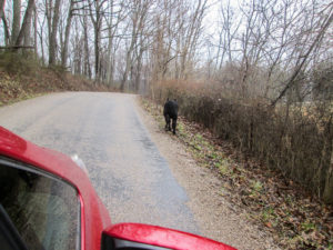
A young cow running from the big red car
We drove the trail to where I would start. It’s always nice to check out the trail, but CW also wanted to look for potentially dangerous dogs. We didn’t see any, but a young cow and bull were wandering in the road. The cow ran ahead of our car. She seemed anxious to find a way back to her friends inside the fence.
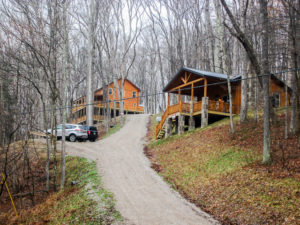
Rental cabins were plentiful
I expected to be hiking in rain, but by the time I began at 9:20, there was only an intermittent drizzle. I wore my poncho just in case and left my backpack in the car. For the first mile and a half, there were no houses. This is the Ash Cave region, though, so I saw numerous rental cabins.
I looked off into a forested area beside the road. Though spring has come on the calendar, we’ve seen few signs in nature beyond some patches of sunny daffodils. Deep in the still, brown brush, movement caught my eye. Several white tails were bobbing like handkerchiefs being tugged by invisible strings. I watched, smiling, until they all frolicked out of sight.
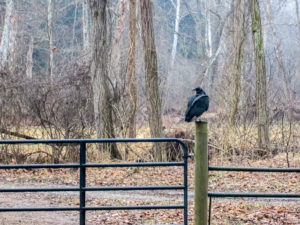
Large black bird on a fence post
My next wildlife encounter was with a big black bird sitting on a fence post. I snapped pictures until he flew away. I don’t know my fowl and I couldn’t get close enough to get a good picture to help me identify it later.
The rain appeared to have stopped. When I reached the car, I exchanged the poncho for my rain jacket. That gave me easier access to my camera and notebook.
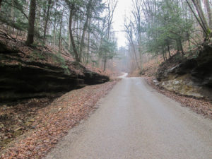
Many rock outcroppings lined the winding roads
Eventually I began seeing a few houses, trailers, and farms spread out. CW was with me when we reached the location of the escaped bovines. The road was clear, so I guess they had all been rounded up.
Hiking alone again, I enjoyed the quiet of a stretch of road sandwiched between forest. A stream ran beside the road. All I heard were my boots softly crunching on the small gravel at the road’s edge and the stream rippling.
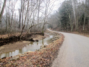
A rippling stream beside the road
On another road a small pudgy dog came out in the street barking at me. His hackles were up and he came quite close, but I kept my hiking stick in his face. He didn’t look as though he was going to eat me, so I wasn’t concerned. Then a lady came out of the house and called him back.
CW joined me and we met a lady at her mailbox. She has lived on that road all her life and told us she would never want to live anywhere else. Until today she didn’t know she lived on the Buckeye Trail. Her extended family owns several properties on the road, including the one we would soon pass with the smiley face satellite dish.
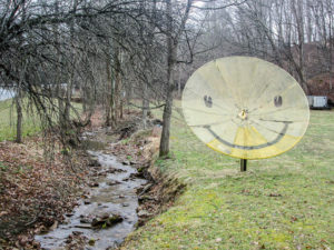
Even the satellite dish is happy living on this road
I was alone again when I heard loud and constant barking ahead. CW must not have heard or seen the dogs or he would have been close by. Suddenly I saw a tiny Chihuahua galloping down the road toward me as fast as his little legs would move. I quickly wondered if I should get out my dog spray. Or my camera. But I didn’t have time for either. As he approached, his nails scratching on the pavement, he looked at me without slowing down and zoomed past. I just had to laugh as I watched him turn into a yard and disappear. I assumed the big dogs had scared him home to safety.
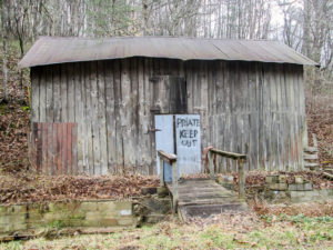
Squirrels can’t spell
When I reached the noise, I found it was coming from some dogs chained up by an outbuilding far back from the road. More barking came from inside the house. I guess the little guy hadn’t stuck around to see how safe he was.
A little farther, I saw an old building that looked abandoned—by people, that is. I watched a squirrel make his way to an entrance under the eave and disappear inside. Maybe it’s a squirrel hotel. From the sign on the door, I learned that squirrels can’t spell.
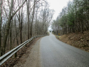
The last climb of the day
My last half mile or so was uphill. I was about to stop for a rest, but I saw the church ahead where I knew CW would be waiting for me. I finished by 11:30 and we started for home. We’ll spend a couple of days there before returning to the trail.
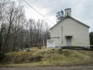
Hopewell Chestnut Grove Church
In Londonderry, we stopped at Family Donut Shoppe where CW always stops for a donut. I went in to see what ice cream they might have. CW focuses so much on the donuts that he didn’t know they have sandwiches and soups too. We stayed for lunch and had chicken salad sandwiches with potato soup.
The dining area is small. About a dozen stools sit in front of two counters, one facing the back of the room and the other facing out the front window. Several people were in and out while we were there. Everyone joins in everyone else’s conversations. It’s a friendly down-home atmosphere.

The original Chocolate Cake Donut Delight Inverted Sundae
After lunch, CW broke down and got his donut. He thought he’d talked himself out of it, but we were sitting at the counter that faced the donut cases. My choices of ice cream are not as plentiful as when I began this journey. With the help of the waitress, we made up a Chocolate Cake Donut Delight Inverted Sundae. Delicious!
Day 3 (Monday): West Trailhead for Boch Hollow State Nature Preserve to hamlet of Enterprise (10.9 trail miles)
We drove up to Xenia last night to use it for our home base this week. Even though we have no Sugar to drop off, we wanted to stop in at Docton Animal Clinic one more time. We always took some snacks for the staff, so this morning we delivered an Easter basket that included a thank-you note from Sugar.

Our last thank-you basket for the staff of Docton Animal Clinic
We have planned three days of hiking followed by a zero day. Someone will be hiking with us each day, so we drove only one car. Today we were scheduled to meet Jake at 10:00 a.m. at the Park & Ride in Enterprise to hike in the Old Man’s Cave section. We were all there by 9:30.
Jake needed to hike from Pt. 1 to Pt. 9, and Pt. 9 is right beside the Park & Ride. Since CW and I will be hiking between Points 8 and 9 with someone else later in the week, Jake drove up to Pt. 8 and walked back to us, sparing us from doing that mile twice. Then we all shuttled up to Pt. 1.
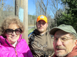
Me, Jake, and CW
Two days ago, CW got very ill. He thinks it was food poisoning. Today he’s much better but still feeling weak. Jake and I began walking the first 6.7 road miles at 10:30 while CW stayed in the car. (He’s already done these miles twice.) He drove ahead a ways and waited for us. When we caught up to him, he drove ahead again. He used his waiting time to work on his Sunday morning devotional for TrailFest next month.
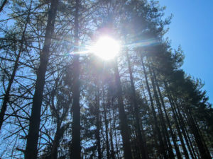
Cloudless blue sky through the treetops
We kept surprising CW by how quickly we reached him. It was no surprise to me. Jake is a fast hiker. If three are hiking, the other two can go ahead and I can lag behind. But with only two, I feel obligated to keep up. And that’s a good thing. It’s a challenge. So I got a good workout.
It was a great day for hiking, going from chilly in the morning to the high 40s by the time we finished. I looked for my clouds but there were none to see today. I didn’t mind though. The sky was brilliant azure, especially lovely showing through the treetops.
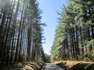
Road cut through pine trees
We traveled paved roads that rolled through quiet countryside. Houses were few. Rental cabins were more plentiful, nestled into the woods. The ascents were not too difficult, though some did go on longer than expected. Jake called them false summits. It looks like you’re coming to the top of the hill and will soon be headed down the other side. But when you get there, you see it continues climbing.
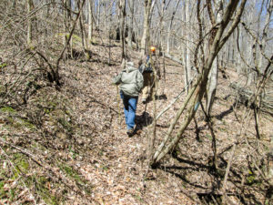
One of the steep hills through private property
At the end of the 6.7 miles, CW was waiting for us. He joined us for the rest of the hike. The Buckeye Trail left the road and followed footpaths through wooded hills for 1.5 miles. The hills were steep and slowed me down, which was okay since CW could keep up with Jake. The map directed us to stay on the trails since we were on private property.
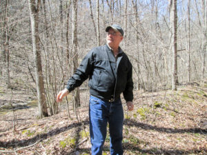
Richard hid in the woods to surprise us
When we were more than halfway through the property, Richard emerged from the woods, startling me. He had texted Jake a bit earlier, asking if he was hiking. Jake replied that he was, not knowing that Richard was close by. Richard knew our schedule and figured we would be in the wooded area, so he came in from the other direction, hid behind a pine tree, and waited.
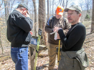
Signing a trail register at the end of the wooded section
We finished the wooded piece together. The doctor who owns the land came out and talked with us a while. We all thanked him for allowing the Buckeye Trail to wind through his property. He told me a permanent easement allows the BT to use those trails for an unlimited time.
Richard’s mother was waiting in his truck. They were on their way to an antique mall in Logan. They rode off, and we began walking.
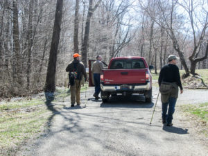
Richard running interference against possible dog trouble
We knew of a dog a short distance ahead that has a habit of coming out in the road and barking at passers-by. Richard had recently had an encounter with it in which he had to use his dog spray. When we reached that spot, Richard was there. He had parked his truck in the middle of the road and was talking to the dog’s owner who was sitting on his porch. The dog was barking but didn’t seem interested in leaving his owner’s side. We were grateful for Richard running interference.
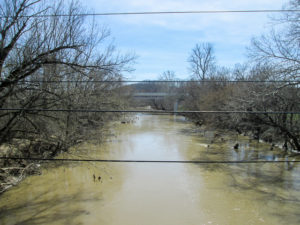
View of Hocking River as we entered Enterprise
After another couple of miles, we crossed over the Hocking River into the hamlet of Enterprise. The trail joined the sidewalk and led to the church where Jake had parked. We had completed our miles for the day.
For Jake, it was especially fulfilling. He is now finished with the Old Man’s Cave section. He has hiked over 1,000 miles of the BT and is working to fill in the gaps around the state. We were happy to help with one of them and share in his completion of a section.
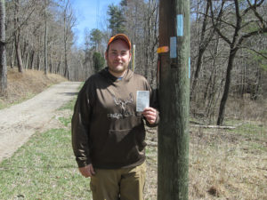
Jake completed Old Man’s Cave section
Jake shuttled us to our car, then took off for home. We checked into our motel before meeting Richard and his mother at The Olde Dutch Restaurant next door. The buffet was excellent. Conveniently, their desserts included ice cream. I had Peanut Butter Moosetracks. It went well with my chocolate pie.
Day 4 (Tuesday): Tecumseh Lake in Shawnee to the BT exit from Wayne National Forest on T305 (11.7 trail miles)
Richard is hiking with us today and tomorrow. We’ll be hiking the last 25 miles in the New Straitsville section that CW and I weren’t able to complete last fall. Richard plans to finish his second time around the Buckeye Trail this year, but these New Straitsville miles will help him on his future plan for a third time around.
We met Richard at a pull-off on T305 at the edge of the Wayne National Forest. The BT has recently been rerouted there, adding more mileage through the woods and moving the trail close to a new shelter for backpackers.
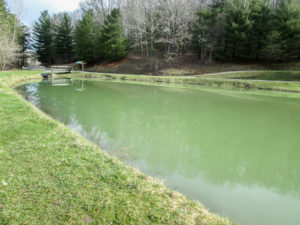
Tecumseh Lake in Shawnee, Ohio
We left a vehicle and shuttled to the town of Shawnee where we made a stop at the BTA office. Richard purchased the latest New Straitsville map. A couple of reroutes and some changes in mileage from point to point have been made since the previous map was printed about five years ago. George, one of the AmeriCorps volunteers, was at the office, and we talked with him a while. We first met him and the other AmeriCorps volunteer, Ryan, when we were hiking in this area last fall. As we were leaving today, Ryan arrived and we exchanged quick greetings.
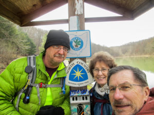
Richard, me, and CW starting out from Tecumseh Lake
We drove to Tecumseh Lake at the edge of town. It is a shallow 13-acre recreational lake that was constructed in 1952. We began hiking from there just after 9:30 a.m. The 11.7 miles today were through Wayne National Forest, so a long day was ahead of us. When we hiked to Shawnee last fall, it was rainy and we got lost in this forest. Today, we had beautiful weather. It was dry and sunny. A chilly start warmed to the mid-50s.
After one of our first road crossings, we had to make our way across a ditch filled with water. That isn’t unusual. I took my time and carefully placed each step to make sure I wouldn’t lose my footing. The guys hopped over quickly.
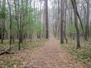
A pine-scented trail
As I started up a narrow dirt path with an even narrower rut in the middle, I heard CW behind me saying, “Girls take their time crossing things while guys just stumble their way forward. That’s why girls don’t fall.” Just then I fell sideways into the V-shaped rut. It was like slow motion. As I went down I thought, Now I won’t get around the BT with only one fall.
I’d had a goal of not falling on the BT but had to give that up when I tripped on an invisible root on the trail last fall. However, I was still going for no more falls. But now I might as well forget about it and just enjoy the earthy bonding experience.
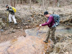
CW and Richard crossing Rock Run, a tributary of Monday Creek
Most streams we encountered were not difficult to cross. Rock Run, a tributary of Monday Creek, was a bit tricky if we wanted to stay dry. But the worst one came a little later. It was at least 15 feet wide with nothing to step on. When we couldn’t locate a better spot in either direction to cross, we carried some small logs from the forest floor and plopped them in the water between our bank and a small island of raised gravel. That got us to the island.
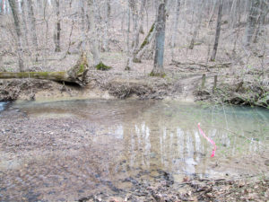
The worst water crossing of the day
Then we tried to reposition the logs on the other side of the gravel where the water was deeper and there was a greater distance to the bank. One log stayed in place but we watched the others, one by one, drift away in the fast current. There was nothing to do then but walk through the water. The guys got wet feet. I walked to the end of the log and then tiptoed quickly to the bank to keep the water from getting to the top of my boots. My water proofing is still working well, so my feet stayed dry. I might have resigned myself to falling on the trail, but I haven’t yet given up on making it around the BT with dry feet.
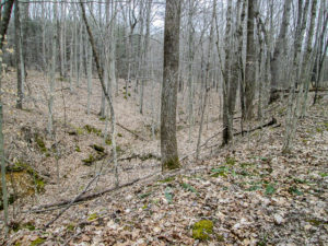
We could see a long distance through the woods
Some of the climbs were challenging, but many of the paths gently undulated. The woods have a very open feeling. A few trees are beginning to bud, but the only green right now is that of the pine trees and patches of ground pine.
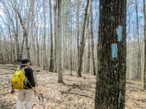
Another turn blaze
According to the BT map description, our last four miles would “meander aimlessly” through strip mined lands. To reinforce that, the map drawing looks like a child scribbled the trail. But all 572 turns (I didn’t count them so that might be an exaggeration) were well marked. The trails all day were blazed sufficiently and they were wide enough to be quite comfortable. This was an enjoyable section of the Wayne National Forest.
We finished at 3:50 p.m. After taking us to our car, Richard returned home. We returned to The Olde Dutch Restaurant. It was so good last night that we had to repeat the experience. For dessert I couldn’t resist the chocolate cheesecake. But I can’t ignore my ice cream, so I also ate some lemon sorbet. I know it isn’t technically ice cream, but it falls into my ice cream category.
Day 5 (Wednesday): BT exit from Wayne National Forest on T305 to West Trailhead for Boch Hollow State Nature Preserve (13.1 trail miles)
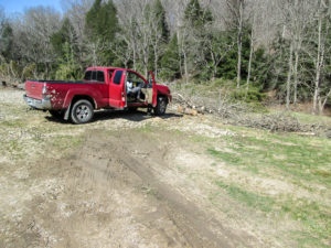
West Trailhead for Boch Hollow State Nature Preserve is a work in progress
We met Richard for the second day, this time at the West Trailhead for Boch Hollow State Nature Preserve. This spot ends the New Straitsville section and begins the Old Man’s Cave section. It’s also where we began hiking with Jake Monday. The trailhead doesn’t look like much yet. The state has sawed down a lot of trees that still lie where they were cut, and stakes decorate the area marking where work will yet be done. Vehicles have a place to park though, so it worked for us.
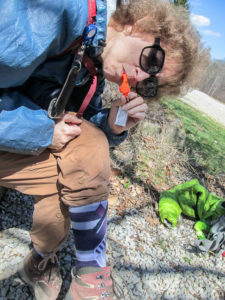
Tired but happy with my new socks and whistle, gifts from my friend Dolores
Three sick, recovering, or tired hikers had a 13.1 mile day ahead of them. Richard was sick yesterday while he was hiking, and he’s still sick today. CW isn’t convinced that Richard really needs these miles on the BT; he thinks he may just be hiking it to be nice and help us out. CW hiked nearly 12 miles in the woods yesterday, still recovering from being sick. This morning, he continued to feel weak. I’ve gotten little sleep the past two nights due to writing my blog drafts.
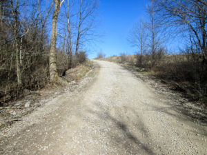
Love the contrast of white road and blue sky
The first nine miles were on roads, so we drove that part of the trail to where we ended yesterday at Wayne National Forest. We began hiking at 9:30 a.m. It was another dry, sunny, crisp morning that would warm up to the high 50s.
Some of the backroads were steep. I think we were all feeling it at times. But I could enjoy the hills when they climbed into the cloudless blue sky.
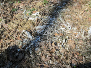
Coyote bones beside the road
We saw few people. An occasional dog owner came out to shush her noisy dog. One man working in his yard asked if we were hiking the Buckeye Trail and chatted a bit. As we left, he cautioned us to watch for coyotes. Gulp.
Later, Richard found a pile of coyote bones on the other side of a guard rail. He knew exactly where to look because when he was through here a year ago, he had seen four dead coyotes in that spot.
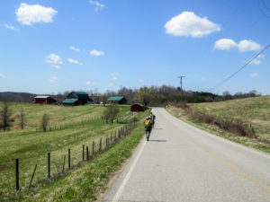
Clouds appeared in the afternoon sky
By noon, clouds were beginning to float across the sky. It was a beautiful sight as we passed through miles of farm land.
A sign on the opposite side of the road caught my eye. The metal frame was stuck in the ground loosely and was flapping in the wind. It didn’t look like a typical printed sign so I went over for a closer look. It was a poster about a lost kitty, but instead of the usual photo there was a hand-drawn picture of the cat by a young child. It was too precious.
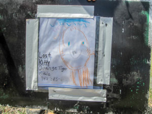
A lovingly made poster for a lost kitty
We reached the East Trailhead for Boch Hollow State Nature Preserve at 1:15. We rested on some rocks and ate our lunch. Our road miles were completed for the day. The BT used to go around Boch Hollow, but two and a half years ago it was rerouted through the preserve.
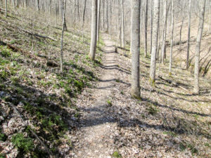
A long, steep hill to start us off through Boch Hollow State Nature Preserve
Boch Hollow’s 607 acres contain woods, wetlands, and geologic features. It has seven miles of trails. The BT uses 4.2 miles of them. My notes said the BT undulates over three ridges. That was daunting to me.
We started right off with a steep climb that went on and on. I had to stop and catch my breath at intervals. I had anticipated the ruggedness of the ascents. But I was to discover that much of the trail gently rolled or descended. It was great.
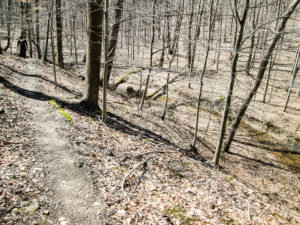
Narrow hillside trail above a valley
Some of the paths were narrow and were cut into hillsides. They were either bare dirt or covered with leaves. Today they were fun because it was dry, but I’m sure they are treacherous under wet conditions.
We saw many rock formations, both beside the trail and in the distance. There were waterfalls as
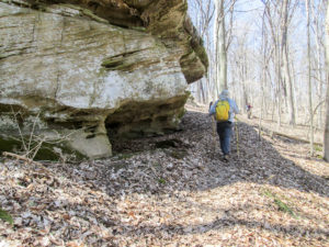
Rock overhang was inviting me in for a nap
well. It reminded me of the Old Man’s Cave section. We had been climbing for a while when we came to one particular rock overhang right next to the trail. It looked like a perfect place to crawl in and take a nap on a bed of leaves. I don’t like to lie on the ground at all, so that tells you how tired I was.
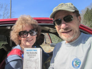
We finished the New Straitsville section
Location maps are placed along the trail every few tenths of a mile. I always like that because I can see my progress in little bits. It seems to lessen the difficulty of the hike for me.
We finished at 4:00 p.m. We had hiked over 13 miles in 6.5 hours. Not bad at all for three hikers physically below par. CW and I are now finished with the New Straitsville section of the BT. Only five and a half sections remain.
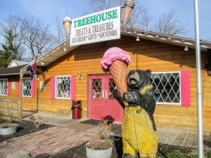
Treehouse Treats & Treasures in Logan
We stopped back in Logan on our way to Xenia. No, we didn’t visit The Olde Dutch Restaurant again. But Monday I had seen an ice cream shop next to the restaurant and wanted to go there. Today was the day. The Treehouse Treats & Treasures had only about a dozen ice cream selections, but we both loved what we got. I got a scoop of Coconut Almond Chip with real flakes of coconut, homemade chocolate chips, and clusters of roasted almonds. Yum!
Day 6 (Friday): Enterprise to Hocking State Forest parking area on Kreashbaum Road (11.7 trail miles)
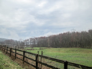
An overcast day
After a day away from the trail, we were back today in the Old Man’s Cave section. Today and tomorrow, Jay is scheduled to hike with us. CW recently met Jay on a BT circuit hike. Those are weekend hikes that occur once a month. Jay joined the circuit group several months ago and will hit 200 miles tomorrow. These two days with us will fill in the gaps he has.
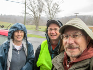
Me, Jay, and CW starting out in a drizzle
Yesterday the weather prediction for today was a lot of rain. Overnight we had heavy rain and the forecast changed to rain ending mid-morning. By the time we met Jay at 9:00 a.m., it was only sprinkling. The sky would remain overcast all day, blanketing us with light shades of gray.
We shuttled to the church in Enterprise and started hiking by 9:30. There was a nice mixture of road and off-road trails today. We began on a short stretch of busy highway, and we were glad for the wide berm. Then we were on to quieter roads.
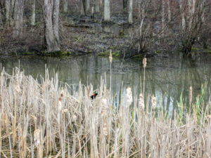
Red-winged blackbird sitting in cattails at the edge of Lake Logan
After 2.5 miles, we reached Lake Logan, a 400-acre lake in Lake Logan State Park. It was developed in 1955 for recreational purposes. The Buckeye Trail follows along the short northern edge of the lake. Red-winged blackbirds flitted around, playing among the cattails. The rain had completely stopped so we paused to pack our rain gear away.
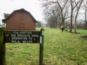
Bill Miller Trail
A short distance later, a section of the BT is named for Bill Miller, a founding member of the BTA and one of its former presidents. He, along with others including Grandma Gatewood, helped build the first 35-mile section of the BT in Hocking County.
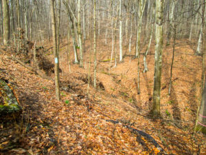
Beautiful hillside trail in forest around Lake Logan
The corridor on which the Bill Miller Trail is located provides the BT with permanent access to a beautiful forested area near Lake Logan. We encountered some of that narrow hillside trail like we did Wednesday. It wasn’t as slippery as I expected it to be after the rain. I just dug my sticks in good to keep from sliding down the hill.
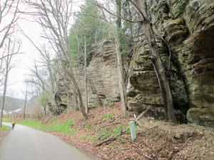
Towering rock outcroppings along the road
We had over 4.5 miles of road walking next. After three hours of hiking, Jay found a high grassy bank to sit on while we ate lunch, serenaded by the resident birds. Refreshed, we returned to the trail, which took us past a great many massive rock formations.
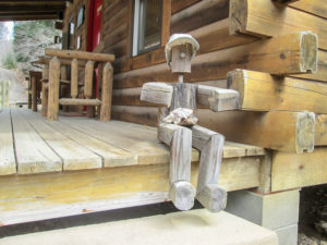
A guy sitting on the porch of the Buckeye Cabins office
We left the road for a half-mile-long footpath, much of it on mushy trail. The wet leaves were so thick that my boots sank several inches without touching the mud beneath them. Then we exited the woods for a short piece of road that passes by the office of Buckeye Cabins, vacation rentals in Hocking Hills. A guy was sitting on the porch, but we couldn’t tell if he was a worker taking a break or a customer waiting for the office to open. He “wooden” talk to us.
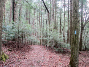
The woods were full of hemlocks
Our last 2.4 miles took us through a forested area. This is one of CW’s favorite parts of the BT, partially because it is plentiful with hemlocks. They look delicate and feathery from a distance, but the needles are sturdy to the touch.
The BT map says the trail has “minor undulations.” I think a few of them are steeper than that, but it is a great trail anyway. It meanders around ravines and crosses streams and gullies. We were supposed to ford Big Rocky Fork after two miles.
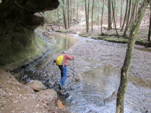
CW fording Big Rocky Fork
Every time we crossed a stream, I asked CW if it was Big Rocky Fork. The answer was always, “No, we haven’t gone far enough.” It seemed far enough to me. I was tired. But we finally reached it, and soon after that we finished our 11.7 miles. It was nearly 3:00 p.m. It had taken us 5.5 hours.
Jay went home. He will be back tomorrow for another day of hiking in the Old Man’s Cave section. We returned to Xenia. No motel tonight. But first, we stopped back at Treehouse Treats & Treasures. I got black cherry ice cream.
Day 7 (Saturday): Hopewell Chestnut Grove Church to Tar Hollow State Forest maintenance buildings (12.7 trail miles)
We were excited to have two hikers join us today. Jay was back in spite of discovering at the end of yesterday’s hike that more miles were planned for today than he thought. Someone (not me) had misread Jay’s text message about what he had left to do in the Old Man’s Cave section. So back on Day 2, CW and I stopped our hike a point too early.
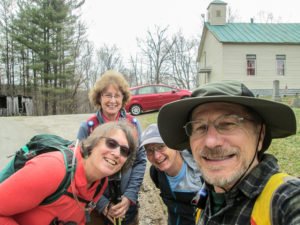
Ann, me, Jay, and CW pumped for the day’s hike
Our other hiker today was Ann. CW met her at the recent circuit hike where he met Jay. She has just begun hiking the Buckeye Trail and has done a few scattered pieces of it. She’s eager to hike with others when she can. Today we were the lucky ones because she didn’t have to work.
Perhaps the real reason Jay and Ann wanted to hike with us today was the meeting place. CW said we would be at the Family Donut Shoppe in Londonderry at 8:00 a.m. if anyone wanted to join us. Jay showed up. Ann came a little later, right after CW and I left. Then we all met at the trail meeting point.
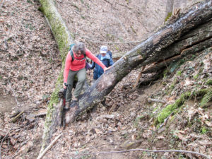
Ann and Jay climbing over an obstruction at a switchback
During our shuttle, we discussed the extra miles Jay didn’t need. CW and I said we could all hike the miles Jay did need first. Then someone could shuttle CW and me back past our car to the spot we needed to start and we’d walk those 4.5 miles by ourselves. Ann hadn’t done them yet and she was perfectly willing to hike them. And Jay insisted he didn’t mind hiking them again. So we all began at Hopewell Chestnut Grove Church by 9:25 a.m.
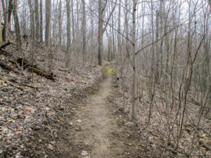
Recently benched trail in Pretty Run Preserve
After less than a mile on road, the trail entered Pretty Run Preserve, a 230-acre area owned by the BTA. They purchased 190 acres of it in January 2010 to permanently protect the trail corridor from development. In December 2012 they purchased 40 more.
The trail winds up and around ridges and crosses streams that feed into the North Branch of Pretty Run. The trail builders made great use of switchbacks. Portions of the hillside trail had been freshly benched, easily identified from the absence of leaves and the fresh cuts to level the path.
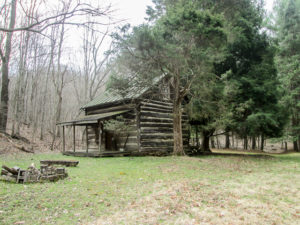
Back porch of the 1839 log cabin
At the bottom of a ridge, we followed a stream into a clearing and found a log cabin believed to have been built in 1839. We were enjoying the serene setting until two ATVs came roaring and bumping down the streambed. They were the first of many we would see today.
The cabin had a front and back porch. Inside were four bare wood bunks, a table and chairs, and a ladder to the loft. A woman must have been involved in this project because there were curtains at the windows.
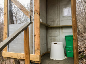
Moldering privy with sliding door open to the left
Farther down the trail, a shelter for backpackers sat in the trees to the left. Up the hill to the right was a privy. I didn’t walk up to check it out, but the guys said it was fancy. That, of course, is relative, but I guess for a privy it was.
This was a moldering privy, something new to me. It was elevated, with latticework covering the space beneath it. Steps led up to a sliding door. I was impressed with the sliding feature, but not so much with the top half of the door being clear glass. Even though it didn’t face the trail, the privy wasn’t so private. Beside the toilet sat bins of wood chips. A handful is to be thrown in after each use to prevent the pile from compacting too tightly and to provide carbon needed for proper composting.
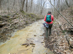
Ann navigating the Buckeye Trail on a four-wheel drive road in a creek bed
We exited Pretty Run Preserve, and soon reentered forest on a four-wheel drive road that climbed steadily for a mile, alternating between a creek bed and a muddy path. The following quarter mile, we climbed more steeply. It was extremely rocky. In many places, mud was unavoidable. I just stepped where it looked like I wouldn’t sink as deeply.
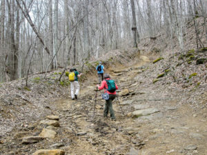
A steep, rocky incline
CW and I were behind the others when two big jeeps came down the road. We had to climb up onto the bank because they were as wide as the road. As strenuous as it was to get to the top of that ridge, I would rather have been walking than riding. The occupants took a terrible beating as those vehicles pounded over the rocks.
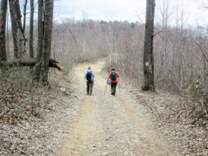
Jay and Ann descending from the ridge
It was after noon when we reached the top. We took our lunch break before descending the other side. I was relieved not only because we were going down but also because the trail was dirt rather than mud and gravel rather than rocks.
Once in a while, we’d hear the roar of ATVs in the distance. It’s big sport in the hills. They go anywhere they find a drivable trail, even if it’s on private property with signs posted to keep out motorized vehicles. We hadn’t seen anyone since the two jeeps over an hour before. Then all of a sudden, three ATVs came toward us. They slowed to a crawl. We gave them lots of room. As soon as they passed us, they had to pull over to let a Hummer come through from the other direction.
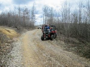
Three ATVs pull over to let a Hummer pass
Eventually we reached real roads. Right after we saw a string of a dozen ATVs, a caravan of jeeps passed us, out cruising on a nice day. We took a short break around 2:00 p.m. at a little church building. There was a privy on the property. It wasn’t fancy, but it was usable.
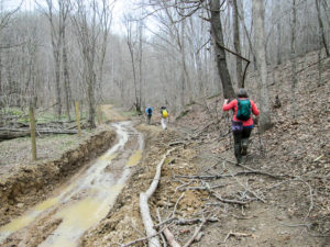
Ann climbing on a muddy haul road
Two miles later, we were on a haul road, once again ascending and navigating around ruts, rocks, and mud. Maybe what got us up the hills today was bean soup. At Family Donut Shoppe this morning, the waitress said there would be bean soup today. Bean soup was mentioned often throughout the day, beginning with our first climb. All of us decided we would make a beeline for the donut shop if we conquered the hills.
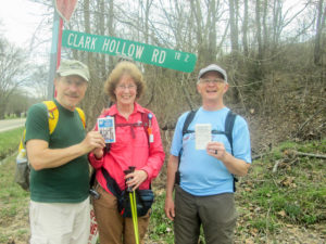
CW, me, and Jay with Old Man’s Cave completed
Another rugged descent and a short bit of road took us to the end of the Old Man’s Cave section. Jay, CW, and I were now finished with this section. One more map to file away. But we still had about a half mile to go into the Scioto Trail section to reach the cars—and the bean soup. We finished hiking at 3:45. We’d covered 12.7 miles.
We gathered up the cars and met at Family Donut Shoppe. The bean soup must have been really good. They didn’t have any left. We had to settle for chili. I got my ice cream there, a butterscotch sundae with whipped cream and nuts.
What a great beginning to our spring hike on the BT. The weather has been perfect—a couple of sprinkles but otherwise dry with moderate temperatures. We finished the New Straitsville section and walked the entire Old Man’s Cave section, adding 76.4 miles on the BT. Only five sections remain. We haven’t had to drive two cars yet. And that’s because of the best aspect of the hike: sharing the trail with friends. We’ve enjoyed time spent with old friends like George, Richard, and Jake. It’s also been so much fun meeting new friends like Jay and Ann. I can’t wait to see what adventures await us in Scioto Trail. I hope you’ll be back to see as well.
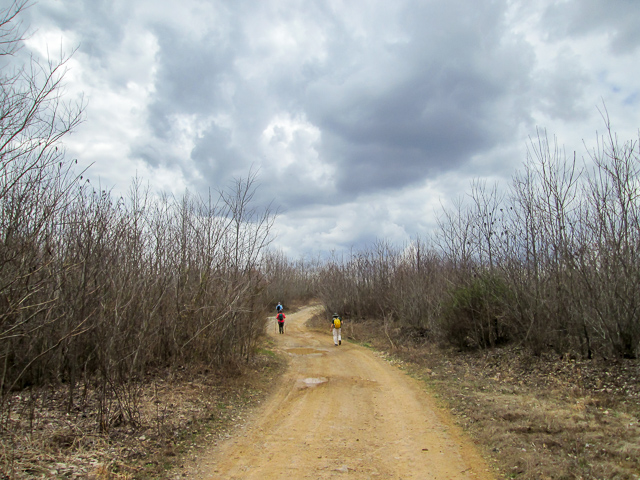
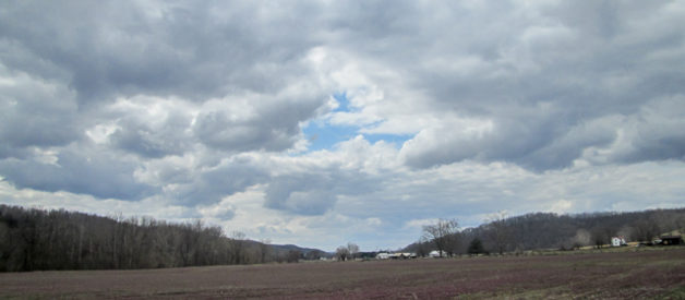
And one more cloud picture from Cloud Gazer as we head home for a break


sharkbytes
April 9, 2019Sorry about Sugar, but it sounds like she had a good long life. And congrats on the trail name. I just don’t have one. I have my one nickname for life, Sharkey, and I just don’t need something different for the trail 😀
CW Spencer
April 9, 2019One good name is enough, and you have a good one. Multiple names might lead to multiple personalities—and that wouldn’t be good.
Bonnie