by guest blogger Bonnie Spencer
May 4, 2019
CW and I are back to hike the Sinking Spring section of the Buckeye Trail. We just finished Scioto Trail Thursday. I’m used to having up to a week between sections. That gives me time to get a blog posted and catch my breath. This time, though, the most I could hope for was three days because we need to get the rest of our hike completed next week. Friday evening CW looked at the 10-day forecast and saw that next week will be warm and wet, but this Saturday would be cool and dry.
We had an agonizing decision. We didn’t want to pass up good weather, but hiking Saturday would give me only one day in between—and it was already gone. I hadn’t done laundry, I hadn’t had a chance to look at the Sinking Spring map to prepare myself, we hadn’t arranged for leaving our second car in the area so that we could drive only one car back and forth each day, we didn’t have time to get our hiking food that was in Xenia, and I desperately needed sleep. Still, that cooler weather was calling me. And I had miraculously finished my blog for Part Two before we left for Bible study Friday night.
When we got home, I threw a load of hiking clothes in the washer, read through the map, made sure my hiking stuff was ready to go, and dropped into bed.
Day 14 (Saturday): Pike Lake State Park to Kincaid State Fish Hatchery in Latham (9.7 trail miles + 0.25 miles off trail)

Captain Avenza powering up for the day
We left the house later than usual, expecting to begin hiking a little later as well. It would be more than a little, though. We made a detour to Butler Springs Christian Camp, which is very close to where Monday’s hike will end. The camp is Buckeye Trail friendly. CW and some other hikers stayed there in a dorm several weeks ago during a hike. We hoped to get permission to leave a car in their lot for a few days. A staff member tried to help CW find Chris, the retreat coordinator, but didn’t locate him. We would have to try again at the end of our day.
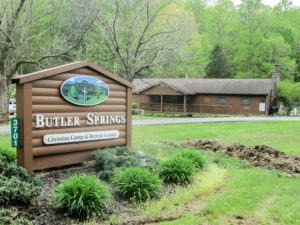
Butler Springs Christian Camp
By the time we got our cars in place and began hiking, it was 11:05 a.m. The sun was shining as we walked down the road away from Pike Lake Dam and out of Pike Lake State Park. It was cool, in the 50s and 60s today, so the sun didn’t bother us. After a half mile, we entered the forest and enjoyed considerable shade thanks to the canopy that was filling in. All the wooded area we were in today was part of Pike State Forest.
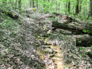
The Buckeye Trail on a steep eroded service road
I had read in the BT section map of the steep hills for today, and CW had also warned me of them. But lately I’ve realized the situation is never as bad as I’ve built it up in my mind to be, so I decided not to be concerned about it. It was a good decision.
I’ve been climbing these hills for a few weeks now, and most of today’s hills were just hills. Even a steep, rocky eroded service road didn’t bother me. Only one particularly steep ascent was difficult, but it was later in the day after I’d grown weary.
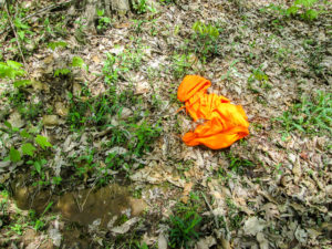
A hunter lost his battle with the morels?
We were enjoying the quietness of the woods with only an occasional conversation among the birds when out of the stillness came the sound of gunfire in the distance—a lot all at once. Remembering back to the camouflage hunters with the morels last week (see Part Two), CW said we were hearing The Battle for Morel Hill. I thought it might be morel target practice.
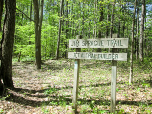
Jim Sprague Trail in Pike State Forest
Then we came upon an orange hoodie lying in the trail. CW said the hunter had lost the fight and was eaten by the morels. This is how we amuse ourselves.
Two miles of Buckeye Trail through Pike State Forest is designated as the Jim Sprague Trail. Jim has given countless volunteer hours to the BTA. In 1990, he organized the Buckeye Trail Crew that travels to various parts of the BT to build new trail.
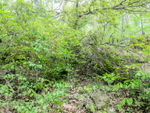
“Hmm. The trail must be under that tree.”
The trail today was an obstacle course, which is great because I love obstacle courses. There was an array of downed trees to step over, climb over, limbo under, or navigate around. The root system of one fallen tree had taken part of the trail. Close by was the top of a tree, still full and green, hiding any trace of a path. It took us a while to get around that one because the only place to go was down a three-foot drop-off.
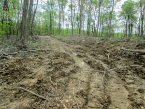
A muddy bridle trail in Pike State Forest
We contended with a considerable amount of muddy trail. I was constantly doing a dance to step in the right places to minimize the damage to my boots. On one hillside, I thought I was going over because of a patch of bare slippery mud with no oasis to provide footing. The safer solution was to use my hiking sticks to climb almost straight up the hill and around the mud. Those sticks were a lifesaver.
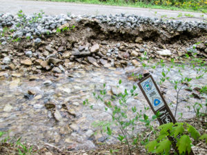
Swiftly flowing creek must be forded to reach the road
Added to our obstacles were quite a few creeks to ford. Some were simple; for others we had to put a bit of thought into our maneuvers. The last challenging crossing was a wide swiftly moving creek that ran along the side of a road. We had no choice but to cross it to get from the woods to the road. CW finally made it across, but he had to take a longer stride than I thought I could manage. I chose another place and threw in extra rocks to ensure dry feet.
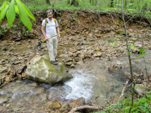
CW went downstream to find a place to ford this creek
The obstacles are fun, but missing blazes can be annoying. Twice today we got off the trail. At the first spot, I didn’t see blazes on either path at a fork. But I didn’t look very hard either. We should have walked a short way on each, but I decided to take the one that looked the most like what we were already on. It took us to a creek.
We didn’t see how to get across with dry feet, so we took quite a while to go through the woods downstream until we found a better place. We made it back to the trail and shortly realized we were not seeing any blue blazes. Back to the creek we went. It looked different from that bank and we saw how we could get across fairly easily. We crossed the second time and returned to the fork, taking the other path. It wasn’t long before we saw blue blazes—and they led us right back to the creek, about 100 feet below the first place we crossed. We crossed for the third time. It was too funny to not laugh at ourselves.
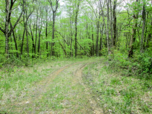
The wide trail we wanted to take—and mistakenly did
Our other mistake happened when we left a road to reenter the forest for the final time. We went around a gate and continued down a lovely service road on the other side. We discussed how wide it was and how we hoped it would be like this the rest of the way. Then our talk switched to “Where are the blazes?” CW checked his Avenza map and saw we were indeed off the trail. My fault again. My map clearly said the BT follows a footpath on the other side of the gate, not the service road. But it was so nice . . . and the footpath was barely visible.
We were on our last tenth of a mile when it began sprinkling. Later it would rain more heavily but we had gotten our good-weather day in. We finished at Kincaid State Fish Hatchery in Latham by 4:30 p.m. That’s better than we expected to do considering our late start, the missed blazes, and some time-eating obstacles. It had been a great decision to hike today.
We ate at West Side Diner nearby in Latham. Then we picked up the other car at Pike Lake Dam and returned to the camp. We found Chris who was happy to let us leave our car. On our way home, we stopped at Locust Grove Dairy Bar where I got a scoop of orange pineapple ice cream.
Day 15 (Monday): Kincaid State Fish Hatchery in Latham to Butler Springs Christian Camp (11.3 trail miles + 0.2 miles to car)
We were home less than 24 hours. We drove up to Xenia yesterday afternoon and left early from there this morning with plans for a long day of hiking. We were to meet George at the fish hatchery at 8:00 a.m. and hike over eleven rugged miles. CW and I were considering following that up with a few quick miles on roads. The reason for such torture was to reduce our four hiking days this week to three.
We got to the hatchery early, so we checked out Kincaid Creek nearby. The BT crosses it, but we had heard it was too high to ford. It did look too high—and swift—so we decided we would take a different route.
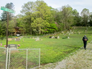
A detour through a cemetery
We began hiking a little after 8:00. Instead of following the road to Kincaid Creek, we took a detour Jim Gilkey recently used on his BT circuit hike. It went through a cemetery and then through the woods where we had a narrow path on a hillside for a bit. I moved slowly on the wet leaves. When the trail disappeared, so had the guys. With no blazes or trail, I had no idea which direction they’d gone. Should I pick a direction and take a chance it would lead me to them . . . or sit and wait and hope they noticed my absence before they reached the other side of the hill? Neither option sounded wise.
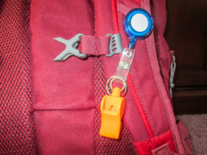
My handy-dandy, ear-piercing safety whistle
I knew CW couldn’t hear me if I yelled. All I could think to do was blow my Fox 40 Classic safety whistle that dangled conveniently from my backpack. I hadn’t used it since my friend Dolores gave it to me for Christmas. It’s only for emergencies. This situation definitely felt like an emergency. I blew it. It was piercing to my ears. Would they hear it? I blew it again. CW finally came back and found me.
With my directional problem solved, I immediately moved on to my next dilemma: how to get across a deep gulley with nearly vertical sides. It took me a long time, but it was accomplished with the help of my sticks, CW’s sticks (he was at the other end of them pulling me), and trees to hang onto. And we still had to walk uphill with no path before we got to the actual trail. After only a half hour, I was worn out.
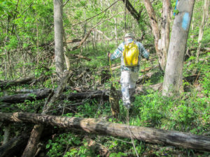
CW making his way through unmaintained trail
From there, the trail ascended steadily for a mile. Even many of the sections that weren’t steep were difficult because they were not maintained. They were covered with tree trunks and branches, large rocks, and snagging greenbrier. Some places were not blazed well. In all fairness, the section supervisor is relatively new and hasn’t had a chance to tackle it all yet. He also doesn’t have the volunteers he needs. He did tie some blue ribbons around trees for Jim’s circuit hike group, and they were helpful to us today. But for the first 2.5 miles, we averaged less than 1.5 miles per hour.
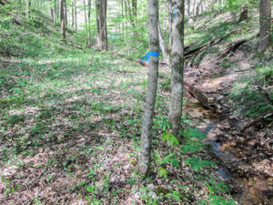
Blue ribbons helped where blazes were lacking
The day was sunny and hot. Temperatures reached the 70s in the afternoon. Even though cool breezes were with us much of the day, in the woods sweat dripped from me and the bugs were menacing.
There was enjoyable trail as well though. Some of it was wide without encroaching brush and brambles. Some gently undulated and was blazed well. Other parts of the trail joined pleasant country roads.
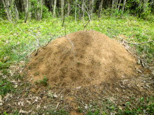
A huge anthill along a skid road
Many people have warned us about copperheads this time of year. We cautiously looked for them hiding in the leaves, always poking the ground beside fallen trees before we stepped over. George paused often to look for them sunning themselves on rocks, and he was disappointed that he didn’t see any. He would have even been happy seeing a black snake. I was happy not seeing any.
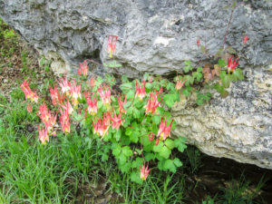
Red columbine growing in a rock formation on Bell Hollow Road
We had a humorous dog encounter today. Three large dogs on the porch of a house began barking before we got there. Two of them stayed on the porch and sent the third one out to deal with us. He went obediently, barking non-stop, and ran straight toward the pasture beside the house. He kept barking at the horses until CW said, “Hey, we’re over here.” He found us and ran over to escort us away. It seems I’m not the only one with directional problems.

Eastern tiger swallowtail butterflies
The redbuds and dogwoods are still blooming. The wildflowers still decorate the forest and roadsides. One special find today were red columbines growing all over a rock formation beside a road. On the same road, there were Eastern tiger swallowtail butterflies flitting all around. I’d given up on getting a photo of them, but then they began congregating on a driveway. They stayed long enough for me to snap a picture.
After the reprieve from the woods, we reentered them for the last stretch of our day’s hike by way of a footpath through private property. Immediately we encountered one of our steepest hills yet. It seemed never-ending. George took off and we caught up to him at the top after we made several stops on the way up.
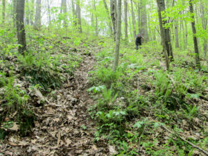
George staying ahead of us on one of our steepest hills
Then the trail entered Pike State Forest. It gently undulated a while until there was another huge ascent. The section map described one area of today’s hike as being “tortured terrain.” I would describe most of the forest portions as torturous terrain.
We made it to the end by 3:00 p.m. It had taken almost seven hours. It’s a good thing we started as early as we did.
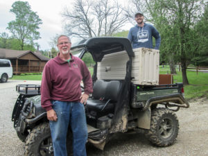
Keith, camp director, and Matt, programming director, at Butler Springs Christian Camp
Our hike ended on the road just up from Butler Springs Christian Camp. As we were standing by our car, two staff members drove up in a John Deere Gator and stopped to ask if we’d found any mushrooms. Everyone we’ve met along the trail this spring has asked us the same question. We had stumbled upon a large one growing in a path today. Keith and Matt were on their way to look for some. We had a nice conversation with them. Everyone we’ve met at the camp has been extremely friendly.
We returned to West Side Diner, this time with George. CW and I were still considering hiking more, but reshuttling would have made it very late. And we were both exhausted from the heat and terrain. CW would have done it if I wanted to, but when I finally decided I just wanted to go home, I think I saw him do a little happy dance.
We picked up the other car and then brought one back to the camp. On the way home, we stopped at UDF in Batavia for ice cream. Mine was white chocolate raspberry.
Day 16 (Tuesday): Butler Springs Christian Camp to Strait Creek Church on SR 41 (10.6 trail miles + 0.2 miles to car)
Like yesterday, we left our house in darkness to get an early start to our hike. Like yesterday, we were going to rack up the miles before the heat became unbearable. Like yesterday, we hoped to add some extra miles after we hiked our planned ones. And, like yesterday, our plans didn’t work out.
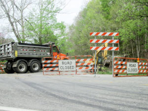
The bridge we needed to cross was closed
On the way to pick up the car we had left at the camp, we passed our finishing spot for today. It was a church just off SR 41 over a short bridge. The BT comes out of the woods on the other side of the road, crosses the bridge, and passes the church. We were going to park at the church. However, this morning barriers were up on both sides of the bridge closing the road.
CW wasn’t comfortable about parking on SR 41, so we did a lot of driving to see if we could still go around and park at the church. We could still walk across the bridge. Later when we came back out to SR 41, CW learned the bridge was going to be torn out today. The short story is that after getting the other car, we parked a car on SR 41 across from the bridge in tall grass. Heavy equipment was already on the scene. The road closing had delayed our starting time for over an hour and a half.
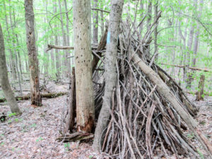
A hut in the woods above Butler Springs Christian Camp
It was past 9:30 a.m. when we finally began hiking from the camp. We had to walk a short distance to where the BT entered the woods on a footpath and climb to the ridge. It was already hot. The temperature was on its way to the high 70s. I thought it was going to be cloudy, but the sun was out most of the day. It was Act II of “Sweat and Bugs.” And even though the trails were in good condition for the most part, muddy spots kept me hopping from side to side to seek out the driest mud. The bugs kept up with me.
Nearly four miles of the BT goes through Fort Hill State Memorial, a 1,300-acre nature preserve. The preserve is home to some earthworks constructed by the Hopewell Indians (100 B.C.-A.D. 500). We didn’t take time to leave the trail to see them.
The trail took us through the parking lot. Where we started back into the woods, there was an “Exit only” sign. We weren’t sure what that meant, but it sounded as if the trail was one way. If so, we were hiking the “wrong” way, but we couldn’t change that. The trail was generally narrow as it meandered around the hillsides. CW said there are usually a lot of people on Fort Hill trails. I could see the wisdom of a one-way trail in high traffic; in many places there was nowhere to pass. We saw only one person today. We were all startled to meet. He was going in the “right” direction but was able to step off the trail to let us pass.
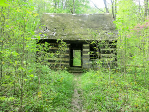
The Buckeye Trail goes through this rustic cabin in Fort Hill State Memorial
We would have enjoyed the trail more if there hadn’t been so many muddy stretches to slow us down. We had to step through them carefully because there was no way to go around them. Other than that, the trail was nice. Maps were posted along the path to show where we were. We listened to water rippling down Baker Fork and enjoyed the wildflowers. Various bridges and steps helped make the experience pleasant. Perhaps the most unique aspect of the trail was that it went through a rustic cabin that sat right on the path. The building is for backpackers and is empty except for two wooden benches.
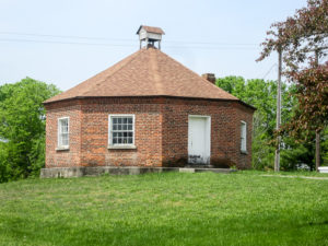
Octagonal Schoolhouse in Sinking Spring
We left the preserve and walked a mile and a half on roads into the village of Sinking Spring, passing the “Octagonal Schoolhouse” on the town square. It was built in 1831 and used as a school until 1844 when the school population grew too large for the space. It has served as a courthouse and a meeting place for various government and civic groups. During the Civil War, it was headquarters for the home guards.

Lunch break with a root beer float
The heat had exhausted me. We took a longer-than-usual lunch break at the Marathon and little grocery. We shared a chicken salad croissant from the deli and I got my ice cream for the day: a root beer float. I can’t remember the last time I had one. It was delicious and cooled me off before I returned to the heat.
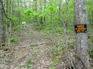
No blazes on the reroute—only an unwelcome sign
Outside of Sinking Spring we entered woods on private property. On the BTA website, a trail change from a year ago rerouted the entrance from a private drive to an ATV road. We couldn’t find any blazes for the reroute and were not sure we were on the trail, especially since a “No Trespassing Keep Out” sign was posted. We proceeded anyway, quietly so as to not stir up any dogs, and we eventually reached the blazed trail.
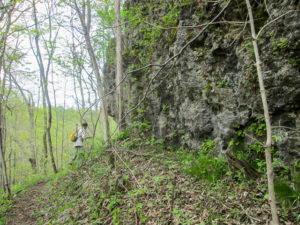
CW meandering around a dolomite cliff in Strait Creek Prairie Bluffs Nature Preserve
Our trail took us into Strait Creek Prairie Bluffs Nature Preserve. Its 1,200 acres have a high diversity of plants and ecosystems. There are 650 species of plants. The preserve includes a forested creek valley, dolomite cliffs, and prairie glades. I almost stepped on a morel right in the middle of a wooded path. That makes two we’ve seen in as many days. In a drier, rocky area we saw an abundance of Indian paintbrush.
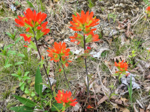
Indian paintbrush in Strait Creek Prairie Bluffs Nature Preserve
It was in the preserve that I met my waterloo—at Strait Creek. The water was wide. The water was deep. There weren’t enough rocks near the surface to get me to the other side. I saw a huge tree 100 feet down the creek lying bank to bank making a perfect bridge. I was sure I could get across it—if I could just get to it. I went part way through the trees on the hillside, but then it became too steep. I didn’t see how to get to my bridge so I went back. CW assessed the situation. Seeing no alternative, he took off wading and got soaked. I balked for a while. Then I started tiptoeing on the rocks I saw, hoping others would materialize as I went. CW stood close by in the cold water to stop me from going downstream if I fell in, he said. What a guy! If I got past him, I was to grab onto that tree trunk.
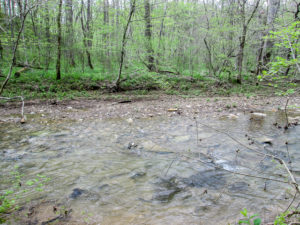
Strait Creek—my waterloo!
I finally had nowhere to step. While I kept looking, I slipped off a rock, stumbling all over to keep my balance. We both thought I was going down. Tree trunk, here I come. But I stayed upright and stood awkwardly on the rocks in the cold water that was over my boots. I hadn’t gotten around the BT without falling. Now I wouldn’t get around without getting wet feet. But I do have a new experience to add to my hiking resume.
For two more miles, we squished our way through the trees and arrived at our car by 4:30 p.m. The last worker was leaving the bridge site. The bridge was gone.
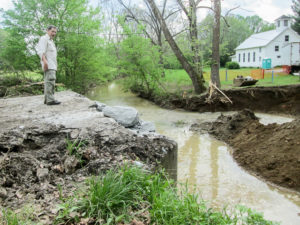
The bridge was gone at the end of the day
We were too tired and sloshy to try to do any extra miles. Reshuttling would have eaten up a lot of time because of the missing bridge. Now there would be no way to cut our days this week down to three. Our other car was back at the camp where we planned to leave it one more night, so we just went on home—after I changed into dry shoes and socks, which thankfully I’d remembered to put in the car.
Day 17 (Wednesday): Strait Creek Church on SR 41 to Peebles (14.5 trail miles)
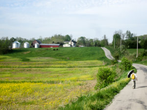
A long road-walking day
Since we have been unsuccessful in hiking extra miles so far, we planned a lot of miles for today. It won’t eliminate tomorrow, but it will shorten it. Our 14.5 miles today were all on roads, which is the reason we could do so many. Even when it’s hilly, we can average a good pace.
Again, shuttling took a long time. We had to go out of our way to pick up the car that was parked at the camp. And because the bridge by the church was out, we had extra driving to get a car around to the church where we began.
Some men were already at the work site when we arrived. A surveyor took time out to help CW find a place to park that would be out of the way. CW squeezed the car between the church and some trees where it was shaded all day.
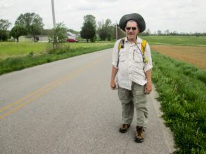
CW enjoying the breeze in his face
We didn’t start hiking till nearly 9:30 a.m. again. The coolest part of the day was gone. It was already sunny and hot and heading into the 80s. It would be an endurance test for me. A great help was the breeze that blew most of the day. Sometimes it was extremely strong, and it usually blew against us. I didn’t mind though. I gladly sacrificed a bit of speed for the heat being blown away.
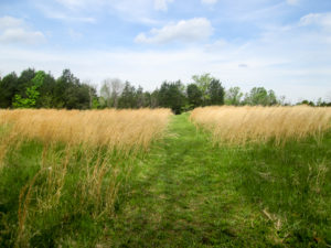
Mowed path through hayfield
We walked four miles before we saw a car on the road. A man stopped his truck to talk. He was a hiker and familiar with the Buckeye Trail. He had wanted to hike the Appalachian Trail sometime but thought he was too old now at 60—until he saw us. He said he didn’t know old people still hiked. No insult taken. We were glad to show him he’s not too old.
Today’s hike had only a short off-road portion. It went through a hayfield and cedar woods on private property. We were thrilled to see a wide path mowed through the field.
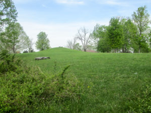
An Adena burial mound as we enter Serpent Mound Historical Site
From there we entered Serpent Mound Historical Site, passing by one of the Adena burial mounds. The site has three burial mounds in addition to the 1,348-foot Serpent Mound, the largest surviving example of a prehistoric effigy mound in the world. It costs to drive into the park, but BT hikers can roam around and see things for free. We didn’t though. We had many miles to go. After a short
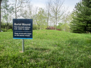
Fort Ancient burial mound in Serpent Mound Historical Site
rest at a shaded picnic table, we continued through the parking lot, passing a Fort Ancient burial mound, and followed the drive to SR 73.
Two miles farther, we were at a country church. We had been walking for three and a half hours and were over halfway to our destination. The welcome benches on the porch of the church provided a shady place to rest and snack.
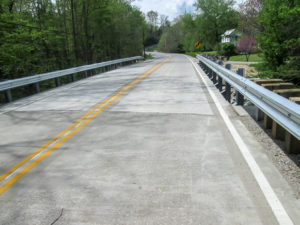
A new bridge where one had recently been washed away
After two more miles, we reached Old SR 32. According to a recent trail alert on the BTA website, a bridge had been washed away there and a detour was given for hikers. Yesterday we decided to check it out before we went home. A new bridge was there. If we had gone by the alert, we would have walked 1.7 miles less (which might not have been a bad idea considering the heat), but I would have needlessly missed part of the BT. I’m glad we took time to look into it.

Clock in the village of Peebles
We followed Old SR 32 toward Peebles and it seemed endless. We’d walked for over five hours. I had no energy left. Approaching the town, we encountered two steep hills. It was one of those times that I didn’t think I could go on because the heat had beaten me down. Yet I had no choice. After I sat down on the roadside to rest for a few minutes, I was able to continue on to the sidewalks of Peebles.
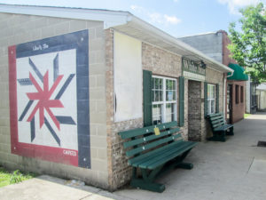
White Star Restaurant in Peebles
We finished at 3:30 p.m., happy that it took only six hours. All I had been thinking about was cold water, food, and a place to sit down. We found all three at White Star Restaurant in Peebles. CW has been there several times. After a delicious home-cooked meal, we went down the street to Sexton’s Dairy Bar and Diner for ice cream where I got an M&M flurry. All the pain of the day disappeared. On the way home, we left a car at a Park & Ride a few miles west of Peebles for the night.
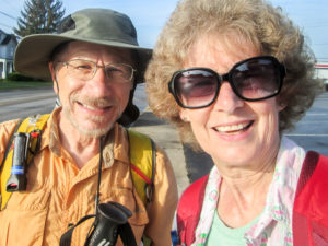
Ready to hit the roads for the last day
Day 18 (Thursday): Peebles to Davis Memorial State Nature Preserve (8.0 trail miles)
It has been a long season: 18 days instead of our usual 15, with only short breaks between. We were both ready to complete this leg today. Since we covered a lot of miles yesterday, we had only eight miles to go to reach the end of the Sinking Spring section. And six of those were on roads.

One of the changing looks of the morning sky
We encountered a lot of fog on our drive to Peebles. The sky was interesting to watch. Sometimes thick clouds covered the sun yet allowed the perfectly round white orb to shine through. Then more clouds would move in front of the sun and totally conceal it. Eventually, the clouds opened up exposing patches of blue.
A little after 8:00 a.m., we hiked out of Peebles past small cozy houses standing side by side, but we soon entered open farmland. Besides some morning traffic, we listened to birds twittering, cows mooing, and roosters cock-a-doodle-dooing.
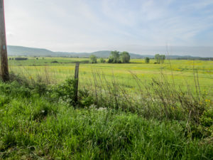
Peaceful morning through open farmland
Even though the terrain was generally flat, sweat was dripping from me before we’d gone a mile. The heat was as bad as yesterday. It was cooler today, only in the 60s and 70s, but the breeze wasn’t as strong. We enjoyed any shade the roadside trees offered.
After 4.5 miles, we left the road for Tolle Hill. Most of the hill is owned by the General Electric Corporation, but they give BT hikers permission to use the trail.
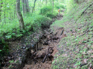
The Buckeye Trail climbs Tolle Hill in a muddy ditch
The first bit of trail was shaded and cool. As we began to ascend, it became muggy. The hill was steep. The path began as grass and then became overgrown with tulip poplar sprigs. Next it followed a narrow muddy ditch partially covered with forest debris. Farther on, the ditch was filled with rocks of all sizes. It was slow going. Sweat was dripping off my face and elbows. I had to keep wiping it from my eyes. If not for the steaminess, it would have been fun climbing over the rocks.
When we reached the ridgetop, the air became cooler again. The trail along the ridge and down the hill was wide and seemed easy after what we’d just been on. At the bottom of the hill, we joined our last road.
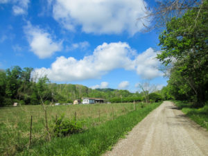
A beautiful sky for a cloud gazer
For a mile and a half we walked under a blue sky with puffy white clouds. It seemed a fitting end to my “Cloud Gazer” hike. We continued to enjoy the wildflowers along the road. We saw a turtle that couldn’t be coaxed out of his shell. And we were surrounded by another kaleidoscope of swallowtail butterflies. That seems to be the official name for a group of butterflies. I had to look it up. However, I prefer to call them a flutter.
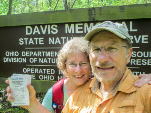
Sinking Spring section completed
At 11:23, we reached our car at the entrance to Davis Memorial State Nature Preserve. We had hiked our eight miles in 3 hours and 15 minutes. The Sinking Spring section of the Buckeye Trail was now behind us, adding 54.1 more miles to the total. We celebrated by returning to White Star Restaurant for lunch. I waited until we got home to have my ice cream today. It was Denali Mint Moose Tracks from our freezer.
This spring, we hiked 191.6 miles bringing the total to 1,283.7. We put 3,399 miles on our cars, and I walked 466,036 steps. We finished the New Straitsville section and completely hiked the Old Man’s Cave, Scioto Trail, and Sinking Spring sections. Only three sections remain, about 160 miles.
It is amazing to us that we didn’t have one rainy day, just an hour or two of sprinkles the whole time. We enjoyed wonderful weather until the heat hit us the last week. On more than half the days, we were blessed to share the trail with friends. We walked where Grandma Gatewood walked. We were lost in Old Man’s Cave. We were swarmed by butterflies. We “climbed every mountain.” Well, not really, but it feels like it to wimpy me. We’ll be back in the fall to finish our journey on the Buckeye Trail. Maybe my boots will be dry by then.

Woohoo! 23 sections and 1,283.7 miles down—3 sections and 160 miles to go


Elainek
May 4, 2019Wow, your hiking adventures amaze me. I enjoy the pictures and your reflections. Can’t wait for the Fall edition. Great job. Elaine
CW Spencer
May 4, 2019Thank you, Elaine. I’m so glad you enjoyed it.
Bonnie
sharkbytes
May 8, 2019Loved the 3 times across the creek story. Ha!
CW Spencer
May 8, 2019Yeah. Reminds me of some of your blaze misadventures on your Midland to Mackinac trip last fall, Joan.