by guest blogger Bonnie Spencer
May 2, 2016
Day 7: Miami and Erie Canal Heelpath at Road 60 to Junction (12.2 trail miles)
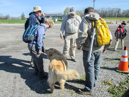
Almost a week passed before we made our last trip north to finish our miles. We started from Xenia again, and the nearly 130-mile drive took us 3.5 hours because we took back roads. By the time we got the cars in place, which included eight extra miles to backtrack to lock a car (we hoped this wasn’t an indication of how our week would go), we didn’t start hiking until 11:45.
The temperature was in the 50s and 60s. Combined with the sunshine, the day ranged from comfortable to hot. A slight breeze was welcome and refreshing.
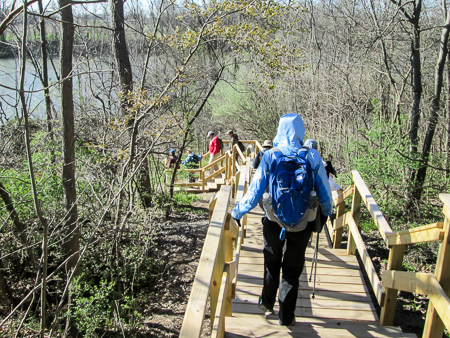
We started off on the heelpath we’d ended on the week before. It went through woods and fields, then jogged across the filled canal prism to the towpath. CW recognized the quick chak chak chak calls of the red-winged blackbirds that were disturbed at us traveling through their territory. He told me about some of them swooping at him the last time he came through. They were more civil this day.
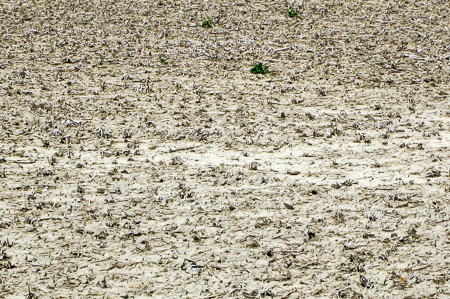
There’s a killdeer hiding somewhere in this field
After an hour, we left the canal for roads, both gravel and paved. We often heard the high-pitched vocals of the killdeer. If they weren’t moving, we couldn’t find them. The tawny coloring of the birds perfectly camouflaged them in the parched brown fields among the corn stalk stubs. I caught some movement and was treated to the scene of a baby swiftly running through the field. It tripped and took a little nosedive, then continued on just as swiftly as before. Killdeer seem to have only one speed: flat out.
We had been told about a man and his wife along our route who are friendly to BT hikers. They both happened to be out in their front yard when we passed. They offered us a cold drink or the use of their facilities, but we weren’t in need of anything at the time. We chatted with them a while before moving on.
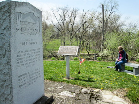
Taking some notes before lunch at the site of Fort Brown
We continued on country roads. Around 2:00, we stopped for lunch at the site of Fort Brown. It was one of several forts built along the Auglaize River for William Henry Harrison in his campaigns against the British and the Indians in the War of 1812. We enjoyed the peaceful setting overlooking the river.
An hour later, we walked into the quiet community of Charloe. It was named for the Ottawa Chief Charloe Peter, the last chief of the Okonoksee Village, which is currently Charloe. CW had been talking about Charloe for miles and was looking forward to visiting Charloe Store. I was extremely hot when we reached the store and welcomed the chance to cool off out of the sun.
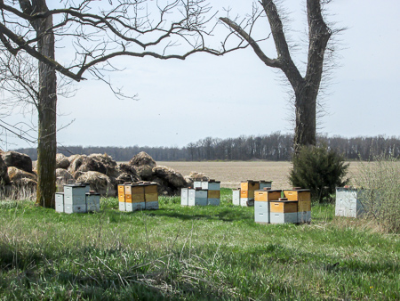
Bees were swarming around the hives and us
Not far from the store, we turned onto a gravel road. We saw bees swarming around hives 50 yards from the shoulder. CW was ahead of me and called back that they were buzzing across the road right past him. I couldn’t see them, so I thought it was just a few and wasn’t too concerned. When I got closer, I stood in the road to get a picture of the hives. Then I could see that hundreds of bees were indeed zooming by me. They were on a mission and, fortunately, it didn’t involve us.
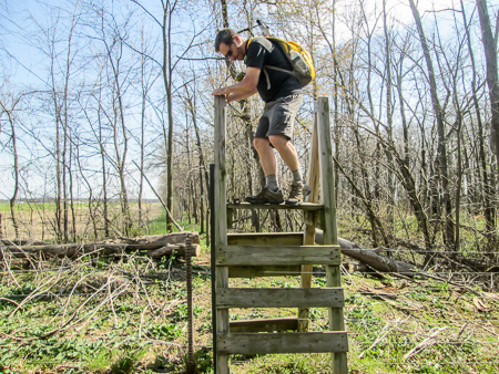
In several places we climbed over wire fences on wooden stiles
We returned to the canal towpath, again alternating between woods and fields. The ground was dry, and in one place there were hoof prints from cattle, obviously made on a much wetter day judging by how deep the imprints were. It was hard to walk on that path. Worse than dodging the groundhog holes because these were so abundant that we couldn’t avoid them.
We finished just before 6:00. Not bad for the late start we had gotten. We had reached Junction and were now finished with the Delphos section. We checked into our motel in Defiance and asked where a good ice cream place was. The girl gave us two names, both close by. We headed for the nearest one, Eric’s “irresistible ice cream,” and were impressed by the selection of flavors. I finally settled on Pretzel M&M. It was a good choice.
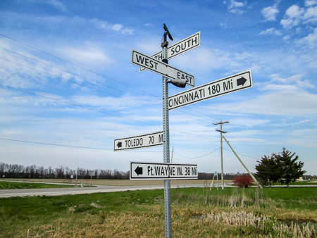
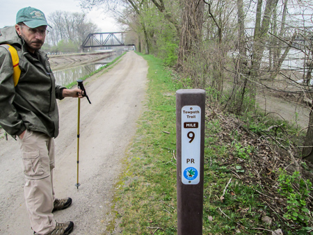
Mileage signs located next to the Junction historical marker
Day 8: Junction to Independence Dam (15.0 trail miles)
We began hiking our third section, Defiance, in the community of Junction, so-named because two canals joined there: Indiana’s Wabash and Erie Canal and Ohio’s Miami and Erie Canal. From there, the two proceeded as one on to Lake Erie.
It had rained through the night and was supposed to continue during the day. When we started out at 9:00, it was in the low 50s with a light rain falling. I knew I could handle that after the drenching we had gotten on our last trip.
After less than half a mile on a paved country road, the trail followed the heelpath of the canal. It crossed what looked like a creek, but there was no way to get to the other side without drowning our boots. We chose to go back out to the road. Shortly the trail went back onto the heelpath, then followed the edge of a field. We had to walk through wet grass that hadn’t been mowed lately. Again, we moved to the road. Normally, I’m a purist; I want to follow the BT exactly. But walking through creeks and tall wet grass was changing my mind about that.
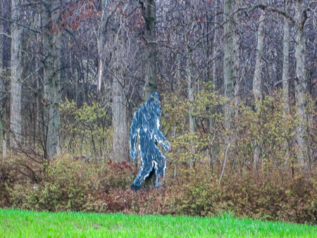
Bigfoot has finally been found!
Have you ever wondered if Bigfoot exists? Well, he does! We spotted him at the edge of a wooded area on Hammersmith Road 18 in Defiance County. I later found out another BT hiker caught a picture of him in the same place several months ago. Apparently the creature doesn’t get around much.
The trail returned to the heelpath. It was a half-mile section that had many substantial dips in the trail, all filled with water. We walked around them on the edges of the trail as much as possible, but we had to fight with the sometimes-prickly vegetation that claimed squatter’s rights.

Umbrellas and raincoats were the order of the day
We emerged from the woods onto a country road that went by the Defiance County Landfill. It was busy with odorous garbage trucks flying by and spraying water up from the wet surface. By this time, we were already quite wet. When we saw a new bike trail that ran parallel to the road, we moved over to it. After a half mile we turned onto residential streets that led into Defiance.
It was past lunchtime and we were hungry. However, it was raining on and off and we couldn’t find a sheltered place to sit down to eat. We kept walking. Finally at 1:30 we reached Fort Defiance Park. The rain had stopped temporarily. CW found a wet bench and spread out his Frogg Togg pants, which he had shed earlier in a no-rain period because they were hot. We ate our lunch overlooking the confluence of the Auglaize and Maumee Rivers.
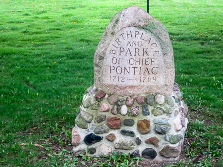
One of many stone markers in Pontiac Park
Fort Defiance was built in 1794 during the Indian Wars. The park is full of historical plaques and monuments. We crossed the Maumee River and walked along the other side through Pontiac Park where we passed stone markers honoring early Americans. It was hard to enjoy it because the rain began coming down hard and sideways.
After less than half a mile, the trail returned to road. We followed it into and through Independence. When we reached Independence Dam State Park, we walked through the park for a mile to the dam, where we finished for the day at 4:30. The rain had stopped somewhere along the way, and the sun came out as we climbed into our car.
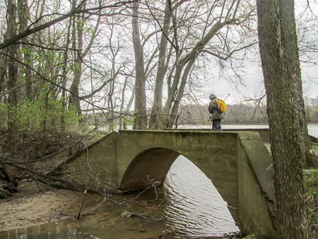
A former mule bridge in Independence Dam State Park
On our way to pick up the other car, we stopped at Dairy Depot. I had spotted it two days before when we drove into Defiance for the first time. They had unusual flavors of ice cream. I decided on Sticks and Stones. For ice cream lovers who are wondering what-in-the-world that is, it is “soft cookie dough chunks, crisp chocolate-covered pretzels, and a gooey salted caramel ripple all swirled into rich chocolate ice cream.” Yum!
We had walked over 100 miles in the past three weeks. The part of the BT we were on is also the North Country Trail (NCT), a 4,600-mile trail stretching across seven states. To commemorate the National Park Service centennial in 2016, the NCT is promoting a Hike 100 Challenge, which is simply to hike 100 miles on the NCT any time within the year. We had now completed the challenge.
Day 9: Providence Metropark to Waterville/Independence Dam to Florida (17.3 trail miles)
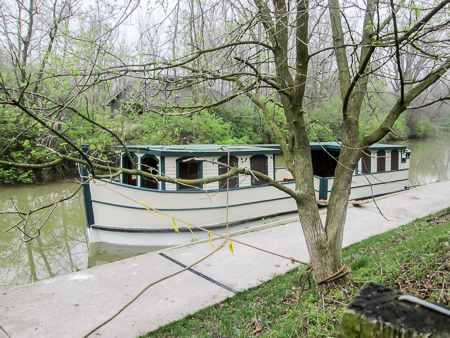
A working canal boat in Providence Metropark
On days 10 and 11 we would be meeting up with Jim Gilkey’s circuit hike that he does one weekend a month. This month it would be 21 miles in the Defiance section. In order to finish everything but Jim’s hike, we did two unconnected legs on day 9. It made for a long day.
We drove over an hour and a half to shuttle the cars and began hiking at 9:45 from Providence Metropark, part of the Metroparks of the Toledo Area. The park has several canal-era features. The Providence Dam, built in 1838, was constructed to maintain water levels in the canal. A
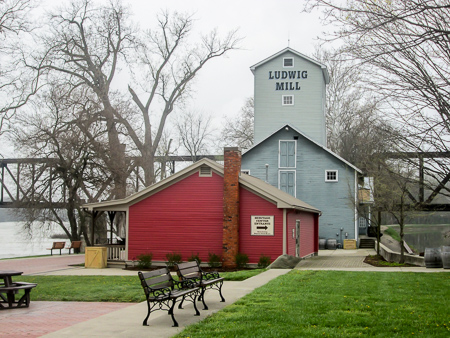
Ludwig Mill in Providence Metropark
mule-drawn canal boat gives rides through Lock #44, one of the last functioning 19th century limestone locks. The Isaac Ludwig Mill is a working water-powered saw and gristmill.
The Towpath Trail would take us northeast more than nine miles through two more parks in the Metroparks system. We loved the trail. It was packed gravel and sand with some loose gravel on top, about seven feet wide. No mud, no bushes to brush against, no wet grass. The canal was to our left and the Maumee River on our right.
The Towpath Trail with the canal to the left and the Maumee River to the right
We had a lot of ground to cover so we started out at a quick pace. We also wanted to beat the predicted rain. Before long, I was so warm that I had to take off both jackets I was wearing. An hour into our hike, a light sprinkle brought out my third jacket, CW’s Frogg Togg. It was too warm for that one, too, but I wanted to keep my pack dry.
We entered Bend View Metropark after 4.5 miles. Bendview Overlook has a nice shelter and a nearly 90 degree view of the river bend. We rested a few minutes before returning to the rain.

A trail snail caught as he was rushing off
I noticed some snails on the trail. I’d never seen them before. At the time, I couldn’t stop to take a picture because I was timing my pace out of curiosity. This was one of the few times I was keeping an eye on my watch. When I finished, I was disappointed to not see any more. A while later I saw one and quickly snapped him.
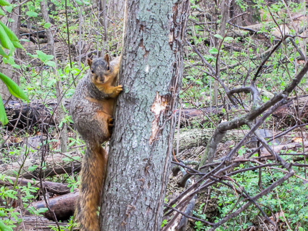
A fox squirrel took great interest in us
Although the snail had paid us no mind, we saw a squirrel that stopped a full minute to study us. I’m fascinated by the black squirrels in the north because all we have at home are gray squirrels. But I was even more fascinated with the big squirrels we’d seen jumping through the trees. Flashes of gold would catch my eye. With our close-up view, I could see that he was gray with a golden underside. I have since learned that they are fox squirrels.
The last 1.5 miles of the Towpath Trail took us through Farnsworth Metropark, which seemed to be all about fishing, picnicking and camping. Located there is the Roche de Bout Shelterhouse, one of the many historic WPA structures found throughout the parks.
Roche de Bout Shelterhouse in Farnsworth Metropark
At the end of the Metroparks, the trail took us onto River Road, which we followed over a mile into Waterville. The rain had become heavier and steady. Water was streaming down my hood into my face. We were soaked when we reached our car just after 2:00.
We ate lunch at Fernando’s in Grand Rapids. The food was good, but I would have enjoyed it more if I’d been sitting next to a big heater.
We had hiked 11.3 miles and wanted to be done, but we still had 6 more to go. Though it stopped raining while we ate, we drove through a downpour while reshuttling the cars. There was no way we would have hiked in that. However, it passed over and there was no rain falling when we began again at 4:45.
Our second leg started at Independence Dam where we had finished the day before. The trail was on paved park roads for a couple miles, then followed the Miami, Wabash, and Erie Canal Towpath Trail. It was mostly packed dirt, not gooey mud but wet enough that it clung to our boots.
Independence Dam on the Maumee River
Once again, we started out briskly. At 5:00 the bells from the church across the road played “The Battle Hymn of the Republic.” It seemed a fitting selection for the pace we were marching at. I had left my pack behind so I could make better time.
It wasn’t long before the heavy rain returned. Not having my pack to keep dry, I didn’t need the Frogg Togg so there wasn’t rain dripping in my face. I just wore my regular rain jacket. Since we were already wet, it actually didn’t seem too bad.
We passed through the village of Florida. Along that section of the towpath, there are several benches that were built as an Eagle Scout project. They were inviting, but we were too intent on ending our long day to try them out.
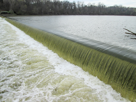
A dam on the Miami, Wabash, and Erie Canal outside of Florida
The sun came out during the last mile of our hike. By the time we finished at 6:45, we were mostly dried out. We ended at another dam, this one on the canal and quite a bit smaller than Independence Dam.
It was late. We paid another visit to Eric’s since it was on our way back to our room. CW got a Mackinaw Island Fudge Hot Fudge Sundae. It looked so good, I got the same. Neither of us was disappointed.
Day 10: Florida to East of Napoleon (11.9 trail miles)
We returned to the dam and parked above it on SR 424 to await Jim’s group shuttling from the day’s ending point. It was nice to just drive one car. The hikers arrived at 9:45. There were 17 of us that day.
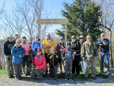
Group photo at the beginning of Jim’s hike
Jim’s hikes always begin with a group photo so everyone gathered by the steps that would take us down to the trail. After very basic instructions to follow the blazes and meet at the cars, everyone took off at their own pace, some in pairs, some in small groups. Much of the day we hung at the back with Jim, who I hear always brings up the rear. He doesn’t want to leave any hiker behind.
Hikers descending to the trail on steps built as an Eagle Scout project
There was no rain in the forecast these last two days. It was sunny and in the 40s when we began. Very pleasant for hiking.
Between watching for roots and groundhog holes in the path and talking, I didn’t take as many pictures as usual. However, I did have to pull my camera out for the doorless outhouse right next to the trail.
Two hours into the hike, the trail emerged from the woods and onto 424. We found everyone ahead of us gathered in a small roadside park in Napoleon finishing their lunches. The ones at the head of the pack had taken off at such a swift pace that I hadn’t expected to see them until we finished. A conversation got started on edible plants. The lawn was plentiful with dandelions, so some of us sampled the yellow blooms. Gradually, groups headed back out.
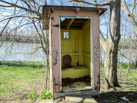
Very accessible but a little lacking in privacy
An hour later, Riverview Frosty Boy popped up on the horizon, not far off the trail. Four hikers detoured; CW and I followed like puppies. Jim stayed behind and waited for us. We sat at picnic tables eating our ice cream. Mine was a Cheesecake Flurry made with chocolate ice cream. The owner came out and talked with us until more customers arrived.
We continued walking at a leisurely pace, sometimes on 424, sometimes on towpath. Along the way, the group picked up another hiker. He was hiking on the BT to prepare for an upcoming AT hike, but his feet were giving him problems. He walked with us to our cars, then got shuttled to his, which was farther than he wanted to walk that day.
The last hikers (that would be CW and me) got to the cars at 4:15. After shuttling, many of the group, including our new friend, ate together at Azul Tequila. Afterwards, CW and I went straight to our room, having already had our ice cream for the day, while the others headed to their campsite.
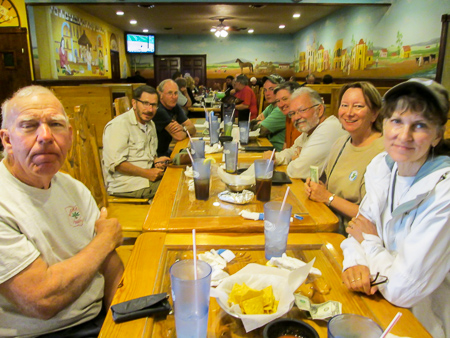
After-hike meal at Azul Tequila
Day 11: East of Napoleon to Providence Metropark (9.3 trail miles)
Since we had to check out of our motel, we had both cars with us again. We met the group at the second parking area for Providence Metropark. That would be their ending spot. Two days ago we had hiked the last mile of this, so we would finish at the first parking lot and had our other car waiting there.
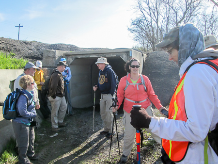
The day’s hike began by walking through a box culvert
We shuttled to the beginning of the hike, took the group photo, and started out at 9:40 through a box culvert under a driveway to a paving company. Our plan was to stay at the head of the group since we wanted to finish quickly. We had at least a four-hour drive ahead of us to get home, plus a stopover in Xenia.
We began at a fast pace, but after a few seconds, we never saw the leaders again. We also never saw the ones in the very back with Jim. We pretty much hung in the middle with a continually shifting group of eight others.
Much of the time we were walking with another writer, and our conversation centered on a variety of writing topics. I hardly noticed where I was walking. I don’t multi-task well. At the end of the day, I looked at my little red notebook that I take notes in so I’ll have reminders of things to blog about. Day 11 was a blank page.
We gained a four-legged hiker
The entire hike alternated between towpath and road. Whenever it was not possible to walk off road, the trail jogged onto US 24. For a short time, we gained a four-legged hiker. He found us in a parking lot. Though we tried to discourage him from joining us, he followed us—actually he led the way—into the woods. He raced on and off the path and eventually disappeared.
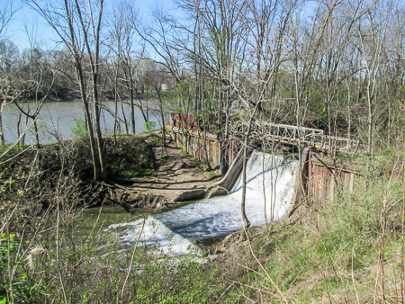
In the early afternoon, we took a break to eat lunch, sitting on logs or on the ground. When we were rested, we continued through the woods, then back out on the road. We came upon Bucklin’s Lock 43 where canal traffic entered the slackwater in the Maumee River provided by Providence Dam.
A half hour later, we reached the service area for Providence Metropark. Workers gathered around us, eager to hear of our hike and to share their park with us. They gave us brochures and invited us back.
Aww. . . He must have put that up on his last time through.
A few yards farther, we reached our car at 2:00. We said our goodbyes to our fellow hikers and drove a mile up the road to get our other car. There we saw the first hikers who had been using their extra time to explore the area. We got a tip from one of them about a good ice cream place in nearby Grand Rapids.
Rita’s Dairy Bar & Deli was popular judging by all the people lined up at the windows and the cars filling their lot. We didn’t want to take the time to stand in line, but we also didn’t want to pass up good ice cream, so we took our place with all the others. We had been following the Maumee River for four days. In fact, it flowed right behind Rita’s. It was only fitting that we end our hike with their Muddy Maumee Hot Fudge Sundae.
Goal check:
- I was surprised at how seldom I looked at my watch. I didn’t check every half mile to see if we made it in 10 minutes. It was so much more relaxing. CHECK!
- We had squeezed every mile we could into each day considering each day’s circumstances. And we’d cut this hike down to 11 days from 13 in the fall. CHECK!
- There was no shortage of ice cream and, so far, I’m not running out of flavors. CHECK!
- One of my fall goals was to lower my cholesterol. After the first week of this hike, I had it checked. It went down from borderline to normal. CHECK!!

144.8 miles in 11 days—CHECK!
We covered 144.8 miles in eleven days. We drove 2,869 miles. My pedometer said I took 343,765 steps. These are the statistics I will soon forget.
I expanded my hiking repertoire. I found “tree mail.” I purchased my first-ever Icy Hot Patch. I hiked in pounding rain. I stepped in a groundhog hole. I encountered a close-up dangerous dog. I stood in the middle of a bee stampede. I found Bigfoot! I saw trail snails. I became acquainted with the beautiful golden fox squirrels. I ate a dandelion bloom. I enjoyed the camaraderie of a Buckeye Trail group circuit hike. These are the experiences I will always remember.
I’m impressed! What a fun read, thanks for letting us follow along. The bees would have freaked me out, I got caught in a swarm once as a child and got two stings. I love the outhouse, lol. And I’m up for Sticks & Stones ice cream!
Amazingly, the bees were not frightening. I couldn’t see them until I was in their midst, and then they didn’t even touch me. It was like I was parting the waters. If I had been stung before, though, I would have freaked out, too! –Bonnie
Thank you for letting me share your adventures – rain,
cold, beauty of nature, sunshine, sunsets, animals, sweet and interesting people and yes, many kinds of ice cream treats along the way!! Always fun and interesting – I admire your endurance (both of you)!
Sending my love, now and always,
Dolores
So happy to share our adventures with you and glad that you enjoyed them. I often think of you when I’m out there—especially when funny things happen.
Sending love back to you,
Bonnie