
by guest blogger Bonnie Spencer
April 17, 2016
Day 4: St. Marys to Spencerville (13.5 trail miles)
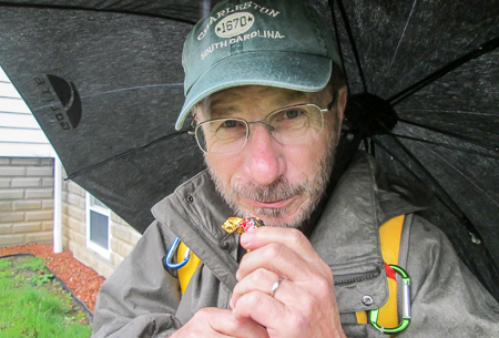
After ten days away from the trail due to various commitments, we headed back north. I had my ice cream list . . . and my umbrella; a rain coat; a pair of old rain pants with dry, broken elastic and a large safety pin to keep them up; a garbage bag in case I needed to cover my pack; and CW’s extra Frogg Toggs jacket. We had been fortunate to have wonderful weather both last fall and this hike so far, but today was expected to be full of rain.
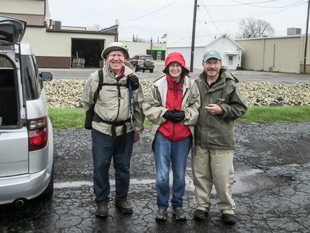
We drove 90 miles in heavy rain from Xenia to Kossuth. That’s where we met Jim Gilkey who was hiking with us for the day. This would be the first time that CW and I would have someone else along with us.
Before we arrived at the meeting place, Jim called to tell us of a road closing on Rt. 66 and how to get around it. What a blessing that was because we wouldn’t have known what to do. We left Jim’s truck in Kossuth and shuttled our cars, one to Spencerville and the other to St. Marys. On the way, we checked out the road closing. A bridge on Rt. 66 that goes over the canal was being replaced. The BT goes right by there, but we were glad to see that our passage on foot wouldn’t be affected.
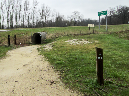
One mile north of St. Marys the BT goes under US 33 through a culvert
When we began hiking from the Lock 13 shelter house in St. Marys at 10:20, the rain had diminished to a light sprinkle. I didn’t bother with the rain pants, umbrella, or garbage bag. Through the morning, the rain alternated between hardly anything and nothing. I was hopeful that we had kept our streak of great hiking weather going.
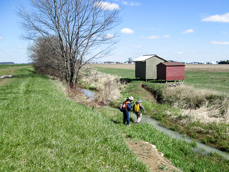
We again followed the canal on the towpath, which along there is also the Miami and Erie State Trail (MEST). After a mile, it took us through a culvert beneath US 33. Though the path was gravel, there were some puddles. I tried to avoid them by staying close to the wall since it was too dark to see the water. The guys didn’t seem to mind, but I was being picky about keeping my boots clean. When we emerged, we all walked on the grassy edges of the towpath to stay out of the muddy middle.
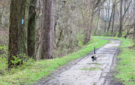
The official Buckeye Trail Goose Escort
Carp swam just below the surface of the water in the canal. They masqueraded as sharks by occasionally revealing the tips of their fins. We encountered many geese that were quite vocal about us trespassing through their neighborhood. We passed under power lines that sounded a constant crackle from the moisture in the air.
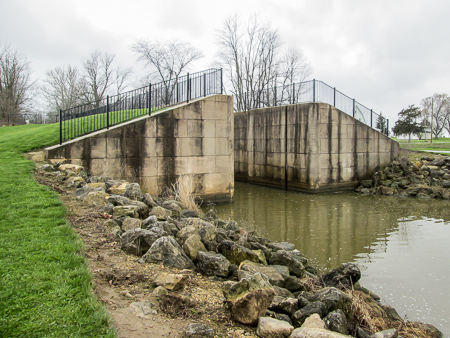
Reconstructed Lock 14 of the Miami and Erie Canal
At some point, it began raining hard enough for CW to pop his umbrella open and for me to put the Frogg Toggs on over my rain jacket. It wouldn’t zip up, but it perfectly covered my pack. When we reached the reconstructed Lock 14, the rain had stopped, so we ate lunch at a picnic table on the lawn.
Soon after we started back out, we reached the construction on Rt. 66. The road was gone. We saw pools of canal water in which fish had been trapped. Many lay dead around the edges; some were still flopping around trying to survive. No one was working that day, so we were able to get a good look at the site.
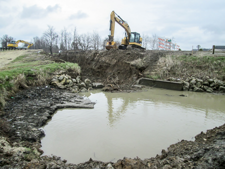
Pool of canal water at Rt. 66 construction site
The rain returned. We were wet and cold 4.5 miles later when we reached the Methodist Church in Kossuth where Jim’s truck was parked. It was 3:00 and we had completed the St. Marys section of the BT.
CW found some dessert in a plastic egg in the churchyard that must have been undiscovered in an Easter egg hunt. Being the considerate guy that he is, he only took one piece and put the other one back for the next wanderer to find. We rested and warmed up for a few minutes in the truck, then got back on the trail. We had a couple more hours to go.
CW enjoys some unexpected dessert
My camera screen had gotten cloudy so I stopped taking pictures, concerned that I would ruin my camera. When it became harder to walk, I realized my jeans were totally soaked and weighing me down. The rain was blowing from the west and there was no way to escape it. I kept my head down, watching the trail carefully to avoid falling into a groundhog hole. [On Day 10, we hiked with Sam, supervisor for the Delphos section. He informed us that there are 175 groundhog holes in these first couple miles of his section!] Every so often, I’d peek out from under my two rain hoods to make sure the canal was still on my right. So much for that streak of great hiking weather.
Soaking wet at the end of the day
It finally stopped raining and we reached our car in Spencerville at 5:00. Jim apparently had so much fun that he said he wanted to hike with us the next two days as well. After making the necessary arrangements and returning Jim to his truck, CW and I checked into our room in Celina and changed into dry clothes. On a tip from the girl at the desk, we found a great ice cream place nearby: Lake City Creamery. Their Buckeye Sundae was wonderful and we decided we would need to find the Creamery the next day, too.
Day 5: Spencerville to Fort Jennings (16.3 trail miles)
This day, we had the luxury of only having to drive one car. On our way to meet Jim, we came to a different detour than the day before. Jim couldn’t help us this time, as he was coming from a different direction. However, CW and GPS worked it out, and we connected with Jim and got the vehicles in place by 10:00.
The temperature was only in the 30s, much colder than I was expecting. The wind was blowing from the north, making it even worse. We were still on the towpath/MEST with little protection from the wind.
CW about to wade through the canal to get to the BT shelter
Before we left Spencerville, we passed Lock 16, the first of many we would pass that day. Two hours in, we came to a BT shelter. It was on the other side of the canal, but there was no bridge. Though the canal was narrow in that spot, we couldn’t get across without getting our feet wet. CW crossed anyway. He wanted to sit down out of the wind and tape up a hot spot that was beginning on his foot. Jim and I chose to stand and shiver on the trail and have a snack while we waited on him.
The towpath seemed to be never-ending. It crossed many rural roads, and each time it did, all I saw ahead was towpath. Road . . . towpath . . . towpath . . . road . . . towpath . . . towpath . . . . I felt like I was in that movie. Speaking of groundhogs . . . we had to continually be on the lookout for their holes. Before the day was over, we had each managed to step in one. The holes are deep and can be dangerous, but we were all fortunate enough to avoid injury.
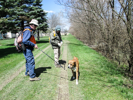
He might look harmless but you should have heard his growl
Two hours and four locks past the shelter, we came to the south edge of Delphos. A dog that lived in a house next to the trail was not happy to share his towpath with us. He greeted us with a low growl while slowly circling us. Jim gave me one of his hiking sticks, so we were all armed. The dog watched us as closely as we watched him. This went on for a few minutes. It was a bit comical because he sounded really mean but didn’t seem to have enough gumption to do anything. Probably, though, he was smart enough to know that if he grabbed one of us, there were still two other people with sticks.
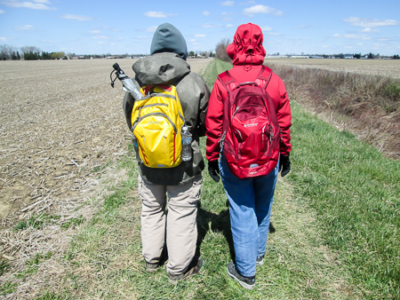
Mustard and ketchup on the Buckeye Trail
We ate lunch at Subway, then returned to the chilly, windy trail. Often I would get ahead of the guys. I don’t like to be cold so I had to walk fast to get warm. Sometimes I dropped behind to take pictures. I told them not to wait on me because I had my “catch-up” bag. On our fall hike, I had used a smaller one of CW’s, so for Christmas, he had given me a larger red daypack. Recently he got a new yellow one like mine for himself. Now we look like mustard and ketchup walking down the trail.
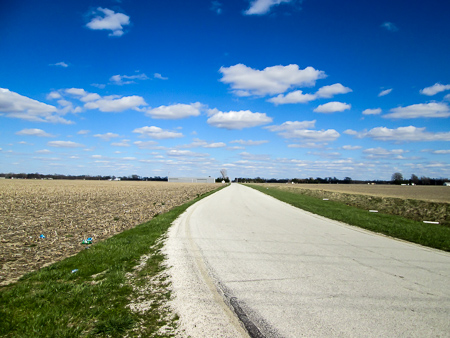
Sunny country road under a beautiful sky
Outside of Delphos, MEST ended and the BT left the towpath. We walked 5.5 road miles before reaching our car in Fort Jennings. The sun was shining, making the end of the day much more comfortable than the beginning.
Before we went back to our motel, we paid another visit to Lake City Creamery where I got a Brownie Sundae with Peanut Butter Cup ice cream. Sadly, we were hiking our way out of range to come back again.
Day 6: Fort Jennings to Miami and Erie Canal Heelpath at Road 60 (13.3 trail miles)
Since we had to check out of our motel, we were back to driving both cars. We dropped one off in Fort Jennings, then drove farther north to get Jim. Leaving his truck at our ending spot, we drove back to our other car.
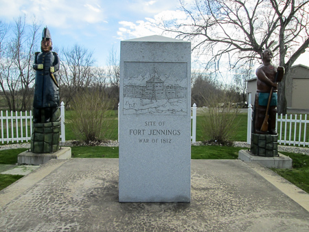
Monument at the site of Fort Jennings
At 10:00 we began our day’s hike on the sidewalks of Fort Jennings. The trail changed to country roads at the village line. A couple miles later, we entered the village of Ottoville. We stopped at a Valero gas station for a bathroom break. It was approaching noon. I knew that I would need a mocha frappe on the drive back to Xenia that evening and that I couldn’t count it as my ice cream because it was already on my list from last fall. The ice cream case caught my eye. I thought this would be a great time for my daily treat, so I got a container of Nestle Dibs Crunch. I ate them, and shared them, while we continued on.
We soon entered a woodsy area and skirted a small pond to reach the towpath of the Miami and Erie Canal. Trailside logs beckoned us to rest a few minutes and have a healthy snack.
Less than a mile after that, we were back on quiet country roads. For more than five miles, we followed Road 25-M, which lies either on or a little west of the towpath. All along that road, we listened to the frogs singing.
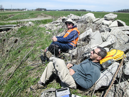
Lunch break and nap on the rock pile
I had been watching for a place to eat our lunches. It was too windy for me to eat out in the open, and there was nothing but open out there. I finally spotted a row of piled-up rocks ahead, about 50 yards back from the road, but it was on the other side of the canal. Though it wasn’t much of a canal, there was no way to cross it. It was 1:30 by that time, and I seriously considered the possibility of jumping over the canal.
As we got closer, I noticed a lane off of our road that seemed to go by the rocks. I checked it out and found that we could get to the rocks and there was just enough room to walk between them and the canal. We had our lunch spot, a perfect windbreak that came with a frog serenade.
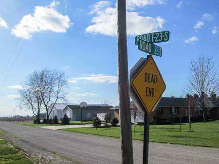
Typical road signs
The road names in that area of Ohio were baffling and somewhat frustrating. The previous day, we had encountered Road U-20, Road 23-U, 23-T, and T-23. This day there were many more including R-23, R-24, 23-Q, 24-Q, Road R, and Road P. We tried to come up with explanations for such unimaginative names. Finally, I had it. Bingo! The area must have been settled by people who love to play that game. We didn’t find anyone who could confirm my theory, though.
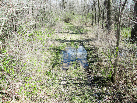
After about four more miles, the BT was blazed to leave the road and follow the Miami and Erie Canal Heelpath. However, Jim told us that it had been rerouted due to an incident a few months ago in which hunters in the adjoining woods approached a group of BT hikers in a very unfriendly manner, guns in hands. They did not want the trail to go through there, so the BT now goes around that area on roads. Too bad. It really looked inviting after all that road walking.
The last bit of the trail sent us home with muddy boots
We picked up the heelpath on the other side of the hunting area. There were only 350 feet to go to reach the truck, but it was the wettest and muddiest section of the day. We finished at 4:30 with muddy boots.
The day had been windy on and off. The sun had been in and out. But it had been warmer than the day before and dry. It turned out to be a very decent day for hiking—so much better than the week had begun.
We covered 43.1 miles this trip, making a total of 79.1. I had survived my first soaking-rain day and my first encounter with a vicious canine wannabe. I had heard of Jim’s vast knowledge on a plethora of topics, and now I had experienced it. You have a question; Jim has an answer. It was definitely an educational week. Hopefully, our next trip will be our last one for this hike and, therefore, will be longer. We need to rest up.

