
by guest blogger Bonnie Spencer
October 20, 2016
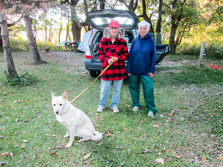
When we got back from our last hike, I got right on the kennel situation. I spent hours online researching the three referrals from the clinic staff. The first one I eventually found out was located too far away. I had already looked into the second and wasn’t comfortable with it. Besides, they weren’t taking new dogs at this time.
I read every word on the third kennel’s site. They were a half hour away, but they were in the direction we would be going. They were reasonable. They even said they board senior dogs and those that require private playtime or limited activity. Perfect! I eagerly called to set up a time for the Meet & Greet they require.
In CW’s words, Sugar didn’t even pass the phone interview. When the lady found out how old Sugar was, she did everything she could to convince me they were not a good fit for Sugar. In all fairness to the lady (and I’m really working the Pollyanna angle here), I later located a chart on dog vs. people years and found out Sugar is beyond senior and into the geriatric category at 72 years. Maybe the lady had access to the same chart.
Discouraged about Sugar’s rejection, I called Dr. Tina and pitifully asked if we could board Sugar at the clinic again. She agreed. And while she was saying yes, I quickly got Sugar signed up for our third week of hiking as well.
Day 6: SR 228 to West Lodi (11.0 trail miles)
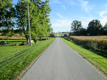
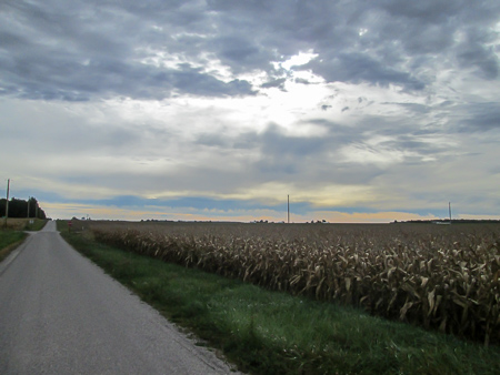
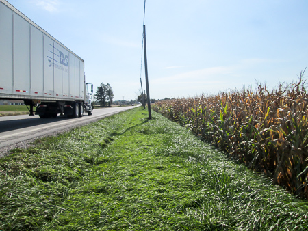
A typical long, straight, quiet country road
We dropped Sugar off at the vet’s office as soon as they opened. Surprisingly, she seemed fine about it. Maybe she remembered how she could refuse her meals there and skip right to her treats. In addition to all of Sugar’s paraphernalia, we took some breakfast treats for the clinic staff. A little insurance for the future never hurts.
It took about 3.5 hours to drive to where we would end our day’s hike. Again, we would be walking totally on country roads. As we were looking around for a safe place to leave our car, a man came out of his house and offered us a spot in his wide gravel driveway. He gave us permission to use it the next day as well. We thanked him profusely and left for our starting point.

CW talking Lucy into going home
On the way, we looked for a restroom. This was pure farmland where there are no stores and no gas stations. While we were trying to decide how far out of the way we were willing to drive, we spotted a porta john on the side of the road. The hiking portion of our day was starting out great. First we are offered a prime parking spot for two days; then a porta john materializes.
We started hiking at 1:30. Before long we had our second friendly encounter of the day (third if you count the porta john). While a family was picking tomatoes in their garden, Lucy slipped away to greet us. The beautiful white dog didn’t make a sound. She showed her affection by standing on her hind legs, putting her front paws on our stomachs, and looking into our eyes. It took some coaxing to get her to go home.

Silken webs dancing on power lines
It’s common to get plastered by spiderwebs in the woods, but how can you run into them on a wide open country road? That’s exactly what was happening to us. While we were trying to figure out this phenomenon, our attention was drawn to the glistening filaments attached to power lines above, one end of each dancing a samba in the breeze.

Mr. Spider with his paragliding thread attached to my shoe
Soon a small dark something flew in front of me, coming from my left and taking a diagonal path towards the road. I thought it might be a bee until it landed on the road and I saw it was a pudgy black spider about a half inch long. So it wasn’t actually flying—it was paragliding. Its silk transport was stuck to the toe of my shoe and snaking in the wind. A short time later, another spider glided in front of me and landed in the grass. We wondered if this was a favorite pastime of country spiders and how many jumps they could make in a day.
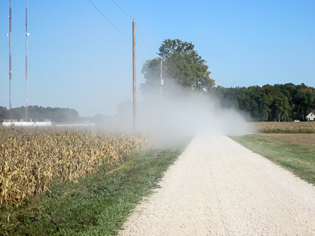
Dust from a vehicle on a gravel section of TR 148
We met Erika and her daughter Madilyn as they were coming home from school that afternoon. Erika stopped her car and commented on how few hikers they get out there. The lack of traffic allowed us time to get acquainted as we talked about hiking, state parks, and “flying” spiders. They drove on. Shortly we passed their house. Erika came out with an armful of snacks, which we humbly took off her hands. We always seem to be hurrying to the next point in order to get a little time at the end of the day to relax. But slowing down to meet and talk with people like them makes our journey so much richer.

Soybeans being harvested
On down the road we experienced a small whirlwind. When the first dried cornstalk leaf rose from a field, I thought it was a bird. But more followed, all joining in a lively circle dance. The rotating wind rustled its way through the cornstalks and carried the dancers across the paved stage before us. We stood still, mesmerized, as the show passed by. Pretty cool.
Our congratulatory team at the end of the day
After four miles on TR 148, we turned onto TR 80 for our last four miles. We paused along the way to watch the harvesting of soybeans. Two enormous combine harvesters made their way down opposite sides of a field, clearing the crop before them. Behind, chaff blew out in every direction. A grain truck joined them and pulled alongside one of the harvesters, which swung its side pipe around to shoot its load of soybeans into the truck. Everything was so efficient.
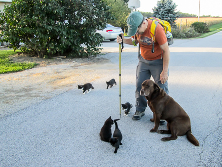
We reached our car at 6:00 and were greeted by the second big friendly dog of the day, this one chocolate colored, and five kittens. I got slobber on my pants to go with the muddy paw print on my shirt from Lucy earlier in the day.
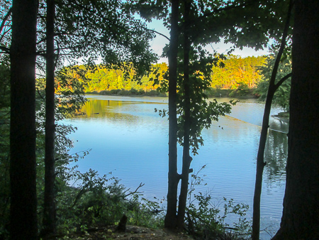
The view from Cold Rush while eating our ice cream
After picking up the other car, we headed for our motel in Norwalk. It was supposed to take 40 minutes and it was already 6:30 and dusk. We definitely wanted to get there before dark. Halfway there, however, the Cold Rush on US 20 turned both our heads. Our cars quickly followed and we enjoyed some of the best—and biggest—sundaes ever. CW had a Turtle Sundae; I had a Mint Chocolate Chip Hot Fudge Brownie Sundae. Cold Rush would close at the end of the week for the season, so our timing had been impeccable. Once again, we had to locate our motel in the dark, but we were in too much of a sugar stupor to care.
Day 7: West Lodi to SR 61 (15.7 trail miles)
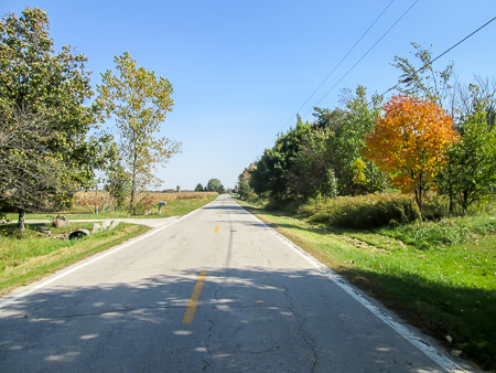
The overcast sky created perfect hiking weather
We hit the trail at 9:30 with no send-off from the resident dog and kittens this morning. It was another perfect day for hiking, overcast and cool. The combination of mostly straight roads and barely any traffic made it conducive to multitasking. CW trailed behind to practice his sermon for the campground Sunday. (The corn was all ears.) I finished a rough draft of yesterday’s blog.
After a while, CW looked for his sermon notes and couldn’t find them. Since they were much more important than the lost map on our last trip, we walked back about a half mile to retrieve them from the road where they had fallen out of his pocket. Until then we were making good time.
Reservations for lunch at Slate Creek Cafe
As we traveled that stretch of road for the third time, a car approached us, slowed down, then stopped. Whenever a car stops by us with the window down, there is a bit of excitement at the anticipation of what the driver will say. This man told us he didn’t think we were walking fast enough, but with a glint of humor in his eyes.
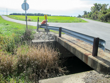
At noon we rested on a guardrail over Slate Creek to eat some lunch. There was no shade in sight.
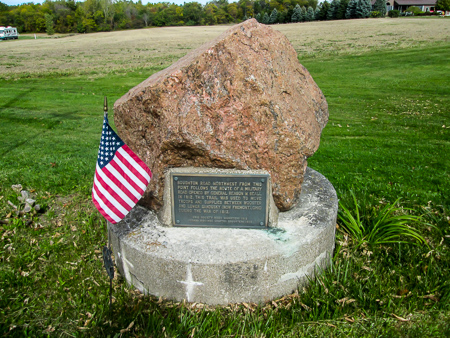
Bronze plaque telling history of Old Military Road
After 5.5 miles of walking directly east, we turned southeast onto Old Military Road. It looked like any of the other roads we had walked, but its history goes back to 1812 when it was used to move troops and supplies during the War of 1812. On a winding section walled in by unharvested cornfields, a man bicycled up behind us and chatted for a bit before wheeling on.
At 2:00 we arrived at the pub in Havana. There we rested and talked with the bartender. I was most grateful for the restroom since we had a long day with absolutely no facilities along the route.
More hills ahead
For about the last five miles, we noticed the hills in the road—and felt every one of them. We finished at 4:30. When we went back for the other car, I saw that we had slightly hilly terrain the whole day. I just hadn’t noticed it with fresh legs.
We had talked earlier in the day of reshuttling the cars and doing a few more miles, but after nearly 16, we gave in to the protests from both our bodies and called it quits. We stopped in at the Havana Tavern again, this time for sandwiches.
We picked up ice cream at Vargo’s Food & Fun down the street from our motel. I had a Heath Flurry, which I ate back in our room where I could recline on the bed and rest my sore legs and feet.
Day 8: SR 61 to Intersection of Cook and Monroe Roads (Huron County) (15.5 trail miles)
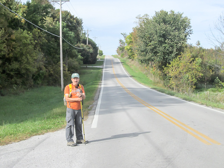
Joan (right) with Ester and Jade, her support team
We decided to do today’s hike in two legs with a reshuttle. Our midpoint would be Indian Creek Campground. When we arrived around 8:30, CW went looking for the owner, but instead found two campers, Joan and Ester. We were amazed that Joan Young also was hiking the BT. We were more amazed to learn she had hiked the entire North Country Trail (NCT), a 4,400-mile trail that goes from New York to North Dakota. And we were even more amazed that she was the first woman to do so.
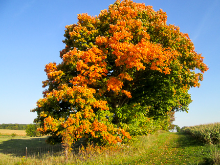
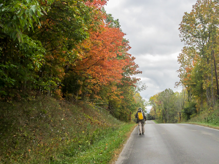
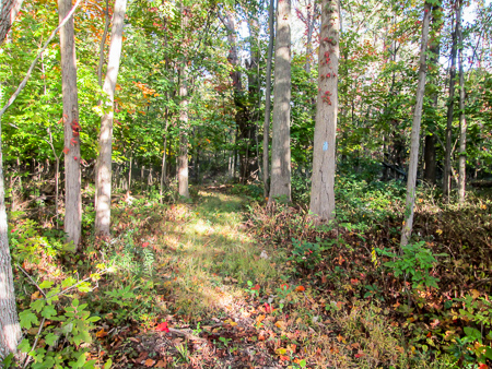
Finally seeing some fall color
Much of the BT is concurrent with the NCT. Joan is in the process of walking the part of the BT the NCT doesn’t cover and plans to complete it next spring. Ester and her dog Jade are Joan’s support team. We very much enjoyed talking with these ladies.
When we found them, they were getting ready for Ester to drop Joan off where she would be hiking for the day. Ester would then break camp and they would head home when Joan completed her day’s miles. If CW had not noticed a sign for US 250 out of Norwalk this morning, we would have taken a longer route to the campground and surely have missed them. Talk about amazing. Just one of those cool God-things that put fellow hikers from Michigan and Kentucky in the same spot several yards off a trail in Ohio at the same moment.
Joan is also an author. If you are interested, you can check out her books here (one is on the NCT) and her website here.
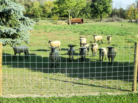
Curious sheep
The campground owner happened by and we paid him a nominal fee to park our car there for the day. It was nice to have it off the road. Our other parking spot this morning was “on” the road, on a wide grassy—but slanted—shoulder. We finally got started at 9:30.
We had seven straight-road miles to go on Townline 131. It was warm, but an occasional breeze was a big help. We passed more soybean harvesting. We were beginning to have some awesome color sightings, which is one of my favorite reasons to hike in the fall.

Skittery sheep
Sheep make me happy, too, so it was fun to see several fields of them today. They were a little different toward passers-by, though, than the cows and horses that stand still staring at us till we’re out of sight. As I stood at the edge of the road taking their picture, they curiously gathered closer to watch. However, one small step in their direction sent them racing to the back of the pasture en masse.
By 11:30 I had finished a “walking” draft of yesterday’s blog. Again the quiet roads were ideal for working.
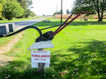
Firelands sign by a mailbox
We became curious about the Firelands signs we saw in some yards. I found out that half a million acres of the west end of the Western Reserve had been given to Connecticut civilians after the American Revolution in 1792. Those folks had angered the British by shipping supplies to the Continental Army. When the British sent raids out to destroy the supplies, they got out of hand. In several cities they burned civilian property. Since there was no money to compensate the people, they were given the Fire Sufferers Lands, later shortened to Firelands, in what is now part of northern Ohio.
The only place to walk on US 250
From TR 131, we turned onto busy US 250. It had been a nice road to drive that morning, but it was absolutely horrible to walk—lots of traffic, many semis, no shoulder. We were basically forced to walk in unmown grass. It looked flat, probably from the hurricane winds from trucks, but it was deep. I had to step high. I felt like I was back in marching band. The temperature was rising, I was tired, and I was in no condition to march. I thought I might drop and CW would have to bring the car back for me. When we could, we moved to the edge of empty cornfields and walked in the dirt.
Emma and Debbie were in their yard and asked what we were doing. We talked a while, answering their questions. Emma had been mowing earlier until a belt came off her riding mower. CW tried to fix it but couldn’t. We said our good-byes.

In need of some TLC
After three quarters of a mile on US 250, we wearily and happily turned off and soon reached our car at the campground. We went in search of another place to park, found one eight miles farther, dropped a car off, and returned to the campground.
Our second leg began at 2:00. I was already worn out from the morning. The temperature had reached the high 70s and the sun was brilliant—ly hot! I don’t do heat well. I wilt. It zaps my energy. I was still wearing my jacket for sun protection, but I decided sunburn was better than heat exhaustion so it came off.
Every bit of shade was welcomed
We both went on auto-pilot—one foot in front of the other. I reminded myself to enjoy the moment. The afternoon roads had more woodsy patches and front yard trees next to them. I welcomed every shady spot in our path, every sip of ice cold water, every breeze that cooled my skin. We made it to the car in just over three hours and immediately started up the air conditioning.
After healthy salads at Wendy’s, we hit Vargo’s again because it was close to the room. I questioned what their Jamocha Shake was. It was just a coffee shake. No chocolate? They could add chocolate syrup. Do it! McDonald’s mocha frappes keep me up at night. What was I thinking? But it sure tasted great!
Day 9: Intersection of Cook and Monroe Roads (Huron County) to Spencer Wildlife Area (17.8 trail miles)
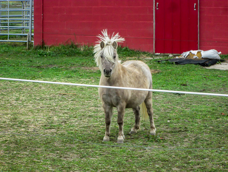
Even horses have bad hair days
We wanted to make this a big-mileage day and maybe not hike tomorrow. We mulled over different possibilities. How many miles could we squeeze out? One leg or two? Do some of it counterclockwise? Our plans were fluid up to when we left the room at 8:05.
We decided on two legs, both clockwise, but we would do the second leg first. That way when we picked up the second car at the end of the day, we would be farthest west and closest to our motel. The middle of our day’s hike would go through Findley State Park, so we chose the middle of the park, where a parking lot was located, for our beginning and ending hiking spots. With cars in place, we began hiking at 9:45.

Hickory Grove Trail in Findley State Park
Yesterday we heard a rain forecast for today, and I was hoping for its accuracy. However, we only experienced a brief sprinkle when we reached the park. That was OK, though. It was cloudy and cool with the high in the mid-50s. So appreciated after yesterday’s heat. The birds sounded cheery as well.
Our first mile was through a wooded area of the park. It was enjoyable to be walking on a leaf-covered dirt trail. I missed one blaze that added a quarter mile, but at least it was in pleasant surroundings. We emerged from the woods at the east end of the park and were back on the familiar pavement of straight roads.
By now we had decided not to hike the next day. The miles today would complete the Norwalk section and take us 9.5 miles into the Medina section. We would be in good shape for our next trip up.

Oreo cows
CW hatched an idea to leave a car in the area and save us (me) some driving. He made some phone calls and contacted someone involved with the Buckeye Trail who lives in the Medina area. The man said we could leave a car in his driveway, so we made arrangements to drop it off when we finished hiking at the end of the day. That meant I wouldn’t have to drive home this trip or back up on our next trip. I was doing a happy dance in the middle of the road!
I took time out to snap a picture of cows I’d never seen before. They were black or brown except for wide white bands around their midsections. I found out they are Belted Galloways, a hardy breed of Scottish cattle. They are one of the oldest breeds of cattle and well suited for northern climates. Because of their appearance, they are also called Oreo cows.
Rolling road and autumn color
The roads had many rises, but they didn’t bother us today. A great breeze blew much of the time creating wonderful hiking conditions. We passed the usual fields and farmhouses and a rare blueberry farm before reaching Spencer Wildlife Area, the farthest point east for us this week on the BT.
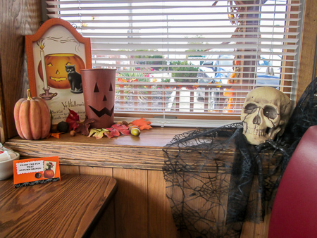
Halloween decor in Spencer Restaurant
While shuttling for our next leg, we couldn’t resist detouring south a mile to the town of Spencer and eating lunch at Spencer Restaurant. Our meals were delicious and the dining room and outside was elaborately decorated for Halloween. The waitress said that was nothing compared to what they do for Christmas.
We started out again at 2:30, this time from where we ended yesterday, and now headed east toward Findley State Park. The overcast morning had given way to sunny skies but there was still a refreshing breeze.

Mr. Clydesdale wouldn’t stop eating for his photo
Can you grow tired of golden fields below gorgeous blue skies? I hadn’t so far. We also enjoyed looking at the houses, both old-style farmhouses and modern spic-and-span houses set back from the road behind large manicured lawns. I wondered if this area was settled by Scots when we saw a Clydesdale. Like the Oreo cow, they originally came from Scotland.
A man stopped his car and asked if we were BT hikers. He had met Ladybug a few years ago when she was hiking the BT. She’d had a sit-down meal with him. We had never met her but knew of her. She was the first female to solo thru-hike the BT. It would have been nice to talk with the BT enthusiast more, but traffic wouldn’t allow it.
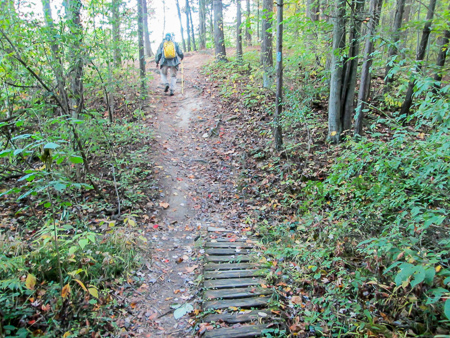
Footpath into Findley State Park from SR 58
We reached Findley State Park at 5:35, finishing the Norwalk section. The BT entered the park from SR 58 on a footpath. The first bit wasn’t the easiest walking. The path was covered with vegetation and sticks. Then at a sort of clearing, we couldn’t find a blaze to know which way to leave it. We finally made our way by looking backwards to see blazes going the other way.
Confused by the blazes and three trails to choose from
After crossing a small parking area, we had another dilemma. The BT was marked with a sign, but also with an unfamiliar three-blaze configuration. There was also a trail to the left of it and another to the right of it. Yesterday, Joan had given us a heads-up that things weren’t as they seemed. She had taken a marked path, but then had to backtrack and take another.
Thorn Mountain Bike Trail with lots of exposed tree roots
We saw blazes on the trail to the right, but according to our map it didn’t look like it went the right way. Joan had said go to the left. We started down the leftmost trail but soon discovered it was on the wrong side of the lake. Must have gone too far left. So we took the middle path, which had no blazes that we could see at first. Finally they began appearing and we were OK. That trail also happened be a mountain bike trail and was fairly rugged. We had to be careful of the many roots in the path, and once had to step off for bikers bouncing down the trail.
View of Findley Lake from the Buckeye Trail
It took us 50 minutes to cover the mile through the park to our car, but still the woods at the beginning and end of our day were pleasant bookends. We finished at 6:30.
Our day wasn’t over. We had quite a bit of driving to do to pick up the other car and drop one off in Medina. If we had known first thing this morning we would be doing that, we would have shuttled differently. It was dark by the time we found the house. We visited a bit with the couple who would car sit for us and didn’t make it back to the motel until 9:45. On the way we stopped at Circle K so CW could get some coffee. That’s where I got my ice cream for the day—a Klondike Bar. What will I do for a Klondike Bar? Hike nearly 18 miles.
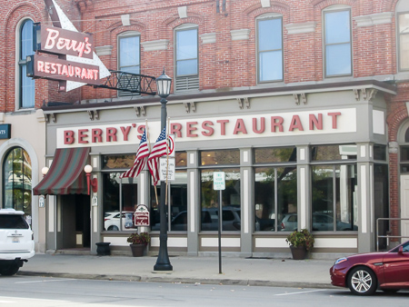
Historic Berry’s Restaurant in Norwalk
We had hiked 60 miles this week. Since we weren’t hiking the last day and we had dropped the car off the night before, we had the morning to enjoy a mini-vacation. CW had seen Berry’s Restaurant in downtown Norwalk. The historic restaurant has been owned by the same family for half a century. The building is the last remaining part of the St. Charles Hotel built in 1867. We had a wonderful, relaxing breakfast there. Then we had time to browse in a few nearby shops before heading home to pick up Sugar.
We’ll take a week off before going back up to finish this fall hike.


sharkbytes
February 26, 2017Just found this. Ha! I took some of the exact same pictures you did. Did you find my blog posts from these days?
CW Spencer
February 26, 2017Yes, Joan, I did read your posts of your hike in this area from when our paths crossed. So much fun reading someone else’s account of the same trail—seeing the things that catch the attention of both, and also the differences in their experiences. –Bonnie