by guest blogger Bonnie Spencer
April 11, 2017
This week the trail will take us northwest to Lake Erie as we hike the Bedford section. We have watched the weather forecast for several days. Though most days should be warm enough, basically we are seeing rain throughout the week, with possible snow on Friday. Not what we want to see. CW talked with Bob Morecki, the Bedford section supervisor. He told us there was a section that hikers call Muddy Lane. After our last week up, that should be a piece of cake. He also said there was a place that once had knee-deep water. We quickly decided that was a bridge (or lack of one) to cross when we get there.
The Bedford section is over 65 miles long. We have the hiking mileage planned out to keep each day reasonable, around 13 miles, except a little more on Thursday. It leaves only a few miles for Friday because we have to make it home in time to pick up Sugar.
Day 5 (Monday): Brecksville Reservation to Bedford Reservation (13.1 trail miles)
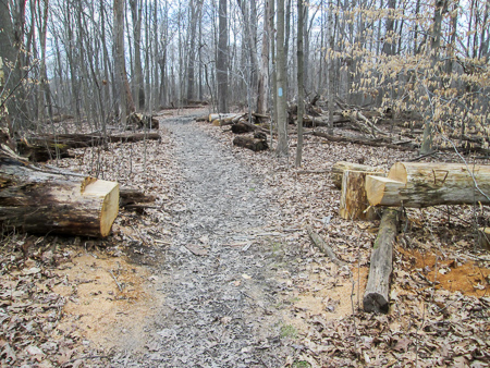
Fallen tree cleverly made into seats
We’re hiking again this week with George and Richard. They came up early and hiked a few miles on Sunday near the far end. Today they started earlier than us since rain is predicted for the afternoon. No sense in all of us getting wet. We arrived at Brecksville Reservation at 11:30 a.m. under sunny skies and headed out immediately from the same point we started last week, but going northwest instead of south.
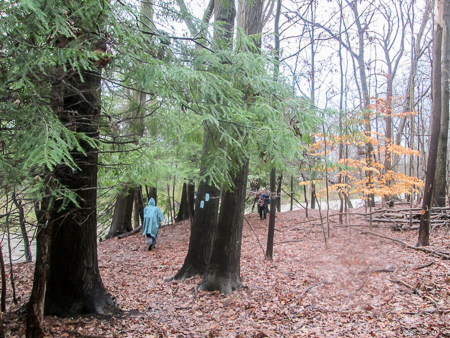
I’m not sure of the exact location of Muddy Lane. It could have been one of several places on the trail through the reservation. There were some steep inclines as well. The experience wasn’t as bad as we remembered on our Akron trip, though. We must be getting used to the mud and hills. We could enjoy the beauty of the woods.
We have seen a great many trees down in the woods up here. Some we have to step over or go around, but many have had a section cut out of them to allow hikers to pass through.
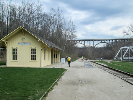
Brecksville RR Station is painted yellow to signify it is a modern depot. The original ones are red.
After a couple of miles, we joined an all-purpose trail that led to the Brecksville Railroad Station. The Valley Railway began in 1880 and connected mineral fields in the south to factories in the north. It ran between Cleveland and Canton. Besides being an asset to industry, it provided respite for city dwellers who wanted to escape the noise and dirt of their neighborhoods for a trip through the pastoral countryside. Today the Cuyahoga Valley Scenic Railroad follows much of the same route.

People gathered on Station Bridge to watch nest of peregrine falcons
Across the tracks from the depot is Station Road Bridge, built in 1881. It’s the oldest remaining metal truss bridge in the Cuyahoga Valley. Today a group of people with high-powered cameras were gathered on the bridge watching a nest of peregrine falcons. We crossed the bridge and continued on a paved bridle trail.
Along this stretch of trail we met George and Richard coming the other way. They had started at the other end and were walking counterclockwise. They were close to finishing, but we had nearly eleven more miles to go before they would pick us up. We chatted briefly, then continued on the bridle trail for close to three miles.
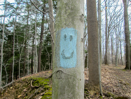
Birch tree face highlighted by BT blaze
After a short time on roads, we were back in the woods. Here we enjoyed creative blazing on the birch trees. Lots of faces are hidden in their bark. One face was seen inside a tree. (see photo at beginning)
Another short time on pavement, then back onto a bridle path for six miles. We were now in Bedford Reservation. The trail crossed bridges, forded small streams, intersected roads, and passed through an old sandstone quarry. With the many streams and gorges, we saw numerous waterfalls.
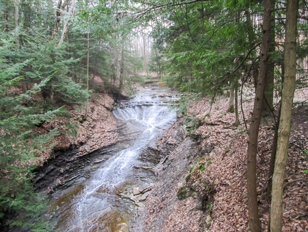
Bridle Veil Falls on Silver Creek seen from viewing platform
We were loving the woods, but we were tired. I was glad when we had only a half mile of roads left. Richard and George were there to meet us when we finished at 5:45 p.m. We had hiked 13.1 miles in a little over six hours.
After checking into our motel, we ate dinner at Bob Evans next door. It was getting late and I didn’t want to go anywhere else, so I got my ice cream there. With limited choices, I had a Molten Chocolate Cake that comes with a scoop of mocha chip ice cream on it. I really just wanted the ice cream, but it wasn’t on the menu by itself. Did I eat the whole thing? Of course. My mother always made me eat everything on my plate.
The rain finally arrived, but we had had a beautiful day for hiking. Now we needed to rest up for tomorrow.
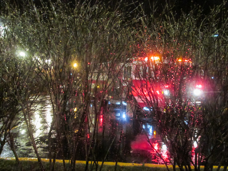
Fire engine outside our motel window
At 10:00 p.m. the fire alarm in the motel went off. I didn’t see anyone rushing out, so we stayed in our room. The alarm blared for 20 minutes until the fire department came and checked it out. Apparently there was smoke in one of the rooms. I watched the fire truck parked right outside our window. It was an exciting finish to a long day. But with the molten chocolate, mocha chips, and fire alarms, I didn’t sleep very well.
Day 6 (Tuesday): Bedford Reservation to Chagrin Falls (13.4 trail miles + 0.2 detour miles)
Hemlock and birch color the footpath along Tinkers Creek
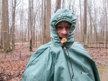
We began hiking a little after 9:00 a.m. in light rain. We slopped along a muddy footpath that crossed Hawthorn Parkway several times. The rain came harder. Richard stopped under the I-271/I-480 bridge to put on his rain pants. That was a good move because doing so stopped the rain. An hour into our day, CW and I took off our rain ponchos. Despite the sometimes treacherous terrain, it was pretty scenery.
We passed half a dozen hikers from the Cleveland Hiking Club doing eight miles of the BT this morning. It is a very active hiking club. They have several hikes going on each day of varying lengths and difficulties. It was nice to run into others out hiking the Buckeye Trail.

CW with Bob Morecki, the Bedford section supervisor
An hour more and we left Bedford Reservation to enter South Chagrin Reservation, still basically on footpaths and bridle trails. As we were crossing a road around 11:30, we heard a car horn. Bob Morecki was driving by when he saw us. He parked to the side of the intersection, and we chatted briefly. He plans to hike with us Friday.
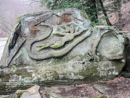
Henry Church Rock on the bank of the East Chagrin River
We continued to meander through the woods. After 2:00 p.m. we reached an overlook from which we could see a boulder carved by Henry Church in 1885 to condemn the treatment of American Indians by the government. Several emblems are carved into the sandstone, one of which is an Indian lady. It used to be called Squaw Rock, but according to the signs we saw, it has been renamed in recent years to Henry Church Rock.
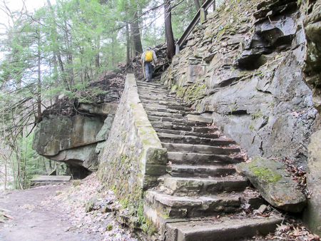
Some of the steps down to Henry Church Rock
A side path leads down to the rock, which sits on the bank of the East Chagrin River. We all decided to get a closer look. It didn’t look as though it was very far down, but 130 steps later we reached it. Going down wasn’t so bad, but coming back up was an endurance test.
We had forded several streams earlier, but then we came to Willey Creek. There was no way across it so we had a minor detour (0.2 mile) out to the Chagrin River Road bridge.
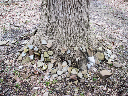
Even trees need love
A tree along the trail had a considerable number of heart-shaped rocks around its base. There was no indication of why. We could only imagine different scenarios. Maybe a group was remembering someone special, or perhaps each heart represented something different to individuals who placed them there.
We finished our hike at 4:30 p.m. We’d done 13.6 miles in 7 hours and 20 minutes. Except for the rain during our first hour, the weather was pleasant. And there had been so much beauty to soak up from the woods.
Birch tree toes?
CW and I discovered the Manhattan Deli while checking out an ice cream shop. It was just a few doors down. We ate supper at the deli, then walked back to Malley’s. I got a Pink Elephant. It sounds like a drink, but really it was a sundae: peppermint stick ice cream with hot fudge sauce, whipped cream, and Spanish peanuts.
Day 7 (Wednesday): Chagrin Falls to Patterson Fruit Farm in Chesterland (15.6 trail miles)
We ran into a problem this morning when placing a car at the end of our hike. Our plan was to park at the Gates Mills Horticultural Center. They didn’t mind, but they close their gate at 3:00 p.m. and we couldn’t take a chance that we’d make it in time. The BT follows roads in this area, so we drove farther along the trail and parked at Patterson Fruit Farm.
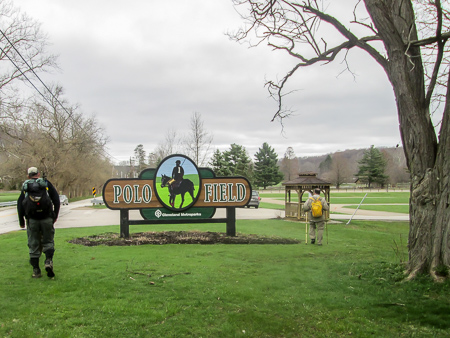
Polo Field in Moreland Hills
None of us minded adding the two extra miles. This was forecast to be the best day of the week: dry, partly sunny, high in the 60s. We got started shortly after 9:00 a.m. First was a half mile more of yesterday’s bridal path along the Chagrin River. Then the trail wandered onto country roads.
We passed a polo field. This area seems to be big on horses. It kind of felt as if we were back in Kentucky’s horse country, though I’ve never seen a polo field there. Northern Ohio has no end to bridle trails. This week we saw some land for sale. The sale sign said that horse owners were welcome.
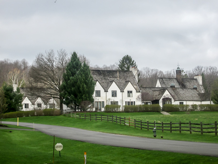
One of the many fine estates along Chagrin River Road
After a mile of roads, we left South Chagrin Reservation. We had several more miles of country roads. Most of them were not too busy, and we had plenty of room to step off the road when we needed to. We passed through the Village of Moreland Hills, the birthplace of President James Garfield. Many huge estates sat far back from the road on large acreages.
Two hours into our hike, we walked into the Village of Gates Mills. It was clean and fresh. Most of the buildings we saw were white. We used the restrooms at the library, had a snack, and moved on.
Chagrin Valley Hunt Club in Gates Mills, a private country club founded in 1909
The trail joined a bridle path and we entered North Chagrin Reservation. This week we had now been in four of the sixteen reservations that are part of the Cleveland Metroparks. Several of the reservations are linked together to form a necklace shape around Cleveland. They have the unofficial name of the Emerald Necklace.
We crossed a small bridge where several men were fishing for steelhead trout in the stream. After a couple miles, we were back on roads for the rest of the day’s hike.
We entered Gates Mills—again. We had walked into the village maybe six miles ago from the south. Now we were actually coming in from the north. That shows how the BT meanders.
Johnny Appleseed greets customers at Patterson Fruit Farm
We passed the horticultural center at 2:30 p.m. We would have made it in time to get our car. But it was a beautiful day for meandering on country roads and we would have two extra miles completed, so no one minded. We reached Patterson Fruit Farm at 3:25 p.m. finishing 15.6 miles in less than 6.5 hours.
We all returned to the motel before going to Pickle Bill’s for dinner. The guys had been there before and I kept hearing about how good it is. Our original plan was to go Thursday night, but someone (all fingers are pointing at moi) had the bright idea that Wednesday would work out better because of our hiking schedule.
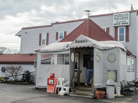
Brennan’s Fish House in Grand River
When we arrived, the lack of cars in the parking lot reminded us they are closed on Wednesdays. Plan B was to eat at Brennan’s Fish House across the road. Brennan’s opened in 1974 but it was two other eating establishments and a hotel before that. The original structure was built in 1865. Surrounded by nautical décor, CW and I enjoyed walleye.
On the way back to the motel, we stopped at Malley’s again for ice cream. I actually got raspberry sorbet for something light, but anything that is served over an ice cream counter falls under the category of ice cream for me.
Day 8 (Thursday): Patterson Fruit Farm in Chesterland to Veterans Park in Mentor (16.7 trail miles)
This would be a day of fluctuation in weather, terrain, and mileage considerations. Originally it was to be the long day for CW and me. Richard and George had knocked off 5.1 miles of it Sunday, but we would have 15.6 miles to do. Since we all did two extra miles yesterday due to the parking dilemma, CW and I were down to 13.6.

Blue sky overhead, gray sky ahead
George had the idea yesterday of us all doing more today to cut down on tomorrow’s miles (a much better idea than my idea of changing the night for going to Pickle Bill’s). This would especially be good for CW and me since we had a long drive home to spring Sugar from her cage before the clinic closed. We would make our decision later. The day was already complicated in that we had to place three vehicles today because we would be ending our hike at different spots.
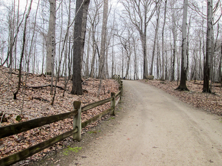
Lucky Stone Loop through Chapin Forest
When we left the motel, light rain was falling. CW and I wore our rain pants. The rain had stopped by the time we began hiking at 8:35 a.m. Sure that more was on the way, we left the pants on. In an hour, we were shedding coats as we enjoyed the sunshine.
After a couple miles on country roads, we turned into Chapin Forest Reservation, a part of Lake Metroparks. The Arbor Lane Trail led to Lucky Stone Loop. The BT follows the latter around the western portion of the summit of Gildersleeve Mountain. The BT map description says the elevation of
View from summit of Gildersleeve Mountain with Sharon Conglomerate ledge in foreground
Gildersleeve is 1,160’. My mind doesn’t understand elevation, but the fact that the elevation was given told me to expect a climb. And Lucky Stone Loop was the only trail with the “difficult” designation on the trailside signs. It really didn’t seem any worse than some of the steeper road inclines we’ve encountered, though.
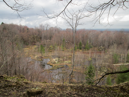
At the top of Gildersleeve, we stood on the Sharon Conglomerate ledges and looked down on a wetland that was once a quarry from which silicon dioxide was mined. In the distance was Lake Erie, but it wasn’t visible today.
CW can always find a way to get to his snacks
The BT descended from the Lucky Stone Loop to one of the many picnic areas along the trail. We were conveniently by the shelter when the rain began. After donning the rest of our rain gear, we continued on a footpath for about a mile, roads for another mile, then joined a bridle trail that entered Penitentiary Glen, another unit of Lake Metroparks.
Some of the bridle trail was the nice crushed limestone, but other parts were sticky mud or sloshy grass. We had one exciting stream to ford. It was the widest and most difficult we had encountered. CW and I had not brought sticks with us today. George and Richard crossed first and hurled their sticks back to us. CW just waded in and got totally wet. Determined not to get the insides of my boots wet, I carefully crossed on wobbly, slippery rocks with the help of the sticks and CW.
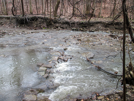
The trickiest, and most exciting, stream we had to ford
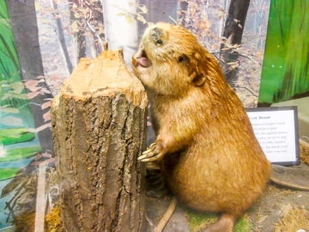
We finally reached the nature center. This is where George and Richard left us because they had already hiked the upcoming miles. CW and I dried out a little in the center. We ate our lunch in the classroom surrounded by taxidermied fowl, fish, and various other creatures including a black bear.
It was foggy and misty when we began our 5.1 miles to meet George and Richard. They were picking up the other car and scouting out a place to reshuttle because we’d all decided by this time to do a few more miles. The BT followed roads through the Village of Kirtland Hills and into Mentor. We reached our meeting place in just under two hours.
One of the critters that joined us for lunch at Penitentiary Glen Nature Center
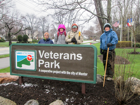
We all left our packs in the cars and set out for 3.1 more miles. Except for a short stretch on a bike trail through a wooded area, we were on city streets. We finished at Veterans Park, another unit of Lake Metroparks, by 4:30 p.m. CW and I had hiked 16.7 miles in less than 8 hours.
After changing at the motel, we all met at the Manhattan Deli for dinner, joined by Bob. Bob, CW, and I then walked down to Malley’s so I could get my ice cream. Tonight it was a Toffee Crunch Hot Fudge Sundae. They have great hot fudge, served in a mini mug so you can pour it yourself.
Day 9 (Friday): Veterans Park in Mentor to Headlands Beach State Park at Lake Erie (7.0 trail miles)
Richard, Bonnie, CW and George bundled up and ready to go
The temperature this morning was not supposed to rise above the 30s. It was snowing. I was so glad we had only seven miles to do. We drove to Headlands Beach and found the gate to the parking lot closed. Fortunately, George found another way in, and we left two vehicles.
We met Bob at Veterans Park and began hiking a little after 8:00 a.m. It was breezy. Snow, sometimes mixed with rain, was still falling. At times it felt like sleet was hitting my face. I was bundled up so well that my face was the only thing cold, though.
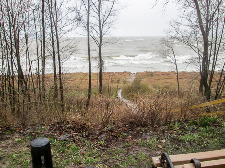
Whitecaps on Lake Erie
The BT followed sidewalks and roads for a mile to the Mentor Lagoons Marina. There we got on the Lakefront Trail, a mile-long former roadbed on a bluff above the Lake Erie shoreline. The wind was blowing 20-something mph and the waves were high and white. We passed a “No swimming” sign. No temptation there.

CW and Bob carefully step through mud on Zimmerman Trail
Leaving the lake, we walked through neighborhoods for two miles. Then we entered Mentor Marsh State Nature Preserve on Zimmerman Trail. This might have been the muddiest two miles we had encountered in both weeks of hiking. I had been through here before. Over three years ago, CW and I hiked the last 10 miles of the Bedford section with Jim Gilkey for his BT finishing hike. The trail was muddy at that time, but nothing like this.
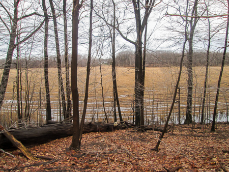
Mentor Marsh covered with recently chopped-down Phragmites
Despite the mud, it’s an interesting place to hike. We could see the marsh through the trees. It is in the process of being restored. It has been taken over by Phragmites australis, or common reed, which is an invasive grass that displaces native plants, reduces wetland wildlife habitat, and increases the potential for fire. The Phragmites has recently been cut down and water-loving trees have been planted in the marsh.
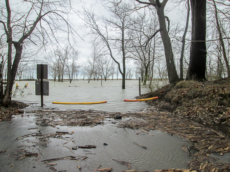
The BT goes straight ahead through this parking lot—but we didn’t feel like swimming today
We left the preserve and headed toward the lake. The BT goes through the parking lot for Headlands Beach, but the whole lot in that area was under water. Bob had never seen it like that before. We had to detour through some trees and cross the lot farther down. Then we followed a walkway between the beach and the parking area. It was extremely cold and blustery.

Bob was a fount of information about the Bedford section
We reached the northern terminus of the Buckeye Trail, the northernmost point of the BT. The others walked down to the lake, but CW and I changed out of our muddy boots and started for home.
We hadn’t gotten far when we realized we were hungry and it was nearly noon. We stopped in at Scooter’s Dawg House. We had passed it Wednesday night on the way to Pickle Bill’s/Brennan’s. Their sign advertised ice cream as well as hot dogs. Perfect!
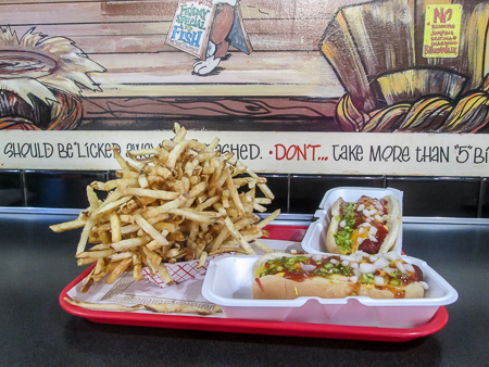
Scooter dawgs and “junior” fries at Scooter’s Dawg House
The seating area was small but the blackboard menu was huge. We just ordered the short Scooter Dawgs. The guy asked if we wanted fries—maybe the junior fries to split. CW agreed, but he was thinking that if they’re “junior” we should probably get two. Glad he didn’t think too long. We never saw such a pile of fries before. CW sent a picture to the guys. After they picked up the other cars, they all showed up at Scooter’s to eat our leftover fries. My ice cream was a Coconut Avalanche Hot Fudge Sundae with whipped cream and nuts.
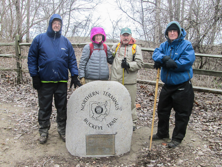
The northernmost point of the Buckeye Trail
CW and I have now walked together from the southern terminus to the northern terminus of the Buckeye Trail. Along with good friends who made it a very enjoyable journey, we have completed the Bedford section—66 more miles. A week that was supposed to be full of rain pleasantly surprised us with relatively few hours of poncho-worthy precipitation.
Our next trip up, we will begin at Lake Erie and hike south as we continue around the Little Loop of the BT.
Always fun to hear someone else’s experiences in familiar places. But how much the weather changes the experience!
Yes, the weather AND the ground conditions. Do you remember such mud when you hiked this area?
Hi you two, So glad to finally hear from you. Love the story & the pictures. Keep them all coming,
Susan
Good to hear from you, too, Susan! Glad you enjoyed this. We are looking forward to our final week that, I think, will be on flatter terrain. Stay tuned . . .