by guest blogger Bonnie Spencer
October 2, 2017
This will be the fifth 10-percenter that CW and I have hiked together (a 10-percenter being roughly ten percent of the Buckeye Trail). Since we’ve already gone from the southwest corner of Ohio to the northeast corner, it seems as though we have hiked half the trail. However, we won’t actually reach the halfway mark in miles until sometime during the second week of this fall hike.
We will be doing the Mogadore, Massillon, and Bowerston sections of the BT. Recently we mapped out our daily hikes and mileage for the first two weeks. Our first week was going to be rather ambitious until we heard the 10-day forecast. It looked as though our fall temperatures were going to play hooky. As the hike approached, the forecast didn’t improve. This time of year, we typically see highs in the 70s, but instead they have been in the 80s with RealFeel temps in the 90s. This is why I don’t hike in the summer! We started coming up with different plans. By Day 1, we were already on Plan C.
Day 1 (Monday): Mantua to Ravenna (7.2 trail miles)
After dropping our pooch off at her vacation spot—against her wishes because she’s a homebody—we drove our two cars northeast to the Akron area. By the time we navigated back roads (to avoid interstate for yours truly), checked into our motel right on the way, and got the cars in place to hike, it was already 3:15 p.m.
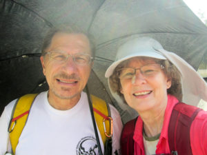
CW and Bonnie with sun protection (and Bonnie’s unwanted nose job)
Last spring we hiked 3.3 miles into the Mogadore section, so that is where we began today, in the Village of Mantua (pronounced “MAN-a-way”). It was all road walking. And it was stifling hot! I kept hearing about the record high temperatures on the drive up. Today’s high was forecast to be 87 degrees (RealFeel of 97 degrees). There were no clouds to block the sun. I wore long sleeves and a hat for protection. I never wear a hat because it makes me hotter. However, three days ago I had a basal cell carcinoma cut out of my nose and I thought I should start being smarter. So I was hotter, but safer. We were very grateful for an occasional breeze.
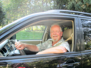
Tom, a friend of the BT, who wants to offer camping on his property in Mantua to BT hikers
After a few blocks through Mantua, we were on country roads. If not for the heat, they would have been totally enjoyable. Canada Road lasted less than a mile and had hardly any traffic. One of the handful of cars stopped beside us, and the driver asked if we were hiking the Buckeye Trail. A pleasant conversation followed. Tom lives on Canada Road and is offering camping on his property for BT hikers. Campsites are needed for hikers wanting to backpack the BT, so Tom is providing a great service. (FYI: He has a swimming pool.) He gave us his contact information, so if anyone is interested, we can get you in touch with him.
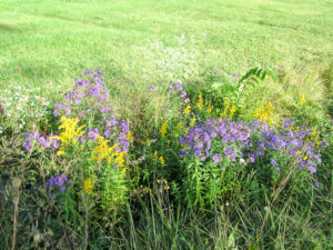
Pretty wildflowers along a country road weren’t frazzled a bit by the extreme heat
The last road went straight for six miles. We didn’t have to do any thinking about which way to turn. There were welcome pieces of shade, compliments of the wooded areas next to the road. As the sun sank lower, we enjoyed more shade.
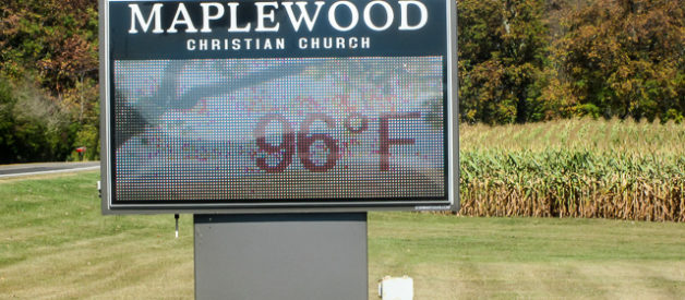
We finished at 6:20 p.m. at the Maplewood Christian Church in Ravenna. Their digital sign said it was 88 degrees. We had walked 7.2 miles in three hours. A short day had been purposely planned since we knew we would get a late start.
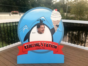
CW chilling at the Chilling Station in Mantua
When we went back to Mantua for our other car, we discovered the Chilling Station. Perfect! We were ready for our daily ice cream. I got a scoop of Majestic Milky Way. For ice cream connoisseurs, that is “chocolate flakes blended with a caramel fudge ribbon in milk chocolate ice cream.” Delicious!
We didn’t get back to the motel till 8:30. Tomorrow we’ll be out “walking in the sunshine” again.
Day 2 (Tuesday): Ravenna to Michael J. Kirwan Lake (9.3 trail miles)
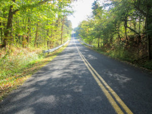
Trees offered some shade under the cloudless sky
The forecast was a high of 89 degrees, hot and muggy with high ozone and poor air quality. Yippee! Because of this, we cut our originally-planned 17.2 miles down to 9.3. That turned out to be a very wise decision.
After a short walk on busy SR 88, where we walked far off the road in a wide grassy area, the BT moved onto quiet country roads. Only seven cars passed us in three miles. Like yesterday, it was hot with no clouds to shield us. Although there were some long stretches of pure sunshine, much of our first six miles was dappled with shade from trees.
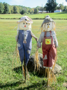
We were perked up by this cheery couple
The lovely country homes were decorated for fall. I’m sure I missed a lot, however, since I was hunkered down under my sunhat. I mostly kept my head down, watching the road, in order to achieve maximum protection for my face.
Through one stretch of shade, I did enjoy some playful black birds (I don’t know what particular kind) that flew noisily out of trees on both sides of the road as I passed. They crossed the road ahead of me, bringing to mind the crisscrossing formation of a marching band, and settled in trees on the opposite side of the road from where they began. As I got closer to them, they repeated it, all of them switching sides again. This went on several more times till they finished their game.
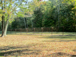
Fence around Camp Ravenna Joint Military Training Center
The BT passes by the western end of Camp Ravenna Joint Military Training Center, formerly the Ravenna Army Ammunition Plant, built at the beginning of WW II. It produced ammunition for the U.S. military during WW II, the Korean War, and the Vietnam War. The Ohio Army National Guard now uses it as a training site. The fenced area is approximately 11 miles by 3.5 miles.
The extreme heat and mugginess made me miserable. When we turned onto our last road, there was finally a small breeze that blew in our faces from time to time.
Around noon, we followed a footpath into West Branch State Park. The park surrounds Michael J. Kirwan Lake, which is over 2,600 acres and makes up nearly half the park. The BT makes a 7-mile loop around the western section of the lake. We had three of those miles to hike on the north side of the lake to get to our car parked in the lot by the causeway.
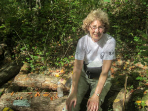
Bonnie with uneaten PB&J, looking much better than she felt
It was slightly cooler under the canopy of trees, but that really isn’t a good word to use because there was nothing cool about the day. I was already spent when we reached the woods, and I never got any better. I shed my long sleeves and hat, which helped somewhat. We soon found a log to sit on. CW ate lunch, but I was too hot and uncomfortable to eat anything.
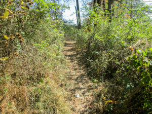
The trail was wide in some places. Other parts were narrow with encroaching weeds, but still fairly navigable. There were some ups and downs. I called them hills; CW called them bumps. I think he was trying to make me feel better. The trail was well-marked for the most part, but in a couple of places we had to choose a path and walk ahead to see if it was the correct one. A really big positive was that the trail was dry. Not a bit of mud! If you read my blog from our spring hike, you know why I’m so ecstatic about that.
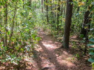
Trail around Michael J. Kirwan Lake
Every time we went up a “bump,” I had to stop to get my breath and hope for some more energy. It wasn’t only the inclines, though. I couldn’t breathe on level ground either, except to force out moans and groans. I had no choice but to take lots of breaks, though I was painfully aware they would prolong my ordeal. If there had been any access to a road, I would have lain on the ground (and I can’t bear to lie on the ground) and waited for CW to drive back for me. I have never been so miserable on a hike. To those of you who tell me that reading these blogs is like being there and experiencing it, I’m truly sorry for what I put you through today.
Finally seeing the lake ahead meant I had survived
We finished at 2:45. It took us 2 hours and 45 minutes to walk the three miles of woods, 5 hours to walk the entire 9.3 miles. I was so relieved to finally spot the lake ahead because it meant we had reached the parking lot. Water and air soon revived me, so I guess I wasn’t as far gone as CW and I thought I was. The temperature when we finished was 90 degrees.
We drove north to Mantua to get ice cream at the Chilling Station again. Yesterday I had seen another intriguing flavor I wanted to try. But the shop didn’t open till 5:00 p.m.! To kill time, we headed down to Rootstown to work out arrangements for parking our car tomorrow. After killing more time browsing in a huge antique mall, we went back up to Mantua. In all, we drove 40 miles for that ice cream! Not like we’re fanatics or anything. I got a scoop of Michigan Pot Hole, “thick, black-tar fudge in chocolate ice cream with chunks of chocolate asphalt.” It was worth every one of those miles!
Day 3 (Wednesday): Michael J. Kirwan Lake to Rootstown (7.9 trail miles)
We got an earlier start today for a couple of reasons. We had arranged to meet someone in Mantua in the early afternoon and had to make sure we could complete our miles and still get there on time. Also, we wanted to start while it was a little cooler. I hoped to avoid a repeat of my near demise yesterday.
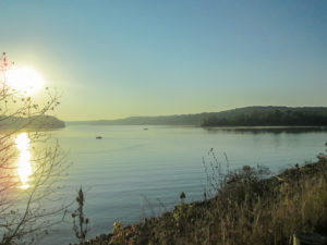
View from the causeway of the morning sun shining on Michael J. Kirwan Lake
With yet another day of high heat ahead, we had again shortened our original miles. We were on the trail at 8:00 a.m. The sun was up but not yet hot—only 61 degrees. My hair felt damp already from the moisture in the air, though.
We walked a short distance on the causeway that crosses the lake and then went back into the woods to continue the loop for four miles on the south side of the lake. These were the same woods that I almost didn’t make it out of yesterday, but today was much better. Although still humid, it was cooler starting out. And I was fresher and hydrated. When I got to the top of a “bump” today, I didn’t need a recovery time. That was such a good feeling.
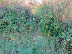
CW on uncleared footpath back into the woods
The footpath into the woods was narrow and not at all cleared. CW finally stopped to put on long pants for protection from the encroaching flora. Right after that, the path became hikable. We were able to make much better time than yesterday. Most of the streambeds were dry. Lots of trees were down, but many recently had sections sawed out of them so hikers could use the path. We had to climb over or go around some larger trees. Except in a couple of places where we had to scout ahead, the trail was blazed well.
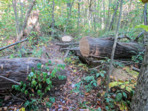
Many trees had fallen across the trail
We emerged from the woods before 10:30. The trail went back on roads—back to high heat and cloudless skies—for four miles. I was a good girl and wore my long sleeves and hat. I had to stop and rest several times to get to the finish line. It was a good thing we weren’t doing any more miles.
Throughout the week, we passed several products for sale in yards. They were displayed with prices. Payment was on the honor system. We saw pumpkins, gourds, corn stalks, and even eggs chilling in a cooler.
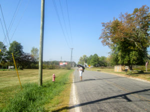
Four miles of cloudless skies and little shade
We finished just after noon, averaging two miles per hour. We were happy with that. After reviving with A/C and ice water, we tootled up to Mantua. We met a recent acquaintance for lunch at McDonald’s. He brought a friend with him who had recently lost his adult daughter to suicide. The man had read CW’s book and wanted to meet him. It was a blessing to us to be able to share some time with both of these men.
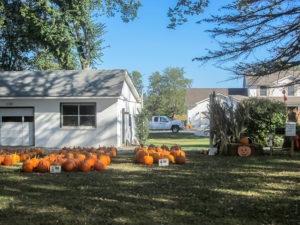
Pumpkins and corn stalks for sale along the road
After picking up the other car, we returned to the motel to drop off a car and begin our ice cream search. We drove one direction and ended up in downtown Akron without finding any. Where do people hide their ice cream up here? We drove back past the motel and went the other direction. Before long, we found Stricklands Frozen Custard (which is really ice cream) that we had discovered in the spring but had forgotten about. They don’t have a huge selection—basically a couple flavors of the day. I got Blueberry. We traveled only 20 miles for our treats today.
Tomorrow will be another early morning. It’s supposed to be cooler, and we have a lot of miles to try to make up.
Day 4 (Thursday): Rootstown to Mogadore (17.1 trail miles + 0.4 miles to escape poison ivy)
What a difference 20 degrees makes. The high today was that much lower than yesterday. It actually felt like fall when we started hiking just after 8:00 a.m.
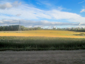
Shady road, sunlit field, and glorious sky
We began with over six miles on roads. The temperature was 61 degrees—cool and refreshing. Partial clouds kept a lot of sun off for over a mile as we walked parallel to I-76. Then we had a mile and a half on a road that became one of our favorites. It was mostly shady from woods that often lined both sides of the street, and there was hardly any traffic. Very peaceful. The last three miles of road walking was sunnier and I had to get my long-sleeved shirt and hat out again. Still, it was so much more tolerable than the rest of the week has been.
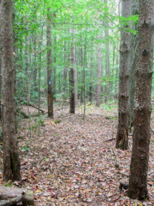
Leaf-covered trail around Mogadore Reservoir
Around 10:30 a.m. we reached the Mogadore Reservoir, a property of Akron Water Department. The BT follows over eight miles of the reservoir shoreline, nearly a third of the total shoreline. We entered the woods on an overgrown footpath that soon gave way to a much better trail. We walked on a floor of leaves—and twigs, roots, and pine cones. The trail was fairly level, though—and dry!—so we zipped through at a good pace.
It was cooler in the shaded woods and so pleasant. I stuffed my long sleeves and hat into my pack. The birds were enjoying the weather, too. I couldn’t see them in the tops of the tall trees, but they sure could be heard, dozens of them all at once. They sounded as if they were having an old-fashioned prayer meeting. Maybe they were singing “I’ll Fly Away.”
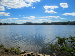
View of Mogadore Reservoir from footpath
For perhaps a half mile, the trail joined a service road. From this point on, we were able to see the reservoir at different places. Even without the fall color in the trees surrounding it, the water provided a beautiful scene with the sun sparkling on its surface.
The trail went back into the woods for a while. The path was similar to what we walked earlier, but the pine cones had been replaced with walnuts, hickory nuts, and acorns. We returned to the service road for a stretch and got to our car at the boathouse just after noon. We had walked 9.7 miles in four hours and still felt great.
We had salads at Arby’s. I sat there shivering in my sweaty T-shirt and damp jacket, but I figured it would be good to store up some cold reserves. We reshuttled the cars and started back on the trail at 1:45 p.m.
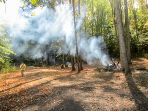
Workers were burning limbs along the service road
The trail continued from the boathouse back into the woods for 4.4 more miles around the reservoir. This afternoon we had some trouble with inadequate blazing and impassable paths. Soon after we began, and due to the lack of blazes, we nearly missed the turnoff from the service road to a footpath that took us closer to the water. Then we wished we had missed it. The path was narrow with poison ivy everywhere. It was impossible to not be brushed by it. When we came to a place where the path was totally grown over with poison ivy, CW refused to go on and I gladly followed him up to the service road, which is where we were to come out anyway.
We continued to alternate between the service road and footpaths. The service road was flatter, wider, and therefore, quicker. The footpaths were completely shaded and cooler, and pretty to look at. Although the surrounding woods had poison ivy, it was more avoidable than earlier.
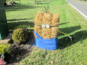
BT hiker just made “bale” and was hanging around Boyle’s Nursery
The last section of woods, however, turned out to be a poison ivy warehouse. The nasty stuff was reaching for us from every direction. We came to a place in the trail that we couldn’t have gotten through without a machete. We had no choice but to backtrack to the service road.
We left the woods for two more miles of road walking to get to our car. The traffic was bad and we spent a lot of time in the grassy or gravelly shoulders. We were tired, but in good shape when we finished just after 5:00 p.m. Physically, we could have knocked off a few more miles, but it was too late in the day. It had taken us less than 7.5 hours to hike 17.5 miles.
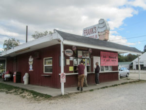
Frank’s Drive-In on OH-43 in Mogadore
We had spotted an ice cream shop this morning during shuttling, and that’s where we headed. Frank’s Drive-In has a large assortment of flavors and the prices are reasonable. The shop will close for the season in a couple of days. I’m glad we got there in time. My scoop of Cappuccino Crunch was one of my favorites so far.
Day 5 (Friday): Nimisila Reservoir to Crystal Springs (7.5 trail miles + 0.6 extra miles to car)
Out of necessity, last night CW and I came up with a Plan D for hiking today. We had previously made arrangements to leave one of our cars up here with Steve Walker, president of the BTA (he didn’t know that car sitting was in the job description when he recently assumed the position), so we would have only one car to drive home. We were going to hike 10.5 miles today to finish the Mogadore section, but we would have been very rushed to get in that many miles and get the car to Steve’s house by 1:00 p.m. So we decided to do 7.5 miles in the Massillon section that was scheduled for our next trip up. I really like to hike the miles in order, but this was shorter, closer to Steve’s house, and closer to our home. It just made sense.
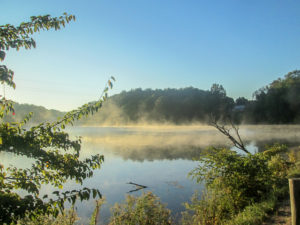
Morning fog on Nimisila Reservoir
The forecast was partly cloudy, high of 70, 10-20 mph winds—all great for hiking. Occasional showers were possible in the afternoon, but we would be finished by then. When we began hiking around 8:00 a.m., it was only in the 40s. Not too cold at all; we knew we would soon warm up from walking.
All the miles today were on roads, so we could make good time. We started hiking along the boundary of Portage Lakes State Park. It consists of several lakes and four reservoirs. We walked south along the east side of Nimisila Reservoir and then passed a couple of lakes outside the state park. Every body of water was a beautiful sight with fog hovering over the surface, infused with golden sunlight. We watched a couple dozen geese in the distance flying together just above the water.
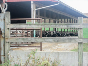
Bovine brunch hour at Clardale Farms
It was shady, cool, and quiet except for the geese flying overhead. We must have been in their traffic pattern. After a couple of miles, there were some open fields that took away our tree protection, but we still had some cloud cover and a breeze. We passed nice houses. Construction was taking place in new subdivisions. A couple more miles and we were in a more rural area with older farmhouses and fields of corn and soybeans. At 10:00, we walked by a large barn where about 30 cows were all lined up having brunch. One fashion-conscious bovine was segregated from the rest. (I couldn’t tell if it was her or her owner’s choice.) She seemed happy to have an audience so she could show off her fancy earrings.
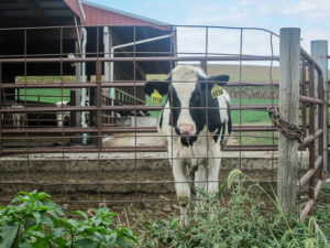
Fashion-conscious Felisha showing off her new earbobs
The last mile was back to more residential countryside, with more houses replacing the crops. The cloud cover had increased by then. The entire morning had been comfortable and quiet and beautiful. It was a great way to end our week.
We finished before 11:00 at the point where the Akron section ends and meets the Massillon section. We had to walk a few tenths farther to our car, as we also had to do this morning when we began. Since we had time for lunch, we drove into nearby Canal Fulton to eat at the Century House, a restaurant we had enjoyed in the spring.
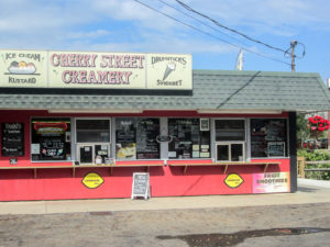
Cherry Street Creamery in Canal Fulton
Then we visited the Cherry Street Creamery. We’d seen it last spring but it hadn’t worked out for us to stop at that time. They have a huge selection of ice cream and frozen yogurt, and they also serve sandwiches. I got a scoop of Mocha Cappuccino Almond Fudge. It was wonderful. This week I’ve had some of the most enjoyable ice cream on the entire Buckeye Trail.
We dropped one car off at Steve’s and were headed home by 1:30. Although we walked only 49 miles this week due to the heat wave, it was a great week. We had survived awful hiking conditions to finish with two beautiful fall days. And we were blessed with good conversation with a friend of the Buckeye Trail and good fellowship with our new friends.
I’ll be back with Part Two in a couple of weeks. Until then, I’ll leave you with these words of wisdom:

Sign hanging in the Chilling Station in Mantua

