
by guest blogger Bonnie Spencer
October 30, 2017
All week, we have been watching the forecast for eastern Ohio. It appears as though there will be no escaping some rain, perhaps heavy; some winds, perhaps blustery; and some chilly mornings. Our rain gear and warmer clothes are packed.
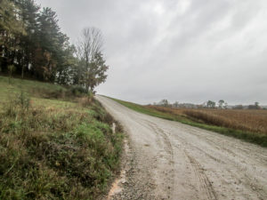
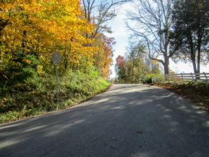
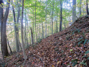
One of the many hills encountered in the Bowerston section
I’ve been reading the trail map for the Bowerston section. It is peppered with words and phrases such as “ascends,” “climbs,” “descends,” “over the hill,” “over the steep hill” (italics mine), “ridge top,” “undulate,” and “up the long hill.” Whew! I’m not even hiking yet and I’m already out of breath.
This section is nearly 64 miles long. CW doubts that we can finish the entire section in the time we have this week considering the rugged terrain and our shortened bookend days. I would love to prove him wrong, but crawling up hills is a pretty slow mode of travel. He’s probably right.
Day 11 (Monday): New Cumberland to near Leesville (9.8 trail miles)
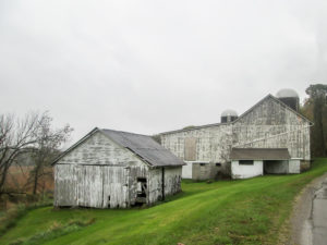
Gray barns against a gray sky
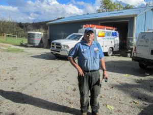
Gray skies blanketed our car on the drive up. When we reached the motel, the sun was trying to peek through but just couldn’t manage to stretch the clouds thin enough to make an opening. No rain appeared until we had unloaded the car; then it was a sprinkle on the windshield. After we got a bite to eat, the sprinkle turned to a light rain. We picked up our other car from where it had vacationed last week in New Philadelphia and located a spot to end today’s hike. Hos, the kind gentleman who owns Hos’s Bait & Tackle, allowed us to leave a car on his property.
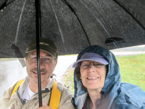
Starting the day in the rain wearing my new blue Frogg Toggs rain jacket
We began hiking at 1:23 p.m. in a steady rain. I was wearing my new blue Frogg Toggs rain suit that CW gave me for my birthday yesterday. He must have been tired of me borrowing his. The pants didn’t keep my jeans entirely dry, but they helped a great deal. I wore the jacket over my pack, opened because it wouldn’t close, but I had another rain coat on underneath. This is a good arrangement for a day of light rain, but today my poncho would have been better.
It rained our entire hike. Sometimes it was just a mist, but most of the time it was a steady to pelting rain. I didn’t take nearly as many pictures as I usually do. It was too wet for my camera to be out. And it was pretty much impossible to take notes. Four hours of rain produced only two notes: starting time and stopping time.
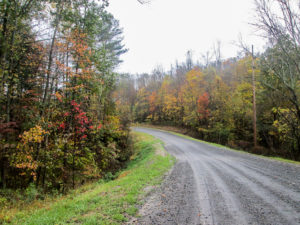
A colorful gravel back road
Virtually all the miles today were on back roads, some paved, some gravel, some dirt—but all only lightly traveled by vehicles. There were a couple that slowed me down quite a bit, but most were tolerable. Maybe I had built up some stamina on our last trip. More likely, though, it was the fact that my mind was focused elsewhere. My Frogg Togg hood kept pulling down on my cap, which pushed on my glasses causing them to dig into my nose. It was annoying. That kept my head down because it hurt my neck to push my head up. I missed a lot of the beautiful countryside we passed through.
Subdued autumn colors in the rain
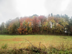
In spite of the wetness and not being able to take notes and pictures, there was a pleasant aspect to the day. On the drive up, we had finally seen some nice fall color. And we saw more on our hike today. It wasn’t full-fledged autumn brilliance, but it was heart-warming scenery none-the-less. CW even remarked that the rain and clean air were refreshing.
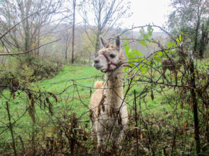
A wet llama bounced over to the fence to check out the hikers
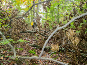
A couple of times, the rain came down quite hard. Once was on a dirt road that was entirely shallow ruts filled with muddy rain water the color of hot chocolate. Every rain drop that plummeted into the water created a momentary quarter-sized circle the color of the dark chocolate left in the bottom of the mug. It was like strobe lights with the dark brown flashes going on and off all over the road. So cool! But it was too wet to get my camera out. (sigh)
We saw numerous twigs and branches strewn across our last road and moved the larger ones off to the side. We reached Hos’s at 5:30. He was glad to see that we made it back. He said they’d had two very heavy downpours and some 50 mph gusts in his valley. We had experienced some high winds, but fortunately, not that strong.
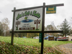
Hos’s Bait & Tackle: live bait, fishing tackle, and a parking place for the day for two grateful BT hikers
We returned to the motel and changed out of our wet clothes. Soup sounded good to us, so we went next door to Jerry’s Restaurant. We followed our hot soup with cold sundaes. Mine was strawberry.
Day 12 (Tuesday): Near Leesville to Tappan Dam (12.0 trail miles)
My clothes were mostly dry this morning. My boots, not so much. I tried to dry the insides with the hair dryer. It may have helped a little. With my thick socks, my feet would stay dry. My camera was still foggy. Hopefully, the pictures I take won’t be.
Today is supposed to be cloudy with possible showers and a high of 58 degrees. That doesn’t sound like a poncho day. Maybe my rain jacket will be sufficient.
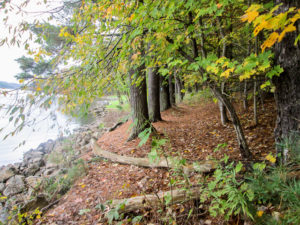
Pine needle path in MWCD heading toward Leesville Lake
We got on the trail at 8:30 a.m. It was cool, low 50s, and dry. There was some cloud cover, but also some sun making it through. The air was crisp. A lovely morning.
After less than a mile on back roads, we entered Muskingum Watershed Conservancy District (MWCD) properties on what the trail map called a “primitive” footpath. That word always makes me think of a narrow trail I can hardly get through because of encroaching overgrowth. Although there was one very short section like that a couple of miles later, the rest of the three miles we hiked in the woods was on paths of wet leaves covering dirt, twigs, and roots, minus any overgrowth.
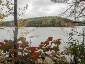
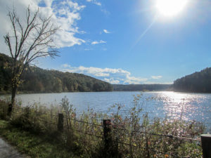
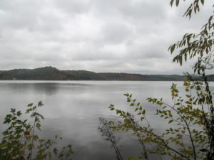
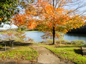
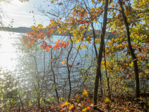
A view of Leesville Lake through the fall foliage
We crossed several small ravines but never had to wade through any water. Some had steep sides and I needed a push or a pull from CW to get up the other side. A few places were narrow with a drop-off and we had to be careful on the wet leaves. But we really enjoyed the woods. It was peaceful and quiet. Some of the trail followed the shoreline of Leesville Lake and was especially scenic.
It began sprinkling about an hour after we entered the woods. We were somewhat protected from the rain, and I was able to use my rain jacket. A half hour later it sprinkled again, turning into a light steady rain. I didn’t want to take a chance on getting soaked like yesterday, so out came the poncho. So much for not being a poncho day.
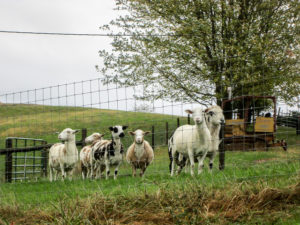
Sheep left their grazing hill to follow us
When we emerged from the woods around 11:00, it was dry, windy, and chilly. We noticed five sheep grazing in a field beside the road. One head popped up and stared at us. Then, in unison, the other four popped up and stared. They stood like statues until they were joined by a sixth sheep that had been watching from the top of a hill. Then, again in unison, they began following us—going a few feet and stopping, going a few more feet and stopping, all the while watching us.
A half hour later, we met Mike. We must have looked a little confused. After driving by us, he stopped, backed up his truck, and asked if we were looking for the Buckeye Trail. We talked for a while. When we said we were headed for lunch at the Western Grill in Bowerston, he said to say hi to Becky who works there.
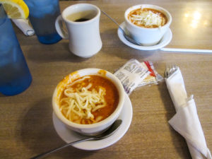
Lasagna soup at Western Grill in Bowerston
Forty-five minutes later we passed his greeting on to Becky. The Western Grill is a friendly, down-home restaurant with a large menu of sandwiches, salads, and full dinners. Though there wasn’t a variety of soups to choose from today, they did have lasagna soup. We’d never heard of it. We both tried it and loved it.
We were back hiking at 1:00. Our rain gear was packed away and I was hoping it would stay there, but before we were even out of Bowerston, it began raining again. And this time there was sleet mixed in. A short time later, the sky over us was blue with puffy white clouds and the sun was beaming down. What a funny day!
CW at top of a killer hill on Willis Run Road under an undecided sky
Our last five miles were almost all on one road: Willis Run. We were enjoying it. The sun was shining. We were drying out. There was no traffic. We figured the only people who use the road must be the ones who live on it. Then at 2:45, three cars passed us. CW said it must be rush hour.
Ordinarily, half of those five miles turn off-road back into the woods, but a trail alert said the MWCD had removed many of the pines in order to restore the native deciduous forest. That removed blazing and also allowed the trail to be overtaken temporarily by pesky bushes. So we got to stay on the road all the way to the car.
Lee, one of many new friends we made along the trail
We passed L&D, a heating and cooling business, the only business I remember seeing on that road. It’s conveniently located across the road from where the owner lives. That would be Lee. As we walked by, he called out to CW asking him how many times he’s hiked this trail. He remembered seeing CW when he hiked through last year with some buddies. We had a good long conversation. Turns out Lee and CW both spent some of their childhood years in nearby Tippecanoe. CW had moved by the time Lee came, but Lee knew just about everyone that CW mentioned. It was one of those small-world experiences. We finally parted with Lee saying we shouldn’t have any more rain today. After all, we were standing under bright blue skies and brilliant sunshine, and our car was only three miles away.
Willis Run Bay at 3:35 p.m.
Ten minutes later, it began pouring—and sleeting again! Out came the ponchos and rain pants. It had rolled in so quickly that we were practically soaked before we could get them on.
The road passed by Willis Run Bay, part of Tappan Lake. It was pretty and I was sorry it was too wet to get my camera out.
Willis Run Bay at 3:40 p.m.
But wait! The rain stopped and the sun came out. I’m sure this is the most fickle weather I’ve ever seen.
We had less than a quarter mile on busy US 250 to get to our car. We watched semis and tankers flying by both ways at 60 mph. While we were walking it, however, not one truck of any size passed by in the lane closest to us. Must have been a trail angel nearby.
We finished hiking by 4:00. We only did 12 miles. I haven’t mentioned the hills today. There were plenty of them, some very steep as the trail map promised. But I did alright with them. We just didn’t push too hard. Slow and steady like the tortoise.
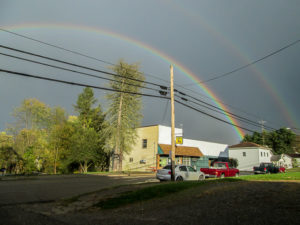
Double rainbow in Bowerston at end of day
On our way through Bowerston to pick up the other car, CW stopped at Western Grill again. While he was inside getting a piece of pumpkin pie to go, it rained. No surprise there. And the sun was still shining brightly. We ended our hike with a double rainbow.
Later, we drove to New Philadelphia for ice cream at Miller’s Creamery, but they had closed for the season. So we drove to Dover where another Miller’s Creamery is open all year. Great ice cream. I got a scoop of Lake Erie Salt Mine, which had salted caramel, cashews, and something fudgy in it.
Day 13 (Wednesday): Tappan Dam to Clendening Lake (10.0 trail miles + 0.2 mile off trail due to lack of blazes)
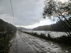
Tappan Lake on a rainy morning
Today would be colder, in the 40s all day. We like cooler weather for hiking, so we weren’t concerned about it. We just took layers and adjusted as needed. Even the precipitation forecast sounded good: spotty showers in the afternoon around 4:00 p.m. But I don’t have much faith in the weather site I’ve been watching, so we packed all our rain gear. Good thing!
As we were about ready to leave the motel a little past seven thirty, we got into a conversation with Jeff from Chicago. He wasn’t familiar with the BT, but he has hiked some of the AT and Pacific Crest Trail. Before we even finished talking, it began sprinkling. Although it stopped a little later, it was an omen of more to come. When we began hiking around 9:30, the rain was back. We started off in our rain pants and ponchos.
Pine needle path along shore of Tappan Lake
The BT followed a road across Tappan Dam with a great view of Tappan Lake. Then we entered the woods. The trail generally follows the shoreline of the lake for about four miles. The covering of wet leaves, pine needles, or a mixture, was nice to walk on. We did get slowed down, though, by the roots, walnuts, and many places where the path narrowed and had a drop-off on one side. We had to be extra careful on the wet leaves not to go sliding down the hill.
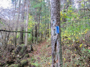
Dark blue bridle trail blaze painted over BT blaze
The woods were enjoyable and beautiful for the most part, but a few things marred that. For a mile or less the BT was on a bridle trail. The BT was marked well, but many of the blazes in that section had been blazed over in the darker blue paint used to mark the bridle trails. It was annoying that the BT was vandalized in that way.
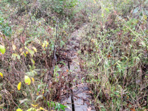
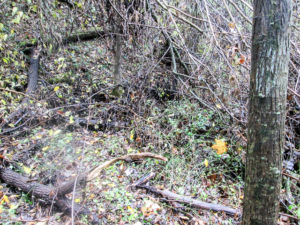
Slippery wooden walkway in an unmaintained spot
Some stretches of trail were definitely what CW and I call “primitive” footpaths. They were narrow and overgrown with brambles that caught on our clothes. My brand new Frogg Toggs rain suit—pants and jacket—have now been fully initiated. They suffered great injury today.
At one point, we found ourselves struggling through an impossible bramble path. It kept getting worse until we could go no further. We had to backtrack through the same angry tangle. CW finally found the correct way, but there was no blaze to turn us off the trail we were on. And the actual trail didn’t even look like a real path, more like a narrow dirt ledge.
Fallen tree with tangle of limbs hiding the trail
Before long, we came across a fallen tree with broken branches everywhere. It was hiding a blaze and any path, so we couldn’t see where a trail might go. It was a disaster. CW eventually located a blaze where the trail made a hard turn past the tree. We climbed over and through the tangle of limbs and continued on.
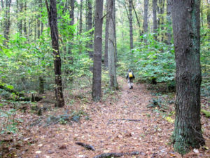
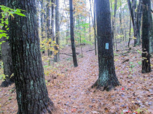
Path through pine woods
We encountered many hills. A couple were real doozies. One was so steep and long that I was walking—very slowly mind you—up that hill non-stop for at least 20 minutes! We finally came out on a road but in less than a quarter mile we were back in a pine woods on a great path for another mile.
The last three miles were on two back roads. It had rained on and off all day, but nothing too hard. I had changed from my poncho to my rain jacket so my camera and map were more accessible. When we started these last miles, it was drizzly and chilly, but it cleared up by the time we finished.
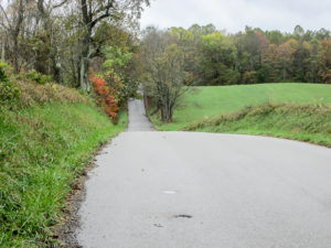
Undulating back road
The roads undulated and my mind undulated with them. I was trying to think of any way that we could get more miles in today. It was killing me to do only 10 miles on a “long” day. We had already explored going a little farther, but the next miles are back in woods and there is no place to move a car just a couple of miles ahead. We would have to do 5.5 more, which didn’t seem like a good idea with the rugged terrain. So I began thinking maybe we could skip down farther in the section and find a way to do two or three miles. But there were problems with that. Even though we will finish earlier today, by the time we could reshuttle the cars it would be at least 5:00. Also, we still weren’t sure of parking spots, so we might not even be able to find a short distance to add. I finally gave up. Ten miles it would be.

Steep but lovely
We finished by 3:30. In spite of some unpleasant trail, our tanks had been filled up with beautiful woods and country roads dressed modestly in their fall wardrobe.
We mutually agreed to return to Miller’s Creamery in Dover. We both wanted a chili cheese dog. (That isn’t ice cream; they also have sandwiches.) I followed my dog with Turtles ‘n’ Mudd ice cream. Very good choice. That’s the kind of mud I can get into!
Day 14 (Thursday): Clendening Lake to Piedmont (14.7 trail miles)
We planned more miles for our last “long” day this week. We knew it would be tiring, but CW was trying to help me get more done. We got up earlier and left the motel before the sun was up. It took us an hour and a half to spot the cars, and we were hiking shortly after 8:00 a.m.
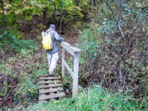
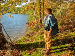
CW entering woods around Clendening Lake
Our first 5.4 miles were through woods around Clendening Lake, though, for the most part, we weren’t close enough to see the water. CW knew what the trail was like, having been through a couple of times already, and he knew it would take longer than the usual hiking we’ve done through woods. The trail turned out to be a mixture of fun and aggravation for me.
Many things were enjoyable about it. Some parts were wide, leaf-covered, and easy to make good time on. We crossed several small streams, but they didn’t have much water and we were able to skip right across without getting our boots wet. Many trees were down across the trail, making it
Tree hurdles
interesting. We climbed over the ones we could; others were too large or had too much branch debris so we detoured around. Even the narrower paths with some uncut brush were OK, adding to the varied woodsy experience. And we didn’t have to deal with any rain today.
Even if we’d had all day to get through this part of the trail, though—which we didn’t—some things would still have frustrated me. Some of those narrow paths were not maintained. Multiflora rose and other nasty things with stickers grabbed at us from all directions. Various nuisances grew tall on the sides of the trail, and we couldn’t get through without getting very chummy with them.
For the most part, the BT was well-blazed here, but there were a couple of places we saw no indication of what we were to do when we had a choice. It took several minutes to explore both options, and then we just had to guess. We happened to choose well, and eventually blazes reappeared.
Tick check
And then there were the little forest freeloaders. CW and I had a tick-counting contest. Who would pick the most ticks off their clothes? We hadn’t been aware of any ticks yesterday, but CW found four in our room last night. We went through all of our gear then, but didn’t find any more. Today they found us. By the time we got out of the woods, CW had attracted 137. I took only 64 off me.
It took us a little over four hours to make it out of the woods. Very slow going, but better than the 1 mph CW had said it could take. We found a spot by a stream to take a break, check for ticks one last time, and enjoy our lunch.
Woods and lurking ticks avoided due to trail detour
The rest of our miles today were on roads. The next six miles normally go right back into the woods, but due to a bridge on SR 799 being repaired, there is a BT detour that goes on roads. Shuttling was complicated with that section of SR 799 closed, but CW said it was a great trade-off that we didn’t have to go through the rest of the woods. He remembers them as being even more strenuous than what we did this morning.
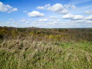
View from the ridge after climbing . . . climbing . . . climbing
Our first road after lunch was one and a half miles of mostly up. We started out with at least 10 minutes of steep incline. Then it leveled off between climbs. We had counted on the road walking to help us get done before dark descended, but my doubts were increasing with every uphill step.
Curvy rural road with trees in the spotlight
Fortunately, though, none of the other roads were quite that aerobic. They definitely undulated, but we plodded along quietly, enjoying the country scenery. When we finished the section of the detour, we had about four more miles of curvy rural roads. Modest houses were spaced far apart.
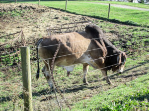
Bull snorting at us
In one field, a few cows and a bull were lying in the sun on hilly terrain. The bull was on an incline, facing up and away from us, so I didn’t think he even knew we were there. But after I stopped to snap some pictures, he slowly got up and lumbered over to the fence, all the while snorting with his head down. We took the cue to get walking. He continued snorting as he escorted us as far as he was able.
We reached the scenic rest stop on Piedmont Lake, where our car was parked, by 4:30. Considering our slow pace in the woods and the hilliness of the roads, we were happy with that time.
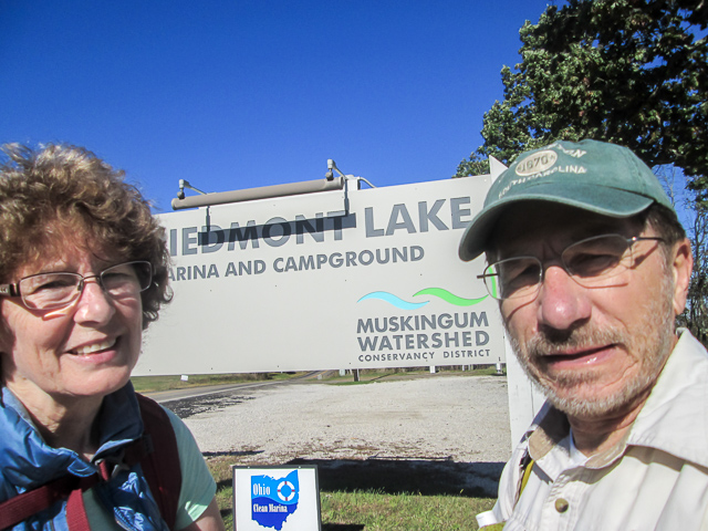
View of Piedmont Lake from the rest area
We began the day with layers of clothes and gloves in 30-degree temperatures. By the end of our hike, it was in the 50s. We enjoyed the full sun all day. With the cool temperature, it was comfortable.
We used up all our traveling energy today with long shuttles. I had a Twix ice cream bar from the gas station across the road from our motel. It hit the spot!
Day 15 (Friday): Piedmont to Marina Road at SR 800 (5.7 trail miles)
We checked out of the motel by 7:00 a.m., and for the second day, we were on the road in the dark. The early start was needed again since we had the long drive home and had to pick up the pup. Although we were hiking less than six miles, they were mostly in the woods.
It took 45 minutes to get the cars in place. By then the sun was coming up over the hills. It wasn’t a vibrant, colorful display, but I think every sunrise is spectacular in its own way. Each one announces the beginning of a brand new day, a new start, another chance to be the best at what you were created to be. One of my favorite quotations from Anne of Green Gables is by Anne’s teacher, Miss Stacy. She tells Anne, “Remember, you can always start everything afresh tomorrow.”
A beautiful spot on the shore of Piedmont Lake
The fog was lying low in the valleys and hovering over the lakes. It was quite chilly starting out. We were bundled up when we began hiking along US 22 before 8:00.
After a half mile, we entered the woods and stayed there for nearly five miles. CW and I were both glad to be getting finished with this portion of the trail. It is the last of the Bowerston section’s off-road miles, and these woods have not always been good to us.
Unlike the trail around Clendening Lake that allowed us only a distant view of the water at one spot, this trail closely follows the shoreline of Piedmont Lake. We enjoyed viewing it through the autumn trees.
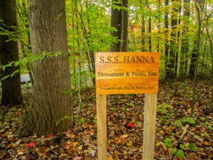
S.S.S.Hanna sign on the BT
We passed through the former Sea Scout (Boy Scout) Camp. The spot is marked where the S.S.S. Hanna (Sea Scout Ship Hanna) was moored. The dry-docked ship, built by Hanna Coal Company in 1946, was used as the scout camp. The only piece of ship that remains is the mooring pin.
Overall, I enjoyed today’s hike more than yesterday’s. I’m not sure that it was much different, but today I looked at it like the obstacle course it is (and I like obstacle courses). It had its ups and downs. There were wide paths and narrow ones with drop-offs. It had varied surfaces of dry crunchy leaves, wet soggy leaves, and cushiony pine needles. In a couple of places, there was mud to maneuver around. There were roots to trip on, stones to slip on, and walnuts to roll on. We crossed many small streams. Some had steep sides to climb up.
CW with pack off climbing through tree limbs
Numerous trees were down across the trail. Each one required a decision whether to step over, climb over, or detour around it. When none of those were possible, we had to climb through. In one place, several thick branches crossed the path at different angles. We had to take our packs off in order to step over and under.
Morning sun reflecting on waters of Piedmont Lake
At certain times, the sun reflected off the water into our eyes and made it difficult to see the blazes. In general, the blazing around the lake was very good. We did have trouble in a couple of places. One was in a large, open, leaf-covered area with many trees. We couldn’t see any blazes, nor could we see an indentation in the leaves where the path might be. CW finally located it in weeds at the edge of the open area, but it didn’t look much like a path.
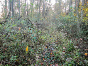
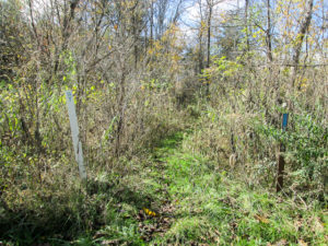
An unmaintained part of the trail
The trail alternated between nice roomy paths with lots of elbow room and the narrow ones that suffocated us with weeds. Sometimes the weeds were taller than us. Often there were stickers hanging into the path. We used our sticks to hold them out of the way, but there were too many to avoid them all. They’d catch on our clothes and stop us in our tracks. More damage was suffered by my rain jacket, which I was wearing for protection. These unmaintained parts of the trail are one of the most frustrating parts of hiking the BT for me. They aren’t really trails. And they are dangerous. We could easily have gotten thorns across our faces.
We encountered lots of cobwebs today. Also Clendening Lake doesn’t have the market on ticks. Every few minutes we stopped to pick them off. I had about the same number as yesterday; CW didn’t count today.
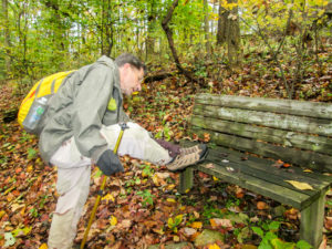
A steep incline around the hill
The last half mile in the woods was a difficult climb. I was pretty weary by that time and could barely drag myself upward. Then we had maybe a quarter mile on roads, with one more ascent for good measure, to get to our car by 11:30.
So this was our obstacle course. Except for the unmaintained trail and the ticks, it was a happy adventure. Although we weren’t able to finish the Bowerston section this week, we did get at least 50 miles in—52.2 to be exact. The rest will have to wait for next spring.
On the way home, we had lunch at 360 Burger. It has a casual atmosphere and good food. A little further down the road, we stopped at The Pantry Door & Deli. It is an Amish business with several aisles of bulk food, deli selections in the back, and a gift shop in an adjoining room. We didn’t have time to look around. Our mission there was ice cream located next to the deli case. I got a scoop of Mint Chocolate Chip, and a container of chocolate covered coffee beans to help me stay awake driving home.
After we got home, I checked once more for ticks and changed my clothes. I was so glad to be done with that part of the hike. But late tonight, I discovered one attached to my elbow Yuck! My first tick bite. One more new experience.
Finished with our fall hike of 157.9 miles
This fall hike did not provide the typical fall weather we were going for. We experienced summer heat, spring rains, and winter sleet. But we braved it and survived it, still in good health. We were challenged with some unmaintained sections, poison ivy farms, and ticks that don’t know they aren’t supposed to bother us in October.
But the good memories always surpass the unpleasant ones. We were blessed to meet Jim and Sarah, hike with Karen, meet Lee and reminisce about friends he and CW have in common, and have fleeting conversation with other friendly people encountered along the trail. We found some fun restaurants, tried some new food, and had some good ice cream. You can’t beat the combination of autumn colors with country roads and water (lakes, not rain).
CW and I have now completed five 10-percenters. We have hiked over halfway around the Buckeye Trail. This fall we added 157.9 trail miles for a total of 812.6. We added 3,446 car miles, and I added 382,565 steps. Next up will be more hills of southeastern Ohio. I hope you’ll join us in the spring.


Elainek
October 31, 2017Once again I thoroughly enjoyed reading about your adventures. You survived some pretty bizarre weather and trails with good humor. Thanks for sharing. I look forward to your next adventure in the Spring. Elaine
CW Spencer
October 31, 2017I’m so glad you enjoyed reading about our hike, Elaine. When we have certain days planned and the trail is already chosen, we just have to take whatever comes and make the best of it. Surprises always await us.
Bonnie
Dolores R. Birkle
November 4, 2017Endurance!! The two of you are amazing to me. I am so happy to be finding out about Ohio in this way. The way you write in detail makes it so interesting, also the reality is that it is not easy but you are enjoying this chapter in your lives together. Thanks for sharing with me.
I love you both,
Dolores
CW Spencer
November 4, 2017I have had a good mentor concerning details. You and I have noticed a lot of details together. Yes, CW and I are enjoying these hikes together. And I enjoy sharing them with you as well. Thanks for reading, Dolores!